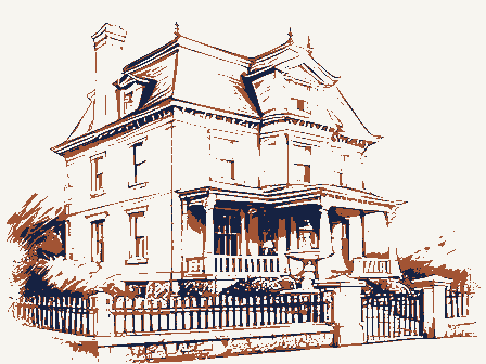
Listed on the National Register of Historic Places in
1976. A historic map-sheet match is not published yet. The record needs a coordinate-quality review before it can be joined to a sheet boundary.
From the record
one of 295 National Register listings in Franklin County · listed in 1976 · category: Building · one of 3 National Historic Landmarks in Franklin County.
National Register reference number.76001429- the number the National Park Service assigned this property when it was listed, and the key its nomination file is catalogued under at the National Archives.
What happened here
An account from the chapter on Columbus city, The inset identifies its exact
source book and publication year.
The Mound Builders and Indians - First White Settlements and Struggle for Possession - Indian Village at the Forks of the Scioto Attacked by Crawford and Dispersed - The Ohio Company, the Scioto Company and Symmes Purchase - Indian Power Broken and British Hopes Blasted - First Surveys - Topography, Geology and Soil of Franklin County.
Regional context, not property-specific
evidence. The
federal wildfire occurrence database
lists 1 fire within 5 miles of Russell, Mark, House between
2011 and 2011, burning about 0 acres in total. None started naturally. None was recorded as arson.
Distance is straight-line from the map coordinates, so a fire counted
here may appear on a neighbouring settlement's page as well.
Reported cause
Fires
Missing data/not specified/undetermined
1
The most recent of
them, most recent first, with the day each was reported and the service
that recorded it.
Regional context, not property-specific
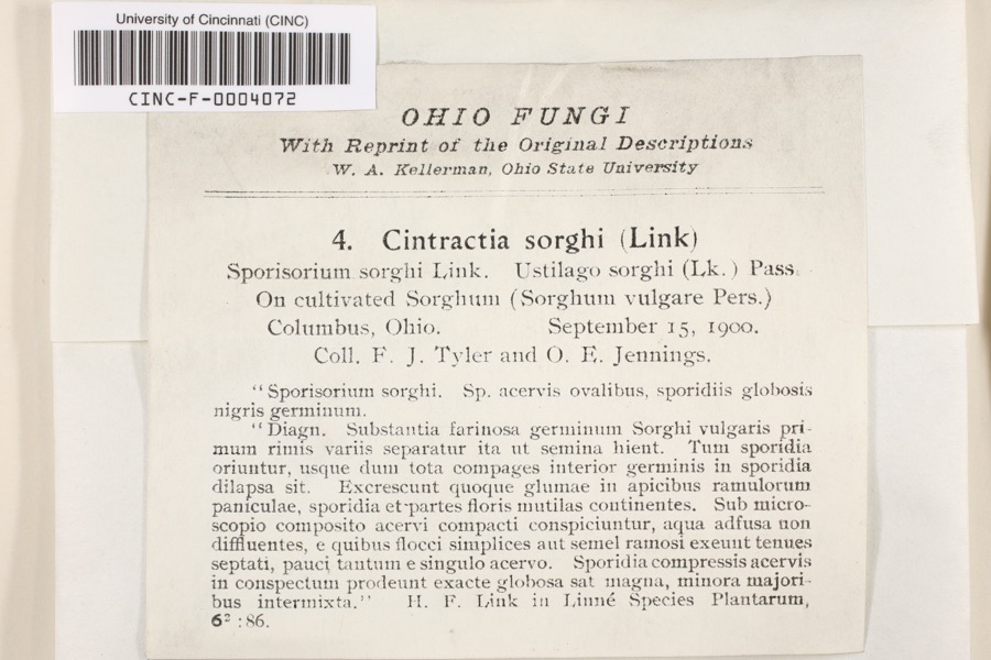
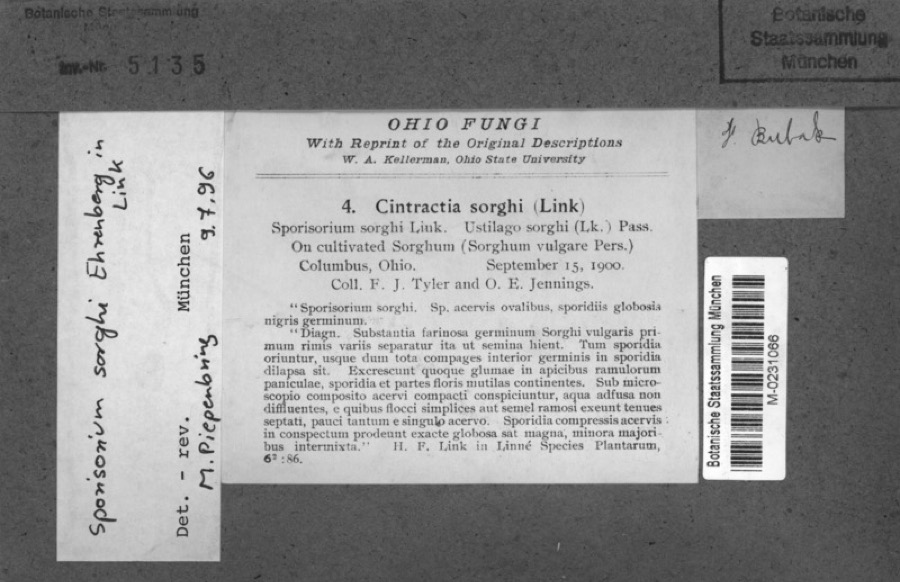
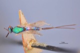
evidence. Museums hold 10,281 specimens
collected within 10 miles of Russell, Mark, House between 1804 and
1975: 8,285 Animalia, 1,275 Fungi, 573 Plantae, 117 Chromista, 30 Unrecorded, 1 Protozoa. 12 distinct Species records are shown.
Collected by 19 V 1938 in original publication, Knull, =, ? and others. Each is a
physical object with a catalogue
number, and each entry opens the museum's record. This is what was
collected and kept, not a survey of what lives here - nothing can be
concluded from a species being absent.
Regional context, not property-specific
evidence. The National Weather Service names
Riverlea, the town this property stands in, in 14 storm reports between 2012 and 2021: 9 thunderstorm wind, 3 hail, 2 flood.
No death or injury is recorded in these reports. Each account below is quoted exactly as the forecast office
filed it, from the NOAA Storm Events Database, and each date
opens the federal record of that event.
No historic map-sheet match is published
for this property yet. That does not mean no map exists. This record needs
a coordinate-quality review before it can be joined to a sheet boundary.
Browse the county's mapped places while that work is
pending.
From the nomination file
1,946 words on record
When this property was proposed for the
National Register, someone wrote the case for it: what the building is,
and why it matters. That document is a federal record in the public domain.
It is quoted below word for word, never summarised. The text was read off the scanned case file by machine, so the
occasional stray character is the recogniser's and the 1970s
typewriter's.
Description of the property
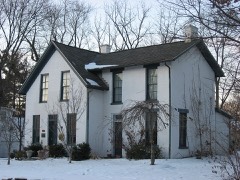
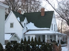
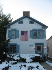
To the north, south, and east is commercial development and to the west is The gable end faces the street with the entrance placed to the right. protected by a gable roofed, half-timbered entrance porch (built late 1920's). Windows are 4/4 pane with narrow frame lintels and ornate, bracketed "window shrubbery. The foundation is stone. Windows on the south side are 4/4 pane. There is a single gabled dormer attached, single-story porch which opens both to the south and west. This extending north, is a two-story "L" added in the late 1920's as a den and of the house. There is a bargeboard which matches that of the house. Behind The entrance foyer is small with the stairway to the second floor rising room, created by enclosing a former portch.
Behind the dining room, which has CONDITION MOVED UNEXPOSED DATE FAIR RUINS south and continues west behind the house,encompassing about three acres. bedroom and entrance to the north-lighted artist's studio. the grounds are beautifully landscaped with mature plants and an outstanding smaller windows on the east side on the second floor.Across the rear of CHECK ONE Built ca.1850,the original board and batten of the Mark Russell House but with a single door.This was once used as a chicken house.
is half-timbered.It has a large multi-paned window on the north side and beams and half timbering made use of lumber from another old Columbus home AI-UNALTERED directly opposite the doorway.A small hall leads back to the den.To the was stuccoed over sometime prior to 1919 when the Russells purchased the wildflower garden giving the appearance ofa set for"Hansel and Gretel". east on a rolling hillside above a busy main road.The property slopes torn down in the mid 20's. in the roofline.
a highly commercialized street, the building echoes the past when this area present owner, wife of Columbus artist Mark Russell, is 90 and it is feared of note, specializing in fine penwork, calligraphy, and the design of stained glass, came to Columbus in 1919 to teach at the Columbus Art School. He had He remained at the Columbus Art School until 1964 and died in 1967. Mrs. INVENTION ARCHEOLOGY-HISTORIC ECONOMICS PHILOSOPHY THEATER AGRICULTURE ART EDUCATION PERIOD EXPLORATION/SETTLEMENT BUILDER/ARCHITECT SCIENCE PREHISTORIC SCULPTURE TRANSPORTATION MILITARY SIGNIFICANCE LITERATURE 1800-1899 book illustrations prior to coming to Columbus. INDUSTRY Russell lives in and maintains the property presently.
was farmland and the adjacent city of Worthington was a small village.The designed murals and windows for the Lincoln-LeVeque Tower (NR).He later developed a decorative pen style and free-lanced doing newspaper pages and of Transfiguration (Little Church Around the Corner) in New York.He also additions were designed by him.
_COMMUNICATIONS Gerichter Art Glass Company, also in New York.Among his glass creations are the windows of the Broad St.Presbyterian Church in Columbus and the Church The property was once part of a 1o0 acre farm in the original Worthington -1500-1599 -1600-1699 SOCIAL/HUMANITARIAN that after her death the property will be sold for commercial development Built ca.1850, the Mark Russell House is a rare surviving example of the and the Russell family has owned the property since 1919.The 1920's -1400-1499 - 1700-1799 and the house destroyed.Mark Russell was a well-known artist and teacher, - RELIGION -1900- - LAW COMMUNITY PLANNING Company Survey and was owned by Moses Maynard.
Mark Russell, an artist trained at the Art Students League in New York and was a designer for the Von ARCHEOLOGY-PREHISTORIC
Quoted from the National Register nomination
for reference 76001429, 17 pages, held by the National Archives in Record
Group 79. See the
catalogue record.
Listed places nearby
6 within 8 miles
Other National Register properties close
enough to walk or drive between, ordered by distance from this one. Both
positions come from the same geocoding pass that matched these properties
to their map sheets.
Listing record. National Park Service National Register of Historic Places, listed-properties dataset, current to 2026-05-22.
Map join. Address geocoded through the United States Census geocoder, then tested against the published boundary of every sheet in the USGS Historical Topographic Map Collection.
How this page is made. Listing fields come from federal records; map-sheet coverage is a labelled coordinate-to-boundary calculation, not a source-field claim.
Wildfire. Short, Karen C. 2022. Spatial wildfire occurrence data for the United States, 1992-2020 [FPA_FOD_20221014]. 6th Edition. Fort Collins, CO: Forest Service Research Data Archive. https://doi.org/10.2737/RDS-2013-0009.6 Collected with United States Government funding and usable without additional permissions or fees.
Specimens. Global Biodiversity Information Facility (GBIF), https://www.gbif.org/. Only records licensed CC0 or CC BY are used. Records licensed CC BY-NC are excluded because this site carries advertising. Images are checked individually and any whose licence is non-commercial, no-derivatives or unreadable is refused.
Storms. NOAA National Centers for Environmental Information, Storm Events Database https://www.ncei.noaa.gov/stormevents/ A work of the United States government, no copyright under 17 U.S.C. 105. Narratives are quoted verbatim from the National Weather Service report and are not edited or summarised.
 Block
Block