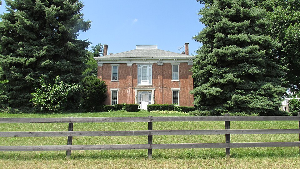
Listed on the National Register of Historic Places in
1976. A historic map-sheet match is not published yet. The record needs a coordinate-quality review before it can be joined to a sheet boundary.
From the record
one of 14 National Register listings in Highland County · listed in 1976 · category: Building.
National Register reference number.76001455- the number the National Park Service assigned this property when it was listed, and the key its nomination file is catalogued under at the National Archives.
Fires near this property
1 since 2019
Regional context, not property-specific
evidence. The
federal wildfire occurrence database
lists 1 fire within 5 miles of Hirons-Brown House between
2019 and 2019, burning about 1 acres in total. None started naturally. None was recorded as arson.
Distance is straight-line from the map coordinates, so a fire counted
here may appear on a neighbouring settlement's page as well.
Reported cause
Fires
Fireworks
1
The most recent of
them, most recent first, with the day each was reported and the service
that recorded it.
Regional context, not property-specific
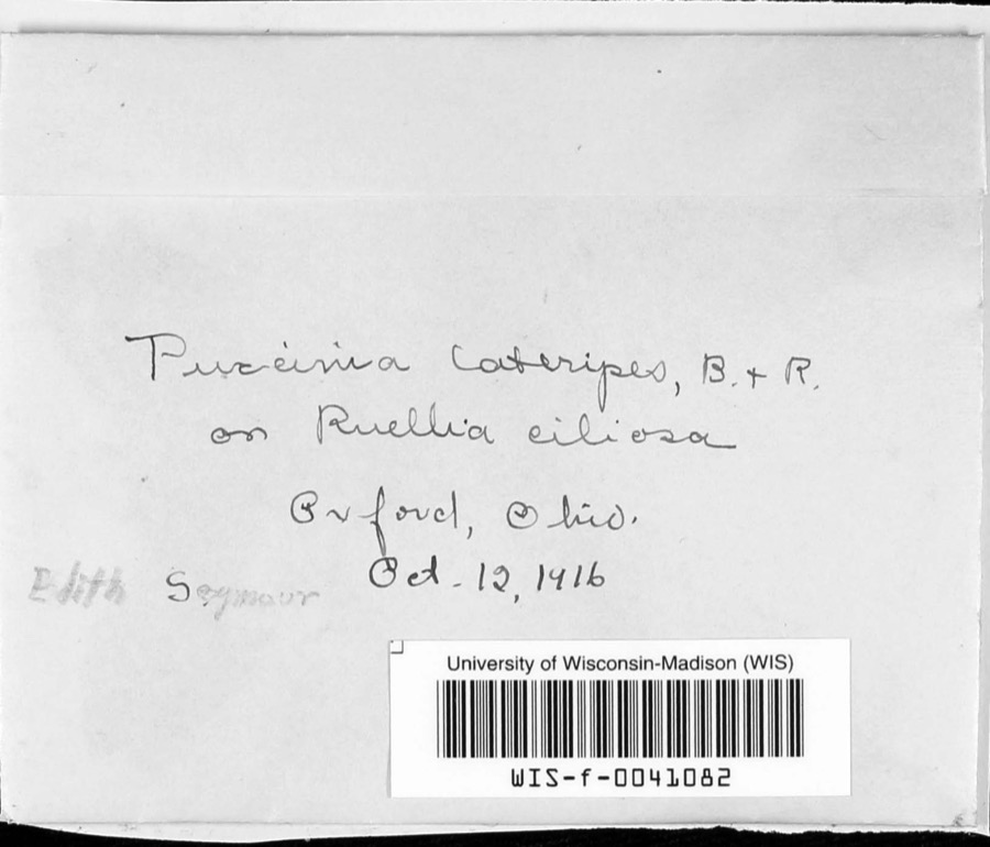
evidence. Museums hold 16 specimens
collected within 10 miles of Hirons-Brown House between 1916 and
1957: 10 Fungi, 6 Animalia. 12 distinct Species records are shown.
Collected by A. B. Seymour, M. Hale, R. Rhoades and others. Each is a
physical object with a catalogue
number, and each entry opens the museum's record. This is what was
collected and kept, not a survey of what lives here - nothing can be
concluded from a species being absent.
Regional context, not property-specific
evidence. The National Weather Service names
Buford, the town this property stands in, in 10 storm reports between 1994 and 2022: 8 thunderstorm wind, 1 tornado, 1 heavy rain.
No death or injury is recorded in these reports. Each account below is quoted exactly as the forecast office
filed it, from the NOAA Storm Events Database, and each date
opens the federal record of that event.
The tornado touched down in the vicinity of Highway 32 and Klein Road in Brown County. The tornado crossed into Highland County just west of Sicily Road. The tornado lifted in Highland County near Highway 321, southeast of Buford. The worst damage occurred to a residence on Sicily Road in Highland County. A section of roofing was removed from part of the home, the front porch supports were lifted and removed, numerous trees were uprooted near the residence, and a piece of wood was driven into decking material. Several other barns and outbuildings were destroyed or heavily damaged along the path. Based on the damage caused by this tornado, wind speeds were estimated at 100 miles per hour. The tornado was in Brown County from 0544 PM EST until 0545 PM EST. The tornado continued in Highland County from 0545 PM EST until 0553 PM EST.
No historic map-sheet match is published
for this property yet. That does not mean no map exists. This record needs
a coordinate-quality review before it can be joined to a sheet boundary.
Browse the county's mapped places while that work is
pending.
From the nomination file
1,471 words on record
When this property was proposed for the
National Register, someone wrote the case for it: what the building is,
and why it matters. That document is a federal record in the public domain.
It is quoted below word for word, never summarised. The text was read off the scanned case file by machine, so the
occasional stray character is the recogniser's and the 1970s
typewriter's.
Description of the property
The Turner House is a two story rectangle, forty-five by thirty-six hip root with & deck. The four sides of the house are each divided into Gothic sidelights. removal by the owner forpurposes of restoration. The other windows of the building are rectangular with double porch was removed or covered by the present one bay wide of stone in front and brick in the back. branches at a mid level landing with one case of stairs continuing wood panel.Storm doors have been added for insulation.The doors _RUINS hung sash and six lights over six.All of the wmdows have plain stone undetermined time many years ago.At one time in the AREAS OF
Statement of significance
Buford, Ohio where the house was subsequently built. In addition to being LAW SIGNIFICANCE TRANSPORTATION PERIOD SCIENCE X1800-1899 ART INDUSTRY _EXPLORATION/SETTLEMENT CONSERVATION AGRICULTURE SCULPTURE MILITARY THEATER INVENTION ARCHEOLOGY-PREHISTORIC ARCHEOLOGY-HISTORIC _COMMUNICATIONS XARCHITECTURE The house is a well-preserved late Greek Revival building with prominent landowners and farmers, members of the family operated stores and -1400-1499 The house is a fine, well preserved farm home of a successful early -1500-1599 was in the period of ownership by the Brown family which purchesed the -1600-1699 the post office in Buford prior to the Civil War. _PREHISTORIC area. - PHILOSOPHY ECONOMICS -1700-1799 _RELIGION -1900- _MUSIC to White Oak Creek as an escape route.
settler and its refinements of design, its unusual features, make it a BUILDER/ARCHITECT Ezekiel Hirons lived in a log house until the present structure was built. A portion house from Ezekiel Hirons. Gothic detailing.The house is atypical of rural southwest Ohio architecture as it is built upon a much more grand scale than is usually found in the The family of Ezekiel Hirons came to Ohio from Kentucky in l8l2 to the mam stairway.The Browns purchased the farm in 1854. There is also a trap door under 9
Quoted from the National Register nomination
for reference 76001455, 10 pages, held by the National Archives in Record
Group 79. See the
catalogue record.
Listing record. National Park Service National Register of Historic Places, listed-properties dataset, current to 2026-05-22.
Map join. Address geocoded through the United States Census geocoder, then tested against the published boundary of every sheet in the USGS Historical Topographic Map Collection.
How this page is made. Listing fields come from federal records; map-sheet coverage is a labelled coordinate-to-boundary calculation, not a source-field claim.
Wildfire. Short, Karen C. 2022. Spatial wildfire occurrence data for the United States, 1992-2020 [FPA_FOD_20221014]. 6th Edition. Fort Collins, CO: Forest Service Research Data Archive. https://doi.org/10.2737/RDS-2013-0009.6 Collected with United States Government funding and usable without additional permissions or fees.
Specimens. Global Biodiversity Information Facility (GBIF), https://www.gbif.org/. Only records licensed CC0 or CC BY are used. Records licensed CC BY-NC are excluded because this site carries advertising. Images are checked individually and any whose licence is non-commercial, no-derivatives or unreadable is refused.
Storms. NOAA National Centers for Environmental Information, Storm Events Database https://www.ncei.noaa.gov/stormevents/ A work of the United States government, no copyright under 17 U.S.C. 105. Narratives are quoted verbatim from the National Weather Service report and are not edited or summarised.
 Block
Block