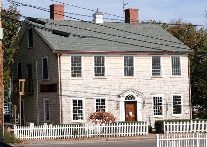
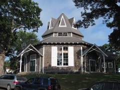
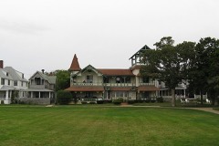
Built in 1796. Listed on the National Register of Historic Places in
1977. A historic map-sheet match is not published yet. The record needs a coordinate-quality review before it can be joined to a sheet boundary.
From the record
“The Ritter House is an historic house on Beach Street in Vineyard Haven, Massachusetts, USA, and is listed on the National Register of Historic Places. The house is one of the few remaining Federal period buildings in Vineyard Haven.”
Wikipedia article Ritter House, CC BY-SA 4.0.
one of 11 National Register listings in Dukes County · listed in 1977 · category: Building · built in 1796 · one of 1 National Historic Landmarks in Dukes County.
National Register reference number.77000169- the number the National Park Service assigned this property when it was listed, and the key its nomination file is catalogued under at the National Archives.
This was the ancient name bestowed by the natives on all the territory covered by the village of Vineyard Haven, in the present town of Tisbury. The Sachem Ponit, in 1682, calls himself "of Nobnocket alias holmes his hole," and his jurisdiction extended north of a line drawn from the stepping stones to the head of Tashmoo, to include the entire neck. Eliot uses an adjectival prefix in various forms to indicate *'dry," one of which forms is Nunnob, which he abbreviates to Nob (Isaiah, XI, 15; XLIV, 3). In the Narragansett dialect the nasal sound of N is heard before the vowel, which accounts for the intrusion of the N in Nobnocket, giving us an etymology of Nob(n)ocket, meaning at the dry land or place. This may indicate that the original Nobnocket was a place where the Indians settled on the shore, an enclosed place, a designation which afterwards was extended to include the whole region above described as Ponit's Sachemship.^
The name of Holmes Hole became officially eclipsed in 1 87 1, as a result of persistent agitation on the part of a number of residents. The original name had in it but a faint suggestion of dignity or character, and to hail from a "Hole" was a source of chagrin to many of its inhabitants when traveling abroad. A number of substitutes were suggested, including Tisbury Harbor and Vineyard Haven, and the latter finding the most favor with the majority, it received its confirmation on Feb. 21, 1871, by the general government, when the Post Office Department officially adopted the name for the office. This new title is a more euphonious and appropriate name than -its predecessor, as the harbor has been the great haven of the Vineyard from time immemorial, and doubtless this last christening will survive for many generations.
Regional context, not property-specific
evidence. The
federal wildfire occurrence database
lists 30 fires within 5 miles of Ritter House between
2015 and 2020, burning about 16 acres in total. None started naturally. None was recorded as arson.
Distance is straight-line from the map coordinates, so a fire counted
here may appear on a neighbouring settlement's page as well.
Reported cause
Fires
Debris and open burning
12
Missing data/not specified/undetermined
10
Equipment and vehicle use
4
Recreation and ceremony
2
Fireworks
1
Smoking
1
The most recent of
them, most recent first, with the day each was reported and the service
that recorded it.
Regional context, not property-specific
evidence. Museums hold 15,012 specimens
collected within 10 miles of Ritter House between 1828 and
1975: 8,652 Animalia, 4,168 Plantae, 1,096 Chromista, 756 Fungi, 158 Bacteria, 134 Unrecorded, 48 Protozoa. 12 distinct Species records are shown.
Collected by A AND P STARRETT, A B Seymour, A. A. Cohen and others. Each is a
physical object with a catalogue
number, and each entry opens the museum's record. This is what was
collected and kept, not a survey of what lives here - nothing can be
concluded from a species being absent.
Regional context, not property-specific
evidence. The federal mineral resources record lists
2 workings within 5 miles of Ritter House: 1 past producer, 1 producer.
1 still produces. What was taken out: Sand and Gravel, Construction. Distance is straight-line from the
map coordinates, so a quarry counted here may appear on a neighbouring
settlement's page as well.
No historic map-sheet match is published
for this property yet. That does not mean no map exists. This record needs
a coordinate-quality review before it can be joined to a sheet boundary.
Browse the county's mapped places while that work is
pending.
Listed places nearby
6 within 8 miles
Other National Register properties close
enough to walk or drive between, ordered by distance from this one. Both
positions come from the same geocoding pass that matched these properties
to their map sheets.
Listing record. National Park Service National Register of Historic Places, listed-properties dataset, current to 2026-05-22.
Map join. Address geocoded through the United States Census geocoder, then tested against the published boundary of every sheet in the USGS Historical Topographic Map Collection.
How this page is made. Listing fields come from federal records; map-sheet coverage is a labelled coordinate-to-boundary calculation, not a source-field claim.
Wildfire. Short, Karen C. 2022. Spatial wildfire occurrence data for the United States, 1992-2020 [FPA_FOD_20221014]. 6th Edition. Fort Collins, CO: Forest Service Research Data Archive. https://doi.org/10.2737/RDS-2013-0009.6 Collected with United States Government funding and usable without additional permissions or fees.
Specimens. Global Biodiversity Information Facility (GBIF), https://www.gbif.org/. Only records licensed CC0 or CC BY are used. Records licensed CC BY-NC are excluded because this site carries advertising. Images are checked individually and any whose licence is non-commercial, no-derivatives or unreadable is refused.
Mines and quarries. USGS Mineral Resources Data System (MRDS) https://mrdata.usgs.gov/mrds/ A work of the United States government, no copyright under 17 U.S.C. 105.
 Block
Block