Listed on the National Register of Historic Places in
1978. A historic map-sheet match is not published yet. The record needs a coordinate-quality review before it can be joined to a sheet boundary.
From the record
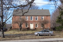
“Newell Farm is a historic farmhouse at 243 Main Street in West Newbury, Massachusetts.”
Wikipedia article Newell Farm, CC BY-SA 4.0.
one of 350 National Register listings in Essex County · listed in 1978 · category: Building · one of 2 National Historic Landmarks in Essex County.
Architectural style. Greek Revival architecture, Federal architecture
National Register reference number.78001406- the number the National Park Service assigned this property when it was listed, and the key its nomination file is catalogued under at the National Archives.
Fires near this property
71 since 2015
Regional context, not property-specific
evidence. The
federal wildfire occurrence database
lists 71 fires within 5 miles of Newell Farm between
2015 and 2020, burning about 28 acres in total. None started naturally. 4 were recorded as arson.
Distance is straight-line from the map coordinates, so a fire counted
here may appear on a neighbouring settlement's page as well.
Reported cause
Fires
Debris and open burning
21
Equipment and vehicle use
14
Missing data/not specified/undetermined
10
Recreation and ceremony
8
Misuse of fire by a minor
5
Power generation/transmission/distribution
5
Arson/incendiarism
4
Smoking
3
Fireworks
1
The most recent of
them, most recent first, with the day each was reported and the service
that recorded it.
Regional context, not property-specific
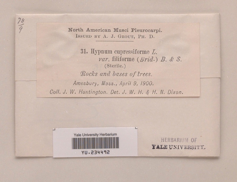
evidence. Museums hold 1,807 specimens
collected within 10 miles of Newell Farm between 1800 and
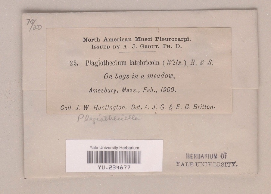
1975: 1,106 Plantae, 580 Animalia, 91 Fungi, 18 Chromista, 6 Protozoa, 4 Unrecorded, 2 Bacteria. 12 distinct Species records are shown.
Collected by A A Eaton, A Brown, A. A. Eaton and others. Each is a
physical object with a catalogue
number, and each entry opens the museum's record. This is what was
collected and kept, not a survey of what lives here - nothing can be
concluded from a species being absent.
Regional context, not property-specific
evidence. The federal mineral resources record lists
23 workings within 5 miles of Newell Farm: 20 past producers, 2 producers, 1 plant.
3 still produce. What was taken out: Sand and Gravel, Construction, Stone, Crushed/Broken, Lead, Silver. Distance is straight-line from the
map coordinates, so a quarry counted here may appear on a neighbouring
settlement's page as well.
No historic map-sheet match is published
for this property yet. That does not mean no map exists. This record needs
a coordinate-quality review before it can be joined to a sheet boundary.
Browse the county's mapped places while that work is
pending.
From the nomination file
2,217 words on record
When this property was proposed for the
National Register, someone wrote the case for it: what the building is,
and why it matters. That document is a federal record in the public domain.
It is quoted below word for word, never summarised. The text was read off the scanned case file by machine, so the
occasional stray character is the recogniser's and the 1970s
typewriter's.
Description of the property
CHECK ONE XORIGINAL SITE MOVED DATE. Newe1l Farm is located on Main Street in West Newbury, set back 200' from the street at the end of a carriage drive circle edged by spruce trees. The nominated area around the house comprises 3 lightly wooded acres, while the rest of the 60 acre property is mostly farmland which stretches eastward to the rear of the house. The present farmhouse was built by Colonel Moses Newell in 1846. The main body - of the house is a five bay, brick, 2½ story house with a center entrance. The ridge roof has gable ends to the sides, four interior end chimneys, and a Greek Revival entablature composed of a slightly projecting four course architrave, above which is a four course frieze and a two course cornice of alternating projecting brick dentil-like headers.
The doorway has rectangular footings and lintel while the windows are treated with inverted triangular lintels and rectangular sills of sandstone. The front entrance has a six light transom and four pane sidelights. The original wooden front steps, weakened by termites, have been replaced by 1½ ton granite steps which were once footings from the cellar of an old house across the street from Newell Farm which was demolished in 1941. The north elevation is three bays deep with two shuttered windows in the gable. The south elevation of the main block is five bays wide on the first story, four bays on the second story, and has two shuttered windows in the gable. The narrow center entry is decorated with a transom and narrow lintel.
To the rear of the main block is a narrower, two story extension two bays deep with a doorway in the westernmost bay. Projecting south from the extension stands a two story kitchen ell.
/ARCHITECT Col. Moses Newell Newell Farm is significant architecturally as a fine Greek Revival/Federal style house built from salvaged materials. Historically, the property is significant for the roles its owners have played in local and state politics and business, and because the pro- perty has remained under continuous family ownership since 1761. Newell Farm is outstanding architecturally for the area because of its unusual size and materials. Most of the other significant houses in the region are of clapboard and far smaller in size than this stately brick house. Moreover, Col. Moses Newell, the original owner, is reported to have built this house with salvage materials from buildings demolished in 1845 to make room for the addition to the State House in Boston.
Moses Newel1 sent his loads of butchered meat from the farm to Charlestown Navy Yard on a regular basis. Returning by way of Beacon Hill, he would bring back loads of building materials. house at Newell Farm. Evidence to support this concept includes an article in the Haverhill Gazette of May 18, 1933, in which L.W. Smith wrote about the farm: "I heard my uncle (Cyrus K. Ordway, partner of Moses Newell) say to some friends that Col.
Newell bought the marble caps over the windows in his house also the ones under the window sills, the blinds, windows, and folding shutters, marble mantels and much of the fine woodwork of the house from one of the fine old houses of Boston that was being torn down to make room for a new building..."1 There are three extra sandstone lintels that match those of the house, one of which was found buried to the rear of the building.
Quoted from the National Register nomination
for reference 78001406, 9 pages, held by the National Archives in Record
Group 79. See the
catalogue record.
Listed places nearby
6 within 8 miles
Other National Register properties close
enough to walk or drive between, ordered by distance from this one. Both
positions come from the same geocoding pass that matched these properties
to their map sheets.
Listing record. National Park Service National Register of Historic Places, listed-properties dataset, current to 2026-05-22.
Map join. Address geocoded through the United States Census geocoder, then tested against the published boundary of every sheet in the USGS Historical Topographic Map Collection.
How this page is made. Listing fields come from federal records; map-sheet coverage is a labelled coordinate-to-boundary calculation, not a source-field claim.
Wildfire. Short, Karen C. 2022. Spatial wildfire occurrence data for the United States, 1992-2020 [FPA_FOD_20221014]. 6th Edition. Fort Collins, CO: Forest Service Research Data Archive. https://doi.org/10.2737/RDS-2013-0009.6 Collected with United States Government funding and usable without additional permissions or fees.
Specimens. Global Biodiversity Information Facility (GBIF), https://www.gbif.org/. Only records licensed CC0 or CC BY are used. Records licensed CC BY-NC are excluded because this site carries advertising. Images are checked individually and any whose licence is non-commercial, no-derivatives or unreadable is refused.
Mines and quarries. USGS Mineral Resources Data System (MRDS) https://mrdata.usgs.gov/mrds/ A work of the United States government, no copyright under 17 U.S.C. 105.
 Block
Block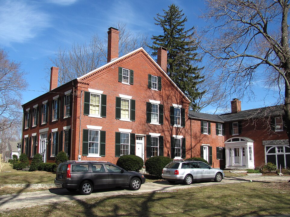





_2701.JPG)