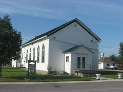
Listed on the National Register of Historic Places in
1978. A historic map-sheet match is not published yet. The record needs a coordinate-quality review before it can be joined to a sheet boundary.
From the record
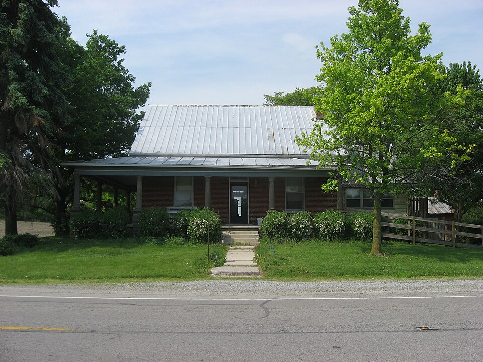
“Rinehart House is a historic house located near Uniopolis in Union Township, Auglaize County, Ohio, United States. A brick structure built in 1861, it was once the home of one of the most prominent citizens of early Auglaize County.”
Wikipedia article Hugh T. Rinehart House, CC BY-SA 4.0.
one of 24 National Register listings in Auglaize County · listed in 1978 · category: Building.
National Register reference number.78002009- the number the National Park Service assigned this property when it was listed, and the key its nomination file is catalogued under at the National Archives.
The first religious society in Union township may be said tc have been formed by Rev. James B. Finley, a Methodist itinerant who preached in the homes of the people, particularly at Charles Lusk's house. The first house of worship was a log building,, located three miles southeast of Uniopolis, and known as Wesley Chapel. A church known as Poplar Hill Church was also a log building. Twenty years later both buildings were replaced by the present neat edifices.
Uniopolis was originally located in the southwest quarter of section 17, and was platted and organized by John Huffman, in September, 1837. Since its organization there have been additions as follows: No. 1, Samuel Focht's ; No. 2, John W. Howe's ; No. 3, Parlett and Stein's ; No. 4, George Blank's. This village was at a standstill until after the construction of the Ohio Southern Railroad. Since that time many buildings have been -erected and public improvements of a substantial character have been made. The population at the present time (1904) is about four hundred.
Regional context, not property-specific
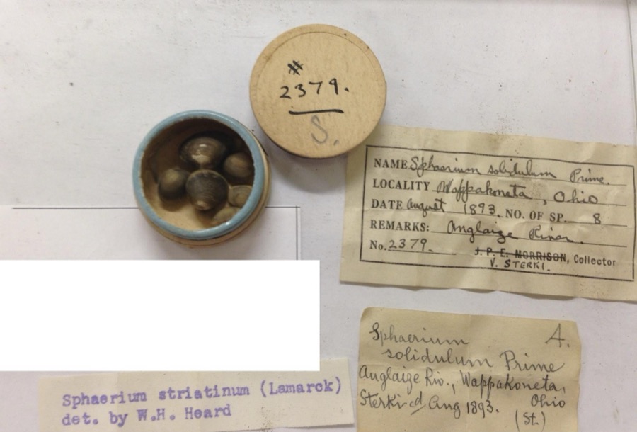
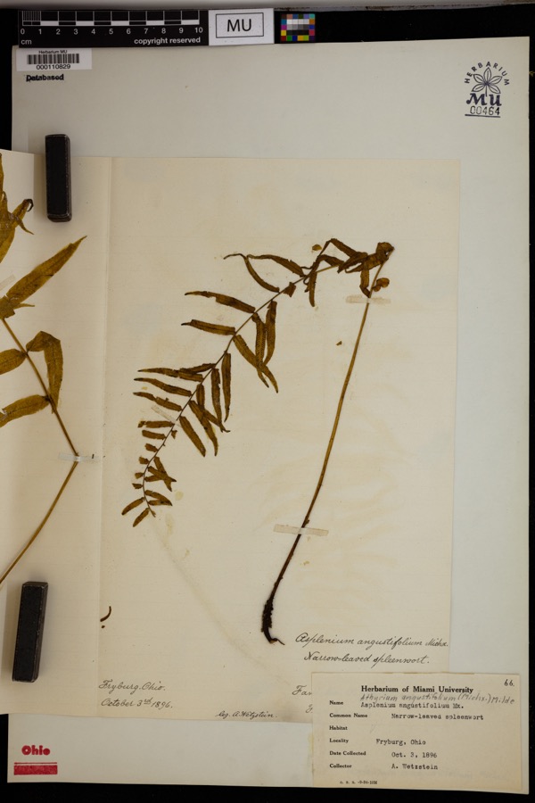
evidence. Museums hold 595 specimens
collected within 10 miles of Rinehart, Hugh T., House between 1893 and
1973: 557 Animalia, 33 Plantae, 5 Fungi. 12 distinct Species records are shown.
Collected by C. Clark, Clark, C. (Clarence), Clark, C. F. (Clarence F.) and others. Each is a
physical object with a catalogue
number, and each entry opens the museum's record. This is what was
collected and kept, not a survey of what lives here - nothing can be
concluded from a species being absent.
Regional context, not property-specific
evidence. The federal mineral resources record lists
3 workings within 5 miles of Rinehart, Hugh T., House: 2 producers, 1 past producer.
2 still produce. What was taken out: Sand and Gravel, Construction. Distance is straight-line from the
map coordinates, so a quarry counted here may appear on a neighbouring
settlement's page as well.
Regional context, not property-specific
evidence. The National Weather Service names
Uniopolis, the town this property stands in, in 10 storm reports between 2013 and 2023: 6 thunderstorm wind, 2 flash flood, 1 hail, 1 tornado.
No death or injury is recorded in these reports. Each account below is quoted exactly as the forecast office
filed it, from the NOAA Storm Events Database, and each date
opens the federal record of that event.
This tornado started at 2354 EST, March 31st, 2023 and ended at 0007 EST, April 1st, 2023 in Auglaize County, Ohio. The injuries occurred just before midnight EST so were included in the March 2023 Storm Data for Ohio, Southwest.||The first sign of visible damage associated with this tornado occurred on Owl Creek Road. At one residence, two large trees were knocked down while a barn was destroyed at another residence. The tornado strengthened as it moved to the northeast, removing a significant portion of a warehouse building roof and snapping several power poles. Just northeast of here, a large commercial greenhouse was completely leveled. The tornado then crossed the intersection of U.S. 33 and Interstate 75, causing significant roof damage and partial exterior wall collapse to an industrial building. At this point, the tornado was at its strongest with estimated winds of up to 110 mph.||On the east side of Interstate 75 and just north of U.S. 33, a truck stop experienced significant damage and a few semi-trailers were blown over. Just northeast of here, a private campground suffered significant damage. At the campsite, numerous trailers were flipped over and a large meeting hall had its roof removed. Several trees were also knocked down. Seven people were injured when the trailers were flipped at the campground.||As the tornado continued northeast, several farmhouses were damaged and outbuildings were damaged or destroyed between Wapakoneta and Uniopolis, particularly along Middle Pike. Considerable debris was noted in nearby fields. A historic brick school building was also destroyed on Brown Road. Numerous trees were also snapped and uprooted along the path. Sporadic damage to trees and outbuildings continued to the northeast before the tornado apparently lifted near the Auglaize/Allen County line.||This tornado started at 2354 EST, March 31st, 2023 and ended at 0007 EST, April 1st, 2023 in Auglaize County, Ohio. The injuries occurred just before midnight EST so were included in the March 2023 Storm Data for Ohio, Southwest.
No historic map-sheet match is published
for this property yet. That does not mean no map exists. This record needs
a coordinate-quality review before it can be joined to a sheet boundary.
Browse the county's mapped places while that work is
pending.
From the nomination file
1,701 words on record
When this property was proposed for the
National Register, someone wrote the case for it: what the building is,
and why it matters. That document is a federal record in the public domain.
It is quoted below word for word, never summarised. The text was read off the scanned case file by machine, so the
occasional stray character is the recogniser's and the 1970s
typewriter's.
Description of the property
The interior retains much of the original character of the house. the existing rooms, a small addition (bath and utility) was put on A cheerful and colorful cluster of buildings surrounds the house. CONDITION DETERIORATED UNEXPOSED XGOOD EXCELLENT UNALTERED FAIR very bottom steps. CHECK ONE The McCarty property rests on a small hill at the corner of State The smokehouse directly east of the house is brick, common bond, and The foundation is brick and the cellar has an outside entrance. and it is painted to match the rest of the outbuildings. relatively well with the rest of the house. Some of these buildings date from before 1880;others are not quite red with white trim, is west of the house, across Wrestle Creek Road.
All windows are 1/1 double hung sash with plain stone lintels The in- of cut stone blocks. -RUINS It ls of common bond brick, from columns are decoratively inscribed, and rest on 22 feet high supports corner is the narrow, steep staircase, which is reminiscent of "ladder and a small hand railing, almost crude in its simplicity, guards the the east end. 1ooks to be as old as the house. It is in poor condition, but plans was once a blacksmithi How it serves as the garage. as old.. Only one modern building, a pole shed, is on the property, addition. The exact date of its construction is unknown, but it ap- Walnut woodwork and chair railings are intact.
Hugh I. Rinehart, a Virginia native, was one of the area's 1700-1799 1500-1599 ECONOMICS COMMUNICATIONS INVENTION ARCHEOLOGY-HISTORIC X1800-1899 RELIGION PERIOD XARCHITECTURE ART AGRICULTURE THEATER BUILDER/ARCHITECT TRANSPORTATION INDUSTRY SIGNIFICANCE XEXPLORATION/SETTLEMENT MILITARY SCULPTURE _ENGINEERING _PHILOSOPHY -1400-1499 _EDUCATION house and the outbuildings.
settled on this property.Rinehart was one of the first three com- -1600-1699 interior, with its handsome walnut woodwork and its utilitarian sim- architecturally,it retains much of its original character.The resident Ron McCarty is planning to continue restoration work on the _COMMERCE _PREHISTORIC LITERATURE earliest white settlers.He came to Auglaize County in 1836,and contributed to the growth of Auglaize County. -1900- The house he built in1861 is located on what was and still is -LAW COMMUNITYPLANNING SPECIFIC DATES ca. 1861 stems from its builder, Hugh T. Rinehart, who as pioneer and public of the peace for 12 years and served on the State Board of Equaliza- ARCHEOLOGY-PREHISTORIC tion. The property family.
This property is worthy of National Register recognition because, missioners of the county, serving from 1848-1850.He was a justice on which the house stands stayed in his family until 19o8,when it
Quoted from the National Register nomination
for reference 78002009, 18 pages, held by the National Archives in Record
Group 79. See the
catalogue record.
Listed places nearby
1 within 8 miles
Other National Register properties close
enough to walk or drive between, ordered by distance from this one. Both
positions come from the same geocoding pass that matched these properties
to their map sheets.
Listing record. National Park Service National Register of Historic Places, listed-properties dataset, current to 2026-05-22.
Map join. Address geocoded through the United States Census geocoder, then tested against the published boundary of every sheet in the USGS Historical Topographic Map Collection.
How this page is made. Listing fields come from federal records; map-sheet coverage is a labelled coordinate-to-boundary calculation, not a source-field claim.
Specimens. Global Biodiversity Information Facility (GBIF), https://www.gbif.org/. Only records licensed CC0 or CC BY are used. Records licensed CC BY-NC are excluded because this site carries advertising. Images are checked individually and any whose licence is non-commercial, no-derivatives or unreadable is refused.
Mines and quarries. USGS Mineral Resources Data System (MRDS) https://mrdata.usgs.gov/mrds/ A work of the United States government, no copyright under 17 U.S.C. 105.
Storms. NOAA National Centers for Environmental Information, Storm Events Database https://www.ncei.noaa.gov/stormevents/ A work of the United States government, no copyright under 17 U.S.C. 105. Narratives are quoted verbatim from the National Weather Service report and are not edited or summarised.
 Block
Block