BlockBefore
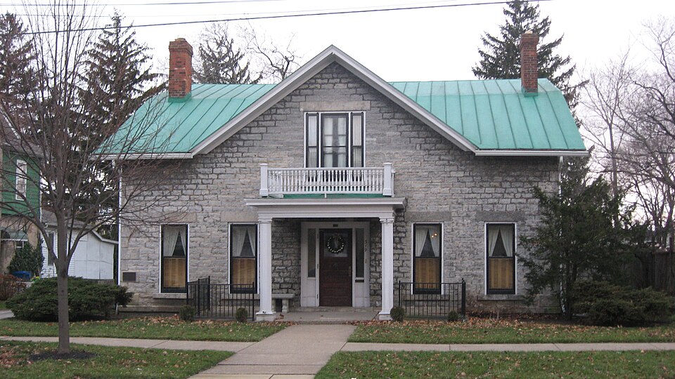
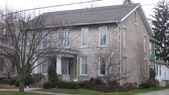
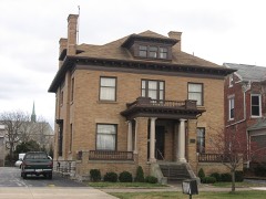
Photograph of William Gordon Melville-Milne House
Photograph by Nyttend, Public domain. Via Wikimedia Commons.

Melville-Milne, William Gordon, House

Listed on the National Register of Historic Places in 1979. A historic map-sheet match is not published yet. The record needs a coordinate-quality review before it can be joined to a sheet boundary.

From the record

one of 175 National Register listings in Erie County · listed in 1979 · category: Building · one of 2 National Historic Landmarks in Erie County.

Sources: the case file at the National Archives · the National Register database, National Park Service

The listing

  • What is counted as historic. The nomination lists 1 building as contributing to the listing.
  • Address. 319 Lawrence St., Sandusky, 44870
  • When was it listed? 1979-03-28
  • Category. building
  • Township. Sandusky city
  • National Register reference number. 79001828 - the number the National Park Service assigned this property when it was listed, and the key its nomination file is catalogued under at the National Archives.

Specimens collected near this property

12 of 3,488 shown

Regional context, not property-specific evidence. Museums hold 3,488 specimens collected within 10 miles of Melville-Milne, William Gordon, House between 1860 and 1975: 1,973 Animalia, 1,201 Plantae, 277 Fungi, 30 Chromista, 6 Protozoa, 1 Unrecorded. 12 distinct Species records are shown. Collected by A. D. Selby, A. Dowdy, A. F. Satterthwait and others. Each is a physical object with a catalogue number, and each entry opens the museum's record. This is what was collected and kept, not a survey of what lives here - nothing can be concluded from a species being absent.

Image SpeciesYear Collected by Where, as recorded
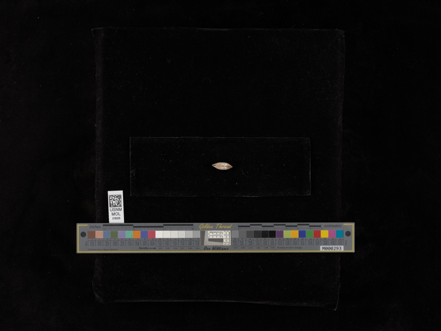
Specimen of Lampsilis radiata radiata (Gmelin, 1791)Lampsilis radiata radiata (Gmelin, 1791)1898United States Fish CommissionSandusky Bay
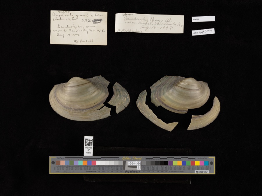
Specimen of Pyganodon grandis (Say, 1829)Pyganodon grandis (Say, 1829)1898United States Fish Commission & W. KendallSandusky Bay near mouth of Sandusky River
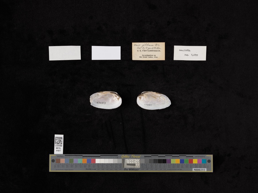
Specimen of Elliptio dilatatus (Rafinesque, 1820)Elliptio dilatatus (Rafinesque, 1820)1899not recordedLake Shore, Near East Harbor
A photograph of the species Perca Linnaeus, not of this specimenPerca Linnaeus, 17581860Smithsonian InstitutionSandusky
A photograph of the species Vermivora chrysoptera, not of this specimenVermivora chrysoptera (Linnaeus, 1766)1868No Person (Birds)Taylor
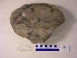
A photograph of the species Macropetalichthys rhapheidolabis, not of this specimenMacropetalichthys rhapheidolabis Norwood & Owen, 1846 (fossil)1881D. S. Young
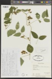
A photograph of the species Apios tuberosa, not of this specimenApios tuberosa Moench1885Wilkinson, E.Cedar Point
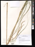
A photograph of the species Spartina pectinata, not of this specimenSpartina pectinata Bosc ex Link1885Wilkinson, E.Cedar Point
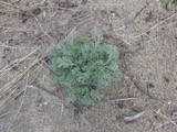
A photograph of the species Artemisia caudata, not of this specimenArtemisia caudata Michx.1886Wilkinson, E.Cedar Point
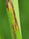
A photograph of the species Graminopassalora graminis, not of this specimenGraminopassalora graminis (Fuckel) U.Braun, C.Nakash., Videira & Crous1886William Trelease; A. CommonsMadison
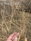
A photograph of the species Panicum virgatum, not of this specimenPanicum virgatum L.1886Wilkinson, E.Cedar Point
A photograph of the species Perca fluviatilis, not of this specimenPerca fluviatilis Linnaeus, 17581886Smithsonian Institution

All 3,488 specimens within 10 miles, at the Global Biodiversity Information Facility.

Mines and quarries near this property

6 within 5 miles

Regional context, not property-specific evidence. The federal mineral resources record lists 6 workings within 5 miles of Melville-Milne, William Gordon, House: 4 past producers, 2 producers. 2 still produce. What was taken out: Stone, Crushed/Broken, Sand and Gravel, Construction, Limestone, General. Distance is straight-line from the map coordinates, so a quarry counted here may appear on a neighbouring settlement's page as well.

Where SiteCommodity StatusRecorded
Wagner QuarryLimestone, GeneralPast ProducerSedimentary
Febus Gravel PitSand and Gravel, ConstructionPast Producer
Huron PitSand and Gravel, ConstructionPast Producer
Erie Materials Inc.Stone, Crushed/BrokenProducer
Geawe QuarryStone, Crushed/BrokenPast Producer
Soldiers Home QuarryStone, Crushed/BrokenProducer

Every working recorded in Erie County

Storms near this property

60 of 81 shown

Regional context, not property-specific evidence. The National Weather Service names Sandusky, the town this property stands in, in 81 storm reports between 1994 and 2023: 42 thunderstorm wind, 30 hail, 3 storm surge/tide, 2 flash flood. The reports record 3 injuries. Each account below is quoted exactly as the forecast office filed it, from the NOAA Storm Events Database, and each date opens the federal record of that event.

WhenEvent Place namedHarm What the report says
August 2023Thunderstorm WindSandusky2 hurtLarge tree downed onto house and injured two inhabitants in Sandusky. Multiple large tree limbs downed elsewhere in Sandusky.
July 2012Thunderstorm WindSandusky1 hurt, $15,000Thunderstorm winds toppled a tree in Sandusky. The tree landed on a car injuring at least one person.
June 2016Thunderstorm WindSandusky$2,000,000A thunderstorm downburst caused widespread wind damage in the northeast portion of Sandusky. The damage swatg was a half mile wide and approximately 2.25 miles long. Numerous large trees and limbs were brought down across the city with some falling on buildings causing roof damage. Numerous large trees were also downed at Battery Park and the Marina. Approximately 30 power poles were blown over on the causeway to Cedar Point. Some power lines landed on cars trapping 15 to 20 people in their vehicles. Power outages due to the downed lines caused Cedar Point to be closed for the following day. At least one site measured a wind gust to 76 mph. Estimated wind speeds based on damage were 70 to 80 mph in downtown Sandusky and as high and greater than 80 mph on the causeway.
September 2005Thunderstorm WindSandusky$750,000Severe thunderstorm downburst winds caused substantial damage in Perkins Township, just south of the City of Sandusky, during the late evening hours of the 22nd. The damage was concentrated in an area just west of the Sandusky Mall. The thunderstorm winds were estimated to be around 70 mph. Forty to fifty homes in Perkins Township were damaged. A few homes had moderate damage but most of the damage was minor. A house nearly one hundred and fifty years old had its chimney knocked down from the severe winds. Another house had a roof collapse into the living room. A garage at another location collapsed after the roof was completely torn off. Other houses primarily had damage to their roofs. A church had two sections of it's roof torn off, and four windows blown out of it. Fifteen to twenty trees were completely uprooted in the area, and hundreds of other trees were knocked down or sustained major damage from large limbs broken off of them. Along with trees, many areas had power lines that were downed.
February 1998Storm Surge/TideSandusky$500,000no account filed
May 2011HailSandusky$400,000A swath of large hail fell across Erie County. Golf ball to hen egg size hail fell from the Sandusky area east across the Milan area to near Birmingham. Hundreds of vehicles and many homes were damaged by the hail.
May 2011HailSandusky$300,000A line of severe thunderstorms produced a swath of large hail ranging in size from ping pong balls to golf balls. Numerous vehicles and homes were damaged as a result of the damaging hail.
May 2010HailSandusky$250,000Quarter to hen egg sized hail was observed. Many vehicles were damaged by the hail.
July 2018Thunderstorm WindSandusky$150,000Thunderstorm downburst winds estimated to be at least 60 mph downed many trees in Sandusky. Damage was also reported in the downtown area. One building lost most of it's roof. A previously fired damaged building in the area partially collapsed. Scattered power outages were also reported.
March 1998Storm Surge/TideSandusky$100,000no account filed
February 1998Storm Surge/TideSandusky$75,000no account filed
June 2012Thunderstorm WindSandusky$50,000Thunderstorm winds downed a few trees and utility poles.
July 2003Thunderstorm WindSandusky$50,000Thunderstorm winds downed several trees. A home and building were damaged by fallen trees. A van was crushed by a tree.
August 2000Thunderstorm WindSandusky$50,000Thunderstorm winds downed several trees. Two cars were crushed by trees.
September 1996Flash FloodSandusky$50,000no account filed
August 2000Thunderstorm WindSandusky$35,000Thunderstorm winds knocked downed several trees. Two of the trees damaged cars.
July 2000Thunderstorm WindSandusky$35,000A 68 mph thunderstorm wind gust was measured in Sandusky. Many trees were downed and two homes were damaged by fallen trees. Two other trees were knocked down five miles south of Sandusky.
June 2007Thunderstorm WindSandusky$30,000Numerous trees and power lines were reported down.
May 2015Thunderstorm WindSandusky$25,000Thunderstorm wind gusts downed several trees and power lines in Sandusky.
September 2007Thunderstorm WindSandusky$25,000Numerous large limbs, several trees and power lines were reported down around Sandusky.
June 2009HailSandusky$20,000Quarter size hail was observed.
July 1996Thunderstorm WindSandusky$20,000no account filed
July 2011Thunderstorm WindSandusky$15,000Thunderstorm winds downed a few trees.
June 2004Thunderstorm WindSandusky$15,000Thunderstorm winds downed several trees and damaged a roof.
August 2000Thunderstorm WindSandusky$15,000Thunderstorm winds downed many trees in Sandusky, Berlin Heights and Vermillion. A billboard sign was also toppled near Sandusky.
June 2010Thunderstorm WindSandusky$12,000Thunderstorm winds downed a tree and a power pole.
August 1998LightningSandusky$12,000Lightning struck the roof of a house, and the ensuing fire caused considerable damage.
July 2006Thunderstorm WindSandusky$10,000Numerous trees were reported down from Sandusky to Huron.
July 2002Thunderstorm WindSandusky$10,000Thunderstorm winds downed several trees.
June 2002Thunderstorm WindSandusky$10,000Thunderstorm winds toppled two power poles.
July 1998Thunderstorm WindSandusky$10,000Numerous trees were downed south of Sandusky.
June 1995Thunderstorm WindSandusky$10,000Trees were downed. Three city vehicles were damaged by falling trees.
July 2008Thunderstorm WindSandusky$7,000Thunderstorm winds downed several trees.
June 2010Thunderstorm WindSandusky$5,000Thunderstorm winds downed several tree limbs in Perkins Township.
June 2007Thunderstorm WindSandusky$5,000Thunderstorm winds downed several large tree limbs.
June 2006Thunderstorm WindSandusky$5,000Numerous large limbs were reported down.
July 1997Thunderstorm WindSandusky$5,000no account filed
September 2011FloodSandusky$3,000Lake enhanced rainfall over Erie County produced torrential rainfall with rates around two inches per hour. As much as 3 to 5 inches of storm total rain fell over the city of Sandusky. Several underpasses filled with water and many roads were closed due to high water.
August 2019Thunderstorm WindSandusky$2,000Several power lines were knocked down on to utility poles.
July 2012Thunderstorm WindSandusky$2,000Thunderstorm winds downed a couple of trees.
June 2009Thunderstorm WindSandusky$2,000Several large limbs were reported down.
July 2002Thunderstorm WindSandusky$2,000Thunderstorm winds downed two large tree limbs.
June 2008Thunderstorm WindSandusky$1,000Thunderstorm winds downed one tree.
August 2008Thunderstorm WindSandusky$1,000Several large limbs were reported down.
June 2006Thunderstorm WindSandusky$1,000A few large limbs were reported down.
June 2023Thunderstorm WindSandusky-Several power poles snapped along U.S. Route 6, about two-miles WSW of Sandusky.
May 2020Thunderstorm WindSandusky-Two trees down two miles SE of Sandusky.
May 2020Thunderstorm WindSandusky-Tree down on Wilson Street in Sandusky.
May 2019Thunderstorm WindSandusky-Numerous trees were blown down across roadways.
July 2017HailSandusky-Penny sized hail was observed.
July 2017HailSandusky-Quarter sized hail was observed.
July 2014HailSandusky-Nickel to quarter sized hail was observed.
September 2012HailSandusky-Penny sized hail was observed.
July 2012HailSandusky-Quarter sized hail was observed.
July 2012HailSandusky-Penny sized hail was observed.
June 2010HailSandusky-Penny sized hail was observed.
June 2010HailSandusky-Quarter sized hail was observed.
May 2010HailSandusky-Quarter sized hail was observed at the NASA Plumb Rock facility.
August 2009HailSandusky-Penny size hail was observed.

Every storm recorded in Erie County

Map coverage status

No historic map-sheet match is published for this property yet. That does not mean no map exists. This record needs a coordinate-quality review before it can be joined to a sheet boundary. Browse the county's mapped places while that work is pending.

From the nomination file

2,671 words on record

When this property was proposed for the National Register, someone wrote the case for it: what the building is, and why it matters. That document is a federal record in the public domain. It is quoted below word for word, never summarised. The text was read off the scanned case file by machine, so the occasional stray character is the recogniser's and the 1970s typewriter's.

Description of the property

half is constructed of limestone and the rear of wood frame. It second floor window under the central gabled wall dormer. The corbeled end chimneys. The lintels, sills, and watertable are The addition has a broad rear gable, a variety of clustered double roof to incorporate the 1912 construction, Also, the original access to the addition. Except for later redecorations, the interior is intact.

CONDITION UNEXPOSED EXCELLENT XALTERED UNALTERED DETERIORATED XGOOD side elevations have symmetrical double hung windows flanking switchback interior stair was changed to a straight run, giving The Melville-Milne House is a rectangular structure whose front sidelights were somewhat altered and a Tuscan columned and tion.The main gable roof was changed into a shallow gambrel CHECK ONE hung windows, a side bay window, a corner porch enclosed with of dressed stone and the wall surfaces of rock faced ashlar. has a central entrance, tall first floor windows, anda tripartite rear is stuccoed to match the limestone on the rest of the house. The house was extensively remodeled in l9l2.

The front entrance has a standing seam metal roof.The original facade(ca.1840) MOVED DATE balustraded porch was added. The wood frame addition at the tongue and groove siding, and a one story, hip roof rear projec- DATE

Statement of significance

Erie Railroad, using limestone from a nearby Washington Street William Gordon Melville-Milne, after whom the house was named, was born in Aberdeen, Scotland and emigrated to Canada and then Although limestone houses are common in Sandusky, the cottage design of the structure, with its central gable, wide eaves, and original intent of the design while almost doubling the size of the Because of its unusual design within a common local building tradi- tion, its associations with the early history of the railroads in Ohio, ART X1800-1899 LAW house. CONSERVATION ARCHEOLOGY-HISTORIC BUILDER/ARCHITECT SCIENCE INVENTION SCULPTURE XARCHITECTURE PERIOD INDUSTRY TRANSPORTATION a district manager of the Toledo Fire and Marine Insurance Company. _EXPLORATION/SETTLEMENT the present owners.

and its ownership by representative citizens of Sandusky, the Melville- _1400-1499 Milne House is a significant landmark in local history. _PREHISTORIC raised eight children in the house, until James, the youngest son, The Melville-Milne House is significant because of its unusual _1600-1699 cottage design and because it is one of several residences built X.SOCIAL/HUMANITARIAN became the sole owner.James was the postmaster of Sandusky and company.The house remained in the Emmons family for several Frederick Emmons, an executive with the Hinde & Dauch Paper _1500-1599 _MILITARY _ENGINEERING AGRICULTURE of its stock.The earliest occupant of the house is not known.

to Missouri before settling in Sandusky in1847.He worked for the Mad River and Lake Erie Railroad until his death in 186l.His widow for employee housing by Ohio's first railroad. In 19l2, the house was purchased and extensively remodeled by _1900- The house was constructed around 1840 by the Mad River and Lake -_1700-1799 -_COMMUNITY PLANNING ca. 1840 -LANDSCAPE ARCHITECTURE quarry. The land was deeded to the railroad in exchange for shares low roof, is unusual in the city.

Read the complete 2,671-word case file.

The whole case file for this property - 2,671 words, 21 pages, reproduced complete.

Quoted from the National Register nomination for reference 79001828, 21 pages, held by the National Archives in Record Group 79. See the catalogue record.

Listed places nearby

6 within 8 miles

Other National Register properties close enough to walk or drive between, ordered by distance from this one. Both positions come from the same geocoding pass that matched these properties to their map sheets.

Photograph PropertyDistance Listed
Bates-Cockrem Houseunder 500 feet1982
Von Schulenburg, Ernst, Houseunder 500 feet1982
Cable, Frank, Houseunder 500 feet1982
Mertz, John, Houseunder 500 feet1992
Hinde, James J., House0.1 miles1982
Mad River Block0.1 miles1974

Sources for this property

National Archives recordThe nomination case file for reference 79001828 in Record Group 79.
Erie CountyAll 175 listed properties in this county.

Provenance

  • Listing record. National Park Service National Register of Historic Places, listed-properties dataset, current to 2026-05-22.
  • Map join. Address geocoded through the United States Census geocoder, then tested against the published boundary of every sheet in the USGS Historical Topographic Map Collection.
  • How this page is made. Listing fields come from federal records; map-sheet coverage is a labelled coordinate-to-boundary calculation, not a source-field claim.
  • Specimens. Global Biodiversity Information Facility (GBIF), https://www.gbif.org/. Only records licensed CC0 or CC BY are used. Records licensed CC BY-NC are excluded because this site carries advertising. Images are checked individually and any whose licence is non-commercial, no-derivatives or unreadable is refused.
  • Mines and quarries. USGS Mineral Resources Data System (MRDS) https://mrdata.usgs.gov/mrds/ A work of the United States government, no copyright under 17 U.S.C. 105.
  • Storms. NOAA National Centers for Environmental Information, Storm Events Database https://www.ncei.noaa.gov/stormevents/ A work of the United States government, no copyright under 17 U.S.C. 105. Narratives are quoted verbatim from the National Weather Service report and are not edited or summarised.