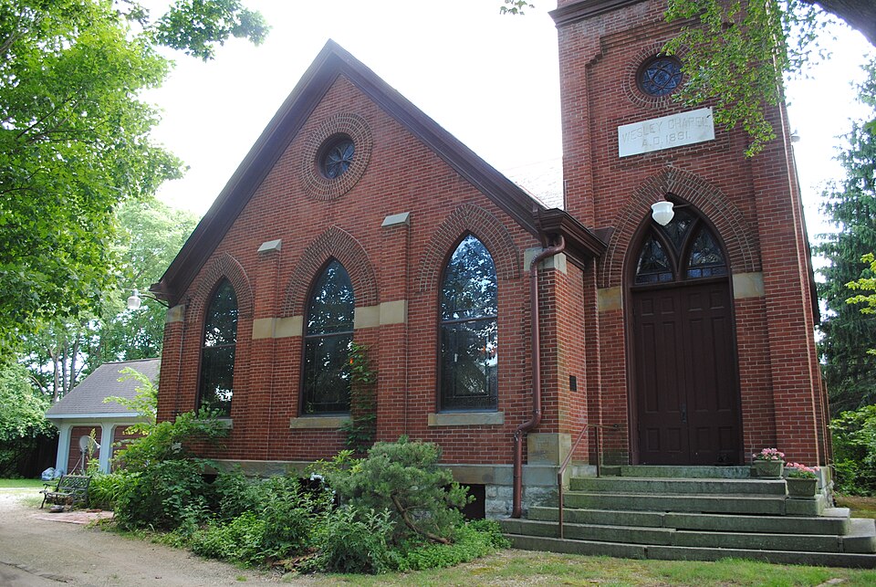
Listed on the National Register of Historic Places in
1979. A historic map-sheet match is not published yet. The record needs a coordinate-quality review before it can be joined to a sheet boundary.
From the record
“Horch, was educated in the public schools near his home in Washington township, Franklin county. Ohio, and at Ringsville school, and was reared to farm work.”
A Centennial Biographical History of the City of Columbus and Franklin County, Ohio .. (1901). Machine-read text.
one of 295 National Register listings in Franklin County · listed in 1979 · category: Building · one of 3 National Historic Landmarks in Franklin County.
National Register reference number.79001843- the number the National Park Service assigned this property when it was listed, and the key its nomination file is catalogued under at the National Archives.
What happened here
An account from the chapter on Columbus city, The inset identifies its exact
source book and publication year.
The Mound Builders and Indians - First White Settlements and Struggle for Possession - Indian Village at the Forks of the Scioto Attacked by Crawford and Dispersed - The Ohio Company, the Scioto Company and Symmes Purchase - Indian Power Broken and British Hopes Blasted - First Surveys - Topography, Geology and Soil of Franklin County.
Unto Mr. and Mrs. Davidsoni have been born seven children : Arminta, the eldest, is the wife of George Van Schoyck, of Norwich township, Franklin county. Millard married Rachel Britton and resides in Washington township. Mary C. became the wife of George Wilcox and died in Washington township. Ida is the wife of George McCullough and died in Norwich township. Irena is the wife of George Fanning, of Oklahoma. Perley J., born on the home farm, April 18, 1868, attended the district schools of Washington township, was for three years a student in the high school at Hilliard, pursued a commercial course in Ada College and studied stenography in Hudson College at Columbus. After completing his education he went to Buena Vista, Virginia, to learn drafting, but, disliking that work, he returned and has since operated the home farm. He is a member of the Masonic Lodge of Hilliard, and in politics is a Democrat. Harry, the youngest of the family, died at the age of twenty-seven years.
This well-known and popular physician of Hilliard's belongs to an old Ohio family of English origin. His paternal grandfather was born in Hummelstown, Dauphin county, Pennsylvania, and at an early day removed to one of the eastern counties of this state, where he engaged jn farming throughout the remainder of his life. He had four children, namely : Solomon ; Anderson ; James C, father of our subject; and Nancy, who married Warren Mc- Neil and died in Iowa.
Regional context, not property-specific
evidence. The
federal wildfire occurrence database
lists 1 fire within 5 miles of Wesley Chapel between
2011 and 2011, burning about 0 acres in total. None started naturally. None was recorded as arson.
Distance is straight-line from the map coordinates, so a fire counted
here may appear on a neighbouring settlement's page as well.
Reported cause
Fires
Missing data/not specified/undetermined
1
The most recent of
them, most recent first, with the day each was reported and the service
that recorded it.
Regional context, not property-specific
evidence. Museums hold 9,448 specimens
collected within 10 miles of Wesley Chapel between 1804 and
1975: 7,469 Animalia, 1,272 Fungi, 559 Plantae, 117 Chromista, 30 Unrecorded, 1 Protozoa. 12 distinct Species records are shown.
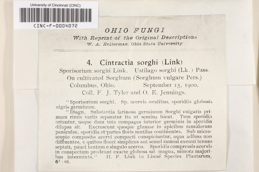
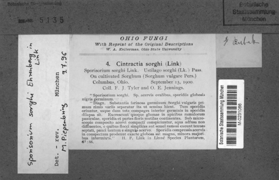
Collected by 19 V 1938 in original publication, Knull, =, ? and others. Each is a
physical object with a catalogue
number, and each entry opens the museum's record. This is what was
collected and kept, not a survey of what lives here - nothing can be
concluded from a species being absent.
Regional context, not property-specific
evidence. The federal mineral resources record lists
2 workings within 5 miles of Wesley Chapel: 1 past producer, 1 producer.
1 still produces. What was taken out: Calcium. Distance is straight-line from the
map coordinates, so a quarry counted here may appear on a neighbouring
settlement's page as well.
Regional context, not property-specific
evidence. The National Weather Service names
Hilliard, the town this property stands in, in 36 storm reports between 1994 and 2025: 18 hail, 16 thunderstorm wind, 1 flash flood, 1 lightning.
The reports record 1 death and 5 injuries. Each account below is quoted exactly as the forecast office
filed it, from the NOAA Storm Events Database, and each date
opens the federal record of that event.
Numerous trees and power lines were knocked down around the county, especially around Dublin. Also around Dublin, a roof of a strip mall was damaged and a tree fell on a home. A spotter reported a wind gust to 60 mph in Hilliard and dime size hail was reported in Reynoldsburg. A 100 foot tree was knocked down on to a tent at Ohio State University. Four workers were injured.
Widespread wind damage occurred across the northern part of the county. Up to 200 trees were downed, some causing extensive damage by falling onto homes and automobiles. Dime size hail also fell across the northern Columbus suburbs. Wind gusts were estimated at near 70 mph.
A brief microburst cause minor damage to some homes, along with downed trees and poowerlines. Three barns in the area also sustained some minor structural damage.
No historic map-sheet match is published
for this property yet. That does not mean no map exists. This record needs
a coordinate-quality review before it can be joined to a sheet boundary.
Browse the county's mapped places while that work is
pending.
From the nomination file
1,403 words on record
When this property was proposed for the
National Register, someone wrote the case for it: what the building is,
and why it matters. That document is a federal record in the public domain.
It is quoted below word for word, never summarised. The text was read off the scanned case file by machine, so the
occasional stray character is the recogniser's and the 1970s
typewriter's.
Description of the property
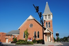
Nested into a curve of the Scioto-Darby Creek Road, the facade of the Wesley Chapel arched, louvered openings on all four sides. The pyramidal roof has gablets on each side and terminates with a foliated crocket. The west gable end is described above. To the right of the gabled section the west side of the stem of the"T" has a narrow, arched door centered in it. CONDITION UNEXPOSED course. EXCELLENT UNALTERED FAIR darker banding terminates. Four semi-circular stone steps lead to the entrance.Above the doorway is a large CHECK ONE projection which houses the chancel of the church.A plain wood cornice The interior of the chapel has the original pews.Beneath the windows the walls tall double door.Above the door there is a high-arched stained glass transom.
the gable is a tall Gothic arched stained glass window.The Arch is framed by narrow arched window.Above is a round window with wood mullions forming a a wide band of darker brick.Wood'tracery'divides the lower sections into three body of the tower is the height of the gable roofs.The east side has another faced sandstone block foundation.Above the foundation is a smooth stone belt intersecting gable roofswhere the two sections meet.The building is ona rock- surrounded by trees and a cemetery.The building mass is a modified "T with On the south face the stem of the Tu has three arched windows.The stained north side of the building is blind.Centered on the wall is a small rectangular glass has a diamond quilted pattern.The outer edges are distinguished by a surrounds the building.The roof is the original slate.
opening. To the left of this,on the east end,is a simple square tower.The X-GOOD Beneath the doorway, under the steps is a bulkhead leading to the basement. stone caps are employed.
The small chapel, which is still in use, is quite a good example of the used give a heavy, solid feeling which apparantly appealed to the congregation. severely damaged by a storm in 1861. By 1891 funds had again been 1500-1599 1891 PHILOSOPHY PREHISTORIC LAW COMMUNICATIONS INVENTION ART CONSERVATION X1800-1899 PERIOD EXPLORATION/SETTLEMENT ARCHEOLOGY-HISTORIC and interior. 1400-1499 EDUCATION SIGNIFICANCE THEATER POLITICS/GOVERNMENT SCIENCE AGRICULTURE SCULPTURE RELIGION MILITARY LITERATURE XARCHITECTURE INDUSTRY ARCHEOLOGY-PREHISTORIC MUSIC detailing in stone and dark brick. In recent years the building has been cleaned and repointed.No other In 1940 the basement was excavated and the exterior (west) hatchway added.
The local stone and brick are well used.Particularly fine is the The first building on this site for the congregation was frame, _COMMERCE -1600-1699 _ENGINEERING The chapel was the home of the first church organized in the Hilliard their chapel and have recently been attending to the neglect of the tower -1700-1799 -TRANSPORTATION -1900- area. raised to build the present structure.The architect was C.A. Stribling built in 1830.It was replaced in 1854 by a brick structure.which was of Co1umbus.The cost was.$6,500.The chapel was dedicated July 24,1892.
Quoted from the National Register nomination
for reference 79001843, 9 pages, held by the National Archives in Record
Group 79. See the
catalogue record.
Listed places nearby
6 within 8 miles
Other National Register properties close
enough to walk or drive between, ordered by distance from this one. Both
positions come from the same geocoding pass that matched these properties
to their map sheets.
Listing record. National Park Service National Register of Historic Places, listed-properties dataset, current to 2026-05-22.
Map join. Address geocoded through the United States Census geocoder, then tested against the published boundary of every sheet in the USGS Historical Topographic Map Collection.
How this page is made. Listing fields come from federal records; map-sheet coverage is a labelled coordinate-to-boundary calculation, not a source-field claim.
Wildfire. Short, Karen C. 2022. Spatial wildfire occurrence data for the United States, 1992-2020 [FPA_FOD_20221014]. 6th Edition. Fort Collins, CO: Forest Service Research Data Archive. https://doi.org/10.2737/RDS-2013-0009.6 Collected with United States Government funding and usable without additional permissions or fees.
Specimens. Global Biodiversity Information Facility (GBIF), https://www.gbif.org/. Only records licensed CC0 or CC BY are used. Records licensed CC BY-NC are excluded because this site carries advertising. Images are checked individually and any whose licence is non-commercial, no-derivatives or unreadable is refused.
Mines and quarries. USGS Mineral Resources Data System (MRDS) https://mrdata.usgs.gov/mrds/ A work of the United States government, no copyright under 17 U.S.C. 105.
Storms. NOAA National Centers for Environmental Information, Storm Events Database https://www.ncei.noaa.gov/stormevents/ A work of the United States government, no copyright under 17 U.S.C. 105. Narratives are quoted verbatim from the National Weather Service report and are not edited or summarised.
 Block
Block