Listed on the National Register of Historic Places in
1979. A historic map-sheet match is not published yet. The record needs a coordinate-quality review before it can be joined to a sheet boundary.
From the record
one of 81 National Register listings in Stark County · listed in 1979 · category: Building.
National Register reference number.79001955- the number the National Park Service assigned this property when it was listed, and the key its nomination file is catalogued under at the National Archives.
Regional context, not property-specific
evidence. The
federal wildfire occurrence database
lists 1 fire within 5 miles of Hoover Farm between
2005 and 2005, burning about 30 acres in total. None started naturally. None was recorded as arson.
Distance is straight-line from the map coordinates, so a fire counted
here may appear on a neighbouring settlement's page as well.
Reported cause
Fires
Debris and open burning
1
The most recent of
them, most recent first, with the day each was reported and the service
that recorded it.
Regional context, not property-specific
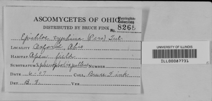
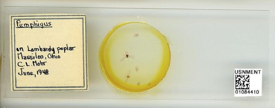
evidence. Museums hold 361 specimens
collected within 10 miles of Hoover Farm between 1836 and
1975: 298 Animalia, 52 Plantae, 5 Unrecorded, 5 Fungi, 1 Protozoa. 12 distinct Species records are shown.
Collected by A. W. Cusick, A.M. Rogers, Allen, John and others. Each is a
physical object with a catalogue
number, and each entry opens the museum's record. This is what was
collected and kept, not a survey of what lives here - nothing can be
concluded from a species being absent.
Regional context, not property-specific
evidence. The federal mineral resources record lists
18 workings within 5 miles of Hoover Farm: 9 producers, 8 past producers, 1 plant.
10 still produce. What was taken out: Sand and Gravel, Construction, Stone, Crushed/Broken, Iron, Limestone, General. Distance is straight-line from the
map coordinates, so a quarry counted here may appear on a neighbouring
settlement's page as well.
Regional context, not property-specific
evidence. The National Weather Service names
North Canton, the town this property stands in, in 28 storm reports between 1998 and 2022: 15 thunderstorm wind, 9 hail, 2 lightning, 2 flash flood.
The reports record 1 injury. Each account below is quoted exactly as the forecast office
filed it, from the NOAA Storm Events Database, and each date
opens the federal record of that event.
On the evening of June 18th heavy rain fell over northern Stark County between 6 and 7 PM. A automated rain gauge in Alliance measured 1.35 inches in that one hour. This intense rain on saturated ground and still flooded portions of town led to flash flooding and more intense damage to the Plain Township area. Two homes on Chaucer Street in Sherwood Village collapsed when their foundations gave way. Several other homes have sanitary sewer problems. More than 100 residents whose property sustained flood damage. 10-14 people were evacuated that evening from an apartment complex which was inundated with 18 of flood waters from a tributary of the Middle Branch of the Nimishillen Creek. Homes on Arboretum Circle were also evacuated on Wednesday night from the Zimber Ditch. Numerous roads sustained erosion and tar removal from the flowing water. Graybill Road between Massillon Road and Mayfair Road suffered erosion. Berna Road was closed for two weeks to repair two damaged pipes. Greensburg Road, near the 1600 block of Nimisila Road was also damaged by flood waters.
Between 620 PM and 635 PM a torrential shower moved over the Beldon Village are in North Canton located just west of I-77. The shower lasted only 15 minutes, however during a 10 minute period rainfall rates jumped to 4.36 in/hr as estimated by NWS Doppler Radar. No gauges were located at the site of the flooding, but radar estimates put this rate around a 100 year rain for this part of Ohio. This extreme rate overwhelmed drainage systems with excessive runoff. The impact area was limited to a 1/4 to a 1/2 mile radius from the Beldon Village Mall. The parking lot of the mall with over 4 feet of water, manhole covers were blown off from the water pressure of the stormwater system, and several nearby roads flooded. A number of businesses were flooded including a grocery store and a fast food restaurant with as much as 2 feet of water. Several cars were flooded and one woman needed to be rescued. Storm total rainfall estimates were a little over an inch, however the extreme rainfall rates were the cause to the damage in this event.
No historic map-sheet match is published
for this property yet. That does not mean no map exists. This record needs
a coordinate-quality review before it can be joined to a sheet boundary.
Browse the county's mapped places while that work is
pending.
From the nomination file
1,770 words on record
When this property was proposed for the
National Register, someone wrote the case for it: what the building is,
and why it matters. That document is a federal record in the public domain.
It is quoted below word for word, never summarised. The text was read off the scanned case file by machine, so the
occasional stray character is the recogniser's and the 1970s
typewriter's.
Description of the property
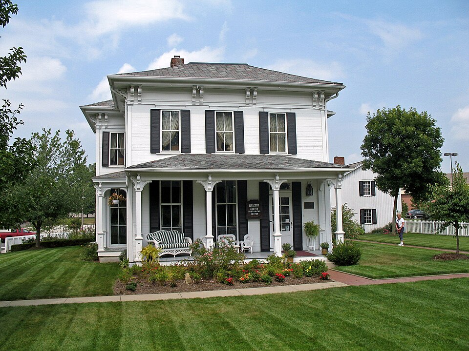
corner of the original farm. The farmhouse, at the front of the complex, is a two-story brick building constructed on a limestone foundation and painted white. It has a hipped roof with asphalt shingles and an overhanging bracketed cornice. It was built in at least two segments with a rectangular 1853 block forming the central portion of the existing building, and a rear wing probably added to the original house. feature of the facade is a wooden porch with hipped roof and bracketed cornice. There is also a simple shed-like porch at the rear of the house.
The interior of the house reflects the 1870 remodeling with all hand-grained woodwork and a side hallway in the front block which has a dark cherry newel post, bannister To the rear and immediate north of the house is a braced-frame tannery with a gable roof just to the west of the barn. The complex was recently renovated and converted to a museum use for displaying Hoover side of the plot. CONDITION UNEXPOSED UNALTERED DETERIORATED FAIR XEXCELLENT remaining half restored to its original appearance as a tannery with central fireplace. and railing.
is gradually being subdivided for suburban Canton.The Center is located on the mature hardwoods and evergreens.A blacktopped parking lot and drive is at the western CHECK ONE and asphalt shingles.It has a central chimney and vertical board and batten siding. A white picket fence surrounds the buildings on three sides and throughout the plot has approximately 160 acre farm originally purchased by Daniel Hoover.The majority of products. Brick sidewalls were added around the house and tannery, and foundation taxus A three-bay bank barn is at the rear of the entire complex.It has elaborately framed -GOOD RUINS louvred ventilation openings and a gabled roof with asphalt covering.
farmstead, and as the only remaining historical tie to the Hoover family, developers in Plain Township. One of the eight, children of the family, Daniel Hoover, apprenticed Hoover would keep one hide for every three he prepared, and farmed the land until his retirement in 1873. Daniel Hoover died in 1905. returning from college, Hoover joined his father in the tannery business on the farm, and Scotch Horse Collar." Hoover became a civic leader in North Canton, helping to establish and operate the interurban between Canton and Akron, serving on the school board, and administering the city as mayor for a short time. Hoover got involved in the sweeper business when a friend, James M. Spangler, came to abandoned and the workers switched to sweeper production.
Since that time, the Hoover 1600-1699 RELIGION THEATER LAW ART COMMUNICATIONS ARCHEOLOGY-HISTORIC PERIOD SIGNIFICANCE BUILDER/ARCHITECT EXPLORATION/SETTLEMENT world.
INDUSTRY MILITARY LITERATURE XINVENTION PREHISTORIC Initially a corner of the leathergoods shop was converted to produce the sweepers; but SOCIAL/HUMANITARIAN XAGRICULTURE him for help after the original financing for his patented invention, an electric sweeper, of the early manufacturing structure and retains much of its original architectural XARCHITECTURE business into North Canton, then known as New Berlin, and expanded it to include the _CONSERVATION The Hoover Historical Center is significant as an intact example of a 19th century and in 187l, purchased it from his father.When his father retired, Hoover moved the _1700-1799 - ENGINEERING X1800-1899 -TRANSPORTATION attended the township schools and Mt.Union College at Alliance from 1866-l870.Upon -SCULPTURE barn to the rear of the complex was probably built about the time of the Victorian -1400-1499 addition to the main house.
Quoted from the National Register nomination
for reference 79001955, 14 pages, held by the National Archives in Record
Group 79. See the
catalogue record.
Listed places nearby
6 within 8 miles
Other National Register properties close
enough to walk or drive between, ordered by distance from this one. Both
positions come from the same geocoding pass that matched these properties
to their map sheets.
Listing record. National Park Service National Register of Historic Places, listed-properties dataset, current to 2026-05-22.
Map join. Address geocoded through the United States Census geocoder, then tested against the published boundary of every sheet in the USGS Historical Topographic Map Collection.
How this page is made. Listing fields come from federal records; map-sheet coverage is a labelled coordinate-to-boundary calculation, not a source-field claim.
Wildfire. Short, Karen C. 2022. Spatial wildfire occurrence data for the United States, 1992-2020 [FPA_FOD_20221014]. 6th Edition. Fort Collins, CO: Forest Service Research Data Archive. https://doi.org/10.2737/RDS-2013-0009.6 Collected with United States Government funding and usable without additional permissions or fees.
Specimens. Global Biodiversity Information Facility (GBIF), https://www.gbif.org/. Only records licensed CC0 or CC BY are used. Records licensed CC BY-NC are excluded because this site carries advertising. Images are checked individually and any whose licence is non-commercial, no-derivatives or unreadable is refused.
Mines and quarries. USGS Mineral Resources Data System (MRDS) https://mrdata.usgs.gov/mrds/ A work of the United States government, no copyright under 17 U.S.C. 105.
Storms. NOAA National Centers for Environmental Information, Storm Events Database https://www.ncei.noaa.gov/stormevents/ A work of the United States government, no copyright under 17 U.S.C. 105. Narratives are quoted verbatim from the National Weather Service report and are not edited or summarised.
 Block
Block