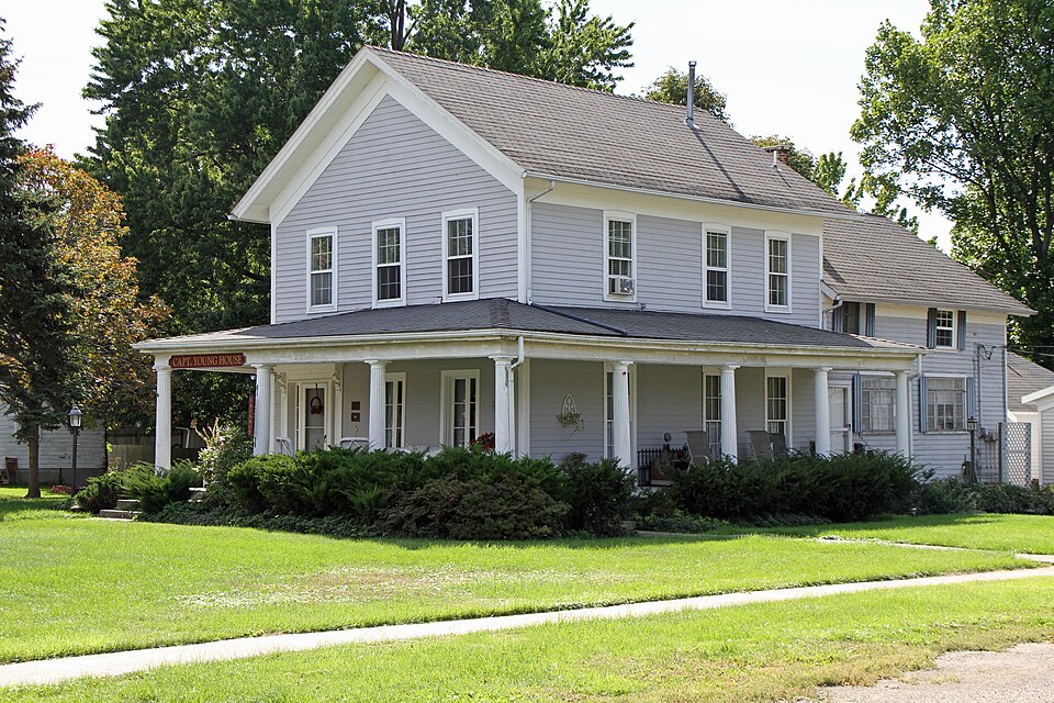
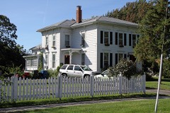
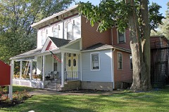
Listed on the National Register of Historic Places in
1979. A historic map-sheet match is not published yet. The record needs a coordinate-quality review before it can be joined to a sheet boundary.
From the record
one of 175 National Register listings in Erie County · listed in 1979 · category: Building · one of 2 National Historic Landmarks in Erie County.
National Register reference number.79003945- the number the National Park Service assigned this property when it was listed, and the key its nomination file is catalogued under at the National Archives.
Specimens collected near this property
12 of 636 shown
Regional context, not property-specific
evidence. Museums hold 636 specimens
collected within 10 miles of Young, Capt., House between 1874 and
1975: 390 Plantae, 178 Animalia, 67 Fungi, 1 Protozoa. 12 distinct Species records are shown.
Collected by ?, A. M. Evans, A.M. Evans and others. Each is a
physical object with a catalogue
number, and each entry opens the museum's record. This is what was
collected and kept, not a survey of what lives here - nothing can be
concluded from a species being absent.
Regional context, not property-specific
evidence. The National Weather Service names
Vermilion, the town this property stands in, in 31 storm reports between 2001 and 2023: 16 thunderstorm wind, 6 hail, 6 flash flood, 1 waterspout.
No death or injury is recorded in these reports. Each account below is quoted exactly as the forecast office
filed it, from the NOAA Storm Events Database, and each date
opens the federal record of that event.
Thunderstorm winds caused extensive damage in Vermilion. Many trees and limbs were downed and a mobile home was knocked off it's foundation and heavily damaged. At a marina, several large boats were heavily damaged when the racks holding them were blown over by the high winds spilling the boats on to the ground.
On March 11th an ice jam developed on the Vermilion River in the Mill Hollow metropark located just south and upstream of the town of Vermilion. The ice jam was stationary for days as water continued to build behind it, flooding the metropark but no other properties or roads. Around 3:30 am on the morning of the 14th the combination of snowmelt and rainfall caused the ice jam to break. The water levels in the Riverside Drive community of Vermilion saw a rapid water rise. One person had to be rescued from waste deep water around 6 am that morning. Several people in the community had already evacuated due to the heightened awareness from the ice jam flood watch leading up to the ice jam break. A second ice jam developed around Riverside Drive which broke around 930 am. It went in cycles all day long, jamming up and then breaking loose because of all the bends in the river. About 20 homes sustained minor flooding damage mainly to garages and outer buildings.
Ice jams formed on the Vermilion River upstream from Vermilion late on 1st and early on the 2nd. During the early morning hours of the 2nd an ice jam broke upstream and then made its way downstream towards Vermilion. After daybreak on the 2nd, another ice jam formed on the river upstream. This second ice jam broke and sent additional ice and water flowing downstream towards Vermilion. By late morning, the river rose approximately two feet in only a few hours. This caused water to quickly rise out of its banks, and required people living near the river to evacuate from their homes.
Multiple road closures due to flash flooding in eastern Erie County, including in Vermilion and Florence Township. Main Road closed at Chappel Creek due to flooding of the creek. Sperry Road closed between OH-60 and the Erie/Lorain county line. Reports of cars stranded in flooded roadways in Vermilion. Radar estimated 3 to 3.75 inches of rainfall in a three hour period.
River ice estimated between 6 and 8 inches thick developed along the Vermilion River during a cold snap around the 21st. Rain and snowmelt on the 23rd caused the river ice to break up and jam. The jam was reported by local authorities to the NWS around 1025 PM EST. By 1144 PM evacuations were underway with swift water rescue teams. In all 11 people were rescued including children. There were at least 40 homes impacted by the ice and flood waters which measured 2 to 5 feet deep. Reports from a resident that there were no flood waters at 10 pm, 2 feet of water starting encroaching on homes by 1030 pm, and by 11 pm had doubled to 4 feet deep.
This event was unique for the Vermilion River, as well as most Lake Erie tributaries, as the water level along the lake rose about 2-3 feet above normal. Strong northerly gales combined with the higher water levels slowed discharge from the Vermilion River into the lake. The backup of water from the lake flooded portions along the Vermilion River near the mouth in a higher severity than was likely from the river alone. Several roads were closed and some minor property damage occurred. Along Riverside Drive the water came up about 2 to 3 feet above the street level flooding the garages and low lying property near the Vermilion River.
A series of severe thunderstorms dumped heavy rains over the northern portion of Erie County. 3.27 inches of rain was measured at Vermilion in a short period of time. South and Mason Roads were reported to have a foot of water flowing across them.
An ice jam had formed upstream of Vermilion near Mill Hollow and Bacon Woods reservation earlier in the month. Above normal temperatures and increased river flows due to snow melt and precipitation caused the ice jam to release, sending flood waters and ice chunks downstream to Vermilion. Residences along Riverside Drive were affected by flood waters and ice chunks were displaced from the river onto the roadway. Water quickly subsided within an hour.
No historic map-sheet match is published
for this property yet. That does not mean no map exists. This record needs
a coordinate-quality review before it can be joined to a sheet boundary.
Browse the county's mapped places while that work is
pending.
From the nomination file
422 words on record
When this property was proposed for the
National Register, someone wrote the case for it: what the building is,
and why it matters. That document is a federal record in the public domain.
It is reproduced in full on its own page, word for word and never summarised. The text was read off the scanned case file by machine, so the
occasional stray character is the recogniser's and the 1970s
typewriter's.
Quoted from the National Register nomination
for reference 79003945, 4 pages, held by the National Archives in Record
Group 79. See the
catalogue record.
Listed places nearby
6 within 8 miles
Other National Register properties close
enough to walk or drive between, ordered by distance from this one. Both
positions come from the same geocoding pass that matched these properties
to their map sheets.
Listing record. National Park Service National Register of Historic Places, listed-properties dataset, current to 2026-05-22.
Map join. Address geocoded through the United States Census geocoder, then tested against the published boundary of every sheet in the USGS Historical Topographic Map Collection.
How this page is made. Listing fields come from federal records; map-sheet coverage is a labelled coordinate-to-boundary calculation, not a source-field claim.
Specimens. Global Biodiversity Information Facility (GBIF), https://www.gbif.org/. Only records licensed CC0 or CC BY are used. Records licensed CC BY-NC are excluded because this site carries advertising. Images are checked individually and any whose licence is non-commercial, no-derivatives or unreadable is refused.
Storms. NOAA National Centers for Environmental Information, Storm Events Database https://www.ncei.noaa.gov/stormevents/ A work of the United States government, no copyright under 17 U.S.C. 105. Narratives are quoted verbatim from the National Weather Service report and are not edited or summarised.
 Block
Block