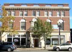
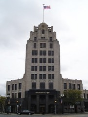
Listed on the National Register of Historic Places in
1980. A historic map-sheet match is not published yet. The record needs a coordinate-quality review before it can be joined to a sheet boundary.
From the record
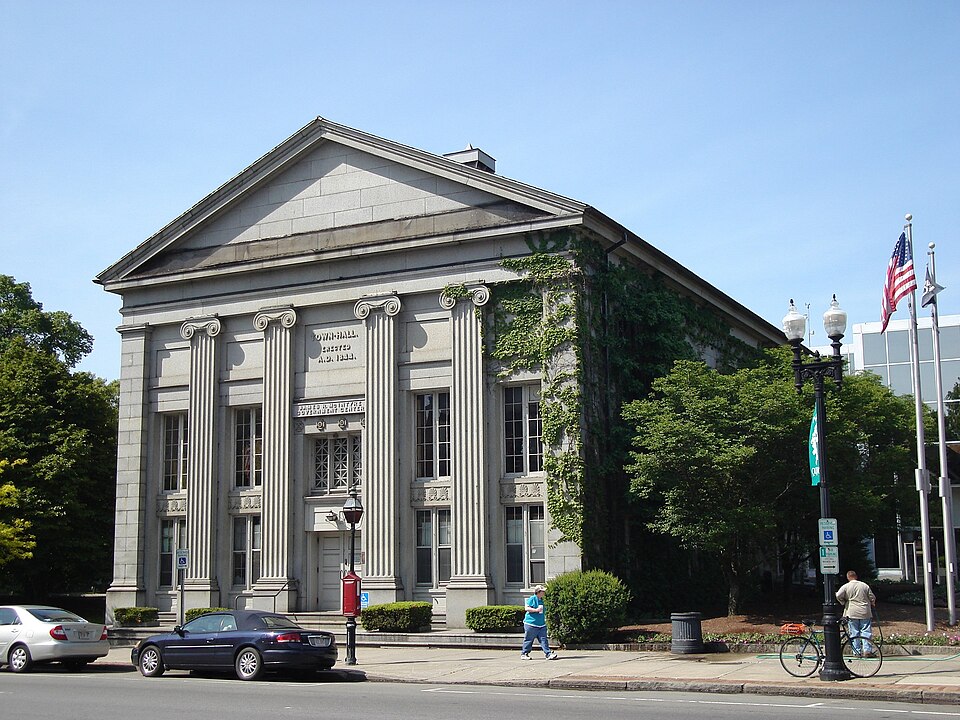
“Quincy City Hall is the seat of government for the City of Quincy, Massachusetts. The historic town hall building at 1305 Hancock Street in Quincy Center was built in 1844.”
Wikipedia article Quincy City Hall, CC BY-SA 4.0.
one of 249 National Register listings in Norfolk County · listed in 1980 · category: Building · one of 2 National Historic Landmarks in Norfolk County.
National Register reference number.80000649- the number the National Park Service assigned this property when it was listed, and the key its nomination file is catalogued under at the National Archives.
Fires near this property
287 since 2015
Regional context, not property-specific
evidence. The
federal wildfire occurrence database
lists 287 fires within 5 miles of Quincy Town Hall between
2015 and 2020, burning about 160 acres in total. None started naturally. None was recorded as arson.
Distance is straight-line from the map coordinates, so a fire counted
here may appear on a neighbouring settlement's page as well.
Reported cause
Fires
Recreation and ceremony
190
Smoking
41
Missing data/not specified/undetermined
26
Debris and open burning
24
Misuse of fire by a minor
3
Fireworks
2
Equipment and vehicle use
1
The most recent of
them, most recent first, with the day each was reported and the service
that recorded it.
Regional context, not property-specific
evidence. Museums hold 9,885 specimens
collected within 10 miles of Quincy Town Hall between 1810 and
1975: 4,958 Plantae, 2,653 Animalia, 1,794 Fungi, 278 Chromista, 139 Protozoa, 45 Unrecorded, 18 Bacteria. 12 distinct Species records are shown.
Collected by (MARSDEN, H W), ?, A C Gibson and others. Each is a
physical object with a catalogue
number, and each entry opens the museum's record. This is what was
collected and kept, not a survey of what lives here - nothing can be
concluded from a species being absent.
Regional context, not property-specific
evidence. The federal mineral resources record lists
5 workings within 5 miles of Quincy Town Hall: 3 producers, 2 past producers.
3 still produce. What was taken out: Sand and Gravel, Construction, Granite, Stone, Crushed/Broken. Distance is straight-line from the
map coordinates, so a quarry counted here may appear on a neighbouring
settlement's page as well.
Regional context, not property-specific
evidence. The National Weather Service names
Quincy, the town this property stands in, in 29 storm reports between 1995 and 2025: 10 thunderstorm wind, 8 flood, 5 flash flood, 3 hail.
No death or injury is recorded in these reports. Each account below is quoted exactly as the forecast office
filed it, from the NOAA Storm Events Database, and each date
opens the federal record of that event.
Several streets in the area of Quincy, Braintree, and Milton were flooded with one to two feet of water. One car was stuck in flood waters at Granite and Chickatawbut Roads in Quincy.
In Quincy, a tree was down on a car at the intersection of Evans Street and West Squantum Street. A person was trapped and extricated, but fortunately was uninjured. Police report relayed by amateur radio.
No historic map-sheet match is published
for this property yet. That does not mean no map exists. This record needs
a coordinate-quality review before it can be joined to a sheet boundary.
Browse the county's mapped places while that work is
pending.
From the nomination file
1,792 words on record
When this property was proposed for the
National Register, someone wrote the case for it: what the building is,
and why it matters. That document is a federal record in the public domain.
It is quoted below word for word, never summarised. The text was read off the scanned case file by machine, so the
occasional stray character is the recogniser's and the 1970s
typewriter's.
Description of the property
DATE_ The Quincy City Hall faces east on Hancock Street in Quincy Square. The surrounding area is developed with commercial, high density residential and transportation uses. It is bounded on the west by a mass transit rail line,on the north by a landscaped pedestrian mall, and on the south by the City owned Hancock Cemetary which dates from c.1640. The First Parish Church (NR) stands directly across Hancock STreet. It is a two story Greek Revival structure of rectangular plan which is constructed of native blue-grey granite ashlar. Facing gable end to the street, its triangular pediment and severe entablature are supported by four fluted lonic pilasters flanked by two end piers, all on high pedastals.
The center entrance approachedby two steps and consists of modern double doors headed by a blank transom,a sign bearing the words CITY HALL, and a tripartite window. It is flanked on either side by two double casement windows which are separated from identical windows above by spandrels carved with anthemions. The upper portion of each bay contain a recessed panel; the central one is enscribed TOWN HALL - ERECTED A.D. 1844. This elevation was heavily altered in 1888 when the town house was converted to the City Hall. Originally a recessed entrance, approached by a long flight of stairs, occupied the entire center opening. Shop front doors, which originally occupied the outer bays, were replaced by the present casements windows as was the double hung sash above.
The side elevators are each four bays in length and contain double-hung sash at the first floor/basementlevel and quadruple hungsash at the second floor/attic level.
Statement of significance
/ARCHITECT Solomon Willard STATEMENT OF SIGNIFICANCE The Quincy City Hall possesses integrity of design, location, materials, and workmanship. It is significant for the continuous role it has played in the development of Quincy government and as an outstanding example of monumental Greek Revival architecture con- structed of native granite. This building is associtated with both the town and city forms of government in Quincy and has been the seat of government activities since its construction in 1844. First settled in 1642, Quincy was incorporated as a part of Braintree in 1640. Braintree was divided into two precincts in 1708 but by 1792 the North Precinct had been incorporated as the town of Quincy.
It was not until May 24,1841 however, that the Town voted to build a townhouse of stone and not until April 18, 1844, that the Town authorized the Treasurer to purchase a lot next to the seventeenth century Hancock Cemetary. Solomon Willard supervised the consturction of the hall that same year. The following notice appeared in the "Quincy Patriot" of April 27, 1844: "To contractors.
Sealed proposals will be received by the Building Committee...for furnishing and deliv- ering on the spot, all materials for building a stone house, fifty by eignty feet, and thirty five feet, four inches in height, the front end and the two sides to be of dressed blue Granite of uniform color, the back end to be of rough Ashiar, and the whole to be laid in cement, together with about one hundred perches of stone for the cellar." Lommn, ee "Quie Topathous" nas efeeted f contract fornthet bulldingor butokn House which will be one of the most elegant edifices in New England.
Quoted from the National Register nomination
for reference 80000649, 9 pages, held by the National Archives in Record
Group 79. See the
catalogue record.
Listed places nearby
6 within 8 miles
Other National Register properties close
enough to walk or drive between, ordered by distance from this one. Both
positions come from the same geocoding pass that matched these properties
to their map sheets.
Listing record. National Park Service National Register of Historic Places, listed-properties dataset, current to 2026-05-22.
Map join. Address geocoded through the United States Census geocoder, then tested against the published boundary of every sheet in the USGS Historical Topographic Map Collection.
How this page is made. Listing fields come from federal records; map-sheet coverage is a labelled coordinate-to-boundary calculation, not a source-field claim.
Wildfire. Short, Karen C. 2022. Spatial wildfire occurrence data for the United States, 1992-2020 [FPA_FOD_20221014]. 6th Edition. Fort Collins, CO: Forest Service Research Data Archive. https://doi.org/10.2737/RDS-2013-0009.6 Collected with United States Government funding and usable without additional permissions or fees.
Specimens. Global Biodiversity Information Facility (GBIF), https://www.gbif.org/. Only records licensed CC0 or CC BY are used. Records licensed CC BY-NC are excluded because this site carries advertising. Images are checked individually and any whose licence is non-commercial, no-derivatives or unreadable is refused.
Mines and quarries. USGS Mineral Resources Data System (MRDS) https://mrdata.usgs.gov/mrds/ A work of the United States government, no copyright under 17 U.S.C. 105.
Storms. NOAA National Centers for Environmental Information, Storm Events Database https://www.ncei.noaa.gov/stormevents/ A work of the United States government, no copyright under 17 U.S.C. 105. Narratives are quoted verbatim from the National Weather Service report and are not edited or summarised.
 Block
Block