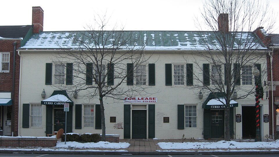
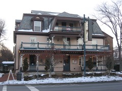
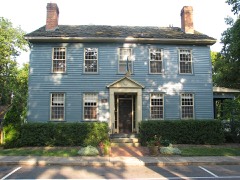
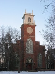
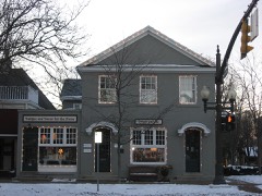
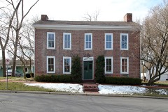
Listed on the National Register of Historic Places in
1980. A historic map-sheet match is not published yet. The record needs a coordinate-quality review before it can be joined to a sheet boundary.
From the record
“Frederick Ferdinand Wing was born December i, 1838, at Dublin, Franklin county, Ohio, where he received a limited education at such times as he could be spared from home, he having begun work at the age of seven. When be was fourteen years old he hired out as a farm hand in his neighborhood at a salary of only seven dollars a month.”
A Centennial Biographical History of the City of Columbus and Franklin County, Ohio .. (1901). Machine-read text.
one of 295 National Register listings in Franklin County · listed in 1980 · category: Building · one of 3 National Historic Landmarks in Franklin County.
National Register reference number.80003010- the number the National Park Service assigned this property when it was listed, and the key its nomination file is catalogued under at the National Archives.
What happened here
An account from the chapter on Columbus city, The inset identifies its exact
source book and publication year.
The Mound Builders and Indians - First White Settlements and Struggle for Possession - Indian Village at the Forks of the Scioto Attacked by Crawford and Dispersed - The Ohio Company, the Scioto Company and Symmes Purchase - Indian Power Broken and British Hopes Blasted - First Surveys - Topography, Geology and Soil of Franklin County.
The chapter on Columbus City in History of Franklin County [Ohio]:, published 1858 names Worthington. This is what it says, exactly as the scans read.
In February, 1810, the Legislature, desirous to establish a more central and permanent seat of government for the State, by joint resolution appointed five commissioners, namely James Findlay, W. Silliman, Joseph Darlinton, Reisin Beall and Wm. McFarland, to meet in Franklinton on the first day of September, then following, to examine and select the most eligible site for the estab- lishment of the permanent seat of government for the State. On December 11th, 1810, the commissioners made their report and say, " That they have diligently examined a number of different places within the circle prescribed, and the majority of said commissioners are of opinion that a tract of land, owned by John and Peter Sells, situated on the west bank of the Scioto River, four miles and three quarters west of the town of Worthington, in the county of Franklin, and on which said Sells now resides, appears to them the most eligible."^^ Dated at Newark, the 12th of September, 1810, and signed by all the commissioners.
No further definite action, however, was had on the subject until February, 1812, when the law was passed establishing it at Columbus. Various proposals were received, offering inducements for its establishment at different points, and amongst the rest were the proposals of Lyne Starling, James Johnston, Alexander McLaughlin and John Kerr, for establishing it on the '-' high bank of the Scioto River, opposite Franklinton," which site was principally a native forest. Franklinton was then at its apex, and a town of considerably more consequence than it now is, and was one of the sites proposed ; but the plan upon which it was laid out, and more particularly its low situation, were considered sufficient objections to its adoption. Worthington and Delaware were also among the sites proposed.
Regional context, not property-specific
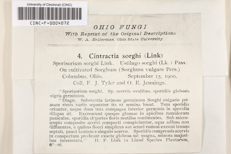
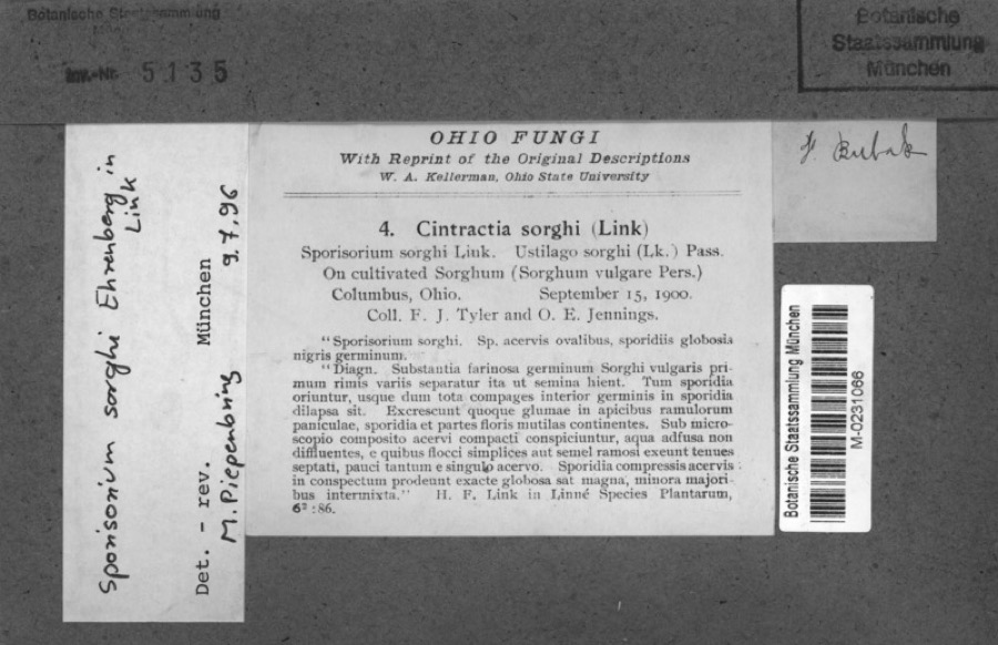
evidence. Museums hold 10,276 specimens
collected within 10 miles of Kilbourn Commercial Building between 1804 and
1975: 8,280 Animalia, 1,275 Fungi, 573 Plantae, 117 Chromista, 30 Unrecorded, 1 Protozoa. 12 distinct Species records are shown.
Collected by 19 V 1938 in original publication, Knull, =, ? and others. Each is a
physical object with a catalogue
number, and each entry opens the museum's record. This is what was
collected and kept, not a survey of what lives here - nothing can be
concluded from a species being absent.
Regional context, not property-specific
evidence. The National Weather Service names
Worthington, the town this property stands in, in 11 storm reports between 1996 and 2022: 5 thunderstorm wind, 3 hail, 2 flood, 1 heavy rain.
No death or injury is recorded in these reports. Each account below is quoted exactly as the forecast office
filed it, from the NOAA Storm Events Database, and each date
opens the federal record of that event.
No historic map-sheet match is published
for this property yet. That does not mean no map exists. This record needs
a coordinate-quality review before it can be joined to a sheet boundary.
Browse the county's mapped places while that work is
pending.
From the nomination file
1,049 words on record
When this property was proposed for the
National Register, someone wrote the case for it: what the building is,
and why it matters. That document is a federal record in the public domain.
It is quoted below word for word, never summarised. The text was read off the scanned case file by machine, so the
occasional stray character is the recogniser's and the 1970s
typewriter's.
Statement of significance
one paragraph) UTMS _completeness USGS maps Areas of Significance--Check and justify below _sketch maps Signed OHIO HISTORIC INVENTORY FEB 2 7 1980 Columbus, Ohio 43211 1. No. 4. Present Name(s) Times Two/ Bib & Tucker County 5. Other Name(s) 3. Location of Negatives 6. Specific Location 16. Thematic Category 28. No. of Stories 29. Basement? Yes X 17. Date(s) or Period Wor thington 30. Foundation Material 7. City or Town If Rural, Township & Vicinity 18. Style or Design 31. Wall Construction 8. Site Plan with North Arrow 19. Architect or Engineer 32. Roof Type & Material 20. Contractor or Builder 33. No. of Bays 21. Original Use, if apparent Front 6 34. Wall Treatment 22. Present Use Store & Residence 35. Plan Shape rectagular 23. Ownership Public Road? 36. Changes 9.
Coordinates Private Xi 24. Owner's Name & Address, in #42) if known David Smith 37. Condition U.T.M. Reference Preservation Site O Structure O Building Bl Object D 26. Loca! Contact Person or Organization Endangered? 11. On National By What? No C 27. Other Surveys in Which Included District Visible from Hist. Dist.? 15. Name of Established District 41. Distance from and 42. Further Description of Important Features Originally gable ended southern wing to the square Kilbourn House, Pro the Kilbourn House, built in 1804. Ash floors, painted walnut wood- work & fireplace mantels still intact. Bark on rafters and floor 43.
History and Significance association with James Kilbourn, founder of Worthington who operated this wing of his house Kilbourn worked as a newspaperman, militia officer, surveyor, mayor, con- gressman, industrial developer, and inn keeper. Aquired by Kilbourn in 1845. Built ca 1829 by 44. Description of Environment and Outbuildings Center of commercial-business district. 15. Sources of Information 46. Prepared by The Worthington News, August 16, 1979 47.
Quoted from the National Register nomination
for reference 80003010, 9 pages, held by the National Archives in Record
Group 79. See the
catalogue record.
Listed places nearby
6 within 8 miles
Other National Register properties close
enough to walk or drive between, ordered by distance from this one. Both
positions come from the same geocoding pass that matched these properties
to their map sheets.
Listing record. National Park Service National Register of Historic Places, listed-properties dataset, current to 2026-05-22.
Map join. Address geocoded through the United States Census geocoder, then tested against the published boundary of every sheet in the USGS Historical Topographic Map Collection.
How this page is made. Listing fields come from federal records; map-sheet coverage is a labelled coordinate-to-boundary calculation, not a source-field claim.
Specimens. Global Biodiversity Information Facility (GBIF), https://www.gbif.org/. Only records licensed CC0 or CC BY are used. Records licensed CC BY-NC are excluded because this site carries advertising. Images are checked individually and any whose licence is non-commercial, no-derivatives or unreadable is refused.
Storms. NOAA National Centers for Environmental Information, Storm Events Database https://www.ncei.noaa.gov/stormevents/ A work of the United States government, no copyright under 17 U.S.C. 105. Narratives are quoted verbatim from the National Weather Service report and are not edited or summarised.
 Block
Block