Listed on the National Register of Historic Places in
1982. A historic map-sheet match is not published yet. The record needs a coordinate-quality review before it can be joined to a sheet boundary.
From the record
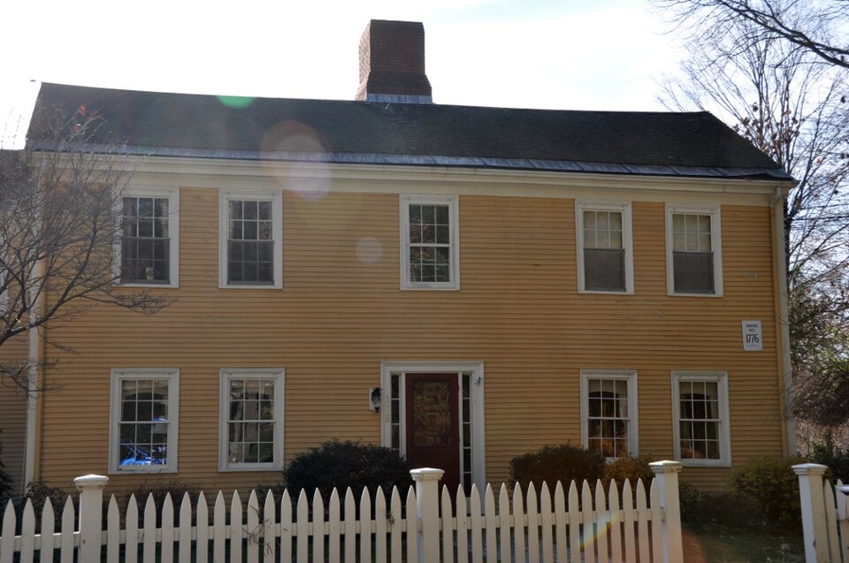
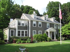
“The Joshua Lewis House is a historic house in Needham, Massachusetts. Built in 1776, it has a well-preserved example of late Georgian architecture, which has been home to a number of individuals of local and national importance, including artist N.C.”
Wikipedia article Joshua Lewis House, CC BY-SA 4.0.
one of 249 National Register listings in Norfolk County · listed in 1982 · category: Building · one of 2 National Historic Landmarks in Norfolk County.
National Register reference number.82002749- the number the National Park Service assigned this property when it was listed, and the key its nomination file is catalogued under at the National Archives.
Dr. Samuel Gould of Needham, was for several winters a teacher in Dedham : of the Mill School, 1788-9 ; East Street, 1792-3 ; North School of Third Parish, 1797 ; and the Second Middle School, 1798. He was the son of Maj. George and Rachael (Dwight) Gould, born in Sutton, Mass., Nov.29, 1770, and married Esther, daughter of Jonathan Kingsbury. Where he was known it was esteemed a compliment to be called '< as polite as Dr. Gould."
Isaac Colburn, having been a teacher in Northboro from Dec. 31, 1788, till March 24, 1789, began to teach in Dedham, Dec. 21, 1789, and probably, was engaged every winter till March 20, 1797. He was the son of Isaac and Hepzibah (Pond) Colburn, born in West Dedham, August 8, 1766, and died May 10, 1845. He married 1st, Elizabeth Dexter of Marlboro ; 2dly, Mary Harris of Needham, Nov. 17, 1817. See Dedham Historical Register, Vol. II., page 112 and III., page 143. He was the father of 15 children, several of whom, including one pair of twins, lived to be over ninety years of age. There is to be seen a photograph of the twelve children of his first wife in a group, taken when the youngest was 55 years of age and the oldest 75. His youngest son, Dana Pond Colburn, was the author of an arithmetic, and at the time of his death, Dec. 15, 1859, was principal of the Rhode Island State Normal School.
Regional context, not property-specific
evidence. The
federal wildfire occurrence database
lists 157 fires within 5 miles of Lewis, Joshua, House between
2003 and 2020, burning about 410 acres in total. None started naturally. None was recorded as arson.
Distance is straight-line from the map coordinates, so a fire counted
here may appear on a neighbouring settlement's page as well.
Reported cause
Fires
Recreation and ceremony
70
Missing data/not specified/undetermined
60
Smoking
17
Debris and open burning
5
Equipment and vehicle use
4
Other causes
1
The most recent of
them, most recent first, with the day each was reported and the service
that recorded it.
Regional context, not property-specific
evidence. Museums hold 16,249 specimens
collected within 10 miles of Lewis, Joshua, House between 1815 and
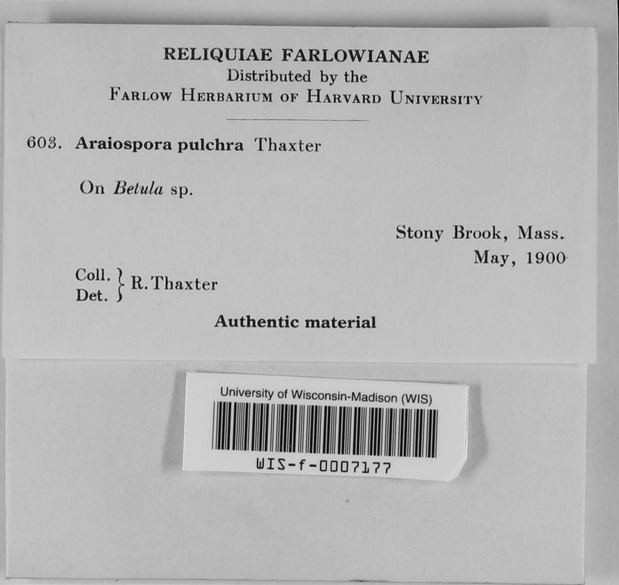
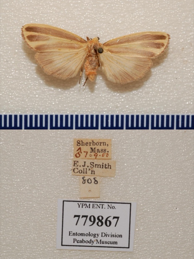
1975: 5,654 Plantae, 5,443 Animalia, 4,596 Fungi, 287 Protozoa, 173 Chromista, 60 Unrecorded, 36 Bacteria. 12 distinct Species records are shown.
Collected by ?, ? ex Herb. W.G. Farlow, A C Gibson and others. Each is a
physical object with a catalogue
number, and each entry opens the museum's record. This is what was
collected and kept, not a survey of what lives here - nothing can be
concluded from a species being absent.
Regional context, not property-specific
evidence. The federal mineral resources record lists
7 workings within 5 miles of Lewis, Joshua, House: 5 past producers, 1 producer, 1 unknown.
1 still produces. What was taken out: Sand and Gravel, Construction, Granite, Stone, Stone, Crushed/Broken. Distance is straight-line from the
map coordinates, so a quarry counted here may appear on a neighbouring
settlement's page as well.
Regional context, not property-specific
evidence. The National Weather Service names
Needham, the town this property stands in, in 19 storm reports between 2000 and 2023: 8 thunderstorm wind, 5 hail, 4 flood, 2 lightning.
No death or injury is recorded in these reports. Each account below is quoted exactly as the forecast office
filed it, from the NOAA Storm Events Database, and each date
opens the federal record of that event.
Flooding reaching the tops of tires in Needham at the intersection of Great Plain Avenue and Ivy Road. The Canton Street railroad underpass in Sharon was flooded. A section of Village Street in Medway was flooded. The exit ramp from U.S. Route 1 near an auto dealership in Norwood was flooded; Dean Street in Norwood was flooded; two sections of University Avenue in Norwood were flooded. Oak Street at Park Street in Medfield was flooded. Albion Road at Cliff Road in Wellesley was flooded; State Route 9 near the Fire Department Headquarters was flooded.
No historic map-sheet match is published
for this property yet. That does not mean no map exists. This record needs
a coordinate-quality review before it can be joined to a sheet boundary.
Browse the county's mapped places while that work is
pending.
From the nomination file
2,473 words on record
When this property was proposed for the
National Register, someone wrote the case for it: what the building is,
and why it matters. That document is a federal record in the public domain.
It is quoted below word for word, never summarised. The text was read off the scanned case file by machine, so the
occasional stray character is the recogniser's and the 1970s
typewriter's.
Description of the property
The Joshua Lewis House stands on a most favorable site of one and a half acres overlooking the meandering Charles River. The simple Georgian farmhouse is clearly vernacular in origin and remains largely unchanged in its architecture and setting. The wood frame house is thought to have been built in 1776, and has the 2½ stories, gable roof, five bay facade, and central chimney characteristic of the period. Only one room deep in the main block, an original leanto and later side and rear wings extend the living space considerably. Original fenestration consists of six over six sash. Centered on the facade is a very simple entrance, its molded architrave framing a door and narrow full-height side- lights.
As is typical of the central chimney plan, the interior of the Joshua Lewis House features front parlors, a rear kitchen (in the leanto), and a steep narrow stairway in the front hall. Wainscotting, exposed corner posts, and original chimneypieces highlight the interior finishing. 0 228 Additions to the building include a two-story modern kitchen wing on the northeast side and a large two-story wing on the south side. Several new window units and an exterior chimney have been added at the rear of the house, but the main block---including its facade--- remains essentially as built. The house is generally in good repair, thanks to the restora- tion and maintenance provided by the present owner.
Statement of significance
/Architect Joshua Lewis Statement of Significance (in one paragraph) The Joshua Lèwis House possesses integrity of location, design, setting, materials and workmanship. It is an interesting architectural piece, but its major signiticance 1n local and national history derives from the people who have lived in it. The house has i been associated with prominent local landowners of the eighteenth century, a noted wood- carver of the mid-nineteenth century, the innovative horticulturist Denys Zirngiebel t. envo ca Bieo Tis and his friend Henry Wadsworth Longfellow, and finally the artist N.C. Wyeth.
The Lewis House thus meets Criterion B of the National Register of Historic Places: The housewas built circa 1776 by Joshua Lewis on property which had been inherited by his wife, Mary Lyon, from her father, a principallandowner in the town. Joshua Lewis and and Mary Lyon were married in 1776, and the house was probably built in that year. After the death ofhis parents, the housewas occupied and owned by Joshua Lewis, JI. Little is known of these early Lewises, although Capt. Joshua Lewis, Jr., was listed on the rolls of the East Needham Militia Company in 1817. The house was sold out of the Lewis family in 1835. After passing through two ownerships it was bought in 1858 by David Livingston, a well-known woodcarver of the time.
The stairway of the Old Boston State House is an example of his work. It was bought in 1864 by James Black, who rented the property to Denys Zirngiebel, who bought it from Black in1874. Denys Zirngieble was a Swiss horticulturist who had been a student of Louis Agassiz, the famous naturalist, at the University of Neufchatel.
Quoted from the National Register nomination
for reference 82002749, 11 pages, held by the National Archives in Record
Group 79. See the
catalogue record.
Listed places nearby
6 within 8 miles
Other National Register properties close
enough to walk or drive between, ordered by distance from this one. Both
positions come from the same geocoding pass that matched these properties
to their map sheets.
Listing record. National Park Service National Register of Historic Places, listed-properties dataset, current to 2026-05-22.
Map join. Address geocoded through the United States Census geocoder, then tested against the published boundary of every sheet in the USGS Historical Topographic Map Collection.
How this page is made. Listing fields come from federal records; map-sheet coverage is a labelled coordinate-to-boundary calculation, not a source-field claim.
Wildfire. Short, Karen C. 2022. Spatial wildfire occurrence data for the United States, 1992-2020 [FPA_FOD_20221014]. 6th Edition. Fort Collins, CO: Forest Service Research Data Archive. https://doi.org/10.2737/RDS-2013-0009.6 Collected with United States Government funding and usable without additional permissions or fees.
Specimens. Global Biodiversity Information Facility (GBIF), https://www.gbif.org/. Only records licensed CC0 or CC BY are used. Records licensed CC BY-NC are excluded because this site carries advertising. Images are checked individually and any whose licence is non-commercial, no-derivatives or unreadable is refused.
Mines and quarries. USGS Mineral Resources Data System (MRDS) https://mrdata.usgs.gov/mrds/ A work of the United States government, no copyright under 17 U.S.C. 105.
Storms. NOAA National Centers for Environmental Information, Storm Events Database https://www.ncei.noaa.gov/stormevents/ A work of the United States government, no copyright under 17 U.S.C. 105. Narratives are quoted verbatim from the National Weather Service report and are not edited or summarised.
 Block
Block