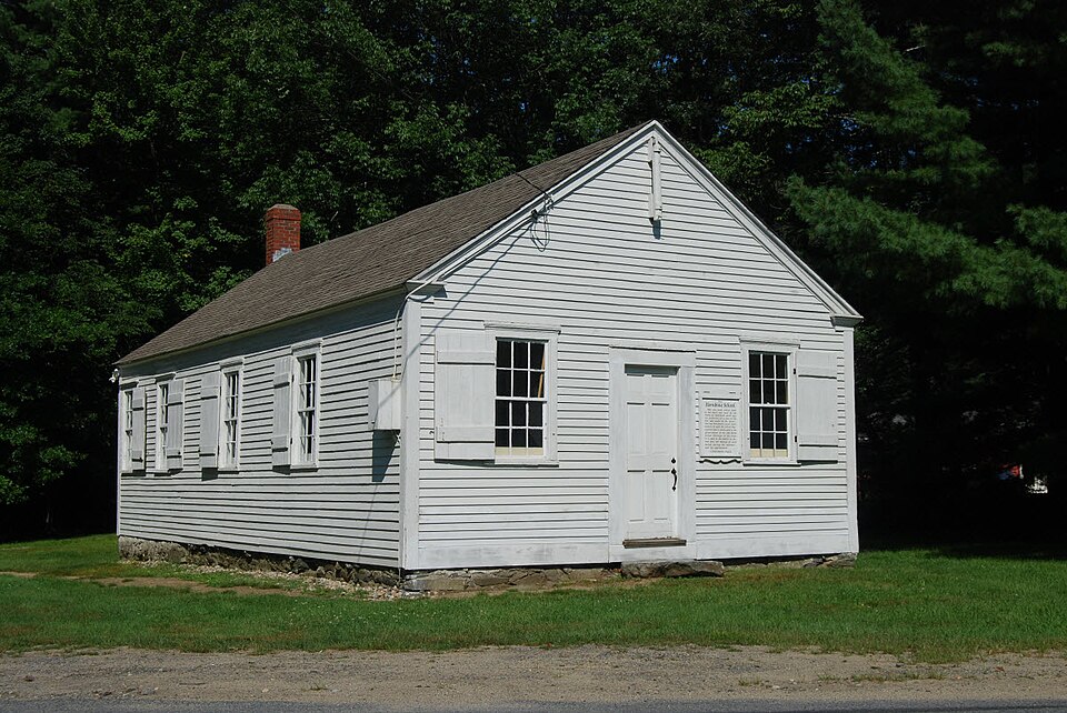
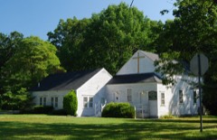
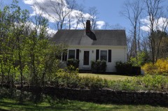
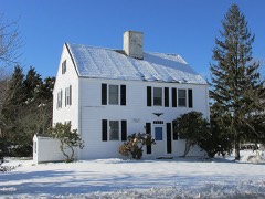
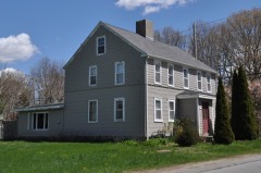
Photograph by Marcbela (Marc N. Belanger), Public domain. Via
Wikimedia Commons.
Hornbine School
Listed on the National Register of Historic Places in
1983. A historic map-sheet match is not published yet. The record needs a coordinate-quality review before it can be joined to a sheet boundary.
From the record
“The Hornbine School is a historic one-room schoolhouse at 144 Hornbine Road in Rehoboth, Massachusetts. Built in 1846 and operated until 1937, it is the best-preserved rural schoolhouse in the town.”
Wikipedia article Hornbine School, CC BY-SA 4.0.
one of 272 National Register listings in Bristol County · listed in 1983 · category: Building · one of 8 National Historic Landmarks in Bristol County.
National Register reference number.83000679- the number the National Park Service assigned this property when it was listed, and the key its nomination file is catalogued under at the National Archives.
What happened here
An account from the chapter on Rehoboth town, The inset identifies its exact
source book and publication year.
No-vV is the time for the poultryman to determine whether or not it will pay him to vaccinate. All authorities agree that all pullets and cockerels should be vaccinated if there has been a recent epidemic of fowl pox or canker on the poultry plant. Even though a poultryman has not suffered loss from this disease it is probably good insurance to vaccinate.
Indian War. - In 1675 commenced the bloody and destructive Indian war known by the name of " Philip's war." Of the miseries of this war Rehoboth, from its proximity to Mount Hope, the residence of Philip, or Pometacom, the prime mover of the war, was destined to suffer its full share. The first blood was spilled within the original jurisdiction of Rehoboth, and the last of Philip's generals, the stern and intrepid old warrior and counselor Annawan, was captured within the present limits of the same town. During this war, which lasted nearly two years, the inhabitants of Rehoboth were kept in almost constant alarm ; a number of them were at different times slain, and the whole town, the garrison-houses excepted, was at one time laid in ashes. This town was also the scene of Pierce's fight, one of the most disastrous battles to the English that occurred during the whole war.
The " three houses" into which " the inhabitants of both towns" (Rehoboth and Swansea) were gathered, and where they rendezvoused during the war, were called garrison-houses. They were fortified and continually guarded in time of danger, and were some-
Regional context, not property-specific
evidence. The
federal wildfire occurrence database
lists 40 fires within 5 miles of Hornbine School between
2006 and 2020, burning about 46 acres in total. None started naturally. 5 were recorded as arson.
Distance is straight-line from the map coordinates, so a fire counted
here may appear on a neighbouring settlement's page as well.
Reported cause
Fires
Missing data/not specified/undetermined
22
Debris and open burning
8
Arson/incendiarism
5
Misuse of fire by a minor
2
Recreation and ceremony
2
Smoking
1
The most recent of
them, most recent first, with the day each was reported and the service
that recorded it.
Regional context, not property-specific
evidence. Museums hold 1,556 specimens
collected within 10 miles of Hornbine School between 1844 and
1975: 783 Animalia, 644 Plantae, 112 Fungi, 12 Chromista, 5 Unrecorded. 12 distinct Species records are shown.
Collected by ?, A E Schuyler, A. and others. Each is a
physical object with a catalogue
number, and each entry opens the museum's record. This is what was
collected and kept, not a survey of what lives here - nothing can be
concluded from a species being absent.
Regional context, not property-specific
evidence. The federal mineral resources record lists
1 working within 5 miles of Hornbine School: 1 plant.
All of them still produce. What was taken out: Sand and Gravel, Construction. Distance is straight-line from the
map coordinates, so a quarry counted here may appear on a neighbouring
settlement's page as well.
Regional context, not property-specific
evidence. The National Weather Service names
Rehoboth, the town this property stands in, in 22 storm reports between 1998 and 2024: 10 thunderstorm wind, 6 hail, 3 flash flood, 2 heavy rain.
No death or injury is recorded in these reports. Each account below is quoted exactly as the forecast office
filed it, from the NOAA Storm Events Database, and each date
opens the federal record of that event.
At 250 PM EST, trees were brought down on Route 44 in Rehoboth. Trees were also brought down on Cedar Street, River Street, and Bay State Road between 250 PM and 310 PM EST. Multiple trees and wires were brought down on Elm Street and County Street.
Heavy rain resulted in flash flooding in parts of Taunton. Winthrop Street was flooded with two feet of water and a car got stuck in flood waters on County Street.
Urban and small stream flooding was reported after nearly 3 inches of rain fell in Bristol County. In Rehoboth, Wolf Plain Brook rose out of its banks and flooded Rocky Hill Road. Several roads in Fall River and New Bedford were closed after being inundated by flood waters. A small stream also came out of its banks in Dartmouth and flooded a nearby field.
In Rehoboth at 439 PM EDT (339 PM EST), there was a social media photo of hail that ranged from dime to quarter size. The report time was radar-estimated.
No historic map-sheet match is published
for this property yet. That does not mean no map exists. This record needs
a coordinate-quality review before it can be joined to a sheet boundary.
Browse the county's mapped places while that work is
pending.
From the nomination file
1,081 words on record
When this property was proposed for the
National Register, someone wrote the case for it: what the building is,
and why it matters. That document is a federal record in the public domain.
It is reproduced in full on its own page, word for word and never summarised. The text was read off the scanned case file by machine, so the
occasional stray character is the recogniser's and the 1970s
typewriter's.
Quoted from the National Register nomination
for reference 83000679, 9 pages, held by the National Archives in Record
Group 79. See the
catalogue record.
Listed places nearby
6 within 8 miles
Other National Register properties close
enough to walk or drive between, ordered by distance from this one. Both
positions come from the same geocoding pass that matched these properties
to their map sheets.
Listing record. National Park Service National Register of Historic Places, listed-properties dataset, current to 2026-05-22.
Map join. Address geocoded through the United States Census geocoder, then tested against the published boundary of every sheet in the USGS Historical Topographic Map Collection.
How this page is made. Listing fields come from federal records; map-sheet coverage is a labelled coordinate-to-boundary calculation, not a source-field claim.
Wildfire. Short, Karen C. 2022. Spatial wildfire occurrence data for the United States, 1992-2020 [FPA_FOD_20221014]. 6th Edition. Fort Collins, CO: Forest Service Research Data Archive. https://doi.org/10.2737/RDS-2013-0009.6 Collected with United States Government funding and usable without additional permissions or fees.
Specimens. Global Biodiversity Information Facility (GBIF), https://www.gbif.org/. Only records licensed CC0 or CC BY are used. Records licensed CC BY-NC are excluded because this site carries advertising. Images are checked individually and any whose licence is non-commercial, no-derivatives or unreadable is refused.
Mines and quarries. USGS Mineral Resources Data System (MRDS) https://mrdata.usgs.gov/mrds/ A work of the United States government, no copyright under 17 U.S.C. 105.
Storms. NOAA National Centers for Environmental Information, Storm Events Database https://www.ncei.noaa.gov/stormevents/ A work of the United States government, no copyright under 17 U.S.C. 105. Narratives are quoted verbatim from the National Weather Service report and are not edited or summarised.
 Block
Block