BlockBefore
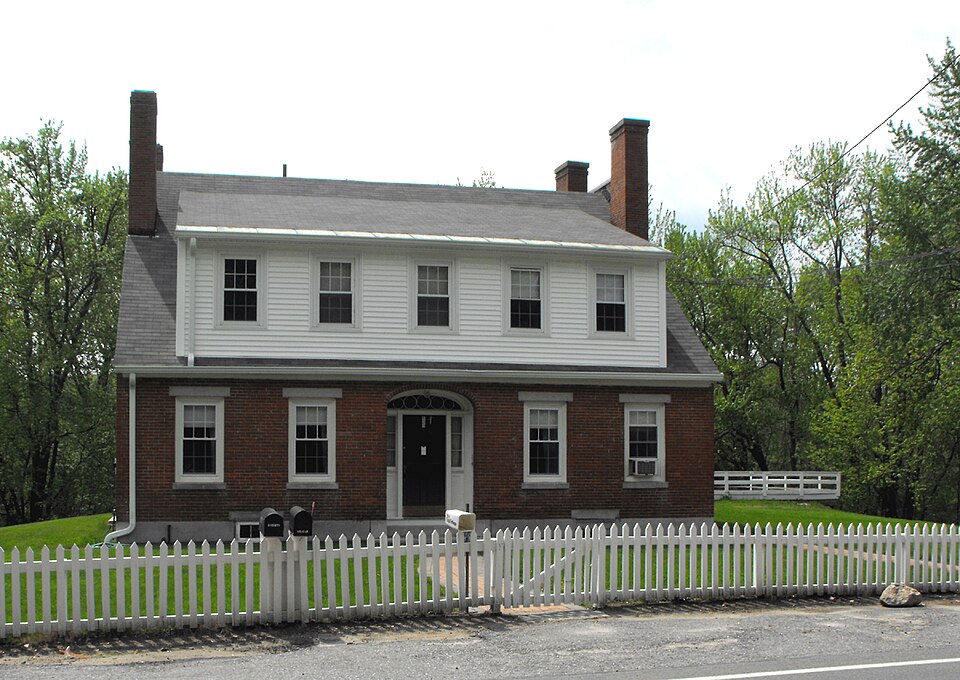
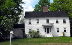
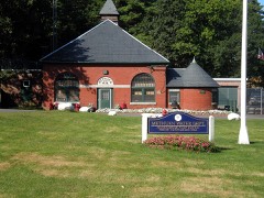
Photograph of Old Town Farm
Photograph by EraserGirl, Public domain. Via Wikimedia Commons.

Old Town Farm

Listed on the National Register of Historic Places in 1984. A historic map-sheet match is not published yet. The record needs a coordinate-quality review before it can be joined to a sheet boundary.

From the record

“Old Town Farm is a historic poor farm building in Methuen, Massachusetts. The brick two story building was built in 1846, after Methuen lost its earlier poor farm due to the loss of part of its territory to newly founded Lawrence.”

Wikipedia article Old Town Farm, CC BY-SA 4.0.

one of 350 National Register listings in Essex County · listed in 1984 · category: Building · one of 2 National Historic Landmarks in Essex County.

Sources: the Wikipedia article · the case file at the National Archives · the National Register database, National Park Service

The listing

  • What is counted as historic. The nomination lists 1 building as contributing to the listing.
  • Address. 430 Pelham St., Methuen, 01844
  • When was it listed? 1984-01-20
  • Category. building
  • Also known as. Methuen MRA
  • Township. Methuen city
  • National Register reference number. 84002413 - the number the National Park Service assigned this property when it was listed, and the key its nomination file is catalogued under at the National Archives.

Fires near this property

50 since 1992

Regional context, not property-specific evidence. The federal wildfire occurrence database lists 50 fires within 5 miles of Old Town Farm between 1992 and 2020, burning about 40 acres in total. None started naturally. 9 were recorded as arson. Distance is straight-line from the map coordinates, so a fire counted here may appear on a neighbouring settlement's page as well.

Reported cause Fires
Missing data/not specified/undetermined17
Misuse of fire by a minor9
Arson/incendiarism9
Smoking7
Debris and open burning3
Railroad operations and maintenance2
Equipment and vehicle use2
Recreation and ceremony1

The most recent of them, most recent first, with the day each was reported and the service that recorded it.

DateCause SizeReported by Name on the report
24 September 2020Smokingunder an acreMassachusetts Bureau of Forest Fire Controlnot named
8 August 2016Debris and open burningunder an acreMassachusetts Bureau of Forest Fire ControlLAWERANCE
5 August 2016Missing data/not specified/undeterminedunder an acreMassachusetts Bureau of Forest Fire ControlMETHUEN
27 August 2019Missing data/not specified/undeterminedunder an acreMassachusetts Bureau of Forest Fire Controlnot named
17 August 2002Recreation and ceremony1.0 acresMassachussetts State Fire Marshal's Officenot named
13 August 2020Arson/incendiarismunder an acreMassachusetts Bureau of Forest Fire Controlnot named
13 August 2020Misuse of fire by a minorunder an acreMassachusetts Bureau of Forest Fire Controlnot named

Every fire recorded in Essex County

Specimens collected near this property

12 of 871 shown

Regional context, not property-specific evidence. Museums hold 871 specimens collected within 10 miles of Old Town Farm between 1816 and 1975: 490 Plantae, 269 Animalia, 102 Fungi, 4 Chromista, 4 Protozoa, 2 Unrecorded. 12 distinct Species records are shown. Collected by A S Gaunt, A. C. Mathieson, A. H. Moore and others. Each is a physical object with a catalogue number, and each entry opens the museum's record. This is what was collected and kept, not a survey of what lives here - nothing can be concluded from a species being absent.

Image SpeciesYear Collected by Where, as recorded
A photograph of the species Lupinus L., not of this specimenLupinus L.1816Boott, F.M.B.Mystic Pond, 6 miles from Boston.
A photograph of the species Viola labradorica, not of this specimenViola labradorica Schrank1816not recordedAndover Turnpike, 6 miles from Boston U.S.A.
A photograph of the species Eleocharis robbinsii, not of this specimenEleocharis robbinsii Oakes1829B. D. Greene
A photograph of the species Carex debilis, not of this specimenCarex debilis var. rudgei L.H.Bailey1853Collector unknown
A photograph of the species Carex rostrata, not of this specimenCarex rostrata Stokes1853W. Boott
A photograph of the species Cyathus striatus, not of this specimenCyathus striatus Willd.1853not recordedAndover, Mass. [Massachusetts]
A photograph of the species Dichelyma capillaceum, not of this specimenDichelyma capillaceum (Dicks.) Myrin1853T. P. James
A photograph of the species Isopterygiopsis pulchella, not of this specimenIsopterygiopsis pulchella (Hedw.) Z.Iwats.1853T. P. James
A photograph of the species Leskea polycarpa, not of this specimenLeskea polycarpa Hedw.1853T. P. James
Vulpia octoflora var. glauca (Nutt.) Fernald1858J. Blake
A photograph of the species Catostomus commersonii, not of this specimenCatostomus commersonii (Lacepède, 1803)1859Putnam, Frederick WardMerrimack River, at Lawrence, Essex County, Massachusetts
A photograph of the species Luxilus cornutus, not of this specimenLuxilus cornutus (Mitchill, 1817)1859FW PutnamMerrimac River, at Lawrence

All 871 specimens within 10 miles, at the Global Biodiversity Information Facility.

Mines and quarries near this property

3 within 5 miles

Regional context, not property-specific evidence. The federal mineral resources record lists 3 workings within 5 miles of Old Town Farm: 1 past producer, 1 unknown, 1 producer. 1 still produces. What was taken out: Sand and Gravel, Construction, Nickel, Gold, Silver, Copper. Distance is straight-line from the map coordinates, so a quarry counted here may appear on a neighbouring settlement's page as well.

Where SiteCommodity StatusRecorded
Dracut Ni Mine/Nickel Mine HillNickel, Gold, Silver, CopperPast Producer
Rocco Zambino and Sons, Inc. PitSand and Gravel, ConstructionProducer
Sand & Gravel OperationSand and Gravel, ConstructionUnknown

Every working recorded in Essex County

Storms near this property

27 since 1998

Regional context, not property-specific evidence. The National Weather Service names Methuen, the town this property stands in, in 27 storm reports between 1998 and 2024: 15 thunderstorm wind, 5 flash flood, 3 lightning, 3 hail. No death or injury is recorded in these reports. Each account below is quoted exactly as the forecast office filed it, from the NOAA Storm Events Database, and each date opens the federal record of that event.

WhenEvent Place namedHarm What the report says
March 2001Flash FloodMethuen$10,000,000no account filed
June 2005LightningMethuen$100,000no account filed
May 2015Thunderstorm WindMethuen$50,000Approximately twenty to thirty trees and wires on Hampstead and Old Homestead Streets were downed by microburst winds.
October 2016Flash FloodMethuen$10,000Two to three inches of rain fell in only a couple of hours and produced significant urban flash flooding. In Methuen, Riverside Drive by the boat ramp was closed due to flooding and several cars were stranded. Route 213 at I-495 was flooded and cars were stuck in the roadway. In Haverhill, the area near Laurel and Railroad Avenues was flooded with four feet of water and a car was stranded in flood waters. The intersection of Primrose and Dexter Avenues was impassable. In Peabody, several roads were impassable due to flooding which included Allens Lane, Walnut Street, Prospect Street near the North Shore Mall, Foster Street, Tremont Street, and Margin Street. In Danvers, Wildwood Road was flooded. In Lynn, a portion of Boston Street was flooded.
September 2014Thunderstorm WindMethuen$10,000Several trees were downed throughout Methuen by thunderstorm winds.
June 2005Thunderstorm WindMethuen$10,000no account filed
July 2002LightningMethuen$10,000no account filed
May 1998LightningMethuen$10,000no account filed
July 2018Flash FloodMethuen$5,000At 2:25 PM a car was trapped in flood waters in Methuen, at the intersection of Burnham Road and Haverhill Street.
July 2016Thunderstorm WindMethuen$5,000A tree was downed into the right lane of Route 213 westbound by thunderstorm winds.
July 2016Thunderstorm WindMethuen$5,000A tree on Route 213 in Methuen was downed by thunderstorm winds.
July 2012Thunderstorm WindMethuen$5,000A tree and wires on Madison Street were downed by thunderstorm winds.
June 2008Thunderstorm WindMethuen$5,000Wires on Liberty Street were downed by thunderstorm winds.
September 2014Thunderstorm WindMethuen$3,000Large tree limbs on Oak Street were downed by thunderstorm winds.
July 2013Thunderstorm WindMethuen$3,000A tree on North Lowell Street in Methuen was downed by thunderstorm winds. Also, a large tree limb was downed onto Curtis Street near the intersection with Jackson Street.
August 2024Thunderstorm WindMethuen$500In Methuen, a large tree was down on power lines on Horne St.
July 2021HailMethuen-In Methuen, quarter size hail was reported.
June 2019HailMethuen-At 1:10 PM EST, three-quarter inch hail was reported in Methuen MA.
July 2018Flash FloodMethuen-At 2:35 PM EST Park Street in Lawrence had heavy flooding from Bennington Street to State Route 28.
October 2014FloodMethuen-The 110/113 rotary was flooded with three feet of water.
July 2007Thunderstorm WindMethuen-Tree down on Armstrong Street.
July 2007Thunderstorm WindMethuen-Several trees downed.
June 1998Flash FloodMethuen-Spicket River
June 1999Thunderstorm WindMethuen-no account filed
June 1999HailMethuen-no account filed
May 1998Thunderstorm WindMethuen-no account filed
August 1998Thunderstorm WindMethuen-no account filed

Every storm recorded in Essex County

Map coverage status

No historic map-sheet match is published for this property yet. That does not mean no map exists. This record needs a coordinate-quality review before it can be joined to a sheet boundary. Browse the county's mapped places while that work is pending.

Listed places nearby

6 within 8 miles

Other National Register properties close enough to walk or drive between, ordered by distance from this one. Both positions come from the same geocoding pass that matched these properties to their map sheets.

Photograph PropertyDistance Listed
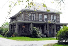
Morse, Moses, House0.8 miles1984
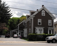
House at 262--264 Pelham Street1.2 miles1984
Methuen Water Works1.4 miles1984
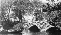
Double-arch Sandstone Bridge1.8 miles1984
House at 50 Pelham Street2.7 miles1984
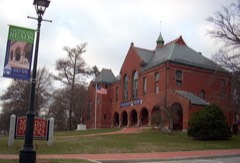
Nevins Memorial Library2.7 miles1984

Sources for this property

National Archives recordThe nomination case file for reference 84002413 in Record Group 79.
Wikipedia articleCommunity-written account of this property, licensed CC BY-SA.
Essex CountyAll 350 listed properties in this county.

Provenance

  • Listing record. National Park Service National Register of Historic Places, listed-properties dataset, current to 2026-05-22.
  • Map join. Address geocoded through the United States Census geocoder, then tested against the published boundary of every sheet in the USGS Historical Topographic Map Collection.
  • How this page is made. Listing fields come from federal records; map-sheet coverage is a labelled coordinate-to-boundary calculation, not a source-field claim.
  • Wildfire. Short, Karen C. 2022. Spatial wildfire occurrence data for the United States, 1992-2020 [FPA_FOD_20221014]. 6th Edition. Fort Collins, CO: Forest Service Research Data Archive. https://doi.org/10.2737/RDS-2013-0009.6 Collected with United States Government funding and usable without additional permissions or fees.
  • Specimens. Global Biodiversity Information Facility (GBIF), https://www.gbif.org/. Only records licensed CC0 or CC BY are used. Records licensed CC BY-NC are excluded because this site carries advertising. Images are checked individually and any whose licence is non-commercial, no-derivatives or unreadable is refused.
  • Mines and quarries. USGS Mineral Resources Data System (MRDS) https://mrdata.usgs.gov/mrds/ A work of the United States government, no copyright under 17 U.S.C. 105.
  • Storms. NOAA National Centers for Environmental Information, Storm Events Database https://www.ncei.noaa.gov/stormevents/ A work of the United States government, no copyright under 17 U.S.C. 105. Narratives are quoted verbatim from the National Weather Service report and are not edited or summarised.