Listed on the National Register of Historic Places in
1985. A historic map-sheet match is not published yet. The record needs a coordinate-quality review before it can be joined to a sheet boundary.
From the record
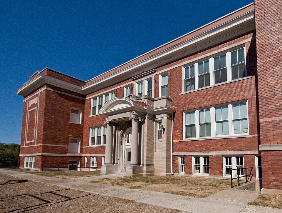
“Healthy Public School is a registered historic building in Mt. Healthy, Ohio, listed in the National Register on May 2, 1985.”
Wikipedia article Mount Healthy Public School, CC BY-SA 4.0.
one of 314 National Register listings in Hamilton County · listed in 1985 · category: Building · one of 9 National Historic Landmarks in Hamilton County.
National Register reference number.85000946- the number the National Park Service assigned this property when it was listed, and the key its nomination file is catalogued under at the National Archives.
Specimens collected near this property
12 of 4,653 shown
Regional context, not property-specific
evidence. Museums hold 4,653 specimens
collected within 10 miles of Mt. Healthy Public School between 1819 and
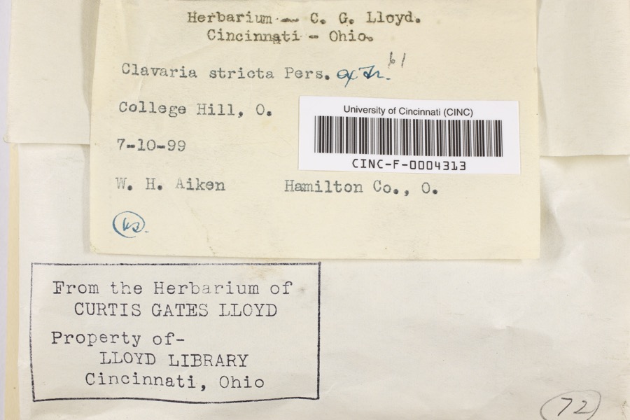
1975: 2,079 Fungi, 1,571 Animalia, 822 Plantae, 141 Protozoa, 21 Unrecorded, 18 Chromista, 1 Bacteria. 12 distinct Species records are shown.
Collected by A Schwartz, A. Braun, A. F. Braun and others. Each is a
physical object with a catalogue
number, and each entry opens the museum's record. This is what was
collected and kept, not a survey of what lives here - nothing can be
concluded from a species being absent.
Regional context, not property-specific
evidence. The federal mineral resources record lists
2 workings within 5 miles of Mt. Healthy Public School: 1 past producer, 1 producer.
1 still produces. What was taken out: Sand and Gravel, Construction. Distance is straight-line from the
map coordinates, so a quarry counted here may appear on a neighbouring
settlement's page as well.
No historic map-sheet match is published
for this property yet. That does not mean no map exists. This record needs
a coordinate-quality review before it can be joined to a sheet boundary.
Browse the county's mapped places while that work is
pending.
From the nomination file
2,516 words on record
When this property was proposed for the
National Register, someone wrote the case for it: what the building is,
and why it matters. That document is a federal record in the public domain.
It is quoted below word for word, never summarised. The text was read off the scanned case file by machine, so the
occasional stray character is the recogniser's and the 1970s
typewriter's.
Description of the property
The Mt. Healthy Public School, now known as the Grace E. Hunt School, is located which flank a longer, recessed section in the center. It has a reinforced concrete foundation with brick wall construction above, sheathed in a golden pressed brick The interior has a central hall plan, perpendicular to the front entrance, with rear are located on both sides of the main corridor. A large auditorium, which fea- the doors and are partially enclosed by small temporary wooden structures.The The three story,flat-roofed Second Renaissance Revival School is basically concrete bands intersecting at right angles to form a rectangle.Several narrow doublehung wood sash windows flank this entrance on the second and third stories.
nice is located above this topmost band, surmounted by a parapet wall which is and white Rookwood tile fountain in the first floor hallway commemorates Grace E. just west of the city's business district in an area that is predominantly residen- tures a stained-glass dome, is located on the first floor.The stairways have iron 7. Description isa round-arched 3-pane fanlight and an enriched archivolt.The Corinthian columns treatment with smooth cement trim.The central recessed section features a slightly levels, separates the school from the low-rise mid-twentieth century one just west. unaltered on both the exterior and interior.
and the Mt.Healthy Public School.An open yard has single 4/4 windows with 3-paned transoms above.Fire escapes are located on the ends of this rear facade. of the building are similar to the front there is no central Two brick school buildings,dating from 1928and 1954 are 1ocated to the north X unaltered & original site X good The plan of the building is basically square, with two large corner pavilions Hunt, a former principal. with large trees, is located just behind the school.
(in one paragraph) The Mt. Healthy Public School, located at the top of a hill in the small commu- the first decade of the twentieth century, the construction of a new school was de- torn down in the 1970's, leaving the Grace E. Hunt School as the earliest representa- native who had worked in the offices of noted architects William LeBaron Jenney and Monastery and Church of the Holy Family in Cincinnati, St. Elizabeth School in Nor- wood and Roger Bacon High School in St. Bernard. 1600-1699 1400-1499 communications 1700-1799 1800-1899 1500-1599 transportation economics commerce offices. The Continued philosophy humanitarian engineering literature exploration/settlement Period prehistoric social/ music sculpture industry Healthy's public education system. law invention agriculture 8.
Significance School District, which included the neighboring communities of New Burlington and .conservation the town's recreational and community activities until a new high school was built Mt.Healthy Public School was certainly one of his earliest commissions as the plans bated and soon thereafter acted upon with the erection of the Mt.Healthy Public The building derives its historical importance as the earliest extant link to Mt.
ago and has since remained vacant.A 1gth century school close to this school was The earliest school in this community dated back to the initial settlement of hilltop area.The large auditorium and gym in the school was the setting for many of preserve the school for possible re-use as a senior citizens' center and school board Catholic Churches and institutional St.Bonaventura's School and Holabird/Root.
Quoted from the National Register nomination
for reference 85000946, 25 pages, held by the National Archives in Record
Group 79. See the
catalogue record.
Listed places nearby
6 within 8 miles
Other National Register properties close
enough to walk or drive between, ordered by distance from this one. Both
positions come from the same geocoding pass that matched these properties
to their map sheets.
Listing record. National Park Service National Register of Historic Places, listed-properties dataset, current to 2026-05-22.
Map join. Address geocoded through the United States Census geocoder, then tested against the published boundary of every sheet in the USGS Historical Topographic Map Collection.
How this page is made. Listing fields come from federal records; map-sheet coverage is a labelled coordinate-to-boundary calculation, not a source-field claim.
Specimens. Global Biodiversity Information Facility (GBIF), https://www.gbif.org/. Only records licensed CC0 or CC BY are used. Records licensed CC BY-NC are excluded because this site carries advertising. Images are checked individually and any whose licence is non-commercial, no-derivatives or unreadable is refused.
Mines and quarries. USGS Mineral Resources Data System (MRDS) https://mrdata.usgs.gov/mrds/ A work of the United States government, no copyright under 17 U.S.C. 105.
 Block
Block