BlockBefore
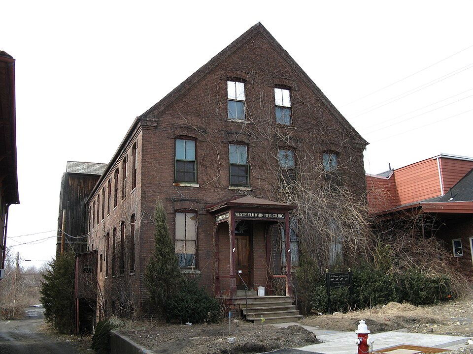
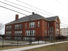
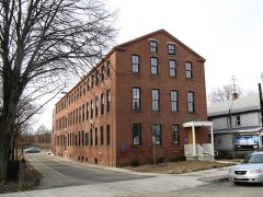
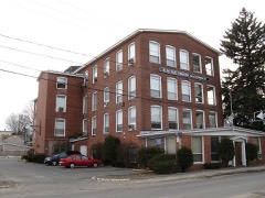
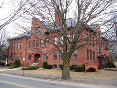
Photograph of Westfield Whip Manufacturing Company
Photograph by John Phelan, CC BY 3.0. Via Wikimedia Commons.

Westfield Whip Manufacturing Company

Listed on the National Register of Historic Places in 1985. A historic map-sheet match is not published yet. The record needs a coordinate-quality review before it can be joined to a sheet boundary.

From the record

“Westfield Whip Manufacturing Company is a historic factory at 360 Elm Street in Westfield, Massachusetts. Built about 1887, it is the best preserved of Westfield's extant whip factory buildings.”

Wikipedia article Westfield Whip Manufacturing Company, CC BY-SA 4.0.

one of 123 National Register listings in Hampden County · listed in 1985 · category: Building.

Sources: the Wikipedia article · the case file at the National Archives · the National Register database, National Park Service

The listing

  • What is counted as historic. The nomination lists 1 building as contributing to the listing.
  • Address. 360 Elm St., Westfield, 01085
  • When was it listed? 1985-10-17
  • Category. building
  • Township. Westfield city
  • National Register reference number. 85003233 - the number the National Park Service assigned this property when it was listed, and the key its nomination file is catalogued under at the National Archives.

The ground it stands on

57,538 words

The chapter on Westfield City in The History of the Celebration of the Two Hundred and Fiftieth Anniversary of the Incorporation of the Town of Westfield, Massachusetts, August 31, September 1, 2, 3, 1919, and Appendix with Reminiscences of the Last Half-century, published 1919 names Westfield. This is what it says, exactly as the scans read.

I think, to many of us, the celebrating of the 25Oth Anniversary of the settlement of Westfield was a glad time ; a time of inspiration that brought with it a sense of pledge to all those splendid New England settlers, the imprints of whose lives we are constantly coming across in all our doings.

Passage source: The History of the Celebration of the Two Hundred and Fiftieth Anniversary of the Incorporation of the Town of Westfield, Massachusetts, August 31, September 1, 2, 3, 1919, and Appendix with Reminiscences of the Last Half-century, published 1919.

To me the idea of an historical loan exhibit seemed the very first and closest expression of our nearness to, and interest in, the early days of the settlements. I felt that we should bring together and gaze once more upon those souvenirs, utensils and belongings which had really been a part of the life of old Westfield, used and lived with, by those people once peopling the town as we do today.

Passage source: The History of the Celebration of the Two Hundred and Fiftieth Anniversary of the Incorporation of the Town of Westfield, Massachusetts, August 31, September 1, 2, 3, 1919, and Appendix with Reminiscences of the Last Half-century, published 1919.

Machine-read from a century-old scan, so expect the errors a machine makes: misspelled names, dropped words, stray characters.

Read the whole chapter on Westfield City - 57,538 words on its settlement, mills, schools and churches.

Fires near this property

131 since 2015

Regional context, not property-specific evidence. The federal wildfire occurrence database lists 131 fires within 5 miles of Westfield Whip Manufacturing Company between 2015 and 2020, burning about 128 acres in total. 9 started naturally. 1 was recorded as arson. Distance is straight-line from the map coordinates, so a fire counted here may appear on a neighbouring settlement's page as well.

Reported cause Fires
Missing data/not specified/undetermined80
Equipment and vehicle use32
Natural9
Recreation and ceremony5
Debris and open burning2
Fireworks1
Arson/incendiarism1
Smoking1

The most recent of them, most recent first, with the day each was reported and the service that recorded it.

DateCause SizeReported by Name on the report
9 September 2016Missing data/not specified/undeterminedunder an acreMassachusetts Bureau of Forest Fire Controlnot named
8 September 2016Equipment and vehicle useunder an acreMassachusetts Bureau of Forest Fire Controlnot named
5 September 2018Natural2.0 acresMassachusetts Bureau of Forest Fire Controlnot named
5 September 2015Missing data/not specified/undeterminedunder an acreMassachusetts Bureau of Forest Fire Controlnot named
17 September 2016Missing data/not specified/undeterminedunder an acreMassachusetts Bureau of Forest Fire Controlnot named
14 September 2016Equipment and vehicle useunder an acreMassachusetts Bureau of Forest Fire Controlnot named
13 September 2016Equipment and vehicle useunder an acreMassachusetts Bureau of Forest Fire Controlnot named

Every fire recorded in Hampden County

Specimens collected near this property

12 of 2,606 shown

Regional context, not property-specific evidence. Museums hold 2,606 specimens collected within 10 miles of Westfield Whip Manufacturing Company between 1831 and 1975: 1,308 Fungi, 695 Plantae, 517 Animalia, 64 Chromista, 22 Unrecorded. 12 distinct Species records are shown. Collected by A. B. Seymour, A. B. Seymour & Clara E. Cummings, A. B. Seymour; (a) A. B. Seymour, (b) Martin and others. Each is a physical object with a catalogue number, and each entry opens the museum's record. This is what was collected and kept, not a survey of what lives here - nothing can be concluded from a species being absent.

Image SpeciesYear Collected by Where, as recorded
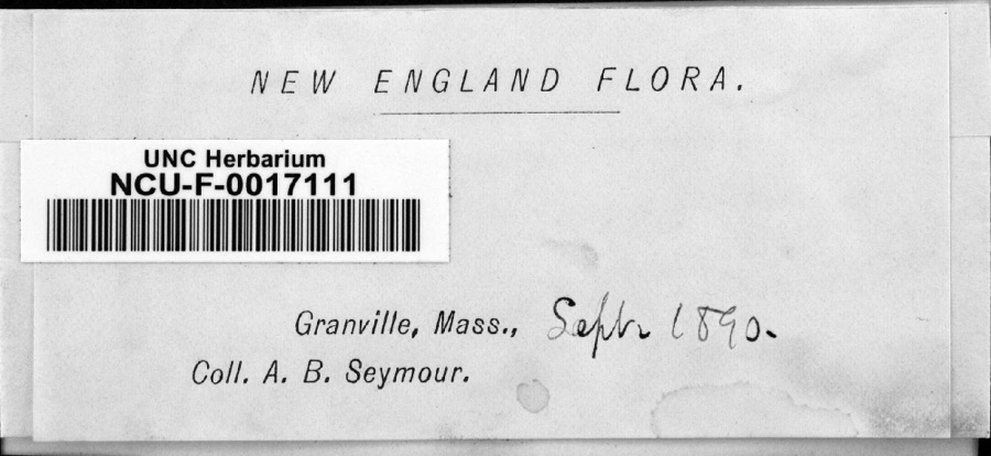
Specimen of FungiFungi1890Seymour, Arthur BlissGranville
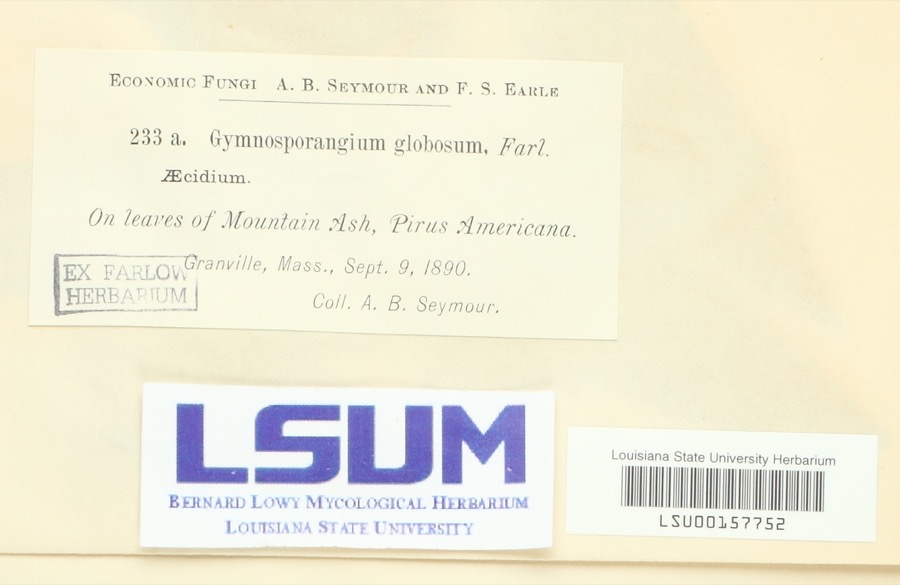
Specimen of Gymnosporangium globosum (Farl.) Farl.Gymnosporangium globosum (Farl.) Farl.1890Arthur B. SeymourGranville
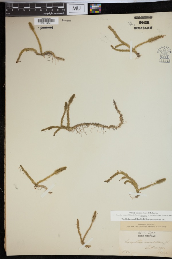
Specimen of Lycopodiella inundata (L.) HolubLycopodiella inundata (L.) Holub1892ChapmanSouthhampton
A photograph of the species Carex bromoides, not of this specimenCarex bromoides Willd.1831Collector unknown
A photograph of the species Panax quinquefolius, not of this specimenPanax quinquefolius L.1831Collector unspecifiedBlandford
A photograph of the species Carex vesicaria, not of this specimenCarex vesicaria L.1836Collector unknown
A photograph of the species Carex vestita, not of this specimenCarex vestita Willd.1836Collector unspecified
A photograph of the species Carex siccata, not of this specimenCarex siccata Dewey1844Collector unknown
A photograph of the species Amphicarpaea bracteata, not of this specimenAmphicarpaea bracteata (L.) Fernald1845Collector unspecified
A photograph of the species Alopecurus geniculatus, not of this specimenAlopecurus geniculatus L.1850not recorded
A photograph of the species Lactuca hirsuta, not of this specimenLactuca hirsuta Muhl. ex Nutt.1850Collector unspecified
Alnus incana (L.) Moench1891unknownWoods Hall.

All 2,606 specimens within 10 miles, at the Global Biodiversity Information Facility.

Mines and quarries near this property

10 of 37 shown

Regional context, not property-specific evidence. The federal mineral resources record lists 37 workings within 5 miles of Westfield Whip Manufacturing Company: 21 past producers, 12 producers, 4 occurrences. 12 still produce. What was taken out: Stone, Crushed/Broken, Sand and Gravel, Construction, Stone, Dimension, Marble, Dimension. Distance is straight-line from the map coordinates, so a quarry counted here may appear on a neighbouring settlement's page as well.

Where SiteCommodity StatusRecorded
Hampden Marble Quarry SeriesMarble, DimensionPast Producer
Sandstone QuarryFlagstonePast Producer
Southampton AreaZinc, Lead, VanadiumOccurrenceDescloizite, Vanadinite
Westfield Quarry Plants L & 2Sand and Gravel, Construction, Stone, Crushed/BrokenProducer
Hampden Marble Quarry Serpentine QuarryStone, DimensionProducerMetamorphic
Sandstone QuarryStone, DimensionProducerSandstone
Serpentine QuarryStone, DimensionProducerMetamorphic
Serpentine QuarryStone, DimensionPast Producer
Baxter Sand and Gravel IncSand and Gravel, ConstructionPast ProducerSedimentary
John S Lane and Son IncSand and Gravel, ConstructionPast ProducerSedimentary

Every working recorded in Hampden County

Storms near this property

60 of 65 shown

Regional context, not property-specific evidence. The National Weather Service names Westfield, the town this property stands in, in 65 storm reports between 1994 and 2025: 36 thunderstorm wind, 20 hail, 4 flash flood, 3 flood. The reports record 3 deaths and 200 injuries. Each account below is quoted exactly as the forecast office filed it, from the NOAA Storm Events Database, and each date opens the federal record of that event.

WhenEvent Place namedHarm What the report says
June 2011Tornado (EF3)Westfield3 killed, 200 hurt, $227,600,000A supercell thunderstorm developed over western Massachusetts. This storm strengthened and produced a long-lived, very significant tornado that did extensive damage across southwest and south central Massachusetts.||This storm will be noted not only for its intensity, but also for the length of the continuous damage path, approximately 38 miles, 31 of which were in Hampden County. The tornado was also very wide at some points, reaching a maximum width of one half mile.||The tornado first touched down in the Munger Hill section of Westfield with damage mainly limited to trees, many uprooted and snapped. The roof of Munger Hill Elementary School was also damaged. The tornado rapidly intensified as it moved into West Springfield and caused extensive damage to industrial buildings and homes. Several buildings had their roofs removed by the tornado, a few structures collapsed, and several multi-story buildings lost their upper stories. ||The tornado then crossed the Connecticut River adjacent to the Memorial Avenue bridge and into the city of Springfield. Here the tornado produced extensive damage to the south side of the downtown area with many homes destroyed. In addition, commercial brick buildings sustained major damage. Roofs were removed from many of these large commercial structures. The tornado also produced severe structural damage to townhomes and apartments near Springfield College. The tornado continued moving east into the Island Pond section of Springfield, where Cathedral High School and St. Michael's Academy sustained significant damage and many homes in this part of the city were completely destroyed.||The tornado continued to move east through Wilbraham near the Wilbraham/Hampden town line producing nearly complete deforestation and significant damage to nearby structures.||Widespread damage occurred in Monson as the tornado moved directly through the center of town. Many houses were completely destroyed and significant damage was done to commercial and residential buildings. The roof of Monson High School was destroyed. Forested parts of town experienced nearly complete deforestation and in some locations the bark was stripped from the tree trunks.||The tornado moved across the Brimfield State Forest where it reached its maximum width of approximately one half mile. Additional significant damage occurred both to structures and forested areas for many miles through Brimfield before crossing into Worcester County just south of Route 20.||Three fatalities were directly attributable to the tornado, two in West Springfield and one in Brimfield. A thirty-nine year old woman in West Springfield was killed when her house collapsed on her while she sheltered her 15 year old daughter in the bathtub. Also in West Springfield, a twenty-three year old man was killed when his van was crushed by a falling tree. A fifty-two year old woman in Brimfield was killed when the trailer home she was living in was thrown 35 feet into the air. In addition, two hundred people were treated for injuries sustained in the tornado.||It was estimated that 1400 houses and at least 78 businesses were either damaged or destroyed. Of these 1400 houses, roughly 300 of them had been completely destroyed, including about 200 in Springfield, 51 in Monson, 39 in Brimfield, and 13 in Wilbraham. Two hundred residential buildings were condemned and more than 300 rental units were lost throughout western Massachusetts. ||Two public schools in Springfield and one in Westfield were severely damaged by the tornado. At least two parochial schools were also destroyed. The students attending these schools were temporarily assigned to other area schools for the remainder of the school year. Public school students will begin the 2011-2012 school year in modular buildings on the site of their former school buildings and parochial students will be travelling to temporary locations, some outside their home city.||Nearly 10,000 acres of woodlands were destoyed with the Massachusetts Forest Landowners Association estimating a clean up cost of $3.6 million. This is included in the property damage estimate. In Springfield alone, 7500 mature trees were uprooted or destroyed.||Shelters that opened across western Massachusetts on June 1, sheltered a total of 330 residents for a total of 30 days.||President Obama issued a Major Disaster Declaration for Hampden County shortly after the tornado.||The Massachusetts Division of Insurance reported that 9500 insurance claims were completed by residents as a result of the June 1 tornadoes, adding up to $175 million worth of damage. This included 5000 personal insurance claims totalling $135 million, 3500 automobile claims totalling $20 million, and 1000 commercial property claims totalling $20 million. These damage amounts are also included in the property damage estimates with this event.||Property damage estimates, injuries, and fatalities are a total for the entire June 1 episode with the majority of the damage and all of the injuries and fatalities directly related to this long track EF3 tornado. The remainder of the property damage listed on this event can be attributed to one of the other 3 tornadoes that occurred in western Massachusetts on June 1.
June 2015Thunderstorm WindWestfield$60,000Trees and wires were downed on Root Road by thunderstorm winds. Three mobile homes were badly damaged and deemed uninhabitable when several trees were downed by thunderstorm winds.
December 2010FloodWestfield$30,000Great Brook flooded out of its banks flooding Shaker Road and Crescent Circle. Yards and homes in the area were flooded and sandbags were requested by the residents.
July 2008Flash FloodWestfield$30,000Heavy rain resulted in flash flooding across portions of Hampden county. In Palmer, a police car was stuck in flood waters on Chudy Street. Several other civilian cars were stuck in flood waters on another street. In Westfield, at least one road was washed out, including the Route 202 underpass, which was deemed impassable and closed. In Ludlow, many streets were flooded with some cars abandoned.
April 2007FloodWestfield$25,000Robbins State Park was closed when it became flooded by Miller Brook.|Minor flooding occurred along the Westfield River through Westfield. A crest of 18.8 feet was recorded at 2 pm on the 16th (flood stage is 13 feet). Flooding affected a portion of Route 20.
June 2008Thunderstorm WindWestfield$20,000One tree was downed by thunderstorm winds landing on two cars in Westfield. Another tree was downed onto a car in West Springfield.
July 2008Thunderstorm WindWestfield$15,000Trees and wires on Lockhouse and North Roads, and Union Avenue were downed by thunderstorm winds.
June 2008Thunderstorm WindWestfield$13,000An amateur radio operator measured a 64 mph wind gust on their home weather station. A few miles away from this measuring station, trees and wires were downed across Westfield. This includes, a tree that was downed onto a car, blocking the road.
August 2016Thunderstorm WindWestfield$10,000A large limb and wires on Cycle Street were downed by thunderstorm winds. A tree was downed onto Shaker Road by thunderstorm winds.
July 2014Thunderstorm WindWestfield$10,000Power lines on South Meadow Road were downed by thunderstorm winds. Trees and power lines along Route 20 were downed as well.
June 2013Thunderstorm WindWestfield$10,000A utility pole on Falley Drive was downed by thunderstorm winds.
August 2012Thunderstorm WindWestfield$10,000Trees on North Road were downed by thunderstorm winds.
July 2011Thunderstorm WindWestfield$10,000Trees were downed by thunderstorm winds.
June 2004Thunderstorm WindWestfield$10,000no account filed
June 2008FloodWestfield$6,000North Elm Street was flooed with three cars stuck in the waters.
October 2020Thunderstorm WindWestfield$5,000In Southwick, there were multiple reports of trees down...on Ed Holcomb Road, Hillside Road, at the Ranch Golf Club, Miller Road, and at the Southwick Acres Campground.
February 2016Thunderstorm WindWestfield$5,000A large tree in the cemetery near Westfield State University was downed by thunderstorm winds.
July 2016Thunderstorm WindWestfield$5,000A tree on Montgomery Road near the high school was downed by thunderstorm winds.
June 2015Thunderstorm WindWestfield$5,000A large oak tree on Mockingbird Lane was downed by thunderstorm winds.
September 2012Thunderstorm WindWestfield$5,000A tree and wires were downed on East Mountain Road.
June 2011Thunderstorm WindWestfield$5,000A large tree on Granville Road was downed by thunderstorm winds.
June 2008Thunderstorm WindWestfield$5,000Trees and wires on General Knox Road were downed by thunderstorm winds.
August 2008Thunderstorm WindWestfield$5,000Trees on North Road were downed by thunderstorm winds.
July 2005Flash FloodWestfield$5,000no account filed
July 2002Thunderstorm WindWestfield$5,000no account filed
July 2019Thunderstorm WindWestfield$3,000A tree was downed on Lockhouse Road and blocked the roadway.
June 2008Thunderstorm WindWestfield$3,000Wires were downed by thunderstorm winds.
July 2022Thunderstorm WindWestfield$2,000Police reported two trees down on Parker Avenue...report relayed by amateur radio operators. A trained spotter also reported small trees down off of Union Street.
August 2002Thunderstorm WindWestfield$2,000no account filed
August 2021Thunderstorm WindWestfield$1,500In Westfield, multiple trees were down, blocking a portion of Route 202.
July 2017Thunderstorm WindWestfield$1,500At 1218 PM EST, trees were brought down on Arnold Street in Westfield. At 1220 PM EST, power lines were brought down on Washington Street.
February 2016Thunderstorm WindWestfield$1,000A large limb on East Mountain Road in Westfield was downed by thunderstorm winds.
July 2014Thunderstorm WindWestfield$1,000Large tree limbs were downed onto Little River Road.
July 2009Thunderstorm WindWestfield$1,000A tree on Route 187 was downed by thunderstorm winds.
May 2008Thunderstorm WindWestfield$1,000Five inch diameter limbs were downed on Main Street by thunderstorm winds.
September 2025Thunderstorm WindWestfield$800In Westfield wires were down and on fire.
August 2021Thunderstorm WindWestfield$500In Westfield, a large limb was down on a house on King Street.
May 2008Thunderstorm WindWestfield$500Several large limbs were downed on East Mountain Road. At the same time, a broadcast meteorologist estimated that wind speeds were around 60 mph.
June 2025Thunderstorm WindWestfield$300In Westfield, a tree fell blocking Lockhouse Rd.
June 2025HailWestfield-In Westfield, quarter sized hail was reported.
June 2024HailWestfield-Quarter sized hail was reported by amateur radio.
September 2021Flash FloodWestfield-In Westfield, the media showed a Twitter photo of the Powdermill Brook overflowing its banks and leading to flash flooding on Greenwood Street in Westfield.
July 2019HailWestfield-Quarter sized hail was observed in Chicopee.
December 2019HailWestfield-Quarter size hail fell in Westfield, MA at from 340 through 344 PM EST from an isolated severe thunderstorm. This was a very unusual event for late December. It was definitely bona fide hail, not related to the ongoing sleet/freezing rain event. Prior to the quarter size hail, dime size hail fell at this location starting at 338 PM EST.
May 2017HailWestfield-At 639 PM EST, Hail up to 1 inch diameter was reported in Westfield.
May 2017HailWestfield-At 635 PM EST, hail up to nickel size was reported in Westfield, per the media.
May 2017HailWestfield-At 645 PM EST, quarter size hail covering the ground was reported in Westfield.
May 2017HailWestfield-At 646 PM EST, quarter size hail was reported on Folly Drive in Westfield.
May 2017HailWestfield-At 647 PM EST, the media reported half dollar size hail falling near Provin Mountain in Westfield.
May 2017HailWestfield-At 743 PM EST, quarter size hail was reported in Westfield.
March 1999Flash FloodWestfield-West Branch Westfield River
February 1997Thunderstorm WindWestfield-A peak wind gust to approximately 60 mph was reported in Westfield and wires were knocked down in Holyoke during a severe thunderstorm. A peak wind gust to 96 mph was recorded by a research wind turbine atop Mount Tom.
June 2013HailWestfield-no account filed
June 2011HailWestfield-no account filed
September 2003HailWestfield-no account filed
August 2003HailWestfield-no account filed
August 2002HailWestfield-no account filed
June 1999LightningWestfield-no account filed
September 1998Thunderstorm WindWestfield-no account filed

Every storm recorded in Hampden County

Map coverage status

No historic map-sheet match is published for this property yet. That does not mean no map exists. This record needs a coordinate-quality review before it can be joined to a sheet boundary. Browse the county's mapped places while that work is pending.

From the nomination file

3,575 words on record

When this property was proposed for the National Register, someone wrote the case for it: what the building is, and why it matters. That document is a federal record in the public domain. It is quoted below word for word, never summarised. The text was read off the scanned case file by machine, so the occasional stray character is the recogniser's and the 1970s typewriter's.

Description of the property

The Westfield Whip Company, 360 Elm Street, Westfield, is located on the south side of the Westfield River, a tributary of the Connecticut River, in western Massachusetts. The building dates from 1887-1892; it is of red brick construction, with limestone trim, and rests on a brick foundation. The factory building faces east onto Elm Street and a small city park and is set back approximately 20 feet from the street. The immediate neighborhood surrounding the whip company building is densely built up with industrial and commercial structures.

Io the north and south, two-story commercial buildings stand about 15 feet from the whip company building, while other commercial/industrial properties, including facilities associated with the western Massachusetts Electric Company, border the lot to the rear. Elm Street, a north/south roadway, crosses the Westfield River about 180 feet to the north. Io the south, Elm Street joins Main Street about one half mile from the nominated property to form Westfield's commercial and institutional center. An industrial city on the primary western corridor from Springfield to the Berkshires, westfield has been served since the 1840s by the east-west route of the Western Railroad (now Conrail), whose tracks stand due north of the whip company, on the north side of the Westfield River.

The tracks of the ca. 1855 westfield and Northampton Railroad, a north-south route now part of the Pioneer Valley Railroad Company, run to the west of the property. The area in which the building is located has been, since the early 19th century, the industrial center of the town, and is dominated by railroad-related structures, industrial buildings, and workers' housing, all of mid- to late-19th century construction.

Read the complete 3,575-word case file.

Statement of significance

(in one paragraph) Builder/Architect Unknown The Westfield Whip Company, located in westtield, Massachusetts,has been, under a variety of owners and appelations, in near continuous use as a whip manufactory it was first constructed in 1887. Westfield, a community known since 1801 as "The Whip City of the World," at one time supported more than 60 such enterprises, of which the present westfield whip Manufacturing Company is the sole survivor still in operation. The factory is significant historically for its continued associations with an industry that constituted some 80 percent of the city's economy through much of the 19th and early 20th centuries and dominated the manufacture of carriage and harness-racing whips worldwide.

Architecturally, the building is significant as an intact example of typical late 19th century industrial construction, and it is among the best preserved of similar, though no longer operating, whip plants in westfield. Of particular note is the factory's original, specialized machinery, much of it intact, in situ, and still in fine working order. The Westfield Whip Company retains integrity of setting, design, location, materials, workmanship, feeling, and association, and fulfills criteria A and C of the National Register of Historic Places on the local level. The introduction of the whip business into Westfield is credited to Titus made of white oak and were twisted stock whips, with sheepskin lashes covered traded to farmers, who attached them to whipstocks.

But in the early 1820s, plaited stocks were introduced. Hiram Hull's invention, ca. 1822, of the "barrel" plaiting machine mechanized a tedious hand process and made it practical to introduce factory conditions to the industry. By 1832, Hull was the largest whipmaster in town, employing 26 men to make 50,000 whips annually, about half the number then made in Westfield. With continual technical advances, the industry expanded rapidly.

Read the complete 3,575-word case file.

The whole case file for this property - 3,575 words, 16 pages, reproduced complete.

Quoted from the National Register nomination for reference 85003233, 16 pages, held by the National Archives in Record Group 79. See the catalogue record.

Listed places nearby

6 within 8 miles

Other National Register properties close enough to walk or drive between, ordered by distance from this one. Both positions come from the same geocoding pass that matched these properties to their map sheets.

Photograph PropertyDistance Listed
Prospect Hill Schoolunder 500 feet2008
Sanford Whip Factory0.4 miles2008
Van Deusen, H. M., Whip Company0.4 miles1987
Moseley School0.5 miles2020
State Normal Training School0.5 miles1983
Octagon House0.6 miles1982

Sources for this property

National Archives recordThe nomination case file for reference 85003233 in Record Group 79.
Wikipedia articleCommunity-written account of this property, licensed CC BY-SA.
Hampden CountyAll 123 listed properties in this county.

Provenance

  • Listing record. National Park Service National Register of Historic Places, listed-properties dataset, current to 2026-05-22.
  • Map join. Address geocoded through the United States Census geocoder, then tested against the published boundary of every sheet in the USGS Historical Topographic Map Collection.
  • How this page is made. Listing fields come from federal records; map-sheet coverage is a labelled coordinate-to-boundary calculation, not a source-field claim.
  • Wildfire. Short, Karen C. 2022. Spatial wildfire occurrence data for the United States, 1992-2020 [FPA_FOD_20221014]. 6th Edition. Fort Collins, CO: Forest Service Research Data Archive. https://doi.org/10.2737/RDS-2013-0009.6 Collected with United States Government funding and usable without additional permissions or fees.
  • Specimens. Global Biodiversity Information Facility (GBIF), https://www.gbif.org/. Only records licensed CC0 or CC BY are used. Records licensed CC BY-NC are excluded because this site carries advertising. Images are checked individually and any whose licence is non-commercial, no-derivatives or unreadable is refused.
  • Mines and quarries. USGS Mineral Resources Data System (MRDS) https://mrdata.usgs.gov/mrds/ A work of the United States government, no copyright under 17 U.S.C. 105.
  • Storms. NOAA National Centers for Environmental Information, Storm Events Database https://www.ncei.noaa.gov/stormevents/ A work of the United States government, no copyright under 17 U.S.C. 105. Narratives are quoted verbatim from the National Weather Service report and are not edited or summarised.