Built in 1836 in the Greek Revival architecture. Listed on the National Register of Historic Places in
1986. A historic map-sheet match is not published yet. The record needs a coordinate-quality review before it can be joined to a sheet boundary.
From the record
“The South Harwich Methodist Church is a historic Methodist church building in South Harwich, Massachusetts, USA. Built in 1836, it is a well-preserved example of a typical Cape Cod church of the first half of the 19th century.”
Wikipedia article South Harwich Methodist Church, CC BY-SA 4.0.
one of 145 National Register listings in Barnstable County · listed in 1986 · category: Building · built in 1836, Greek Revival architecture.
National Register reference number.86001887- the number the National Park Service assigned this property when it was listed, and the key its nomination file is catalogued under at the National Archives.
Fires near this property
75 since 2003
Regional context, not property-specific
evidence. The
federal wildfire occurrence database
lists 75 fires within 5 miles of South Harwich Methodist Church between
2003 and 2020, burning about 21 acres in total. 6 started naturally. 7 were recorded as arson.
Distance is straight-line from the map coordinates, so a fire counted
here may appear on a neighbouring settlement's page as well.
Reported cause
Fires
Missing data/not specified/undetermined
33
Debris and open burning
10
Recreation and ceremony
7
Arson/incendiarism
7
Natural
6
Equipment and vehicle use
5
Smoking
3
Power generation/transmission/distribution
2
Misuse of fire by a minor
1
Fireworks
1
The most recent of
them, most recent first, with the day each was reported and the service
that recorded it.
Regional context, not property-specific
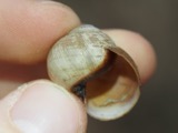
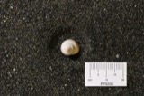
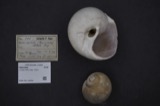
evidence. Museums hold 2,197 specimens
collected within 10 miles of South Harwich Methodist Church between 1840 and
1975: 1,066 Animalia, 856 Plantae, 222 Fungi, 31 Unrecorded, 14 Chromista, 7 Bacteria, 1 Protozoa. 12 distinct Species records are shown.
Collected by A. B. Seymour, A. Pealey, A. R. Hodgdon and others. Each is a
physical object with a catalogue
number, and each entry opens the museum's record. This is what was
collected and kept, not a survey of what lives here - nothing can be
concluded from a species being absent.
Regional context, not property-specific
evidence. The federal mineral resources record lists
2 workings within 5 miles of South Harwich Methodist Church: 1 past producer, 1 producer.
1 still produces. What was taken out: Sand and Gravel, Construction. Distance is straight-line from the
map coordinates, so a quarry counted here may appear on a neighbouring
settlement's page as well.
Regional context, not property-specific
evidence. The National Weather Service names
Harwich, the town this property stands in, in 8 storm reports between 1997 and 2024: 3 hail, 2 flood, 1 thunderstorm wind, 1 tornado.
No death or injury is recorded in these reports. Each account below is quoted exactly as the forecast office
filed it, from the NOAA Storm Events Database, and each date
opens the federal record of that event.
The same supercell storm that produced the Barnstable-Yarmouth tornado went on to touch down again near the center of Harwich, MA at 1210 PM EDT (1110 AM EST). The initial touchdown was just east of Harwich Elementary School, just south of Parallel Street. It moved northeast through Harwich Center, passing just south of a golf course, and lifted in East Harwich in the Vicinity of Queen Anne Road. At least 150 hardwood trees were either uprooted or snapped. A few homes also had shingles that were ripped off. Wind gusts were estimated as high as 110 mph, which is on the high end of the Enhanced Fujita EF-1 ranking. Harwich spent $1.2 million on cleanup of roads. That figure is estimated to be one-third of the total costs, when individual homeowner claims are taken into account.||The tornado then lifted. However, severe straight-line wind damage was observed in Chatham. Numerous large trees were uprooted, consistent with 90 mph gusts or greater.
In Harwich, two large trees were down on a house on Lake Pleasant Avenue (Route 124). A tree was down on Bank Street. Another tree was down on Gotham Road and yet another down on Sisson Road. A large limb was down on Route 28 near Route 274. A large tree and wires was down on Guilford Drive. Tree and wires down on Main Street at Uncle Harry's Road.
No historic map-sheet match is published
for this property yet. That does not mean no map exists. This record needs
a coordinate-quality review before it can be joined to a sheet boundary.
Browse the county's mapped places while that work is
pending.
From the nomination file
2,928 words on record
When this property was proposed for the
National Register, someone wrote the case for it: what the building is,
and why it matters. That document is a federal record in the public domain.
It is quoted below word for word, never summarised. The text was read off the scanned case file by machine, so the
occasional stray character is the recogniser's and the 1970s
typewriter's.
Description of the property
The South Harwich Methodist Church, built in 1836, occupies a prominent site at the intersection of Chatham, Deep Hole, and 01d County Roads in the resort and residential community of Harwich on the south side of the Cape Cod peninsula. The church is set back about 100 feet from the road and faces south on a level lot. Fronting the church is a broad lawn, while to the east, west, and north is a graveyard whose first burials predate the church's construction by seven years. A granite-paved walkway leads from a roadside cattle blind of cut stone to the church. Residences (some of them of 19th century construction) and 20th century motels and commercial buildings are located in the church's immediate neighborhood.
The clapboard-sheathed church is a simple, gable-roofed structure, thirty-seven feet wide and forty-five feet long. It is sited with its gable end facing the street. The building rises one story from a brick foundation. There is no tower- The church's exterior displays a mix of Greek Revival and Gothic Revival elements. The broad facade is framed by delicate panelled pilasters, which support the building's entablature and cornice with returns. Vented windows and doors are set within lancet-headed openings. The three-bay main facade features a central window with paired 6/6 sash, flanked by entryways. Two granite steps lead to each entryway. Both the east and west facades each contain three 1ancet-headed window openings containing paired 6/6 sash surmounted by vents.
On the rear, northern facade are located two 6/6 sash windows, also within 1ancet-headed windows. Interior The building's interior is remarkably intact. In plan, it is essentially rectangular, with two vestibules on either side of the central window. The altar is set in front of a small, round-arched bay projecting to the rear of the building.
/Architect Unknown Statement of Significance (in one paragraph) The South Harwich Methodist Church, built in 1836, holds historical associations with the growth of Methodism in the central Cape Cod town of Harwich and was in daily use until the mid 20th century. Architecturally, the church is a well-preserved representative of the simply ornamented, rec tangular-pl an churches buildings erected on the Cape during the first half of the 19th century, a period of unprecedented ecclesiastical construction. The church's use of both Greek Revival and Gothic Revival features distinguishes it, as does its particularly intact interior.
Retaining integrity of location, design, setting, materials, feeling, and workmanship, the South Harwich Methodist Church thus fulfils Criteria A and C of the National Register of Historic Places on the local level. While Methodist societies had been formed in America prior to the Revolution, Methodism was not promulgated on the Cape Cod peninsula until ca. 1790, when itinerant minister Jesse Lee, disciple of southern evangelical Devereux Jarratt, visited a number of towns in the region. With the help of other circuit riders, Methodism's spread thereafter was rapid, coupled with the construction of a number of Methodist meetinghouses. In the Harwich area, Methodist converts built a meetinghouse on Queen Anne Road on the Chatham border in East Harwich in 1799.
(This was replaced in 1811 with a structure that was apparently similar to the nominated property, with gable front and framing pilasters; it was substantially altered in 1905.) The nominated property, the town's second Methodist seat of worship, was erected in 1836 on 1and deeded to the church by John Paine Eldredge. The first burials took place prior to the church's construction in 1829. Other societies followed shortly thereafter, in North Harwich in 1842 and near the Chatham line at Bethel in 1853 (neither survive).
Quoted from the National Register nomination
for reference 86001887, 14 pages, held by the National Archives in Record
Group 79. See the
catalogue record.
Listed places nearby
6 within 8 miles
Other National Register properties close
enough to walk or drive between, ordered by distance from this one. Both
positions come from the same geocoding pass that matched these properties
to their map sheets.
Listing record. National Park Service National Register of Historic Places, listed-properties dataset, current to 2026-05-22.
Map join. Address geocoded through the United States Census geocoder, then tested against the published boundary of every sheet in the USGS Historical Topographic Map Collection.
How this page is made. Listing fields come from federal records; map-sheet coverage is a labelled coordinate-to-boundary calculation, not a source-field claim.
Wildfire. Short, Karen C. 2022. Spatial wildfire occurrence data for the United States, 1992-2020 [FPA_FOD_20221014]. 6th Edition. Fort Collins, CO: Forest Service Research Data Archive. https://doi.org/10.2737/RDS-2013-0009.6 Collected with United States Government funding and usable without additional permissions or fees.
Specimens. Global Biodiversity Information Facility (GBIF), https://www.gbif.org/. Only records licensed CC0 or CC BY are used. Records licensed CC BY-NC are excluded because this site carries advertising. Images are checked individually and any whose licence is non-commercial, no-derivatives or unreadable is refused.
Mines and quarries. USGS Mineral Resources Data System (MRDS) https://mrdata.usgs.gov/mrds/ A work of the United States government, no copyright under 17 U.S.C. 105.
Storms. NOAA National Centers for Environmental Information, Storm Events Database https://www.ncei.noaa.gov/stormevents/ A work of the United States government, no copyright under 17 U.S.C. 105. Narratives are quoted verbatim from the National Weather Service report and are not edited or summarised.
 Block
Block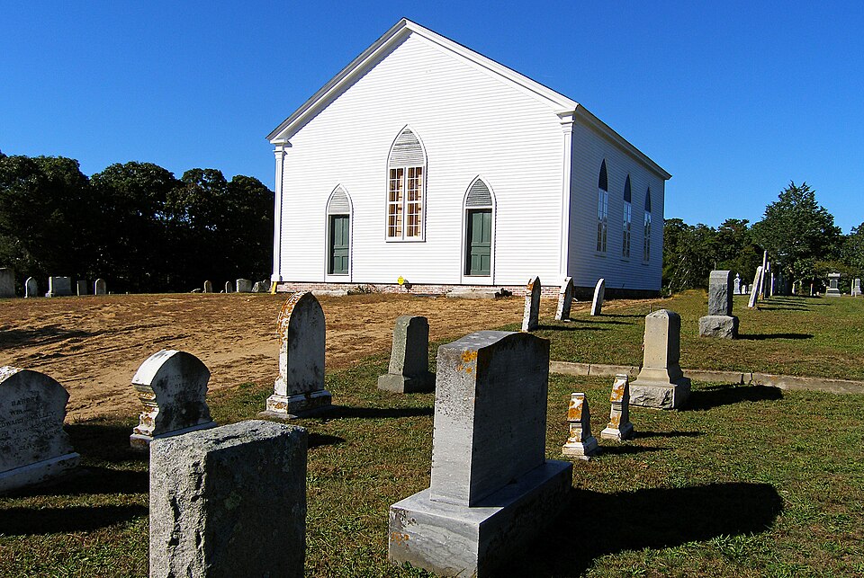


.jpeg)