Listed on the National Register of Historic Places in
1988. A historic map-sheet match is not published yet. The record needs a coordinate-quality review before it can be joined to a sheet boundary.
From the record
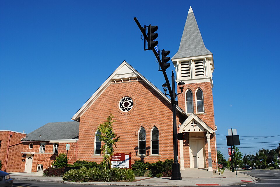
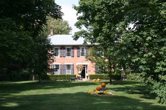
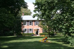
“The Hilliard United Methodist Church is a historic Methodist church in central Hilliard, Ohio, United States. The oldest religious structure in the community, it has been named a historic site.”
Wikipedia article Hilliard United Methodist Church, CC BY-SA 4.0.
one of 295 National Register listings in Franklin County · listed in 1988 · category: Building · one of 3 National Historic Landmarks in Franklin County.
National Register reference number.88000634- the number the National Park Service assigned this property when it was listed, and the key its nomination file is catalogued under at the National Archives.
The ground it stands on
433 words
The chapter on Norwich Township in History of Franklin County [Ohio]:, published 1858 names Hilliard. This is what it says, exactly as the scans read.
This township was laid out and organized by its present name in 1813; but it then extended across the river, including what is now the south end of Perry. In the original division of the county into townships in 1803, what is now Norwich constituted a part of Franklin Township ; and when Washington was set off and established in 1809, it then constituted a part of that township, and so remained until 1813. There never was any village in this township until after the Columbus, Piqua and Indiana Railroad was estalished, and then the village of Hilliard was laid out in the fall of 1853, by John R. Hilliard. The place is generally known as " Hilliard's Station." It is quite a small village of probably a dozen families, two grocery stores, and a post office. The first post office in this township was established in the spring of 1852, at )Smiley's
There is one grist mill and several saw mills in this township. The grist mill is on the Scioto, erected by Joseph Corban some twelve or fifteen years since. A saw mill at the same place had been erected by Samuel Wilcox, some years before. These are now knov\^n as " Howard's mills." There is a steam saw mill at Hilliard, and one or two others in the township.
Regional context, not property-specific
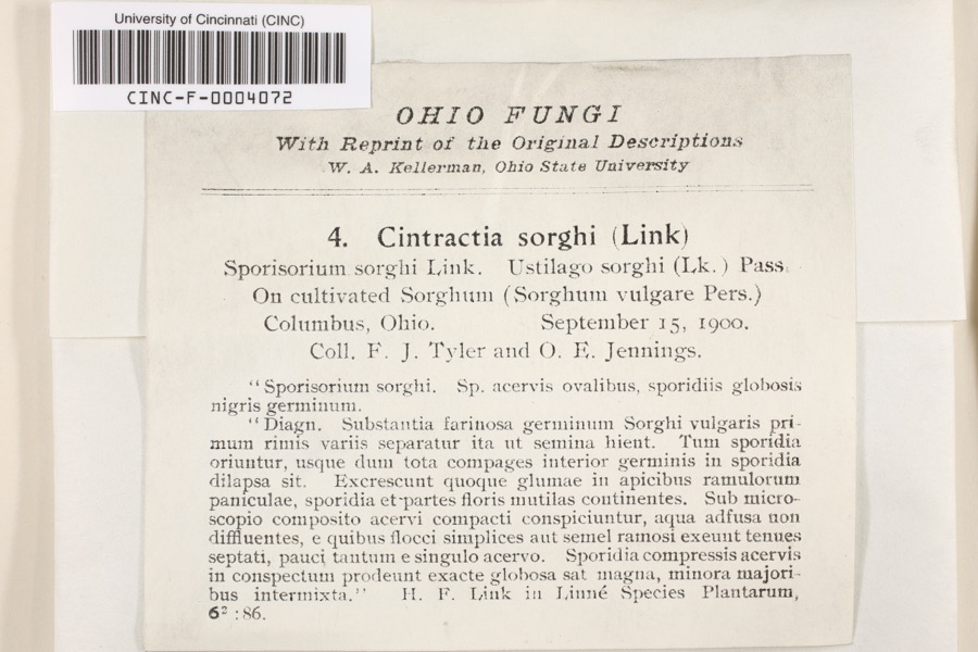
evidence. Museums hold 7,878 specimens
collected within 10 miles of Hilliard Methodist Episcopal Church between 1804 and
1975: 6,167 Animalia, 1,204 Fungi, 396 Plantae, 101 Chromista, 9 Unrecorded, 1 Protozoa. 12 distinct Species records are shown.
Collected by =, ?, A. Brooks and others. Each is a
physical object with a catalogue
number, and each entry opens the museum's record. This is what was
collected and kept, not a survey of what lives here - nothing can be
concluded from a species being absent.
Regional context, not property-specific
evidence. The federal mineral resources record lists
2 workings within 5 miles of Hilliard Methodist Episcopal Church: 1 past producer, 1 producer.
1 still produces. What was taken out: Calcium. Distance is straight-line from the
map coordinates, so a quarry counted here may appear on a neighbouring
settlement's page as well.
Regional context, not property-specific
evidence. The National Weather Service names
Hilliard, the town this property stands in, in 36 storm reports between 1994 and 2025: 18 hail, 16 thunderstorm wind, 1 flash flood, 1 lightning.
The reports record 1 death and 5 injuries. Each account below is quoted exactly as the forecast office
filed it, from the NOAA Storm Events Database, and each date
opens the federal record of that event.
Numerous trees and power lines were knocked down around the county, especially around Dublin. Also around Dublin, a roof of a strip mall was damaged and a tree fell on a home. A spotter reported a wind gust to 60 mph in Hilliard and dime size hail was reported in Reynoldsburg. A 100 foot tree was knocked down on to a tent at Ohio State University. Four workers were injured.
Widespread wind damage occurred across the northern part of the county. Up to 200 trees were downed, some causing extensive damage by falling onto homes and automobiles. Dime size hail also fell across the northern Columbus suburbs. Wind gusts were estimated at near 70 mph.
A brief microburst cause minor damage to some homes, along with downed trees and poowerlines. Three barns in the area also sustained some minor structural damage.
No historic map-sheet match is published
for this property yet. That does not mean no map exists. This record needs
a coordinate-quality review before it can be joined to a sheet boundary.
Browse the county's mapped places while that work is
pending.
From the nomination file
4,757 words on record
When this property was proposed for the
National Register, someone wrote the case for it: what the building is,
and why it matters. That document is a federal record in the public domain.
It is quoted below word for word, never summarised. The text was read off the scanned case file by machine, so the
occasional stray character is the recogniser's and the 1970s
typewriter's.
Statement of significance
Xlocally Applicable National Register Criteria Areas of Significance (enter categories from instructions) Period of Significance Significant Dates Cultural Affiliation Significant Person State significance of property, and justify criteria, criteria considerations, and areas and periods of significance noted above. integrity as a religious structure of the 1880s and for its role as the "Old Hilliard," as the original town is called, as shown on the attached stand, along with a handful of commercial buildings, a small number of buildings are the many frame, middle class and working class houses from both the 19th and early 20th centuries. [x See continuation sheet 1883 Architecture Unknown Architect/Builder map. Hilliard Methodist Episcopal Church meets National Register criterion C.
church continues to be used for religious services today. Constructed during the days when the city of Hilliard was a tiny village, population increased from only 610 in 1950 to over 5,600 in 1960,and Hilliard Methodist Episcopal Church is one of four properties in Hilliard Gothic detailing has been maintained and its character preserved as the this church was a symbolic stronghold in the community.The building's Hilliard began to take on the character of a suburban bedroom community.
significance and contribution to the development of the town asa rural the railroad line some ten miles west of Columbus map),the community The church is significant in its local context for its architectural In 1988,Hi1liard has become a city of 10,500 which is continuing to grow Old Hilliard represents the original settlement of"Hilliard's Station"as which are being nominated to the National Register for their architectural only 19th century church in Hilliard to survive to the present day. evolved slowly as a railroad town and agricultural center during the next Criteria Considerations (Exceptions) It was platted in 1853 by John Hilliard.
Quoted from the National Register nomination
for reference 88000634, 33 pages, held by the National Archives in Record
Group 79. See the
catalogue record.
Listed places nearby
6 within 8 miles
Other National Register properties close
enough to walk or drive between, ordered by distance from this one. Both
positions come from the same geocoding pass that matched these properties
to their map sheets.
Listing record. National Park Service National Register of Historic Places, listed-properties dataset, current to 2026-05-22.
Map join. Address geocoded through the United States Census geocoder, then tested against the published boundary of every sheet in the USGS Historical Topographic Map Collection.
How this page is made. Listing fields come from federal records; map-sheet coverage is a labelled coordinate-to-boundary calculation, not a source-field claim.
Specimens. Global Biodiversity Information Facility (GBIF), https://www.gbif.org/. Only records licensed CC0 or CC BY are used. Records licensed CC BY-NC are excluded because this site carries advertising. Images are checked individually and any whose licence is non-commercial, no-derivatives or unreadable is refused.
Mines and quarries. USGS Mineral Resources Data System (MRDS) https://mrdata.usgs.gov/mrds/ A work of the United States government, no copyright under 17 U.S.C. 105.
Storms. NOAA National Centers for Environmental Information, Storm Events Database https://www.ncei.noaa.gov/stormevents/ A work of the United States government, no copyright under 17 U.S.C. 105. Narratives are quoted verbatim from the National Weather Service report and are not edited or summarised.
 Block
Block