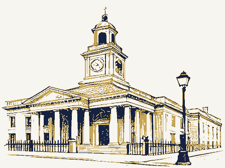
Listed on the National Register of Historic Places in
1988. A historic map-sheet match is not published yet. The record needs a coordinate-quality review before it can be joined to a sheet boundary.
Research this district
This curated hub for Cuyahoga County, Ohio brings together the page's documented record links, visible map or image evidence where published, and routes to related local records.
Use the page's provenance and linked records to distinguish the source material from the site's navigation and summaries.
How should I cite it?
Open the original record, preserve its repository and identifier, then use the citation tool for this page as a path back to the source.
Where should I go next?
Follow the county or state hub for related places and records, then use the guide for a source-aware research sequence.
From the record
“In 1834 he removed to Detroit, and practiced there till 1838, when he returned to Cleveland, where he spent the remainder of his professional life, and made himself a high reputation both as a physician and a valuable citizen. His leading traits as a physician were the exercise of benevolence and fearlessness in the performance of his professional duties.”
History of Cuyahoga County Ohio (1870). Machine-read text.
one of 338 National Register listings in Cuyahoga County · listed in 1988 · category: Building · one of 3 National Historic Landmarks in Cuyahoga County.
National Register reference number.88000637- the number the National Park Service assigned this property when it was listed, and the key its nomination file is catalogued under at the National Archives.
The ground it stands on
23,212 words
The chapter on Cleveland City in History of Cuyahoga County Ohio, published 1870 names Cleveland. This is what it says, exactly as the scans read.
At the Erie Conference M. EK. Church, in the fall of 1838, resolutions were passed dis approving any expression by the churches on the question of American slavery. This action was received with disfavor by a portion of the members of the church in Cleveland. On September 1, 1839, an organization was effected, consisting of about sixty members, who withdrew from the First Methodist Episcopal Church for that purpose. This new church stood alone until May, 1843. when it sent delegates to a convention held at Utica, New York, and there went into the organization which has ever since been known as the Wesleyan Methodist Connection of America.
John W. Allen was born in Litchfield, Connecticut, in 1802. He resided in Chenango county, New York, from 1820 to 1825, when he removed to Cleveland, where he has ever since lived. He was admitted to the bar the next year, and for several succeeding years was engaged in the active practice of his profession.
Regional context, not property-specific
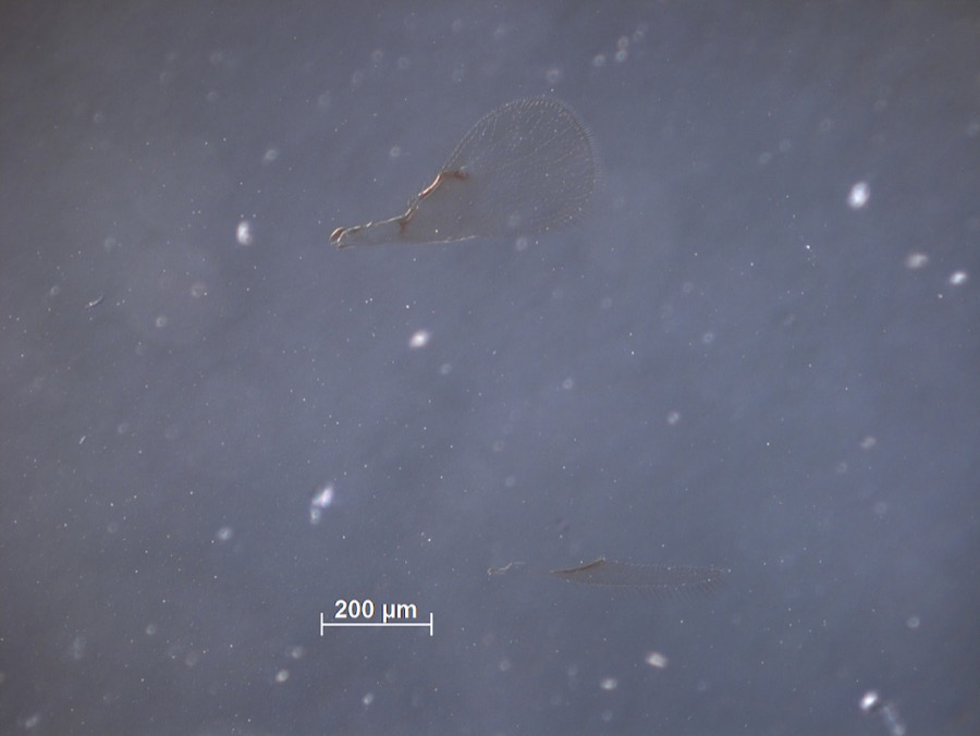
evidence. Museums hold 3,879 specimens
collected within 10 miles of Notre Dame Academy between 1849 and
1975: 3,469 Animalia, 219 Fungi, 111 Plantae, 73 Protozoa, 5 Unrecorded, 1 Chromista, 1 incertae sedis. 12 distinct Species records are shown.
Collected by A. D. Huryn, A. D. Selby, A. Hall and others. Each is a
physical object with a catalogue
number, and each entry opens the museum's record. This is what was
collected and kept, not a survey of what lives here - nothing can be
concluded from a species being absent.
Regional context, not property-specific
evidence. The federal mineral resources record lists
18 workings within 5 miles of Notre Dame Academy: 11 unknowns, 5 producers, 1 past producer, 1 plant.
6 still produce. What was taken out: Iron, Zirconium, Halite, Salt. Distance is straight-line from the
map coordinates, so a quarry counted here may appear on a neighbouring
settlement's page as well.
Regional context, not property-specific
evidence. The National Weather Service names
Cleveland, the town this property stands in, in 95 storm reports between 1994 and 2025: 51 thunderstorm wind, 26 hail, 11 flash flood, 3 lightning.
The reports record 3 deaths and 6 injuries. Each account below is quoted exactly as the forecast office
filed it, from the NOAA Storm Events Database, and each date
opens the federal record of that event.
During a sailboat race on Lake Erie, two people who were not wearing life preservers, were swept overboard by high waves and drowned. A total of four boats capsized and twelve people were swept overboard.
Thunderstorm wind gusts of 35 to 40 mph blew down two large tents on the west side of Cleveland. Three people inside were injured when the tents collapsed. One person was hospitalized. A peak wind gust of 36 mph was measured at nearby Cleveland Hopkins International Airport.
During the afternoon hours of the 2nd, a severe thunderstorms moved over downtown Cleveland. This thunderstorm remained nearly stationary over the downtown area for around an hour, and dropped as much as four and a half inches of rain. Several rainfall reports of 3.0 to 4.5 inches were received from downtown Cleveland. This rain fell in less than 90 minutes. Local streets and highways throughout the downtown area quickly filled with water. Many roads, including Interstate 90 were impassable by flood waters as much as four feet deep. Many vehicles became stranded in the flood waters. Once the rain ended, the high water receded quickly. This was a very local event in Cuyahoga County as the southern part of the county remained mainly dry. In fact, Cleveland Hopkins Airport did not receive any rainfall from this thunderstorm.
Heavy thunderstorm rain caused widespread flooding of roads and low lying areas in Cleveland and surrounding suburbs. In Newburgh Heights, Interstate 77 was flooded with three to four feet of water and an elderly couple had to be rescued from their floating car. Over five inches of rain was measured in some southern and eastern sections as storms repeatedly crossed the area for several hours.
Thunderstorms dumped up to three inches of rain on downtown Cleveland during the late afternoon hours. A television station located just east of downtown recorded 2.75 inches of rain in only 48 minutes. Major street flooding occurred and dozens of cars became stuck in water up to four feet deep. Several motorists had to be rescued from their vehicles.
Broadcast media posted a photo on social media of a large tree that fell on a house on the west side of Cleveland. The time was radar estimated. The media also reported 25,000 residents within the metropolitan Cleveland area lost power. One Giant Eagle grocery store had to throw out all of their refrigerated items after losing power. Tree limbs were also reported down on Martin Luther King Boulevard.
Rainfall amounts of 2 to 3.5 inches fell over Cleveland during a span of 60-90 minutes. Citywide flooding resulted as storm water systems were overwhelmed. Many roads including I 480 were flooded and closed for a brief period.
The Big Creek in Cuyahoga County (drainage basin 35.3 square miles) cuts through parts of Brooklyn and Cleveland before draining into the Cuyahoga River. On the morning of the 7th radar estimated rainfall amounts between 1.5 and 1.75 inches over the Big Creek basin. Some roads adjacent to the creek were closed. Most notably, the Cleveland Metropark Zoo was closed as water flooded their parking lots and threatened the veterinary clinic and other buildings.
16 papers published in this town,
digitised by the Library of Congress and free to read: 0 issues,
0 pages. Every page is searchable, so a name or a street can be
looked for directly in what the town printed about itself at the time.
No historic map-sheet match is published
for this property yet. That does not mean no map exists. This record needs
a coordinate-quality review before it can be joined to a sheet boundary.
Browse the county's mapped places while that work is
pending.
From the nomination file
2,009 words on record
When this property was proposed for the
National Register, someone wrote the case for it: what the building is,
and why it matters. That document is a federal record in the public domain.
It is quoted below word for word, never summarised. The text was read off the scanned case file by machine, so the
occasional stray character is the recogniser's and the 1970s
typewriter's.
Statement of significance
Mlocally Areas of Significance (enter categories from instructions) State significance of property, and justify criteria, criteria considerations, and areas and periods of significance noted above. public and private, between 1900 and 1930. School buildings in this style include the Sisters of St. Joseph Academy, built c. 1908, 1927; Tremont School, built 1910; and Fruitland School, built 1903. Notre Dame is a Georgian Revival style St. Benedict's School, built 1923; the Eclectic Romanesque style St. John Nepomucene Church, built 1902-20; the Renaissance Revival style Nativity of Blessed Virgin School, built 1925; the Lombard Casimir Church, built 1918. 1914 architecture Architect/Builder significance.
Significant Person William Jansen Cleveland church buildings and his versatile use of the twentieth century The Notre Dame Academy Building is architecturally significant.Built in See continuation sheet The Notre Dame Academy is a significant local example of the institutional Significant Dates architectural style as seen in academic facilities in Cleveland.
Period of Significance particularly good example of the Collegiate Gothic style because of its sisters had come from Germany upon the invitation of Cleveland's Bishop Collegiate Gothic style was widely used in Cleveland school buildings, both Collegiate Gothic style dating from the early part of this century.The central entrance tower with octagonal Tudor turrets, perpendicular lancets, and quatrefoil window as well as the building's overall attention to details Cultural Affiliation growing number of wealthy Catholic families.The origins of Cleveland's Romanesque style St.Vitus Church, built 1932; and the Romanesque style St.
Quoted from the National Register nomination
for reference 88000637, 15 pages, held by the National Archives in Record
Group 79. See the
catalogue record.
Listed places nearby
6 within 8 miles
Other National Register properties close
enough to walk or drive between, ordered by distance from this one. Both
positions come from the same geocoding pass that matched these properties
to their map sheets.
Listing record. National Park Service National Register of Historic Places, listed-properties dataset, current to 2026-05-22.
Map join. Address geocoded through the United States Census geocoder, then tested against the published boundary of every sheet in the USGS Historical Topographic Map Collection.
How this page is made. Listing fields come from federal records; map-sheet coverage is a labelled coordinate-to-boundary calculation, not a source-field claim.
Specimens. Global Biodiversity Information Facility (GBIF), https://www.gbif.org/. Only records licensed CC0 or CC BY are used. Records licensed CC BY-NC are excluded because this site carries advertising. Images are checked individually and any whose licence is non-commercial, no-derivatives or unreadable is refused.
Mines and quarries. USGS Mineral Resources Data System (MRDS) https://mrdata.usgs.gov/mrds/ A work of the United States government, no copyright under 17 U.S.C. 105.
Storms. NOAA National Centers for Environmental Information, Storm Events Database https://www.ncei.noaa.gov/stormevents/ A work of the United States government, no copyright under 17 U.S.C. 105. Narratives are quoted verbatim from the National Weather Service report and are not edited or summarised.
 Block
Block