BlockBefore
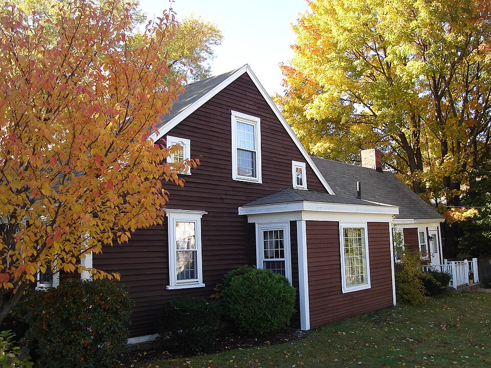
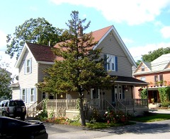
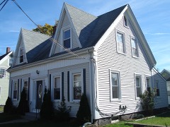
Photograph of Noah Curtis House
Photograph by Sswonk, CC BY-SA 3.0. Via Wikimedia Commons.

Curtis, Noah, House

Listed on the National Register of Historic Places in 1989. A historic map-sheet match is not published yet. The record needs a coordinate-quality review before it can be joined to a sheet boundary.

From the record

“The Noah Curtis House is a historic house at 313 Franklin Street in Quincy, Massachusetts.”

Wikipedia article Noah Curtis House, CC BY-SA 4.0.

one of 249 National Register listings in Norfolk County · listed in 1989 · category: Building · one of 2 National Historic Landmarks in Norfolk County.

Sources: the Wikipedia article · the case file at the National Archives · the National Register database, National Park Service

The listing

  • What is counted as historic. The nomination lists 1 building, 1 structure as contributing to the listing.
  • Address. 313 Franklin St., Quincy, 02169
  • When was it listed? 1989-09-20
  • Category. building
  • Also known as. Quincy MRA
  • Township. Quincy city
  • Architectural style. Federal architecture
  • National Register reference number. 89001335 - the number the National Park Service assigned this property when it was listed, and the key its nomination file is catalogued under at the National Archives.

Fires near this property

333 since 2015

Regional context, not property-specific evidence. The federal wildfire occurrence database lists 333 fires within 5 miles of Curtis, Noah, House between 2015 and 2020, burning about 191 acres in total. None started naturally. None was recorded as arson. Distance is straight-line from the map coordinates, so a fire counted here may appear on a neighbouring settlement's page as well.

Reported cause Fires
Recreation and ceremony210
Smoking51
Missing data/not specified/undetermined33
Debris and open burning29
Fireworks3
Equipment and vehicle use3
Misuse of fire by a minor3
Railroad operations and maintenance1

The most recent of them, most recent first, with the day each was reported and the service that recorded it.

DateCause SizeReported by Name on the report
7 September 2015Recreation and ceremonyunder an acreMassachusetts Bureau of Forest Fire ControlWEYMOUTH
7 September 2015Recreation and ceremonyunder an acreMassachusetts Bureau of Forest Fire ControlBRAINTREE
5 September 2016Smokingunder an acreMassachusetts Bureau of Forest Fire ControlQUINCY
5 September 2015Recreation and ceremony2.0 acresMassachusetts Bureau of Forest Fire ControlWEYMOUTH
4 September 2016Smokingunder an acreMassachusetts Bureau of Forest Fire ControlHINGHAM
29 September 2015Recreation and ceremonyunder an acreMassachusetts Bureau of Forest Fire ControlBRAINTREE
29 September 2015Recreation and ceremonyunder an acreMassachusetts Bureau of Forest Fire ControlWEYMOUTH

Every fire recorded in Norfolk County

Specimens collected near this property

12 of 9,543 shown

Regional context, not property-specific evidence. Museums hold 9,543 specimens collected within 10 miles of Curtis, Noah, House between 1810 and 1975: 4,959 Plantae, 2,445 Animalia, 1,696 Fungi, 276 Chromista, 107 Protozoa, 44 Unrecorded, 16 Bacteria. 12 distinct Species records are shown. Collected by (MARSDEN, H W), A C Gibson, A Phelps Wyman and others. Each is a physical object with a catalogue number, and each entry opens the museum's record. This is what was collected and kept, not a survey of what lives here - nothing can be concluded from a species being absent.

Image SpeciesYear Collected by Where, as recorded
Specimen of Lysimachia × producta (A.Gray) FernaldLysimachia × producta (A.Gray) Fernald1900A. P. Chute
A photograph of the species Thalictrum L., not of this specimenThalictrum L.1810Boott, J.W.Near Boston.
A photograph of the species Anemone L., not of this specimenAnemone L.1815Boott, J.Andover Turnpike, 7 miles from Boston.
Ericaceae1815BoottBoston, U.S.A.
A photograph of the species Limonium vulgare, not of this specimenLimonium vulgare Mill.1815not recordedOn Cragies Road [=near Cragies Bridge], 1 1/2 miles from Boston.
A photograph of the species Mollugo verticillata, not of this specimenMollugo verticillata L.1815Boott, F.M.B.Boston.
A photograph of the species Persicaria Mill., not of this specimenPersicaria (L.) Mill.1815Boott, J.W.Craigie's Road, 2 miles from Boston.
A photograph of the species Ranunculus L., not of this specimenRanunculus L.1815not recordedThicket at South Boston.
Cistaceae1816Boott, J.W.Boston.
Dianthus armeria L.1816Boott, J.Boston.
A photograph of the species Fallopia Adans., not of this specimenFallopia Adans.1816Boott, J.W.Andover Turnpike, near Boston. N. America.
A photograph of the species Paronychia Mill., not of this specimenParonychia Mill.1816Boott, J.W.Andover Turnpike, near Boston. N. America.

All 9,543 specimens within 10 miles, at the Global Biodiversity Information Facility.

Mines and quarries near this property

10 of 13 shown

Regional context, not property-specific evidence. The federal mineral resources record lists 13 workings within 5 miles of Curtis, Noah, House: 7 producers, 6 past producers. 7 still produce. What was taken out: Sand and Gravel, Construction, Stone, Crushed/Broken, Granite. Distance is straight-line from the map coordinates, so a quarry counted here may appear on a neighbouring settlement's page as well.

Where SiteCommodity StatusRecorded
Bates Brothers Seam Face Granite CoGranitePast ProducerGranite
Marshfield Sand and GravelGranitePast ProducerGranite
Old Colony Crushed StoneGranitePast ProducerGranite
Bates Brothers Realty Trust QuarryStone, Crushed/BrokenProducer
Ernest Minelli Inc QuarryStone, Crushed/BrokenProducer
Margetts QuarryStone, Crushed/BrokenProducer
Old Colony QuarryStone, Crushed/BrokenProducer
Braintree PlantSand and Gravel, ConstructionProducer
J F Price CoSand and Gravel, ConstructionPast ProducerSedimentary
Liberty PitSand and Gravel, ConstructionProducer

Every working recorded in Norfolk County

Storms near this property

29 since 1995

Regional context, not property-specific evidence. The National Weather Service names Quincy, the town this property stands in, in 29 storm reports between 1995 and 2025: 10 thunderstorm wind, 8 flood, 5 flash flood, 3 hail. No death or injury is recorded in these reports. Each account below is quoted exactly as the forecast office filed it, from the NOAA Storm Events Database, and each date opens the federal record of that event.

WhenEvent Place namedHarm What the report says
November 2002Storm Surge/TideQuincy$15,000no account filed
August 2015LightningQuincy$10,000Lightning struck a house on Vassall Road, shattering the chimney and breaking a water pipe near the chimney.
August 2010FloodWest Quincy$8,000Several streets in the area of Quincy, Braintree, and Milton were flooded with one to two feet of water. One car was stuck in flood waters at Granite and Chickatawbut Roads in Quincy.
July 2021Thunderstorm WindQuincy$5,000In Quincy, a tree was down on a car at the intersection of Evans Street and West Squantum Street. A person was trapped and extricated, but fortunately was uninjured. Police report relayed by amateur radio.
April 2017FloodWest Quincy$5,000At 944 AM EST an amateur radio operator reported a flooded basement on Bunker Hill Lane in Quincy.
June 2016FloodQuincy$5,000A car was stuck in 3 to 4 feet of water near the intersection of Willard and Robertson Streets.
August 2016FloodWest Quincy$5,000A car was stuck in flood waters on Independence Avenue and Bennington Street.
July 2006Thunderstorm WindQuincy$5,000no account filed
August 2005Flash FloodQuincy$5,000no account filed
August 2005Thunderstorm WindQuincy$5,000no account filed
August 2001Thunderstorm WindQuincy$5,000no account filed
June 2021Thunderstorm WindQuincy$1,500In Quincy, trees were down on Holbrook Road at Newport Avenue. A tree was down on Warren Avenue.
July 2021Thunderstorm WindWest Quincy$1,000In Quincy, a tree was down at 49 Nelson Street. Also, a tree was down on Furnace Brook Parkway.
July 2017FloodWest Quincy$1,000At 511 PM EST, an amateur radio operator reported Vernon Street flooded and impassable, with cars stuck in the flooding.
July 2020Thunderstorm WindQuincy$500In Quincy, there was a report of a tree down - street unknown.
July 2025Flash FloodQuincy-In Quincy, significant flooding was occurring on the southeast Expressway.
July 2025Flash FloodQuincy-In Quincy, I-93 northbound was closed due to flooding in the Furnace Brook area.
July 2023Flash FloodQuincy-In Quincy, DPW assistance was requested for flooding on Enterprise Dr.
July 2023Flash FloodWest Quincy-In Quincy, I-93 North at exit 9 had the middle and right lanes flooded and impassable.
August 2017FloodWest Quincy-At 349 PM EST, a car was trapped in street flooding at junction of Independence Avenue and Bennington Street in Quincy.
July 2017FloodWest Quincy-At 333 PM EST, multiple cars were trapped in flood waters on Water Street in Quincy.
June 2016FloodNorth Quincy-Standish Road was impassable due to flooding near the intersection with Parke Avenue.
May 2015HailQuincy-no account filed
June 2000Thunderstorm WindQuincy-no account filed
June 2000HailQuincy-no account filed
July 2000Thunderstorm WindQuincy-no account filed
July 2000LightningQuincy-no account filed
October 1995Thunderstorm WindQuincy-no account filed

Every storm recorded in Norfolk County

Map coverage status

No historic map-sheet match is published for this property yet. That does not mean no map exists. This record needs a coordinate-quality review before it can be joined to a sheet boundary. Browse the county's mapped places while that work is pending.

From the nomination file

1,299 words on record

When this property was proposed for the National Register, someone wrote the case for it: what the building is, and why it matters. That document is a federal record in the public domain. It is reproduced in full on its own page, word for word and never summarised. The text was read off the scanned case file by machine, so the occasional stray character is the recogniser's and the 1970s typewriter's.

The whole case file for this property - 1,299 words, 10 pages, reproduced complete.

Quoted from the National Register nomination for reference 89001335, 10 pages, held by the National Archives in Record Group 79. See the catalogue record.

Listed places nearby

6 within 8 miles

Other National Register properties close enough to walk or drive between, ordered by distance from this one. Both positions come from the same geocoding pass that matched these properties to their map sheets.

Photograph PropertyDistance Listed
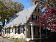
Curtis, Thomas, House0.4 miles1989
Quincy Water Company Pumping Station0.4 miles1989
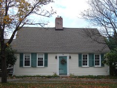
Pratt--Faxon House0.6 miles1989
Lennon, Edward J., House0.6 miles1989
Barnicoat, S. H., Monuments0.6 miles1989
Nightengale House0.7 miles1989

Sources for this property

National Archives recordThe nomination case file for reference 89001335 in Record Group 79.
Wikipedia articleCommunity-written account of this property, licensed CC BY-SA.
Norfolk CountyAll 249 listed properties in this county.

Provenance

  • Listing record. National Park Service National Register of Historic Places, listed-properties dataset, current to 2026-05-22.
  • Map join. Address geocoded through the United States Census geocoder, then tested against the published boundary of every sheet in the USGS Historical Topographic Map Collection.
  • How this page is made. Listing fields come from federal records; map-sheet coverage is a labelled coordinate-to-boundary calculation, not a source-field claim.
  • Wildfire. Short, Karen C. 2022. Spatial wildfire occurrence data for the United States, 1992-2020 [FPA_FOD_20221014]. 6th Edition. Fort Collins, CO: Forest Service Research Data Archive. https://doi.org/10.2737/RDS-2013-0009.6 Collected with United States Government funding and usable without additional permissions or fees.
  • Specimens. Global Biodiversity Information Facility (GBIF), https://www.gbif.org/. Only records licensed CC0 or CC BY are used. Records licensed CC BY-NC are excluded because this site carries advertising. Images are checked individually and any whose licence is non-commercial, no-derivatives or unreadable is refused.
  • Mines and quarries. USGS Mineral Resources Data System (MRDS) https://mrdata.usgs.gov/mrds/ A work of the United States government, no copyright under 17 U.S.C. 105.
  • Storms. NOAA National Centers for Environmental Information, Storm Events Database https://www.ncei.noaa.gov/stormevents/ A work of the United States government, no copyright under 17 U.S.C. 105. Narratives are quoted verbatim from the National Weather Service report and are not edited or summarised.