Listed on the National Register of Historic Places in
1990. A historic map-sheet match is not published yet. The record needs a coordinate-quality review before it can be joined to a sheet boundary.
From the record
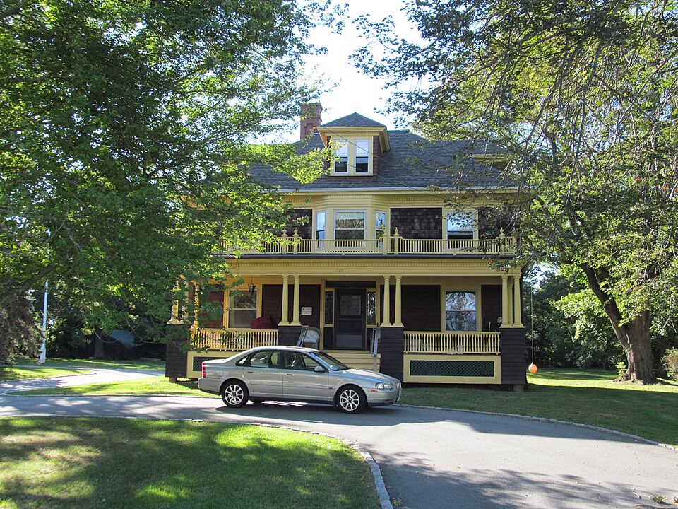
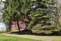
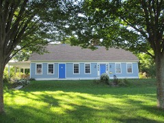
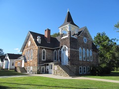
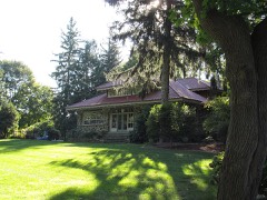
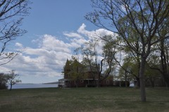
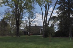
“Gardner House is a historic house at 1129 Gardner's Neck Road in Swansea, Massachusetts. The Colonial Revival house was built in 1903 for Francis Gardner, owner of a market garden farm on the site, and a local town selectman.”
Wikipedia article Francis L. Gardner House, CC BY-SA 4.0.
one of 272 National Register listings in Bristol County · listed in 1990 · category: Building · one of 8 National Historic Landmarks in Bristol County.
National Register reference number.90000077- the number the National Park Service assigned this property when it was listed, and the key its nomination file is catalogued under at the National Archives.
This town is memorable as the place where the first English blood was shed in " King Philip's War."2 On Sunday, June 20, 1675, King Philip permitted his men to march into Swansea and annoy the English by killing their cattle, in hopes to provoke them to commence the attack, for it is said that a superstition prevailed among them that the side who shed the first blood should finally be conquered. The Indians were so insolent that an Englishman finally fired upon one of them, and wounded him. The Indians upon this commenced open war. As soon as the intelligence of this massacre reached Boston, a company of foot under Capt. Henchman, and a troop under Capt. Prentice, immediately marched for Mount Hope, and being joined by another company of one hundred and ten volunteers under Capt. Moseley, they all arrived at Swansea June 28th, where they joined the Plymouth forces, under Capt. Cudworth. Mr. Miles' house, being garrisoned, was made their headquarters. About a dozen of the troop went immediately over the bridge, where they were fired upon out of the bushes, and one killed and one wounded. The English forces then pursued the enemy a mile or two, when the Indians took to the swamp, after having lost about a half-dozen of their number. The troop commenced their pursuit of the Indians next morning. They passed over
The history of this church possesses more than a local and temporary interest, as it relates to the religious and secular interests of all this region of country for a period of more than two centuries. Indeed, its history, with that of some of its pastors, connects it with some of the most important movements in the early annals of these colonies. Several of the contiguous towns, including Warren and Barrington, now in Rhode Island, and Somerset in this State, formed a part of Swansea, and the people were generally interested in the church, many of them as members, and most of them as adherents and coadjutors. Liberal measures were provided for the education of the young, and for the accommodation of all the people with the means of religious instruction and worship. Among the most active of the men thus employed was "Sir. Myles and Capt. Thomas Willett, the latter, who at a later period of life became the first English mayor of New York on its cession from the Dutch. Happy would it have been for the social, educational, and moral prosperity of the town of Swansea if the same principles could have been carried to their maturity which were so nobly acted on in the first period of its history.
Regional context, not property-specific
evidence. The
federal wildfire occurrence database
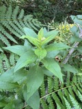
lists 27 fires within 5 miles of Gardner, Francis L., House between
2006 and 2020, burning about 34 acres in total. None started naturally. 6 were recorded as arson.
Distance is straight-line from the map coordinates, so a fire counted
here may appear on a neighbouring settlement's page as well.
Reported cause
Fires
Missing data/not specified/undetermined
9
Arson/incendiarism
6
Debris and open burning
6
Misuse of fire by a minor
4
Recreation and ceremony
1
Power generation/transmission/distribution
1
The most recent of
them, most recent first, with the day each was reported and the service
that recorded it.
Regional context, not property-specific
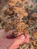
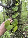
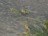
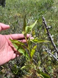
evidence. Museums hold 1,283 specimens
collected within 10 miles of Gardner, Francis L., House between 1844 and
1975: 585 Animalia, 542 Plantae, 98 Fungi, 48 Chromista, 10 Unrecorded. 12 distinct Species records are shown.
Collected by A E Schuyler, A., A. B. Hervey and others. Each is a
physical object with a catalogue
number, and each entry opens the museum's record. This is what was
collected and kept, not a survey of what lives here - nothing can be
concluded from a species being absent.
Regional context, not property-specific
evidence. The federal mineral resources record lists
1 working within 5 miles of Gardner, Francis L., House: 1 plant.
All of them still produce. What was taken out: Sand and Gravel, Construction. Distance is straight-line from the
map coordinates, so a quarry counted here may appear on a neighbouring
settlement's page as well.
Regional context, not property-specific
evidence. The National Weather Service names
Swansea, the town this property stands in, in 10 storm reports between 2002 and 2025: 3 lightning, 2 flash flood, 2 thunderstorm wind, 2 flood.
No death or injury is recorded in these reports. Each account below is quoted exactly as the forecast office
filed it, from the NOAA Storm Events Database, and each date
opens the federal record of that event.
A National Weather Service Damage Survey team concluded that an EF1 tornado moved through portions of eastern Rhode Island and southeastern Massachusetts. The tornado began as a waterspout that occurred just off of Rumstick Point in Barrington, Rhode Island. The waterspout then moved onto land over the southern portion of Warren near the Warren/Bristol line at Hanley Farm Road. It continued eastward across the Kickemuit River in the Touisset Highlands section of Warren then crossed the Cole River and continued to cause damage in the Ocean Grove section of Swansea.||Most of the damage had a rating of EF0 on the Enhanced Fujita Scale with wind speeds of 65 to 75 mph. However, there was one small section of Warren that experienced EF1 damage. Wind speeds in that area were estimated at 90 mph. ||The tornado path length was 4.2 miles and for the most part was continuous. It was very narrow with a path width of only 40 yards. The waterspout was first observed off of Barrington at 4:00PM EDT. It moved onto land in Warren at 4:05PM EDT and into Massachusetts at 4:10PM EDT.||No injuries were reported. The majority of the damage was to trees, some of which fell onto power lines and houses. There were numerous eyewitness accounts of dark funnels, swirling debris, and intense roaring. At least one garage door bowed out toward the path of the tornado.
No historic map-sheet match is published
for this property yet. That does not mean no map exists. This record needs
a coordinate-quality review before it can be joined to a sheet boundary.
Browse the county's mapped places while that work is
pending.
From the nomination file
1,165 words on record
When this property was proposed for the
National Register, someone wrote the case for it: what the building is,
and why it matters. That document is a federal record in the public domain.
It is reproduced in full on its own page, word for word and never summarised. The text was read off the scanned case file by machine, so the
occasional stray character is the recogniser's and the 1970s
typewriter's.
Quoted from the National Register nomination
for reference 90000077, 8 pages, held by the National Archives in Record
Group 79. See the
catalogue record.
Listed places nearby
6 within 8 miles
Other National Register properties close
enough to walk or drive between, ordered by distance from this one. Both
positions come from the same geocoding pass that matched these properties
to their map sheets.
Listing record. National Park Service National Register of Historic Places, listed-properties dataset, current to 2026-05-22.
Map join. Address geocoded through the United States Census geocoder, then tested against the published boundary of every sheet in the USGS Historical Topographic Map Collection.
How this page is made. Listing fields come from federal records; map-sheet coverage is a labelled coordinate-to-boundary calculation, not a source-field claim.
Wildfire. Short, Karen C. 2022. Spatial wildfire occurrence data for the United States, 1992-2020 [FPA_FOD_20221014]. 6th Edition. Fort Collins, CO: Forest Service Research Data Archive. https://doi.org/10.2737/RDS-2013-0009.6 Collected with United States Government funding and usable without additional permissions or fees.
Specimens. Global Biodiversity Information Facility (GBIF), https://www.gbif.org/. Only records licensed CC0 or CC BY are used. Records licensed CC BY-NC are excluded because this site carries advertising. Images are checked individually and any whose licence is non-commercial, no-derivatives or unreadable is refused.
Mines and quarries. USGS Mineral Resources Data System (MRDS) https://mrdata.usgs.gov/mrds/ A work of the United States government, no copyright under 17 U.S.C. 105.
Storms. NOAA National Centers for Environmental Information, Storm Events Database https://www.ncei.noaa.gov/stormevents/ A work of the United States government, no copyright under 17 U.S.C. 105. Narratives are quoted verbatim from the National Weather Service report and are not edited or summarised.
 Block
Block