 Block
From the record
10 National Register listings published here.
Sources: the National Register database, National Park Service
30 topographic sheets cover 24 settlements here, and 10 properties are on the National Register of Historic Places.
10 National Register listings published here.
Sources: the National Register database, National Park Service
Every property in this county listed on the National Register of Historic Places, with the year it was listed and the federal nomination document.
| Photograph | Property | Type | Listed | Reference |
|---|---|---|---|---|
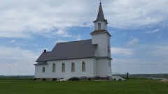 | Bradley First Lutheran Church | building | 2000 | 00001213 |
| Clark Center Lutheran Church | building | 2005 | 05001336 | |
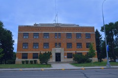 | Clark County Courthouse | building | 2002 | 02000026 |
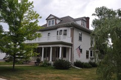 | Gov. S. H. Elrod House | building | 1979 | 79002399 |
| Garden City Opera House | building | 1988 | 88002839 | |
| Good Hope Lutheran Church | building | 2002 | 02000727 | |
| Raymond Farmers and Citizens State Bank | building | 2016 | 16000824 | |
| Security State Bank | building | 2002 | 02000577 | |
| Southeast Merton School No. 19 | building | 1990 | 89002338 | |
| Telemarken Lutheran Church | building | 1989 | 89001720 |
Every wildfire the federal occurrence database records inside this county: 89 of them, burning about 1,399 acres. 6 started naturally and 3 were recorded as arson. Each settlement page carries the fires within five miles of it.
| Reported cause | Fires |
|---|---|
| Missing data/not specified/undetermined | 27 |
| Debris and open burning | 24 |
| Equipment and vehicle use | 19 |
| Natural | 6 |
| Railroad operations and maintenance | 4 |
| Arson/incendiarism | 3 |
| Recreation and ceremony | 2 |
| Misuse of fire by a minor | 2 |
| Power generation/transmission/distribution | 1 |
| Other causes | 1 |
The five largest, by the area the report gives. None of them was recorded as arson.
| Date | Cause | Size | Reported by | Name on the report |
|---|---|---|---|---|
| 16 July 2006 | Natural | 400 acres | South Dakota Wildland Fire Suppression | not named |
| 16 July 2006 | Natural | 240 acres | South Dakota Wildland Fire Suppression | not named |
| 8 April 2003 | Missing data/not specified/undetermined | 150 acres | South Dakota Wildland Fire Suppression | SOUTH SLOUGH |
| 21 October 2000 | Equipment and vehicle use | 70 acres | Raymond Volunteer Fire Department | KENNEALLEY |
| 25 July 2016 | Equipment and vehicle use | 40 acres | South Dakota Wildland Fire Suppression | ERICKSON |
| 16 July 2006 | Natural | 30 acres | South Dakota Wildland Fire Suppression | not named |
| 14 May 2008 | Debris and open burning | 30 acres | South Dakota Wildland Fire Suppression | not named |
| 18 April 2008 | Debris and open burning | 30 acres | South Dakota Wildland Fire Suppression | not named |
Every settlement page carries the fires within five miles of it - see the settlement index below.
The NOAA Storm Events Database holds 427 reports for this county, causing 1 death, 10 injuries and about $3,777,330 in recorded property damage. Each settlement page carries the reports that name it.
| Kind of event | Reports |
|---|---|
| Hail | 233 |
| Thunderstorm Wind | 131 |
| Tornado | 36 |
| Flood | 12 |
| Flash Flood | 10 |
| Funnel Cloud | 3 |
| Heavy Rain | 1 |
| Lightning | 1 |
The most serious of them, by death, then injury, then recorded damage. The accounts are quoted exactly as the forecast office filed them.
| When | Event | Place named | Harm | What the report says |
|---|---|---|---|---|
| June 1961 | Tornado (F3) | not stated | 1 killed, 7 hurt, $250,000 | no account filed |
| July 1982 | Tornado (F1) | not stated | 2 hurt, $25,000 | no account filed |
| August 2010 | Thunderstorm Wind | Clark | 1 hurt | Seventy mph winds blew a semi off of Highway 212. The semi suffered extensive damage with the driver receiving minor injuries. |
| May 1984 | Tornado (F3) | not stated | $2,500,000 | no account filed |
| July 1977 | Tornado | not stated | $250,000 | no account filed |
| May 1960 | Tornado (F0) | not stated | $250,000 | no account filed |
| April 2023 | Flood | Crocker | $150,000 | no account filed |
| April 2019 | Flood | Crocker | $120,800 | no account filed |
| June 1994 | Hail | Willow Lake | $50,000 | Hail fell in a narrow path estimated to be 15 miles long across southern Clark County and including the Willow Lake area. Corn, wheat, and soybean crops were severely damaged. The hail broke windows on several homes, damaged siding and shingles, and damaged vehicles. |
| July 1985 | Tornado (F1) | not stated | $25,000 | no account filed |
| June 1972 | Tornado (F1) | not stated | $25,000 | no account filed |
| July 1963 | Tornado (F2) | not stated | $25,000 | no account filed |
| July 1962 | Tornado (F2) | not stated | $25,000 | no account filed |
| May 1953 | Tornado (F2) | not stated | $25,000 | no account filed |
| May 1953 | Tornado (F1) | not stated | $25,000 | no account filed |
| July 1995 | Hail | Clark SD to | $5,000 | Golf ball-size hail broke windows. The hail, combined with heavy rain and 40 mph Winds, also damaged crops, especially corn and small grain. |
| September 1995 | Hail | Garden City | $5,000 | Hail broke windows and caused undetermined crop damage. |
| July 1994 | Thunderstorm Wind | Clark | $5,000 | Thunderstorm Winds blew down several large trees. One tree in Clark fell onto a house, damaging the roof, chimney, television antenna, and a porch roof. |
| July 1994 | Thunderstorm Wind | Willow Lake | $5,000 | Thunderstorm Winds blew a large tree down onto a vehicle and small shed. |
| April 2006 | Flash Flood | Raymond | $5,000 | no account filed |
| April 1967 | Tornado (F1) | not stated | $2,500 | no account filed |
| July 2025 | Lightning | Clark | $2,000 | Lightning struck the Clark water tower, destroying the generator transfer switch and the emergency services repeater. |
| July 1995 | Thunderstorm Wind | Elrod | $2,000 | Thunderstorm Winds caused tree damage. |
| June 1992 | Tornado (F0) | not stated | $30 | no account filed |
| July 2025 | Thunderstorm Wind | Willow Lake | - | Photos of thunderstorm wind damage posted to social media include multiple trees damaged or toppled. |
| July 2025 | Flood | Raymond | - | The Clark County Emergency Manager sent photos of street flooding in the town of Raymond. |
| July 2025 | Thunderstorm Wind | Carpenter | - | The Clark County Emergency Manager sent photos of wind damage which included sheet metal torn from an elevator, and a pair of doors blown off a machine shed. |
| July 2025 | Thunderstorm Wind | Carpenter | - | The Clark County Emergency Manager reported that thunderstorm winds had damaged a cattle pod and grain bin. |
| June 2025 | Thunderstorm Wind | Raymond | - | A trained spotter estimated the wind speeds at between 60 and 70 mph. |
| June 2025 | Thunderstorm Wind | Willow Lake | - | Trained spotter reports an uprooted pine tree and four inch diameter branches broken off of multiple trees. |
| June 2025 | Thunderstorm Wind | Clark | - | A trained spotter reported a tree in their yard snapped at the base. |
| June 2025 | Thunderstorm Wind | Vienna | - | The mesonet weather station in Mayfield Colony measured a 68 mph wind gusts, which damaged a machine shed. |
| June 2025 | Thunderstorm Wind | Vienna | - | Tree branches were reported down in the city of Vienna. |
| July 2025 | Thunderstorm Wind | Willow Lake | - | On Dry Lake, winds caused a boat to capsize, and three boaters required rescue. |
| July 2024 | Flood | Bradley | - | A trained observer reported water over the gravel road north of Cottonwood Lake. |
| July 2024 | Thunderstorm Wind | Crocker | - | A trained spotter reported several tree branches were knocked down due to thunderstorm winds. |
| June 2024 | Flash Flood | Willow Lake | - | Emergency management reported water over 422nd ave and 424th ave around highway 28. |
| June 2023 | Tornado (EF0) | Clark Co Arpt | - | A landspout tornado was observed north of the Clark County airport to the northeast of Clark. |
| July 2023 | Hail | Carpenter | - | Mostly quarter size hail, with a few larger stones, covered the ground with no gravel visible on roads. The hail was three inches deep in some spots. |
| August 2023 | Tornado (EF0) | Willow Lake | - | Law enforcement and a storm chaser reported the brief touchdown of a tornado in an open field. The tornado path was later visible on hi-resolution satellite imagery. |
| August 2023 | Thunderstorm Wind | Willow Lake | - | Emergency management reported that thunderstorm winds had blown in the doors on a barn. |
| May 2022 | Tornado (EF1) | Garden City | - | The tornado touched down quickly on the southern edge of the|farm. A barn completely lost the roof and external walls on about|two thirds of the structure. Debris from the barn was spread to|the northeast. 2x4 s were pierced vertically into the ground and|sheet metal from the barn was wrapped around trees. One|2x4 pierced through the garage attached to the house. Debris|would continue to be found about a quarter mile to the northeast,|across an open field and into the neighbor's farm yard. |
| May 2022 | Tornado (EF0) | Elrod | - | A brief tornado touchdown resulted in the loss of half a barn|roof. Debris from the barn was spread to the north northwest. The|small track was evident through a shelterbelt where large tree|branches were broken and debris was left in the upper reaches of|the trees. Barn debris would continue to track into an open field|roughly 0.3 miles from the original location. Other structures on|the property were also damaged by wind and flying debris. |
| May 2022 | Thunderstorm Wind | Clark | - | Storage buildings were damaged, and hail bailers were tipped by estimated 75 mph winds. |
| June 2022 | Thunderstorm Wind | Vienna | - | Wind gusts were estimated to be 60 mph. |
| May 2022 | Tornado (EF0) | Raymond | - | An eyewitness observed a brief tornado touchdown while planting|a field 5 miles north and 2 miles east of Raymond, SD. No damage |occurred. |
| May 2022 | Thunderstorm Wind | Clark | - | One inch tree limbs were broken and shingles were blown off of a roof by estimated 75 mph wind gusts. |
| May 2022 | Thunderstorm Wind | Willow Lake | - | Both a storage garage and a shed were destroyed by estimated 75 mph wind gusts. |
| May 2021 | Thunderstorm Wind | Clark | - | Damaging winds embedded within a line of thunderstorms downed several large trees and power poles, displaced a 40 pound iron gate 40 yards, and caused minor structural damage. 500 people were without electricity after a tree took out an electric substation. |
| August 2021 | Thunderstorm Wind | Clark | - | Estimated 80 mph winds downed multiple trees and power lines. A grain bin was destroyed and a roof was torn off a building as well. |
| August 2021 | Thunderstorm Wind | Clark | - | Tree branches were downed by estimated 60 mph winds. |
| August 2021 | Thunderstorm Wind | Willow Lake | - | A tree was toppled onto a house by estimated 70 mph winds. |
| August 2021 | Thunderstorm Wind | Vienna | - | An estimated 60 mph wind was reported. |
| March 2019 | Flood | Crocker | - | Many city, county, and township roads had been flooded and closed throughout the county. |
| August 2019 | Thunderstorm Wind | Elrod | - | Sixty mph winds were estimated. |
| July 2019 | Thunderstorm Wind | Elrod | - | Sixty mph winds were estimated. |
| July 2018 | Hail | Willow Lake | - | Quarter size hail and strong winds damaged many acres of corn and beans. |
| May 2017 | Thunderstorm Wind | Willow Lake | - | Sixty mph winds were estimated. |
| June 2017 | Thunderstorm Wind | Elrod | - | Sixty-five mph winds were estimated. |
| June 2017 | Thunderstorm Wind | Clark | - | Eighty mph winds removed a shed roof along with downing several trees. |
The Survey's mineral resources record lists 1 working inside this county. It still produces. Each settlement page carries the workings within five miles of it.
| Commodity | Workings |
|---|---|
| Sand and Gravel, Construction | 1 |
The least common of them first, because a county's hundredth gravel pit says nothing its first ten did not.
| Where | Site | Commodity | Status | Recorded |
|---|---|---|---|---|
| Seefelt Pit | Sand and Gravel, Construction | Producer |
Named settlements recorded in the Geographic Names Information System, each with the topographic sheets covering it. Villages, hamlets and abandoned places alike. Each is shown with the nearest named watercourse or landform and the survey quadrangle it falls on.
Darlington township · 57225 · Carpenter NE quadrangle
8 sheets, 1953 to 1985
No longer a settlement
Woodland township · 57225 · Baileys Lake quadrangle
8 sheets, 1953 to 1985
No longer a settlement
Fordham township · 57322 · Carpenter NE quadrangle
8 sheets, 1953 to 1985
No longer a settlement
Fordham township · 57258 · Raymond SE quadrangle
8 sheets, 1953 to 1985
No longer a settlement
Rosedale township · 57322 · Carpenter SE quadrangle
8 sheets, 1953 to 1985
No longer a settlement
Washington township · 57221 · Cherry Lake quadrangle
8 sheets, 1953 to 1985
No longer a settlement
The vanished settlements of Clark County: the places named above that are no longer on the map.