 Block
From the record
5 National Register listings published here.
Sources: the National Register database, National Park Service
33 topographic sheets cover 20 settlements here, and 5 properties are on the National Register of Historic Places.
5 National Register listings published here.
Sources: the National Register database, National Park Service
Every property in this county listed on the National Register of Historic Places, with the year it was listed and the federal nomination document.
| Photograph | Property | Type | Listed | Reference |
|---|---|---|---|---|
 | Dakota Club Library | building | 2004 | 04000474 |
| Drees Brothers General Mechandise | building | 1998 | 98000445 | |
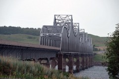 | Forest City Bridge | structure | 2001 | 01001217 |
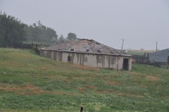 | Laurens Polygonal Hog House | building | 1995 | 95001468 |
Every wildfire the federal occurrence database records inside this county: 1,707 of them, burning about 33,998 acres. 353 started naturally and 37 were recorded as arson. Each settlement page carries the fires within five miles of it.
| Reported cause | Fires |
|---|---|
| Equipment and vehicle use | 406 |
| Natural | 353 |
| Misuse of fire by a minor | 228 |
| Fireworks | 227 |
| Missing data/not specified/undetermined | 212 |
| Debris and open burning | 92 |
| Power generation/transmission/distribution | 48 |
| Other causes | 43 |
| Arson/incendiarism | 37 |
| Smoking | 34 |
| Recreation and ceremony | 27 |
The five largest, by the area the report gives. None of them was recorded as arson.
| Date | Cause | Size | Reported by | Name on the report |
|---|---|---|---|---|
| 29 June 2002 | Fireworks | 14,224 acres | Cheyenne River Agency | LAPLANTE |
| 6 July 2006 | Missing data/not specified/undetermined | 2,093 acres | Cheyenne River Agency | FOUR BEAR |
| 6 July 2006 | Equipment and vehicle use | 907 acres | Cheyenne River Agency | CLUB HOUSE |
| 18 July 2006 | Natural | 633 acres | South Dakota Wildland Fire Suppression | not named |
| 18 July 2006 | Natural | 622 acres | Cheyenne River Agency | FUDGE II |
| 24 July 2018 | Equipment and vehicle use | 518 acres | Cheyenne River Agency | ABEAR |
| 18 October 2000 | Equipment and vehicle use | 490 acres | Cheyenne River Agency | VIRGINCRK |
| 16 July 2003 | Equipment and vehicle use | 469 acres | Cheyenne River Agency | BRONZE |
Every settlement page carries the fires within five miles of it - see the settlement index below.
The NOAA Storm Events Database holds 516 reports for this county, causing no deaths, 1 injury and about $1,018,800 in recorded property damage. Each settlement page carries the reports that name it.
| Kind of event | Reports |
|---|---|
| Hail | 263 |
| Thunderstorm Wind | 192 |
| Tornado | 27 |
| Flood | 17 |
| Flash Flood | 14 |
| Funnel Cloud | 2 |
| Lightning | 1 |
The most serious of them, by death, then injury, then recorded damage. The accounts are quoted exactly as the forecast office filed them.
| When | Event | Place named | Harm | What the report says |
|---|---|---|---|---|
| June 1964 | Tornado (F2) | not stated | 1 hurt | no account filed |
| June 2008 | Flood | Moreau | $500,000 | no account filed |
| April 2019 | Flood | Isabel | $198,800 | no account filed |
| June 2010 | Flash Flood | Bear Creek | $100,000 | Very heavy rains of 4 to 7 inches caused flash flooding in several areas along Highway 212 from west of Lantry to Eagle Butte. Several homes and businesses along with most roads in Eagle Butte were flooded with quite a bit of damage received. |
| June 2008 | Flood | Promise | $75,000 | Runoff from very heavy rains caused the Moreau River to rise above flood stage on June 5th. The river crested at 25.4 feet on June 8th before falling back below flood stage on June 10th. Flood stage on the Moreau River is 21 feet. |
| July 1994 | Tornado (F0) | Eagle | $50,000 | A brief tornado destroyed a 14 x 80 foot mobile home, damaged a propane tank, and broke windows in several houses. |
| September 1986 | Tornado (F1) | not stated | $25,000 | no account filed |
| June 1964 | Tornado (F0) | not stated | $25,000 | no account filed |
| June 1953 | Tornado (F2) | not stated | $25,000 | no account filed |
| June 2009 | Flash Flood | Parade | $10,000 | Heavy rain caused flash flooding on the Moreau River with the bridge on Route 14 being overtopped. The bridge had to be closed west of Green Grass. A basement was also flooded three miles east of Green Grass along with several roads in the area. |
| July 1994 | Thunderstorm Wind | Timber lake | $5,000 | no account filed |
| May 1977 | Tornado | not stated | $2,500 | no account filed |
| April 1955 | Tornado (F2) | not stated | $2,500 | no account filed |
| July 2025 | Hail | Promise | - | Ping-Pong ball-sized hail was reported. |
| July 2025 | Thunderstorm Wind | Glencross | - | A trained spotter estimated winds up to 60 mph caused minor crop damage. |
| July 2025 | Thunderstorm Wind | Bear Creek | - | A peak wind gust of 73 mph was recorded at the South Dakota State University mesonet station six miles north-northwest of Lantry. |
| August 2025 | Thunderstorm Wind | Lantry | - | A trained spotter reported damage to their flags by an estimated 60 mph wind gust. |
| August 2025 | Thunderstorm Wind | Eagle Butte | - | A peak measured gust of 62 mph was recorded on a personal weather station 14 miles south of Parade. |
| September 2025 | Thunderstorm Wind | Parade | - | A wind gust of 70 mph was recorded by the South Dakota State University Mesonet station 1 mile east-southeast of Parade. |
| September 2025 | Flood | Whitehorse | - | The river gauge on the Little Moreau at Promise went above flood stage on the afternoon of September 18th, topping out at 23.03 feet (2.03 feet above flood stage) during the early morning hours of September 19th. The river fell below flood stage later that afternoon. Virgin Creek, which flows into the Little Moreau just before they enter the Missouri River, was flowing across Promise Road at a depth of over one foot. |
| September 2025 | Flood | Eagle Butte | - | Tribal Officials report that the culvert on BIA Rt 8 has partly washed out. Travel through the area was difficult. |
| July 2024 | Thunderstorm Wind | Lantry | - | The public reported thunderstorm wind damage in the form of 3 inch diameter limbs broken off trees in addition to several power poles that had also snapped. |
| July 2024 | Thunderstorm Wind | Bear Creek | - | A public caller stated that thunderstorm wind gusts uprooted trees. |
| June 2024 | Thunderstorm Wind | Timber Lake Arpt | - | The Timber lake airport attendant reported no noticeable damage associated with estimated 60 mph winds. |
| August 2024 | Thunderstorm Wind | Thatcher | - | Thunderstorm winds resulted in a power outage that persisted through the early morning the next day. |
| June 2023 | Thunderstorm Wind | Ridgeview | - | The South Dakota Department of Transportation weather station a mile northeast of Ridgeview recorded a wind gust of 63 mph. |
| June 2023 | Thunderstorm Wind | Ridgeview Jewett Arp | - | A South Dakota Department of Transportation weather station recorded a wind gust of 60 mph. |
| April 2022 | Hail | Ridgeview | - | The large hail broke vehicle and house windows. |
| June 2022 | Thunderstorm Wind | Lantry | - | Nickel hail was observed in addition to the severe wind. |
| June 2022 | Thunderstorm Wind | Lantry | - | This report came from mPING, and indicated that one inch tree limbs were broken and/or shingles were blown off. |
| June 2022 | Hail | Thatcher | - | In addition to the hail, 50 to 60 mph wind gusts were estimated to have occurred. |
| July 2022 | Hail | Firesteel | - | A trained spotter estimated 70 to 80 mph winds. The wind and large hail broke skylights on the house. In addition, a fence was damaged, along with tree branches down. |
| July 2022 | Thunderstorm Wind | Isabel | - | A trained spotter reported extensive damage north of Isabel. There was damage to trees, some uprooted, and damaged siding and broken windows on a house and vehicles. In addition, a machine shed and grain bins were destroyed. Some areas had complete crop loss. |
| June 2022 | Thunderstorm Wind | Cheyenne Agency | - | Location is approximate, and time is estimated via radar. |
| June 2022 | Thunderstorm Wind | Cheyenne Agency | - | Winds were estimated at 60 mph or stronger. |
| July 2021 | Hail | Moreau | - | A storm produced hail for nearly 30 minutes with large hail to quarter size occurring at the end of the storm. |
| September 2021 | Hail | Isabel | - | Quarter to half dollar hailstones lasted a couple minutes and produced minor damage to a home. |
| July 2020 | Thunderstorm Wind | Cheyenne Agency | - | Sixty mph winds were estimated. |
| July 2020 | Thunderstorm Wind | Parade | - | Sixty mph winds were estimated. |
| August 2020 | Thunderstorm Wind | Timber Lake | - | Sixty mph winds were estimated. |
| June 2020 | Thunderstorm Wind | Lantry | - | Estimated sixty mph winds brought some tree limbs down and took some shingles off the house. |
| June 2020 | Thunderstorm Wind | Lantry | - | A wind gust of 94 mph brought down many large tree branches. |
| June 2020 | Thunderstorm Wind | Firesteel | - | Eighty mph winds were estimated by a storm chaser. |
| March 2019 | Flood | Isabel | - | Snowmelt flooding occurred along the Moreau River with several roads closed. There was also several county and BIA bridges that were closed. People in Whitehorse had to go through Timber Lake to get out. There was also a bridge near Promise that had to be closed due to water over it. There were other flooded roads in the county with reports of some cattle stranded. |
| August 2019 | Hail | Trail City | - | A severe thunderstorm with large hail and destructive winds left southeast Corson and continued southeast across eastern Dewey county destroying crop and grassland in its path. The storm then entered western Potter county. |
| July 2019 | Thunderstorm Wind | Firesteel | - | A few tree limbs were downed by estimated sixty mph winds. |
| July 2018 | Thunderstorm Wind | Timber Lake | - | Sixty mph winds were estimated. |
| July 2018 | Thunderstorm Wind | La Plant | - | Estimated seventy mph winds downed many large tree branches. |
| June 2018 | Hail | Isabel | - | Hail covered the ground up to 2 inches in spots. |
| June 2018 | Thunderstorm Wind | Eagle Butte | - | Estimated eighty mph winds tipped a mobile home over. |
| June 2018 | Thunderstorm Wind | Moreau | - | An estimated sixty mph wind blew down an old leaning house. |
| June 2018 | Thunderstorm Wind | Parade | - | Sixty mph winds were estimated. |
| June 2018 | Thunderstorm Wind | Eagle Butte | - | Sixty mph winds were estimated. |
| July 2018 | Thunderstorm Wind | Eagle Butte | - | Estimated ninety mph winds destroyed an empty trailer along with tipping another one over. A delivery truck was also tipped over and a mobile home was destroyed. A couple buildings had parts of their roofs blown off with many trees damaged or uprooted. Some power lines were also downed. |
| June 2018 | Hail | Thatcher | - | Large hail and damaging winds destroyed many acres of crops and pastureland as a severe thunderstorm moved southeast out of Dewey into northwest Sully county. |
| August 2017 | Flash Flood | Trail City | - | Two to three inches of heavy rain caused flash flooding of several parts of a road east of Trail City. |
| July 2017 | Thunderstorm Wind | Isabel | - | Estimated seventy mph winds brought down several large branches. |
| July 2017 | Thunderstorm Wind | Thatcher | - | Seventy mph winds were estimated. |
| May 2016 | Thunderstorm Wind | Ridgeview | - | Sixty mph winds were estimated. |
| August 2016 | Thunderstorm Wind | Firesteel | - | Sixty mph winds were estimated. |
The Survey's mineral resources record lists 8 workings inside this county. 3 still produce and 5 are closed or unrecorded. Each settlement page carries the workings within five miles of it.
| Commodity | Workings |
|---|---|
| Sand and Gravel, Construction | 8 |
The least common of them first, because a county's hundredth gravel pit says nothing its first ten did not.
| Where | Site | Commodity | Status | Recorded |
|---|---|---|---|---|
| Bear Creek Pit | Sand and Gravel, Construction | Producer | ||
| Cheyenne Sioux Tribe Pit | Sand and Gravel, Construction | Past Producer | ||
| Gravel Pit | Sand and Gravel, Construction | Past Producer | ||
| Highway Gravel Pit | Sand and Gravel, Construction | Past Producer | ||
| John Beer Pit | Sand and Gravel, Construction | Producer | ||
| Lamb Pit | Sand and Gravel, Construction | Producer | ||
| Munson Coal Pit | Sand and Gravel, Construction | Past Producer | ||
| Swede Marshall Pit | Sand and Gravel, Construction | Past Producer |
Named settlements recorded in the Geographic Names Information System, each with the topographic sheets covering it. Villages, hamlets and abandoned places alike. Each is shown with the nearest named watercourse or landform and the survey quadrangle it falls on.
North Dewey unorganized territory · 57636 · On Elm Creek · Lantry quadrangle
7 sheets, 1953 to 1986
North Dewey unorganized territory · 57625 · On Green Grass Creek · Parade NW quadrangle
8 sheets, 1952 to 1986
South Dewey unorganized territory · 57442 · Patch Skin Buttes SW quadrangle
7 sheets, 1953 to 1985
South Dewey unorganized territory · 57601 · On Moreau River · Moreau quadrangle
7 sheets, 1953 to 1985
North Dewey unorganized territory · 57625 · Parade SW quadrangle
7 sheets, 1953 to 1986
South Dewey unorganized territory · 57601 · On Virgin Creek · Promise quadrangle
8 sheets, 1951 to 1985
North Dewey unorganized territory · 57656 · Timber Lake quadrangle
8 sheets, 1953 to 1986
South Dewey unorganized territory · 57661 · On Little Moreau River · White Horse quadrangle
8 sheets, 1952 to 1985
South Dewey unorganized territory · 57652 · On Jewett Creek · Glencross SE quadrangle
8 sheets, 1952 to 1985