 Block
From the record
13 National Register listings published here.
Sources: the National Register database, National Park Service
25 topographic sheets cover 10 settlements here, and 13 properties are on the National Register of Historic Places.
13 National Register listings published here.
Sources: the National Register database, National Park Service
Every property in this county listed on the National Register of Historic Places, with the year it was listed and the federal nomination document.
| Photograph | Property | Type | Listed | Reference |
|---|---|---|---|---|
| Thomas Ashcroft Ranch | building | 1987 | 87000547 | |
| Blake Ranch House | building | 1987 | 87000534 | |
| Emmanuel Lutheran Church and Cemetery | building | 1987 | 87000531 | |
| Fowler Hotel | building | 2008 | 08000886 | |
| Giannonatti Ranch | building | 1987 | 87000546 | |
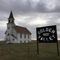 | Golden Valley Norwegian Lutheran Church | building | 1987 | 87000548 |
| Axel Johnson Ranch | building | 1987 | 87000541 | |
| Little Missouri Bank Building | building | 1987 | 87000536 | |
| John and Daisy May Livingston Ranch | building | 1987 | 87000542 | |
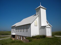 | Peace Valley Evangelical Church and Cemetery | building | 1987 | 87000550 |
| L. W. Shevling Ranch | building | 1987 | 87000537 | |
| Oliver O. Stokes House | building | 1987 | 87000532 | |
| Vessey School | building | 1987 | 87000553 |
Every wildfire the federal occurrence database records inside this county: 410 of them, burning about 64,094 acres. 264 started naturally and 3 were recorded as arson. Each settlement page carries the fires within five miles of it.
| Reported cause | Fires |
|---|---|
| Natural | 264 |
| Equipment and vehicle use | 55 |
| Missing data/not specified/undetermined | 55 |
| Power generation/transmission/distribution | 9 |
| Debris and open burning | 9 |
| Other causes | 5 |
| Recreation and ceremony | 5 |
| Arson/incendiarism | 3 |
| Fireworks | 2 |
| Misuse of fire by a minor | 1 |
| Railroad operations and maintenance | 1 |
| Smoking | 1 |
The five largest, by the area the report gives. None of them was recorded as arson.
| Date | Cause | Size | Reported by | Name on the report |
|---|---|---|---|---|
| 28 March 2015 | Natural | 13,950 acres | Montana/Dakotas State Office | SHEEP DRAW |
| 31 October 1999 | Equipment and vehicle use | 5,900 acres | Ludlow Volunteer Fire Department | JOE TILL |
| 17 September 2000 | Natural | 5,000 acres | Camp Crook Volunteer Fire Department | PRICE FIRE |
| 1 April 2015 | Power generation/transmission/distribution | 2,829 acres | Custer Gallatin National Forest | MOONSHINE |
| 16 July 2002 | Power generation/transmission/distribution | 2,500 acres | Sorum/Reva Volunteer Fire Department | PAINTER |
| 16 July 2002 | Power generation/transmission/distribution | 2,400 acres | Buffalo Volunteer Fire Department | TRAVERS |
| 27 August 2003 | Natural | 2,339 acres | Miles City Field Office | MEAT HOOK |
| 6 November 1999 | Equipment and vehicle use | 1,600 acres | Camp Crook Volunteer Fire Department | DOUG DAHL |
Every settlement page carries the fires within five miles of it - see the settlement index below.
The NOAA Storm Events Database holds 749 reports for this county, causing no deaths, no injuries and about $1,334,750 in recorded property damage. Each settlement page carries the reports that name it.
| Kind of event | Reports |
|---|---|
| Hail | 357 |
| Thunderstorm Wind | 346 |
| Tornado | 22 |
| Flood | 14 |
| Flash Flood | 5 |
| Wildfire | 4 |
| Heavy Rain | 1 |
The most serious of them, by death, then injury, then recorded damage. The accounts are quoted exactly as the forecast office filed them.
| When | Event | Place named | Harm | What the report says |
|---|---|---|---|---|
| May 2011 | Flood | Ladner | $300,000 | Record flooding occurred on the Little Missouri River from the Montana state line southwest of Camp Crook to the North Dakota state line. Homes and rural roads along the river were inundated. The river gage crested at a record stage of 19.27 feet, which is 7.27 feet over flood stage, exceeding the stage of 17.67 feet set in 2009. The highest flow was 19,400 cubic feet per second. |
| July 2015 | Thunderstorm Wind | Buffalo | $200,000 | The combination of large hail and strong wind gusts caused property damage in Buffalo. |
| May 2019 | Flood | Ladner | $100,000 | Runoff from heavy rain caused minor flooding throughout Harding County. Minor flooding was reported along the upper portions of the Grand River; Little Missouri River; and around Buffalo, Reva, and Ladner. The Little Missouri River crested a little over two feet above flood stage at the SD Highway 20 bridge on May 23, with a peak flow just over 5000 cfs. |
| June 2014 | Flood | Reva | $100,000 | Three to five inches of rain caused significant flooding along Alkali Creek, Rabbit Creek, and the South Fork of the Moreau River and their tributaries. Several roads were flooded, including Jefferson Road southeast of Reva, Harding Road, and Camp Crook Road. |
| September 2013 | Flash Flood | Ludlow | $100,000 | Three to five inches of rain was reported over northeastern Harding County. Runoff from the heavy rain inundated many roads, driveways, and fields in the area. |
| June 2008 | Flood | Ralph | $100,000 | The Little Missouri River at Camp Crook crested at 14.04 feet, about 2 feet above flood stage. Minor flooding was reported around Camp Crook, Redig, and along the north fork of the Moreau River. Highway 79 was closed from Reva, south to the Butte County line. |
| July 1994 | Hail | not stated | $50,000 | Widespread hail accumulated on roads, broke windows in several homes, and damaged some vehicles. |
| July 2012 | Hail | Camp Crook | $50,000 | no account filed |
| July 2012 | Hail | Buffalo | $25,000 | Hail covered U.S. Highway 85; the ground was completely white from hail. |
| July 1969 | Tornado (F4) | not stated | $25,000 | no account filed |
| May 2013 | Hail | Ladner | $20,000 | Several lambs were killed by golf ball size hail. |
| September 2013 | Thunderstorm Wind | Ralph | $20,000 | The combination of hail and wind broke windows, destroyed a Quonset hut, and blew several 1700 pound hay bales off a stack. |
| June 2011 | Tornado (EF0) | Redig | $20,000 | A small tornado destroyed part of a barn, rolled large steel calf shelters, blew down steel stockade walls, and lifted a calf shelter over a nine foot fence. |
| July 2011 | Hail | Buffalo | $20,000 | Large hail damaged home, automobiles, and roof of an outbuilding. |
| August 2009 | Thunderstorm Wind | (2wx)Buffalo | $20,000 | no account filed |
| June 1999 | Tornado (F1) | Ladner | $15,000 | Tornado moved across a ranch. 15 sheep were killed when they were picked up and thrown through a barbed wire fence into a pond. Cattle stockades were destroyed and a grain bin anchored in concrete was picked up and thrown several yards. Storm path and width were provided by a local pilot who flew over the area the following morning. |
| March 2014 | Flood | Ladner | $10,000 | Minor flooding occurred along the Little Missouri River due to ice jams. The river gauge at Camp Crook crested at 16.2 feet, or 4.2 feet above flood stage. Outbuildings and agricultural land in the area were flooded. |
| September 2013 | Thunderstorm Wind | Ralph | $10,000 | Strong winds blew 500 gallon tanks off their stands, destroyed a Quonset hut, and moved a mobile home off its foundation. |
| July 2011 | Hail | Camp Crook | $10,000 | Softball sized hail fell. |
| July 2003 | Hail | Redig | $10,000 | Large hail damaged the roof of a house. |
| July 2011 | Hail | Buffalo | $10,000 | no account filed |
| July 2011 | Hail | Camp Crook | $10,000 | no account filed |
| June 2008 | Thunderstorm Wind | Ladner | $10,000 | no account filed |
| May 1996 | Hail | Harding | $7,500 | no account filed |
| August 2014 | Thunderstorm Wind | Camp Crook | $5,000 | Wind-driven hail broke all the windows of a house. |
| September 2013 | Hail | Ralph | $5,000 | The combination of large hail and gusty winds broke windows and skylights in a home and destroyed a garden. |
| July 2012 | Thunderstorm Wind | Camp Crook | $5,000 | The combination of hail and wind caused minor property damage. |
| July 2012 | Thunderstorm Wind | Buffalo | $5,000 | The combination of hail and wind caused minor damage. |
| July 2011 | Thunderstorm Wind | Reva | $5,000 | Strong wind gusts blew hail through windows in a house and school building. |
| July 2011 | Tornado (EF1) | Reva | $5,000 | A tornado touched down west of the Slim Buttes in eastern Harding County and tracked eastward, dissapating prior to reaching SD Highway 79. Trees and a semi-trailer were blown over at a ranch west of the Slim Buttes. A rancher reported trees snapped along Jones Creek east of the Slim Buttes. |
| July 2005 | Thunderstorm Wind | Buffalo | $5,000 | Windows were blown out of a house and numerous trees were downed. |
| July 1994 | Thunderstorm Wind | Buffalo | $5,000 | Widespread hail accumulated on roads, broke windows in several homes, and damaged some vehicles. |
| August 2014 | Hail | Redig | $5,000 | no account filed |
| May 2013 | Hail | Ludlow | $5,000 | no account filed |
| September 2013 | Hail | Ralph | $5,000 | no account filed |
| July 2011 | Hail | Ludlow | $5,000 | no account filed |
| September 2010 | Hail | Redig | $5,000 | no account filed |
| May 1996 | Hail | Harding | $5,000 | no account filed |
| June 1999 | Thunderstorm Wind | Buffalo | $4,000 | Power company reported 4 power poles blown over. |
| June 2001 | Thunderstorm Wind | Redig | $3,000 | A workshop collapsed during a thunderstorm. |
| June 1957 | Tornado (F1) | not stated | $2,500 | no account filed |
| July 2014 | Thunderstorm Wind | Redig | $2,000 | Wind tore part of the roof off a trailer house. |
| June 2013 | Thunderstorm Wind | Redig | $2,000 | The combination of hail and wind caused minor damage. |
| May 1998 | Hail | Redig | $2,000 | Hail broke several windows. |
| July 2001 | Thunderstorm Wind | Ladner | $2,000 | no account filed |
| June 2015 | Thunderstorm Wind | Reva | $1,000 | Wind-driven hail broke windows. |
| August 2010 | Thunderstorm Wind | Camp Crook | $1,000 | Strong wind gusts damaged a fence and blew down many tree branches. |
| July 2003 | Hail | Ladner | $1,000 | no account filed |
| May 1996 | Thunderstorm Wind | Harding | $1,000 | no account filed |
| June 1994 | Hail | Camp Crook | $500 | Minor window damage. |
| August 1962 | Tornado (F1) | not stated | $250 | no account filed |
| June 2025 | Hail | Ladner | - | Public confirmed hail size. |
| June 2025 | Thunderstorm Wind | (2wx)Buffalo | - | ASOS recorded wind gust. |
| June 2025 | Thunderstorm Wind | Ladner | - | SD mesonet recorded wind gust. |
| June 2025 | Thunderstorm Wind | Ladner | - | SD mesonet recorded wind gust. |
| June 2025 | Thunderstorm Wind | Ludlow | - | SD mesonet recorded wind gust. |
| June 2025 | Thunderstorm Wind | Ludlow | - | SD mesonet recorded wind gust. |
| June 2025 | Thunderstorm Wind | Ladner | - | SD mesonet recorded wind gust. |
| June 2025 | Thunderstorm Wind | Ralph | - | SD mesonet recorded wind gust. |
| June 2025 | Thunderstorm Wind | Ralph | - | SD mesonet recorded wind gust. |
The Survey's mineral resources record lists 106 workings inside this county. 16 still produce and 90 are closed or unrecorded. Each settlement page carries the workings within five miles of it.
| Commodity | Workings |
|---|---|
| Uranium | 85 |
| Lignite | 17 |
| Sand and Gravel, Construction | 11 |
| Uranium, Lignite | 4 |
| Stone, Crushed/Broken | 2 |
| Petroleum (Oil), Natural Gas, Uranium, Bloating Material, Stone, Crushed/Broken | 1 |
| Sand and Gravel, Construction, Lignite | 1 |
| Petroleum (Oil), Stone, Crushed/Broken, Natural Gas, Bloating Material, Uranium | 1 |
| Petroleum (Oil), Lignite | 1 |
| Bloating Material, Stone, Crushed/Broken, Uranium, Sand and Gravel, Construction | 1 |
| Natural Gas, Petroleum (Oil), Stone, Crushed/Broken, Uranium | 1 |
| Natural Gas, Sand and Gravel, Construction, Petroleum (Oil) | 1 |
The least common of them first, because a county's hundredth gravel pit says nothing its first ten did not.
| Where | Site | Commodity | Status | Recorded |
|---|---|---|---|---|
| Buffalo Quad | Lignite, Petroleum (Oil), Natural Gas, Uranium, Bloating Material, Stone, Crushed/Broken | Past Producer | Carnotite, Clay, Lignite | |
| Ladner Quad | Petroleum (Oil), Lignite, Bloating Material, Stone, Crushed/Broken, Uranium, Sand and Gravel, Construction | Past Producer | 1910 | |
| Ludlow Quad | Lignite, Natural Gas, Petroleum (Oil), Stone, Crushed/Broken, Uranium | Past Producer | ||
| Ralph Quad | Lignite, Natural Gas, Sand and Gravel, Construction, Petroleum (Oil) | Occurrence | ||
| Willett & Midland No. 1 Quads | Sand and Gravel, Construction, Lignite, Petroleum (Oil), Stone, Crushed/Broken, Natural Gas, Bloating Material, Uranium | Past Producer | ||
| Reva Quad - Deposit 7 | Stone, Crushed/Broken | Producer | ||
| Thyboe Prospect | Uranium, Stone, Crushed/Broken | Past Producer | ||
| Lonesome Pete Mine | Uranium, Lignite | Occurrence | Coal | |
| Pickpocket Mine | Uranium, Lignite | Past Producer | Coal | |
| Relf Mine | Uranium, Lignite | Past Producer | Coal | |
| Unnamed Mine | Uranium, Lignite | Past Producer | Coal | |
| Craig Pass Gravel Deposit | Sand and Gravel, Construction | Producer | ||
| Davis Pit | Sand and Gravel, Construction | Producer | ||
| Forest Service Pit | Sand and Gravel, Construction | Producer | ||
| Gravel Pit | Sand and Gravel, Construction | Past Producer | ||
| Gravel Pit | Sand and Gravel, Construction | Past Producer | ||
| Gravel Pit | Sand and Gravel, Construction | Past Producer | ||
| Mackey Pit | Sand and Gravel, Construction | Producer | ||
| Raymond Pit | Sand and Gravel, Construction | Producer | ||
| Sdg - Mouth of Bull Creek Quad - Deposit 2 | Sand and Gravel, Construction | Occurrence | TERRACE | |
| Sdg - Mouth of Bull Creek Quad - Deposit 33 | Sand and Gravel, Construction | Producer | TERRACE | |
| Sdg - Mouth of Bull Creek Quad - Deposit 49 | Sand and Gravel, Construction | Producer | TERRACE | |
| Hawk Eye No. 1 | Uranium, Lignite | Past Producer | ||
| Last Chance Group | Uranium, Lignite | Past Producer | ||
| Lonesome Pete Mine | Uranium, Lignite | Past Producer | ||
| National Park 1-16 Claims | Uranium, Lignite | Occurrence | ||
| Riley 1 & 3 Claims | Uranium, Lignite | Past Producer | ||
| Riley Group | Uranium, Lignite | Past Producer | ||
| Unnamed Mine | Uranium, Lignite | Producer | Coal | |
| Unnamed Mine | Uranium, Lignite | Producer | Coal | |
| Unnamed Mine | Uranium, Lignite | Producer | Coal | |
| Unnamed Mine | Uranium, Lignite | Producer | Lignite | |
| Unnamed Mine | Uranium, Lignite | Producer | Coal | |
| Unnamed Mine | Uranium, Lignite | Producer | Coal | |
| Unnamed Mine | Uranium, Lignite | Producer | Coal | |
| Unnamed Mine | Uranium, Lignite | Producer | Coal | |
| Billy Dale | Uranium | Past Producer | ||
| Blue Jay Claims | Uranium | Prospect | ||
| Bob Cat Claims | Uranium | Prospect | ||
| Bone Group | Uranium | Past Producer | ||
| Boot Creek Claims | Uranium | Prospect | ||
| Buddy Claims | Uranium | Prospect | ||
| Calamity Jane Group | Uranium | Prospect | ||
| Canyon Group | Uranium | Prospect | ||
| Cap Claims | Uranium | Prospect | ||
| Carbonate | Uranium | Past Producer | ||
| Cattail Claims | Uranium | Prospect | ||
| Cedar Butte Claims | Uranium | Prospect | ||
| Cedar Canyon | Uranium | Occurrence | 1953 | |
| Cedar Canyon - Sple. No. 1 | Uranium | Occurrence | Carnotite | |
| Cedar Canyon - Sple. No. 2 | Uranium | Occurrence | Carnotite | |
| Cedar Canyon - Sple. No. 3 | Uranium | Occurrence | Carnotite | |
| Cedar Canyon - Sple. No. 4 | Uranium | Occurrence | Carnotite | |
| Cedar Canyon - Sple. No. 5 | Uranium | Occurrence | Carnotite | |
| Cedar Canyon - Sple. No. 6 | Uranium | Occurrence | Carnotite | |
| Cedar Canyon - Sple. No. 7 | Uranium | Occurrence | Carnotite | |
| Cedar Canyon - Sple. No. 8 | Uranium | Occurrence | ||
| Cedar Canyon - Sple. No. 9 | Uranium | Occurrence | ||
| Cedar Canyon - Thybo Spring | Uranium | Occurrence | ||
| Cedar Canyon - Thybo Well | Uranium | Occurrence | ||
| Crazy Claims | Uranium | Past Producer | ||
| Cub Lode | Uranium | Prospect | ||
| D-2 Claims | Uranium | Prospect | ||
| Daisey Mae No.6 | Uranium | Prospect | ||
| Daisy Mae No.5 | Uranium | Prospect | ||
| Darky Claims | Uranium | Prospect | ||
| Divide Claims | Uranium | Prospect | ||
| Dot No.1 | Uranium | Prospect | ||
| Eleanor Claims | Uranium | Prospect | ||
| Falcon Group | Uranium | Prospect | ||
| Finger Buttes Group | Uranium | Prospect | ||
| Flat Top Butte | Uranium | Prospect | ||
| Flat Top Group | Uranium | Past Producer | ||
| Hilltop | Uranium | Past Producer | ||
| Hinds Claims | Uranium | Prospect | ||
| Hoop and Holler | Uranium | Prospect | ||
| Jack Claims | Uranium | Prospect | ||
| Jayhawk Group | Uranium | Prospect | ||
| Jeffry Lynn No.1 | Uranium | Prospect | ||
| Jim Claims | Uranium | Past Producer | ||
| Jones Claims | Uranium | Prospect | ||
| Jones Creek Claims | Uranium | Prospect | ||
| L and L Claims | Uranium | Prospect | ||
| Lars Group | Uranium | Prospect | ||
| Last Chance | Uranium | Past Producer | ||
| Lindahl | Uranium | Past Producer | ||
| Lucky Strike Claims | Uranium | Prospect | ||
| Marie Claim | Uranium | Prospect | ||
| Mccurdy Lease | Uranium | Prospect | ||
| Mink Group | Uranium | Past Producer | ||
| Moonshine | Uranium | Past Producer | ||
| Quad Claims | Uranium | Prospect | ||
| Rattlesnake Group | Uranium | Prospect | ||
| Red No.1 | Uranium | Prospect | ||
| Riley Spring Mine | Uranium | Past Producer | ||
| Ruth Lode | Uranium | Prospect | ||
| Ruth Marie | Uranium | Prospect | ||
| Snake Eye | Uranium | Past Producer | ||
| State Lease | Uranium | Prospect | ||
| Susan, Becky | Uranium | Past Producer | ||
| Table Mountain Claims | Uranium | Prospect | ||
| Trio Lode | Uranium | Past Producer | ||
| Twin No.2 | Uranium | Prospect | ||
| Tyboe Property | Uranium | Prospect | ||
| Wildcat Claims | Uranium | Prospect | ||
| Windy Claims | Uranium | Prospect |
Named settlements recorded in the Geographic Names Information System, each with the topographic sheets covering it. Villages, hamlets and abandoned places alike. Each is shown with the nearest named watercourse or landform and the survey quadrangle it falls on.
North Harding unorganized territory · 57720 · On Rush Creek · Buffalo quadrangle
6 sheets, 1935 to 1980
Camp Crook town · 57724 · Near Hoag Coal Mine Draw · Camp Crook quadrangle
8 sheets, 1935 to 2005
South Harding unorganized territory · 57720 · Near Gilbert Draw · Harding quadrangle
7 sheets, 1935 to 1993
North Harding unorganized territory · 57720 · Near Table Mountain · Table Mountain quadrangle
6 sheets, 1935 to 1980
North Harding unorganized territory · 57755 · Near Flint Butte · Ludlow quadrangle
8 sheets, 1935 to 2005
South Harding unorganized territory · 57720 · On South Sand Creek · Redig quadrangle
6 sheets, 1935 to 1980