Block
From the record
36 National Register listings published here.
Sources: the National Register database, National Park Service
34 topographic sheets cover 9 settlements here, and 36 properties are on the National Register of Historic Places.
36 National Register listings published here.
Sources: the National Register database, National Park Service
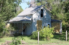
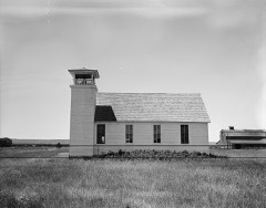
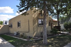
Every property in this county listed on the National Register of Historic Places, with the year it was listed and the federal nomination document.
Every wildfire the federal occurrence database records inside this county: 146 of them, burning about 6,796 acres. 16 started naturally and 1 was recorded as arson. Each settlement page carries the fires within five miles of it.
| Reported cause | Fires |
|---|---|
| Missing data/not specified/undetermined | 52 |
| Equipment and vehicle use | 30 |
| Debris and open burning | 27 |
| Natural | 16 |
| Misuse of fire by a minor | 8 |
| Fireworks | 6 |
| Railroad operations and maintenance | 3 |
| Power generation/transmission/distribution | 2 |
| Arson/incendiarism | 1 |
| Smoking | 1 |
The five largest, by the area the report gives. None of them was recorded as arson.
| Date | Cause | Size | Reported by | Name on the report |
|---|---|---|---|---|
| 7 July 2016 | Natural | 750 acres | South Dakota Wildland Fire Suppression | MEDICEN KNOLL |
| 19 February 2000 | Missing data/not specified/undetermined | 700 acres | Kennebec Volunteer Fire Department | MEDICINE CREEK |
| 18 June 2006 | Equipment and vehicle use | 650 acres | South Dakota Wildland Fire Suppression | not named |
| 15 September 2012 | Missing data/not specified/undetermined | 600 acres | South Dakota Wildland Fire Suppression | GRASS FIRE |
| 17 June 2006 | Missing data/not specified/undetermined | 500 acres | South Dakota Wildland Fire Suppression | not named |
| 11 October 2015 | Equipment and vehicle use | 460 acres | South Dakota Wildland Fire Suppression | SUNFLOWER FIELD CA |
| 26 August 2018 | Railroad operations and maintenance | 365 acres | South Dakota Wildland Fire Suppression | CANNING CA |
| 31 July 2006 | Equipment and vehicle use | 300 acres | South Dakota Wildland Fire Suppression | not named |
Every settlement page carries the fires within five miles of it - see the settlement index below.
The NOAA Storm Events Database holds 512 reports for this county, causing no deaths, 10 injuries and about $3,066,130 in recorded property damage. Each settlement page carries the reports that name it.
| Kind of event | Reports |
|---|---|
| Thunderstorm Wind | 256 |
| Hail | 210 |
| Flood | 18 |
| Flash Flood | 13 |
| Tornado | 12 |
| Lightning | 2 |
| Funnel Cloud | 1 |
The most serious of them, by death, then injury, then recorded damage. The accounts are quoted exactly as the forecast office filed them.
| When | Event | Place named | Harm | What the report says |
|---|---|---|---|---|
| July 1973 | Tornado (F3) | not stated | 10 hurt, $2,500,000 | no account filed |
| April 2019 | Flood | Pierre | $184,600 | no account filed |
| September 1999 | Flash Flood | Blunt | $175,000 | no account filed |
| June 2008 | Flash Flood | Pierre | $75,000 | Very heavy rain of over 3 inches caused flash flooding in many parts of Pierre into the early morning hours. Many roads were under 1 to 2 feet of water. Several homes in southeast Pierre received sewer backup. Also several homes on Grey Goose road received flood damage. |
| June 2008 | Lightning | Pierre | $50,000 | no account filed |
| June 2008 | Flash Flood | Pierre | $25,000 | Very heavy rains of 2 to 4 inches caused flash flooding throughout much of Hughes county. Many roads and crops were damaged by the high water. |
| June 1992 | Tornado (F2) | not stated | $25,000 | no account filed |
| July 1970 | Tornado (F0) | not stated | $25,000 | no account filed |
| August 2009 | Flash Flood | Blunt | $5,000 | Several county and township roads between Blunt and Harrold were overrun with water flowing out of nearby fields. |
| June 1995 | Thunderstorm Wind | Pierre | $1,000 | Large tree branches snapped and a temporary green house was blown away. |
| June 1994 | Thunderstorm Wind | Blunt | $500 | Strong winds damaged a large sign. |
| July 1982 | Tornado (F0) | not stated | $30 | no account filed |
| July 2025 | Thunderstorm Wind | (Pir)Pierre Arpt | - | A collapsing thunderstorm produced a measured wind gust of 82 mph at the Pierre Regional Airport Automated Surface Observing System (ASOS). The winds resulted in tree and vehicle damage on the east side of Pierre. |
| August 2025 | Thunderstorm Wind | Rousseau | - | A caller stated that thunderstorm winds, estimated at about 60 mph, ripped most of the leaves from their trees. |
| August 2025 | Thunderstorm Wind | (Pir)Pierre Arpt | - | A peak wind gust of 71 mph was measured. |
| June 2024 | Thunderstorm Wind | Pierre | - | Emergency management reports broken tree branches and power knocked out. |
| June 2023 | Thunderstorm Wind | (Pir)Pierre Arpt | - | The Automated Surface Observation Station at the Pierre Municipal Airport measured a wind gust of 67 mph. |
| June 2023 | Thunderstorm Wind | Blunt | - | A South Dakota Department of Transportation weather station recorded a wind gust of 64 mph. |
| June 2023 | Thunderstorm Wind | De Grey | - | A personal weather station recorded a wind gust of 59 mph. |
| July 2023 | Hail | Pierre | - | A photo of an estimated 4.5 inch hailstone was submitted on Facebook. |
| July 2023 | Hail | Pierre | - | A photo of an estimated 3 inch hailstone was submitted on Facebook. |
| June 2022 | Thunderstorm Wind | De Grey | - | The roof was blown off of a trailer home, as reported on social media. |
| August 2022 | Thunderstorm Wind | Blunt | - | Trained spotter estimated wind speeds of 60 mph. |
| July 2022 | Thunderstorm Wind | Pierre | - | The public report was from social media with a photo of an uprooted tree. |
| June 2020 | Thunderstorm Wind | (Pir)Pierre Arpt | - | Sixty mph winds were estimated. |
| June 2020 | Thunderstorm Wind | Canning | - | Severe winds took part of the roof off a barn which killed two calves. The overhead door on another building was blown in. |
| June 2020 | Thunderstorm Wind | De Grey | - | Seventy mph winds downed an electrical pole along with breaking off several large tree limbs. |
| March 2019 | Flood | Pierre | - | In late March, a berm was constructed around the east side of Blunt to control snowmelt flooding on the Medicine Creek and divert the water to an open field away from homes and businesses. Part of the creek backed up into town. A small part of U.S. Highway 83 flooded on March 28th along with other county roads. |
| May 2019 | Flood | Pierre | - | A quick intense rainfall of over an inch led to flooded streets in Pierre with some vehicles becoming stuck. |
| August 2019 | Hail | Blunt | - | Golf ball to baseball size hail fell in an around Blunt with many windows broken along with siding damaged. |
| August 2019 | Hail | De Grey | - | A storm chaser reported hail stones of 3 inches or larger. |
| August 2019 | Flood | Blunt | - | Very heavy rain caused flooding over Highway 14 near Blunt. The water depth was 1 to 2 feet in spots disrupting traffic for several hours. |
| August 2019 | Thunderstorm Wind | Pierre | - | Sixty mph winds were estimated. |
| August 2019 | Thunderstorm Wind | De Grey | - | Sixty mph winds were estimated. |
| August 2019 | Thunderstorm Wind | Blunt | - | Estimated sixty-five mph winds occurred with baseball size hail with windows and siding damaged. |
| August 2019 | Thunderstorm Wind | Blunt | - | Seventy-eight mph winds were measured along with tennis ball size hail. |
| June 2018 | Hail | (Pir)Pierre Arpt | - | A severe thunderstorm with large hail and damaging winds came out of Sully county and tracked southeast across Hughes county destroying thousands of acres of crop and pastureland along its path. Some property damage also resulted from the severe winds and large hail. |
| June 2018 | Flash Flood | De Grey | - | Heavy rains caused flash flooding over mainly west bend road for several hours. |
| May 2018 | Thunderstorm Wind | Blunt | - | A semi truck was blown over near the junction of Highways 14 and 83 by sixty mph winds. |
| May 2018 | Thunderstorm Wind | Pierre | - | Estimated sixty mph winds downed some tree branches and took some shingles off a roof. |
| May 2018 | Thunderstorm Wind | Blunt | - | Some small trees were downed in Blunt by estimated sixty-five mph winds. |
| May 2018 | Thunderstorm Wind | (Pir)Pierre Arpt | - | An apartment building roof was damaged in Pierre by winds gusting over 60 mph. |
| August 2018 | Hail | Blunt | - | Very large hail caused some siding and car damage along with knocking out some windows. |
| August 2018 | Thunderstorm Wind | Pierre | - | Sixty mph winds were estimated. |
| August 2017 | Flash Flood | Pierre | - | Very heavy rains of 1.5 to 3.5 inches falling over a short period of time brought flash flooding to Pierre during the morning hours. There was flooding over several roads along with man hole covers coming off. The flash flooding resulted in stalled vehicles along with the flooding of some businesses and homes. Some vehicles became stalled with a few rescues occurring. Several areas were barricaded to prevent further stranded vehicles. |
| May 2016 | Hail | Harrold | - | Baseball size hail damaged several vehicles. |
| June 2016 | Thunderstorm Wind | Blunt | - | Sixty-five mph winds tossed patio furniture around, scattered lumber and other building supplies, rolled an a-frame feeder, and broke 3 to 4 inch branches off of several trees. |
| June 2015 | Thunderstorm Wind | Pierre | - | Eighty mph winds or higher downed many trees throughout Pierre along with damaging many buildings and vehicles. |
| June 2015 | Thunderstorm Wind | Pierre | - | A large tree branch was downed by sixty mph winds. |
| July 2015 | Thunderstorm Wind | De Grey | - | Sixty mph winds were estimated. |
| July 2015 | Thunderstorm Wind | Harrold | - | Estimated seventy mph winds damaged a yield sign, tipped over a 55 gallon drum, and damaged a door and wall of a building along with a fruit tree. |
| June 2014 | Thunderstorm Wind | (Pir)Pierre Arpt | - | Sixty-five mph winds were estimated. |
| July 2013 | Thunderstorm Wind | Pierre | - | An estimated wind gust of 60 mph was reported by the public. |
| June 2013 | Thunderstorm Wind | (Pir)Pierre Arpt | - | A cabin on the east shore of the Missouri River was destroyed by an estimated eighty mph wind. |
| June 2012 | Hail | Pierre | - | Half dollar size hail caused some tree and vehicle damage. |
| July 2011 | Thunderstorm Wind | Harrold | - | Sixty mph winds were estimated in Harrold. |
| June 2011 | Flash Flood | Pierre | - | Heavy rains resulted in flash flooding in and around Pierre. Streets and roads were flooded and barricaded while emergency pumps worked to evacuate water. |
| June 2011 | Thunderstorm Wind | Pierre | - | Seventy mph winds downed a few trees and caused some other structural damage in Pierre. Power was also out in parts of Pierre. |
| June 2011 | Flash Flood | Pierre | - | Very heavy rains of 4 to over 5 inches fell in the Pierre and surrounding areas causing flash flooding of many streets and roads. With the ongoing flooding on the Missouri River along with the sewers plugged, pumps had to remove all of the water in Pierre. |
| July 2011 | Thunderstorm Wind | (Pir)Pierre Arpt | - | Seventy mph winds were estimated east of Pierre. |
The Survey's mineral resources record lists 6 workings inside this county. None of them still produces: all are closed or unrecorded. Each settlement page carries the workings within five miles of it.
| Commodity | Workings |
|---|---|
| Sand and Gravel, Construction | 6 |
The least common of them first, because a county's hundredth gravel pit says nothing its first ten did not.
| Where | Site | Commodity | Status | Recorded |
|---|---|---|---|---|
| Gravel Pit | Sand and Gravel, Construction | Unknown | ||
| Gravel Pit | Sand and Gravel, Construction | Unknown | ||
| Gravel Pit | Sand and Gravel, Construction | Unknown | ||
| Gravel Pit | Sand and Gravel, Construction | Unknown | ||
| Okobojo | Sand and Gravel, Construction | Unknown | ||
| Polo Grounds Pit | Sand and Gravel, Construction | Unknown |
Named settlements recorded in the Geographic Names Information System, each with the topographic sheets covering it. Villages, hamlets and abandoned places alike. Each is shown with the nearest named watercourse or landform and the survey quadrangle it falls on.
West Hughes unorganized territory · 57501 · Near Mosteller Draw · Antelope Island quadrangle
10 sheets, 1934 to 1986
North Hughes unorganized territory · 57522 · On South Fork Medicine Knoll Creek · Blunt quadrangle
8 sheets, 1953 to 1985
West Hughes unorganized territory · 57501 · Near Brekke Draw · Canning quadrangle
10 sheets, 1934 to 1986
West Hughes unorganized territory · 57501 · On Chapelle Creek · De Grey quadrangle
7 sheets, 1953 to 1985
West Hughes unorganized territory · 57501 · Willow Creek Butte quadrangle
9 sheets, 1937 to 1986
West Hughes unorganized territory · 57501 · On Medicine Knoll Creek · Rousseau quadrangle
10 sheets, 1934 to 1986