 Block
From the record
4 National Register listings published here.
Sources: the National Register database, National Park Service
17 topographic sheets cover 15 settlements here, and 4 properties are on the National Register of Historic Places.
4 National Register listings published here.
Sources: the National Register database, National Park Service
Every property in this county listed on the National Register of Historic Places, with the year it was listed and the federal nomination document.
| Photograph | Property | Type | Listed | Reference |
|---|---|---|---|---|
| He Dog Consolidated School | building | 100005331 | ||
| Rosebud Hotel | building | 1980 | 80003734 | |
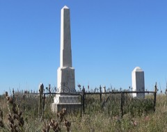 | Spotted Tail Gravesite | site | 1980 | 80003735 |
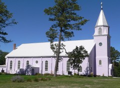 | St. Francis Mission | district | 1975 | 75001723 |
Every wildfire the federal occurrence database records inside this county: 4,609 of them, burning about 106,669 acres. 493 started naturally and 586 were recorded as arson. Each settlement page carries the fires within five miles of it.
| Reported cause | Fires |
|---|---|
| Misuse of fire by a minor | 1255 |
| Arson/incendiarism | 586 |
| Missing data/not specified/undetermined | 572 |
| Fireworks | 562 |
| Debris and open burning | 515 |
| Natural | 493 |
| Equipment and vehicle use | 412 |
| Other causes | 94 |
| Power generation/transmission/distribution | 55 |
| Recreation and ceremony | 48 |
| Smoking | 17 |
The five largest, by the area the report gives. One of them was set deliberately.
| Date | Cause | Size | Reported by | Name on the report |
|---|---|---|---|---|
| 27 July 2012 | Natural | 43,639 acres | Rosebud Agency | LONG HORN COMPLEX |
| 5 October 2011 | Missing data/not specified/undetermined | 17,500 acres | Rosebud Agency | OKREEK |
| 17 October 2012 | Power generation/transmission/distribution | 14,453 acres | Rosebud Agency | CROOKSTON |
| 29 July 2002 | Misuse of fire by a minor | 3,004 acres | Rosebud Agency | LOOKING |
| 28 March 2015 | Natural | 1,745 acres | Rosebud Agency | FORT |
| 7 November 1999 | Misuse of fire by a minor | 1,720 acres | Rosebud Agency | CAN HILL |
| 22 October 1992 | Arson/incendiarism | 1,705 acres | Rosebud Agency | RIDGE RUNN |
| 10 January 2000 | Debris and open burning | 1,330 acres | Rosebud Agency | ONE HORN |
Every settlement page carries the fires within five miles of it - see the settlement index below.
The NOAA Storm Events Database holds 567 reports for this county, causing no deaths, 8 injuries and about $4,255,810 in recorded property damage. Each settlement page carries the reports that name it.
| Kind of event | Reports |
|---|---|
| Thunderstorm Wind | 253 |
| Hail | 251 |
| Tornado | 40 |
| Flash Flood | 10 |
| Flood | 5 |
| Funnel Cloud | 4 |
| Lightning | 2 |
| Wildfire | 1 |
| Dust Devil | 1 |
The most serious of them, by death, then injury, then recorded damage. The accounts are quoted exactly as the forecast office filed them.
| When | Event | Place named | Harm | What the report says |
|---|---|---|---|---|
| April 2025 | Tornado (EF1) | St Francis | 6 hurt, $1,000,000 | The tornado touched down 2 miles SE of Spring Creek just south of|BIA route #30 and remained over open field. The tornado tracked to|the east-northeast where it destroyed an outbuilding that was|built with heavy wood and anchored to a cement slab. The|outbuilding contents where thrown some 50yds to east up a hill.|The tornado crossed BIA route #30 where it strengthened,|destroying a single wide mobile home. The undercarriage of the|mobile home was tossed and crumpled 100yds from its foundation.|All walls where completely destroyed and the contents of the home|were thrown to the north to northeast. The tornado then moved |back into mostly open terrain before encountering some trees and |power poles just to the southwest of St. Francis. The circulation |then moved into St. Francis causing significant tree damage with |trees both uprooted and some trees near the catholic church had |their trunks snapped at the base. As the tornado passed through |the west side of St. Francis it caused significant roof damage to |the community center and an elderly living facility. The tornado |began to weaken slightly as it exited St. Francis and began to |move more toward the north-northeast and back over open terrain. |The tornado produced its last damage in Rosebud with the water |supply center and the adjacent storage facility receiving |signficant roof damage with the roofs being thrown toward the west|to southwest. The tornado dissipated 2 miles north of Rosebud. |
| August 1999 | Lightning | Parmelee | 1 hurt | A 32 year old man was paralyzed by lightning when lightning struck the screen door in front of him. He was knocked to the ground and witnesses say that he was indirectly hit by the lightning strike. Paramedics on scene noted that there were no entrance or exit wounds. He was transported to Rapid City for medical care. |
| June 1971 | Tornado (F2) | not stated | 1 hurt | no account filed |
| June 2004 | Lightning | Okreek | $500,000 | no account filed |
| March 2019 | Flood | Mission | $250,000 | During the early morning of March 23, Hidden Timber Dam along Antelope Creek failed, most likely from being overtopped by the excessive runoff from melted snow on frozen ground. As the water made its way downstream, it flooded several roads along Antelope Creek and the Keya Paha River. |
| March 2019 | Flood | St Francis | $250,000 | Runoff from melting snow, combined with frozen culverts, caused flooding which covered numerous roads. Several areas of high water were reported by the Rosebud Sioux Tribe, including 285th Street east of Prairie Hills and BIA 7 near Parmalee. Flooding along the Little White River and its tributaries covered several sections of BIA 5. |
| August 2004 | Thunderstorm Wind | St Francis | $250,000 | A roof was completely blown off a mobile home, causing the walls to collapse. A roof on a stick-built house was partially torn off and most of the shingles were missing. The door was blown off another mobile home. 9 large power transmission poles were broken. |
| September 1979 | Tornado (F2) | not stated | $250,000 | no account filed |
| July 1974 | Tornado (F2) | not stated | $250,000 | no account filed |
| July 2009 | Hail | Rosebud | $200,000 | Baseball to softball sized damaged buildings and automobiles in Rosebud. |
| June 2004 | Flash Flood | Okreek | $200,000 | no account filed |
| May 2019 | Flood | Parmelee | $100,000 | A few roads were flooded near the Keya Paha River, Little White River, and smaller tributaries of these rivers. |
| March 2012 | Hail | St Francis | $100,000 | Hail to the size of softballs fell at Rosebud Casino, producing damage to the building and vehicles. |
| June 2011 | Thunderstorm Wind | Mission | $100,000 | Winds knocked down power poles and damaged small buildings. |
| September 2000 | Thunderstorm Wind | Mission | $100,000 | no account filed |
| July 2013 | Flash Flood | Parmelee | $60,000 | Debris clogged the outlet works at Ghost Hawk Dam and Rosebud Dam, causing the dams to overflow after heavy rain. In addition, a breach of Omaha Boy Dam, about a mile southwest of the Rosebud Dam, increased inflows into the lake. Several culverts and roads were damaged by the flooding, including Ghost Hawk Road and Grass Mountain Road. The Little White River near Rosebud rose from less than 100 cfs to over 1000 cfs in less than four hours, with a peak flow of 1300 cfs. |
| July 2010 | Thunderstorm Wind | Rosebud | $50,000 | Wind gusts estimated at 60 mph blew down many trees. |
| August 2007 | Thunderstorm Wind | Parmelee | $50,000 | A roof was blown off a house and power lines were blown down at the Upper Cut Meat housing area. The nearby Magpie Creek RAWS measured a wind gust of 78 mph. |
| July 2003 | Thunderstorm Wind | St Francis | $50,000 | Many trees and power lines were downed around Saint Francis with some property damage. A mobile home was tipped over by the strong winds. No one was injured. |
| July 1998 | Tornado (F1) | St Francis | $50,000 | A SMALL TRAILER WAS TURNED OVER. |
| July 1994 | Thunderstorm Wind | St. Francis | $50,000 | Thunderstorm Winds blew down a casino under construction. |
| May 2000 | Thunderstorm Wind | St Francis | $45,000 | 39 power poles blown over by strong winds. 1 Trailer home overturned 3 miles south of St. Francis. |
| September 2000 | Thunderstorm Wind | Rosebud | $35,000 | no account filed |
| July 2009 | Hail | Mission | $30,000 | Hail to the size of baseballs fell from four miles west of Mission to the Antelope housing area east of Mission. |
| August 2007 | Flood | St Francis | $25,000 | no account filed |
| July 2005 | Thunderstorm Wind | Lakeview | $25,000 | no account filed |
| July 1961 | Tornado (F2) | not stated | $25,000 | no account filed |
| July 2010 | Thunderstorm Wind | Okreek | $20,000 | Wind gusts between 62 and 78 mph lasted a half hour. Large branches and small trees were blown down. |
| July 2005 | Hail | Lakeview | $20,000 | no account filed |
| May 2003 | Hail | St Francis | $20,000 | no account filed |
| July 1997 | Hail | Lakeview | $20,000 | no account filed |
| May 2016 | Tornado (EF2) | Mission | $10,000 | A tornado developed over southeastern Todd County and moved northeastward for about ten minutes. The tornado did not damage any structures as it tracked across fields for almost five miles. However, it did snap eight to ten power poles at the ground at the intersection of Littleburg Road and Hidden Timber Road. Several large trees in a shelter belt were snapped off and uprooted. |
| July 2013 | Thunderstorm Wind | St Francis | $10,000 | The combination of large hail and wind broke the windows of a house and caused other minor damage. |
| March 2012 | Thunderstorm Wind | Mission Sioux Arpt | $10,000 | The combination of large hail and strong wind gusts broke windows and damaged a house. |
| August 2012 | Thunderstorm Wind | Mission | $10,000 | Wind gusts were estimated around 80 mph. |
| June 2011 | Flash Flood | Parmelee | $10,000 | Two to three inches of rain fell over the Rosebud Reservation in less than three hours. Several rural roads were washed out. |
| July 1999 | Thunderstorm Wind | Olsonville | $10,000 | Spotters reported power lines blown down and several cars were damaged by fallen tree branches. |
| July 2011 | Hail | Rosebud | $10,000 | no account filed |
| July 2009 | Hail | St Francis | $10,000 | no account filed |
| June 2014 | Hail | St Francis | $5,000 | A few hail stones were the size of tennis balls. |
| August 2011 | Thunderstorm Wind | Parmelee | $5,000 | The combination of hail and wind produced minor damage. |
| July 2009 | Thunderstorm Wind | St Francis | $5,000 | Tree tops eight to ten inches in diameter were snapped off by strong southeast winds. |
| July 2005 | Thunderstorm Wind | Lakeview | $5,000 | Grain bins damaged. |
| June 2011 | Hail | Rosebud | $5,000 | no account filed |
| June 2011 | Thunderstorm Wind | Okreek | $3,000 | Strong winds blew shingles off a roof overturned a small structure. |
| August 2007 | Thunderstorm Wind | St Francis | $3,000 | A metal Quonset barn was totally blown apart by winds estimated at 60-70 mph. |
| August 2002 | Thunderstorm Wind | Mission | $3,000 | Thunderstorm winds destroyed a machine shed and blew an eight foot diameter watering tank one-quarter mile. |
| July 2000 | Hail | Mission | $3,000 | Seven vehicles had windows shattered by the hail. |
| June 1971 | Tornado (F1) | not stated | $2,500 | no account filed |
| September 1962 | Tornado (F1) | not stated | $2,500 | no account filed |
| June 2019 | Dust Devil | Mission | $2,000 | A dust devil briefly developed west of Mission. It destroyed a metal carport and blew shingles off the house. It tossed a trampoline into a tree, damaged a swing set, and broke tree branches. |
| May 2016 | Thunderstorm Wind | Mission | $2,000 | The combination of hail and wind stripped leaves and branches from trees, destroyed plants, stripped paint off windows. |
| June 2011 | Thunderstorm Wind | Mission Sioux Arpt | $2,000 | Thunderstorm winds blew the top off a grain bin. |
| July 2011 | Thunderstorm Wind | Rosebud | $1,000 | A 40 foot billboard was blown over. |
| May 2000 | Thunderstorm Wind | St Francis | $1,000 | Roof of a farm building damaged by strong winds |
| May 2013 | Thunderstorm Wind | Okreek | $500 | no account filed |
| August 1986 | Tornado (F0) | not stated | $250 | no account filed |
| June 1982 | Tornado (F0) | not stated | $30 | no account filed |
| June 1982 | Tornado (F0) | not stated | $30 | no account filed |
| April 2025 | Tornado (EF0) | Mission | - | A brief spin-up touched down and produced EF0 damage to a|homestead 7 miles north of Mission. A mobile home lost all of its|roof and its north facing wall while the main home on the property|suffered major roof damage with most of the contents from the home|thrown back to the west. Other outbuildings on the property|suffered minor damage. |
The Survey's mineral resources record lists 17 workings inside this county. None of them still produces: all are closed or unrecorded. Each settlement page carries the workings within five miles of it.
| Commodity | Workings |
|---|---|
| Sand and Gravel, Construction | 17 |
The least common of them first, because a county's hundredth gravel pit says nothing its first ten did not.
| Where | Site | Commodity | Status | Recorded |
|---|---|---|---|---|
| Bristow Pit | Sand and Gravel, Construction | Past Producer | ||
| Heinert Pit | Sand and Gravel, Construction | Past Producer | ||
| Lindekugel Pit | Sand and Gravel, Construction | Past Producer | ||
| Rosebud Sioux 1588 | Sand and Gravel, Construction | Past Producer | ||
| Rosebud Sioux Adm Reserve | Sand and Gravel, Construction | Past Producer | ||
| Rosebud Sioux Ex A 43-2 | Sand and Gravel, Construction | Past Producer | ||
| Rosebud Sioux Pit 1265 1/2 | Sand and Gravel, Construction | Past Producer | ||
| Rosebud Sioux Pit 2008 1/2 | Sand and Gravel, Construction | Past Producer | ||
| Rosebud Sioux Pit 5213 | Sand and Gravel, Construction | Past Producer | ||
| Rosebud Sioux Pit 6366 | Sand and Gravel, Construction | Past Producer | ||
| Rosebud Sioux Pit 7198 | Sand and Gravel, Construction | Past Producer | ||
| Rosebud Sioux Pit 895 | Sand and Gravel, Construction | Past Producer | ||
| Rosebud Sioux Pit 897 | Sand and Gravel, Construction | Past Producer | ||
| Rosebud Sioux Pit L-56 | Sand and Gravel, Construction | Past Producer | ||
| Rosebud Sioux Pit Ref 3110 | Sand and Gravel, Construction | Past Producer | ||
| Rosebud Sioux Tribal Pit | Sand and Gravel, Construction | Past Producer | ||
| Sharp Fish Pit | Sand and Gravel, Construction | Past Producer |
Named settlements recorded in the Geographic Names Information System, each with the topographic sheets covering it. Villages, hamlets and abandoned places alike. Each is shown with the nearest named watercourse or landform and the survey quadrangle it falls on.
East Todd unorganized territory · 57555 · Mission quadrangle
5 sheets, 1955 to 1982
West Todd unorganized territory · 57570 · On West Branch Rosebud Creek · Rosebud quadrangle
5 sheets, 1955 to 1982
West Todd unorganized territory · 57555 · On Scabby Creek · Soldier Creek quadrangle
5 sheets, 1955 to 1982
West Todd unorganized territory · 57572 · Near Sawmill Canyon · Spring Creek quadrangle
5 sheets, 1955 to 1983
West Todd unorganized territory · 57570 · Saint Francis quadrangle
5 sheets, 1955 to 1982