 Block
Custer, South Dakota
19 topographic sheets cover this place, the earliest surveyed in 1896 and the latest in 1977. It stands in the West Custer unorganized territory. It lies in ZIP code area 57730. The Survey maps it on the Custer quadrangle. 1,919 people lived here at the 2020 count. It stands 5,315 feet above sea level.
Research this city
On record in Custer
Buildings and businesses the archive holds for this place. Each opens its own page, with the source record it came from.
On the National Register 12 of 26 shown
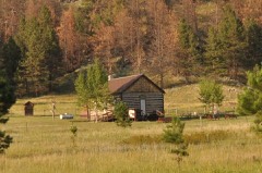 Cold Springs Schoolhouselisted 1973
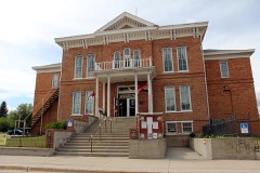 Custer County Courthouselisted 1972
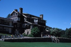 Custer State Game Lodgelisted 1983
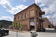 First National Bank Buildinglisted 1982
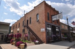 Garlock Buildinglisted 2004
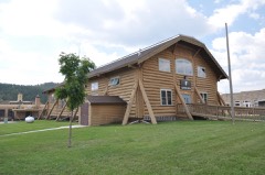 Grace Coolidge Memorial Log Buildinglisted 2001
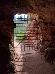 Historic Trail and Cave Entrancelisted 1995
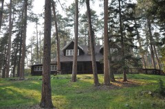 Peter Norbeck Summer Houselisted 1977
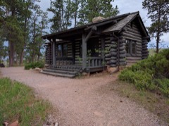 Ranger Stationlisted 1995
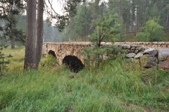 South Dakota Dept. of Transportation Bridge No. 17-289-107listed 1993
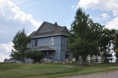 Towner, Francis Averill (T. A.) and Janet Leach, Houselisted 1990
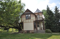 Newton Seymour Tubbs Houselisted 1993
Population over time
2 figuresCuster fell from 2,067 to 1,919 between 2010 and 2020. These are the recorded population figures Wikidata holds for this place, reached through the Geographic Names Information System number this page is keyed on rather than by name, so they belong to this place and not to another of the same name. Most are census counts, but not all are: an early figure may be a founding or settlement estimate, and an estimate published within five years of a census is left out. The change column is computed, and is left blank where more than 20 years separate a figure from the one before it, because a gap that long is not a change between two counts.
| Year | People | Change |
|---|---|---|
| 2010 | 2,067 | |
| 2020 | 1,919 | -148 (-7%) |
Topographic sheets covering this place
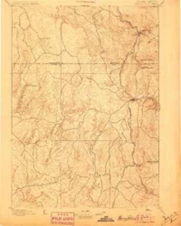
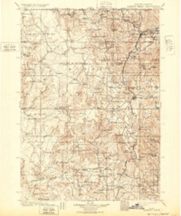
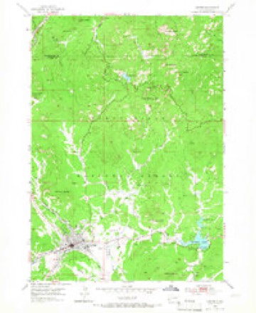
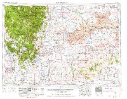
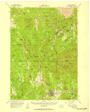
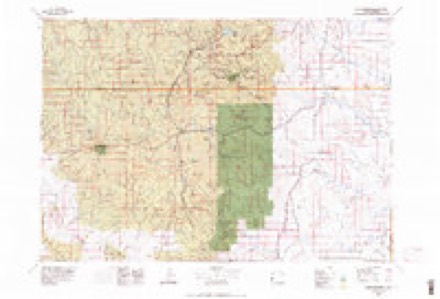
6 surveys from 19 printed sheetsMatched by testing this settlement's coordinate against the published boundary of every sheet in the United States Geological Survey's historical collection. Each opens the scanned sheet at the Survey.
- 1896 USGS Harney Peak quadrangle1:125000
- 1901 USGS Harney Peak quadrangle1:125000, 4 printings
- 1954 USGS Custer quadrangle1:24000, 5 printings
- 1955 USGS Hot Springs quadrangle1:250000, 5 printings
- 1956 USGS Custer quadrangle1:62500, 2 printings
- 1977 USGS Mount Rushmore quadrangle1:100000, 2 printings
Fires near this place
239 since 1992Regional context, not property-specific evidence. The federal wildfire occurrence database lists 239 fires within 5 miles of Custer between 1992 and 2020, burning about 780 acres in total. 93 started naturally. 2 were recorded as arson. Distance is straight-line from the map coordinates, so a fire counted here may appear on a neighbouring settlement's page as well.
| Reported cause | Fires |
|---|---|
| Natural | 93 |
| Debris and open burning | 62 |
| Missing data/not specified/undetermined | 30 |
| Recreation and ceremony | 28 |
| Equipment and vehicle use | 8 |
| Power generation/transmission/distribution | 7 |
| Other causes | 4 |
| Misuse of fire by a minor | 3 |
| Arson/incendiarism | 2 |
| Smoking | 1 |
| Fireworks | 1 |
The most recent of them, most recent first, with the day each was reported and the service that recorded it.
| Date | Cause | Size | Reported by | Name on the report |
|---|---|---|---|---|
| 8 September 2003 | Natural | under an acre | Black Hills National Forest | ROSE QUARTZ |
| 6 September 2007 | Natural | under an acre | Black Hills National Forest | GRAHAM |
| 5 September 2010 | Debris and open burning | under an acre | South Dakota Wildland Fire Suppression | DEER MEADOW |
| 5 September 2000 | Natural | under an acre | Black Hills National Forest | BUCKHORN MTN |
| 5 September 1995 | Natural | under an acre | South Dakota Wildland Fire Suppression | LOST |
| 5 September 1992 | Natural | under an acre | Black Hills National Forest | BUCKHORN |
| 3 September 2006 | Natural | under an acre | Black Hills National Forest | WILLOW |
| 3 September 2004 | Natural | under an acre | Black Hills National Forest | ROSE |
Settlements close enough to share some of these fires:
Mines and quarries near this place
10 of 270 shownRegional context, not property-specific evidence. The federal mineral resources record lists 270 workings within 5 miles of Custer: 153 past producers, 56 prospects, 50 occurrences, 11 producers. 11 still produce. What was taken out: Feldspar, Mica, Feldspar, Mica, Beryllium. Distance is straight-line from the map coordinates, so a quarry counted here may appear on a neighbouring settlement's page as well.
| Where | Site | Commodity | Status | Recorded |
|---|---|---|---|---|
| Beecher Lode | Lithium, Beryllium, Mica, Niobium (Columbium), Tantalum | Past Producer | 1900 | |
| Big Spar Mine | Fluorine-Fluorite | Producer | ||
| Buster Dike | Beryllium, Feldspar, Mica, Tantalum | Past Producer | 1939 | |
| Climax Mica Mine | Tin, Beryllium, Mica | Past Producer | 1880 | |
| Come Along Lode | Feldspar, Mica, Tin | Past Producer | Cassiterite, Mica | |
| Crown Mine | Mica, Beryllium, Feldspar, Tantalum | Past Producer | 1879 | |
| Custer Mountain Lode | Beryllium, Feldspar, Mica, Lithium, Tantalum | Past Producer | Beryl, Feldspar, Lepidolite, Mica, Spodumene | |
| Dike No. 2 Mine | Feldspar, Lithium, Mica | Occurrence | Feldspar, Mica, Spodumene | |
| Highland Lode | Tantalum, Niobium (Columbium), Mica | Past Producer | ||
| Highland Mine | Beryllium, Mica, Feldspar, Tantalum, Lithium | Past Producer | 1907 |
Storms near this place
60 of 217 shownRegional context, not property-specific evidence. The National Weather Service names Custer in 217 storm reports between 1994 and 2025: 181 hail, 21 thunderstorm wind, 5 flash flood, 3 tornado. No death or injury is recorded in these reports. Each account below is quoted exactly as the forecast office filed it, from the NOAA Storm Events Database, and each date opens the federal record of that event.
| When | Event | Place named | Harm | What the report says |
|---|---|---|---|---|
| September 2013 | Hail | Custer | $2,000,000 | Hail damaged vehicles and property. |
| August 2019 | Flash Flood | Custer | $1,000,000 | Significant flooding occurred on French Creek from the Custer Limestone area downstream to Stockade Lake, including the City of Custer. Several smaller tributaries into French Creek, including Ruby Creek, also flooded. Flash flooding inundated Custer Limestone Road just east of the intersection of Forest Service 284 and Forest Service 285, French Creek Road at Hoover Court, Highway 16, Highway 16A, Highway 89, Custer Street, South 4th Street, French Creek Drive, Gordon Street, 7th Street, 8th Street, Washington Street, Sidney Park, Granite Valley Drive, and Iron Creek Road. Several homes and businesses were also flooded. |
| August 2001 | Lightning | Custer | $500,000 | no account filed |
| July 2011 | Hail | Custer | $250,000 | no account filed |
| June 2012 | Hail | Custer | $100,000 | Hail to golf ball size covered the ground. |
| July 2015 | Hail | Custer | $100,000 | no account filed |
| September 2013 | Hail | Custer | $100,000 | no account filed |
| August 2013 | Hail | Custer | $100,000 | no account filed |
| August 2013 | Hail | Custer | $75,000 | no account filed |
| July 2010 | Hail | Custer | $50,000 | Ping-pong ball sized hail damaged vehicles in downtown Custer. |
| June 2003 | Hail | Custer | $50,000 | Hail damage to cars in and near Custer. |
| September 2013 | Hail | Custer | $50,000 | no account filed |
| August 2013 | Hail | Custer | $50,000 | no account filed |
| August 2013 | Hail | Custer | $50,000 | no account filed |
| August 2013 | Hail | Custer | $25,000 | Hail covered the ground around Sanator. Snowplows had to clear the hail from U.S. Highway 385. |
| August 2013 | Hail | Custer | $15,000 | no account filed |
| June 2015 | Hail | Custer | $10,000 | Hail cracked a truck windshield caused minor damage to other vehicles. |
| June 2012 | Thunderstorm Wind | Custer | $10,000 | Strong winds damaged the roof of a home. |
| June 1994 | Tornado (F0) | Custer | $5,000 | A tornado destroyed a chicken coup, chain link fence, and flipped a 1500 pound trailer upside down. The tornado also reportedly held 8 x 10 foot shed in the air for 10 minutes. A witness reported the tornado was not connected to a cloud and appeared to form from nearly clear skies. Perhaps this could better be defined as a land spout. |
| July 2009 | Hail | Custer | $5,000 | no account filed |
| May 2016 | Flash Flood | Custer | $2,000 | Iron Creek overflowed its banks at Needles Highway (SD Highway 87), with three to four inches of water covering the highway. All water crossings on Iron Creek Trail 15 were either damaged or destroyed, making the trail impassible for several weeks. |
| July 2015 | Hail | Custer | $1,000 | Hail damaged a camper. |
| June 2025 | Hail | Custer | - | Largest hail about the size of a quarter. Most hail was smaller, pea to nickel. |
| May 2024 | Thunderstorm Wind | Custer | - | Wind gusts were estimated at near 60 mph. |
| April 2024 | Thunderstorm Wind | Custer | - | Wind gusts were estimated at near 60 mph. |
| September 2023 | Flood | Custer | - | Runoff from heavy rain caused flash flooding in Ghost Canyon and Box Canyon, west of Hermosa. Ghost Canyon Road and Battle Creek Road were flooded with water and debris. Battle Creek and Grace Coolidge Creek overflowed their banks in several areas. Water and debris filled the ditches along Highway 40 and Highway 36. The Battle Creek at Hermosa river gage crested at 8.86 feet and 846 cfs at 915 PM MST. |
| May 2021 | Tornado (EF1) | Custer | - | A tornado touched down just northeast of Custer and tracked to the east-northeast for over five miles. This tornado snapped several trees along Willow Creek Road. |
| June 2020 | Hail | Custer | - | Hail was mostly to quarter size, with a few near golf ball size, and accumulated to six inches deep, with a few piles larger than two feet. |
| June 2020 | Flash Flood | Custer | - | Runoff from heavy rain and copious amounts of hail combined to produce street flooding in Custer. The excessive runoff overwhelmed culverts and caused flooding along French Creek upstream of Stockade Lake. |
| August 2019 | Flood | Custer | - | Runoff from heavy rainfall continued to cause flooding in the Custer area. |
| August 2019 | Heavy Rain | Custer | - | The RAWS recorded a rainfall total of 5.35 inches. |
| July 2018 | Thunderstorm Wind | Custer | - | Wind gusts were estimated at 60 mph. |
| July 2018 | Hail | Custer | - | Quarter sized hail was reported at the Custer State Park Headquarters office. |
| June 2017 | Thunderstorm Wind | Custer | - | Part of the YMCA building's roof was torn off, a large sign was blown down, and trees were toppled by strong winds in Custer. |
| June 2017 | Thunderstorm Wind | Custer | - | Many pine trees were bent and several trees were snapped by the wind. |
| June 2016 | Hail | Custer | - | Ping pong ball sized hail fell at the Custer State Park headquarters. |
| June 2016 | Thunderstorm Wind | Custer | - | Numerous large pine trees were snapped and uprooted in an area about 100 yards wide. |
| June 2016 | Hail | Custer | - | Golf ball sized hail fell at Beaver Lake Campground. |
| June 2016 | Thunderstorm Wind | Custer | - | A pine tree was snapped in half. |
| May 2016 | Hail | Custer | - | Hail to the size of ping pong balls was reported at the Center Lake Campground in Custer State Park. |
| May 2016 | Hail | Custer | - | The ground was covered with hail. |
| May 2016 | Flood | Custer | - | Iron Creek overflowed its banks upstream and downstream from Lakota Lake, causing minor flooding. Iron Creek covered the Needles Highway (SD Highway 87) with at least three to four inches of water. A road downstream from Lakota Lake was covered by water when an eight foot diameter culvert wasn't able to keep up with the flood waters. |
| July 2016 | Hail | Custer | - | Time estimated--check on radar. |
| July 2016 | Hail | Custer | - | Baseball sized hail was reported at Sylvan Lake in Custer State Park. |
| July 2016 | Hail | Custer | - | Ping pong ball sized hail fell at the Custer State Park headquarters. |
| July 2016 | Hail | Custer | - | The Mount Coolidge Communications Center reported quarter sized hail. |
| July 2015 | Hail | Custer | - | Ping pong ball sized hail was reported at Sylvan Lake. |
| June 2015 | Hail | Custer | - | Wind gusts to 50 mph also accompanied the storm. |
| July 2014 | Hail | Custer | - | Half dollar to golf ball size hail fell in Custer State Park from the Grace Coolidge Campground to the State Game Lodge. |
| June 2012 | Hail | Custer | - | Nickel sized hail and heavy rain fell at Outlaw Ranch near Bismark Lake in Custer State Park. |
| June 2012 | Hail | Custer | - | Quarter sized hail fell at Mount Coolidge. |
| August 2012 | Thunderstorm Wind | Custer | - | Wind gusts were estimated at 60 mph. |
| July 2010 | Hail | Custer | - | Nickel to quarter sized hail covered the ground. |
| August 2008 | Hail | Custer | - | Hail covered the deck of a house. |
| August 2007 | Flash Flood | Custer | - | Nearly stationary thunderstorms dropped two to four inches of rain in less than two hours in the Custer area. Flooding was reported throughout much of the City of Custer, with many streets from downtown to areas south and east of town covered by water. No significant damage was reported. |
| August 2003 | Hail | Custer | - | A severe thunderstorm dropped hail to the size of golf balls for 30 minutes in Custer. |
| August 2001 | Flash Flood | Custer | - | Flash flooding occurred through Buck Springs & Gillette Canyons. Normally dry creek beds had water flowing from 18 inches to 4 feet deep and from 6 feet to 20 feet wide. Excessive run-off from scorched earth of the Jasper fire of 2000 contributed more to the flooding than did heavy rainfall. |
| July 2001 | Hail | Custer | - | Golfball sized hail fell for 10 minutes. |
| July 1998 | Lightning | Custer | - | LIGHTNING CAUSED .5 ACRE FIRE IN PINE TREES AND GRASS, IN CUSTER STATE PARK. |
| July 1995 | Thunderstorm Wind | Custer | - | Winds were estimated at 70 mph. |
Nearest settlements
The eight closest, with where each one stands in the county. Distances are straight-line, computed from the Geographic Names Information System coordinates.
| Map | Place | Distance | Sheets |
|---|---|---|---|
| Berne | 4.1 miles | 18 | |
| Fourmile | 4.7 miles | 17 | |
| Sanator | 4.8 miles | 16 | |
| Sylvan Lake Resort | 5.8 miles | 19 | |
| Vestal Springs | 6.3 miles | 18 | |
| Blue Bell | 7.1 miles | 18 | |
| Danoby (historical) | 7.1 miles | 18 | |
| Junction Ranger Station | 7.5 miles | 18 |
Elsewhere
Matched on this settlement's Geographic Names Information System number rather than its name, so it cannot be a different place of the same name in another state.
| Wikipedia article on Custer | An encyclopaedic summary. Its text is share-alike, so it is linked here rather than copied. |
| Wikidata item Q1026175 | The structured record the population and elevation above come from. Public domain (CC0). |
Provenance
This settlement is recorded in the Geographic Names Information System as feature 1265633. The sheet list is computed by point-in-boundary test against the United States Geological Survey's historical topographic inventory. Both are works of the United States government and carry no copyright under 17 U.S.C. 105.
Wildfire. Short, Karen C. 2022. Spatial wildfire occurrence data for the United States, 1992-2020 [FPA_FOD_20221014]. 6th Edition. Fort Collins, CO: Forest Service Research Data Archive. https://doi.org/10.2737/RDS-2013-0009.6 Collected with United States Government funding and usable without additional permissions or fees.
Mines and quarries. USGS Mineral Resources Data System (MRDS) https://mrdata.usgs.gov/mrds/ A work of the United States government, no copyright under 17 U.S.C. 105.
Storms. NOAA National Centers for Environmental Information, Storm Events Database https://www.ncei.noaa.gov/stormevents/ A work of the United States government, no copyright under 17 U.S.C. 105. Narratives are quoted verbatim from the National Weather Service report and are not edited or summarised.