 Block
Dimock, South Dakota
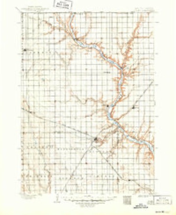
11 topographic sheets cover this place, the earliest surveyed in 1898 and the latest in 1985. It stands in Dimock town. It lies in ZIP code area 57331. The Survey maps it on the Parkston quadrangle. 137 people lived here at the 2020 count. It stands 1,375 feet above sea level.
Population over time
2 figuresDimock grew from 125 to 137 between 2010 and 2020. These are the recorded population figures Wikidata holds for this place, reached through the Geographic Names Information System number this page is keyed on rather than by name, so they belong to this place and not to another of the same name. Most are census counts, but not all are: an early figure may be a founding or settlement estimate, and an estimate published within five years of a census is left out. The change column is computed, and is left blank where more than 20 years separate a figure from the one before it, because a gap that long is not a change between two counts.
| Year | People | Change |
|---|---|---|
| 2010 | 125 | |
| 2020 | 137 | +12 (+10%) |
Topographic sheets covering this place
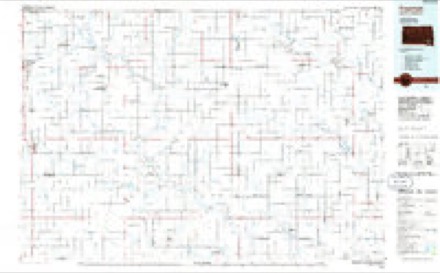
5 surveys from 11 printed sheetsMatched by testing this settlement's coordinate against the published boundary of every sheet in the United States Geological Survey's historical collection. Each opens the scanned sheet at the Survey.
- 1898 USGS Olivet quadrangle1:125000, 4 printings
- 1955 USGS Sioux Falls quadrangle1:250000, 3 printings
- 1958 USGS Sioux Falls quadrangle1:250000
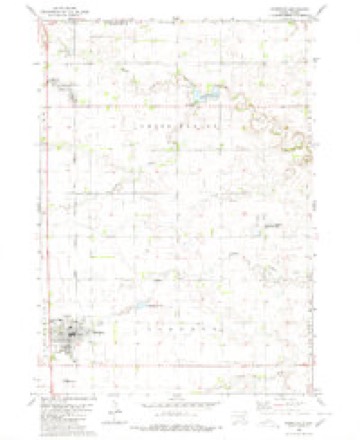
- 1980 USGS Parkston quadrangle1:24000
- 1985 USGS Freeman quadrangle1:100000, 2 printings
Fires near this place
25 since 2000Regional context, not property-specific evidence. The federal wildfire occurrence database lists 25 fires within 5 miles of Dimock between 2000 and 2020, burning about 251 acres in total. None started naturally. None was recorded as arson. Distance is straight-line from the map coordinates, so a fire counted here may appear on a neighbouring settlement's page as well.
| Reported cause | Fires |
|---|---|
| Missing data/not specified/undetermined | 17 |
| Debris and open burning | 5 |
| Equipment and vehicle use | 2 |
| Railroad operations and maintenance | 1 |
The most recent of them, most recent first, with the day each was reported and the service that recorded it.
| Date | Cause | Size | Reported by | Name on the report |
|---|---|---|---|---|
| 16 September 2014 | Missing data/not specified/undetermined | 30 acres | South Dakota Wildland Fire Suppression | YORK |
| 20 August 2014 | Missing data/not specified/undetermined | 20 acres | South Dakota Wildland Fire Suppression | BULL |
| 11 July 2012 | Missing data/not specified/undetermined | 1.0 acres | South Dakota Wildland Fire Suppression | NEUGEBAUER BALES |
| 10 July 2014 | Missing data/not specified/undetermined | 4.0 acres | South Dakota Wildland Fire Suppression | RAILROAD |
| 10 July 2014 | Missing data/not specified/undetermined | 4.0 acres | South Dakota Wildland Fire Suppression | JIMMY |
| 21 May 2015 | Equipment and vehicle use | 20 acres | South Dakota Wildland Fire Suppression | TJARKS FIRE |
| 27 April 2013 | Missing data/not specified/undetermined | 15 acres | Davison County | RASSMUSSEN FIRE |
| 26 April 2014 | Missing data/not specified/undetermined | 1.0 acres | South Dakota Wildland Fire Suppression | CROW LAKE 2 |
Settlements close enough to share some of these fires:
Storms near this place
55 since 1998Regional context, not property-specific evidence. The National Weather Service names Dimock in 55 storm reports between 1998 and 2024: 32 flood, 17 hail, 3 tornado, 2 flash flood. No death or injury is recorded in these reports. Each account below is quoted exactly as the forecast office filed it, from the NOAA Storm Events Database, and each date opens the federal record of that event.
| When | Event | Place named | Harm | What the report says |
|---|---|---|---|---|
| July 2009 | Hail | Dimock | $3,000,000 | Large hail caused widespread damage to vehicles, windows, and siding and roofs on homes. The hail also caused widespread crop damage, with over 66 thousand acres affected. Damage to both property and crops was estimated to be in the millions of dollars. |
| April 2011 | Flood | Dimock | $1,000,000 | Major flooding of the James River, as well as flooding of small streams and lakes in the county, continued through April. Much farmland remained flooded, both near to and away from the James River. The James River was 5.8 feet above flood stage northeast of Scotland on April 1st, and fell very slowly during the month. A large area of land and numerous roads were flooded at the start of the month. Water was running over other roads, from flooded streams, creeks, and fields as well as from the James River. Many roads were heavily damaged. Some homes and businesses were also flooded, with the flooding of these places slowly alleviating through the month. High water and groundwater levels from record precipitation in the year 2010, a main reason the flooding onset was so fast in March, was also a main reason that the flooding subsided so slowly during April. |
| June 2008 | Flash Flood | Dimock | $1,000,000 | Repeated heavy rain from thunderstorms caused widespread flash flooding in western Hutchinson County. Communities affected included Parkston and Tripp, with Parkston being especially hard hit. Numerous roads and homes were flooded, including up to 200 homes in Parkston. Parks and businesses were also flooded. In nearby rural areas, numerous fields were flooded, causing an unknown amount of crop damage. Small streams such as Pony Creek in Parkston flooded, adding to the damage. |
| September 2019 | Flood | Dimock | $25,000 | A continuation of flooding from August, the James River near Mitchell (gage site JRMS2) responded sharply to 5 to 8 inches of rainfall between September 10-12 (7.54 inches at Mitchell) to reach the 4th highest crest on record at 8.05 feet above flood stage on September 13. Innumerable county and township roads near the river were inundated, with significant flooding of South Dakota Highway 37 east of Mitchell and 42 east of Ethan. Significant amounts of agricultural land remained flooded. Moderate flooding continued at the end of the month. |
| August 2013 | Thunderstorm Wind | Dimock | $20,000 | Thunderstorm winds blew in the roof and doors of a hog barn, and damaged siding on buildings. Ventilation fans in the hog barn were damaged, and air control shutters were destroyed. The winds also caused tree damage, including a few trees blown down. The winds were accompanied by large hail. |
| August 2019 | Flood | Dimock | $10,000 | A continuation of flooding from July, the James River near Mitchell (gage site JRMS2) crested 4.97 feet above flood stage on August 8. Many rural roads near the river were inundated, with continued flooding of significant amounts of agricultural land. Moderate flooding continued at the end of the month. |
| August 2013 | Hail | Dimock | $10,000 | Large hail caused crop damage in the area. Both corn and soybean crops were damaged, but the leaf damage to the beans was suspected of making that crop suffer the greater damage. The amount of crop damage was not known, but over one thousand acres on one family farm suffered lost or damaged crops. The hail was driven by damaging winds and also caused damage to vehicles, windows, roofs, and siding. |
| August 2013 | Hail | Dimock | $10,000 | Large hail damaged siding, vehicles, and crops. The hail covered the ground. The amount of crop damage was not known. |
| October 2019 | Flood | Dimock | $5,000 | A continuation of flooding from September, the James River near Mitchell (gage site JRMS2) spent a vast majority of the month at minor flood stage, but started on October 1 in moderate flooding at 3.18 feet above flood stage. Significant amounts of agricultural land remained flooded. Minor flooding continued at the end of the month. Property damage costs are rough estimates. |
| July 2024 | Flood | Dimock | - | Flooding continued from June on the James River near Mitchell, with declining river levels. The river fell below flood stage on the evening of July 8th. |
| June 2023 | Flood | Dimock | - | Flooding continued from May along the James River near Mitchell, SD with very slowly falling levels through the month. The peak river level was 1.15 feet above flood stage (18.15 ft) occurring early in the day on the 1st, before falling below flood stage early on the 14th. |
| May 2023 | Flood | Dimock | - | Flooding continued from April along the James River near Mitchell, SD with very slowly falling levels through the month. Flood levels were in the Moderate category for 4 days and Minor stage for 31 days. Flooding continued into June. |
| April 2023 | Flood | Dimock | - | The James River near Mitchell, SD rose above flood stage during the early morning of April 18th before cresting around 4.03 feet above flood stage (21.03 feet) on April 28th, which is in the Moderate category. The river was above Minor flood stage at this location for 13 days and above Moderate stage for 6 days. Flooding continued into May. |
| June 2022 | Flood | Dimock | - | Minor flooding was ongoing at the start of June 2022 on the James River near Mitchell (gage site JRMS2), with a crest at 2.15 feet above flood stage on June 13. A significant amount of rural land was flooded. The river remained at minor flood stage at the end of the month. |
| May 2022 | Flood | Dimock | - | As water from early spring rains and late winter snowmelt in North Dakota and far northern South Dakota routed downstream, the James River at Mitchell (gage site JRMS2) climbed into minor flood stage on May 30, and reached 0.28 feet above flood stage at the end of the month. Impacts were limited to inundation of some areas of agricultural land near the river. Minor flooding continued at the end of the month. |
| July 2022 | Flood | Dimock | - | Minor flooding was ongoing at the start of July 2022 on the James River near Mitchell (gage site JRMS2). Five to seven inches of rainfall the first seven days of July in a small area at and north of Huron resulted in a crest at 1.20 feet above flood stage on July 24. A significant amount of rural land was flooded. The river remained at minor flood stage at the end of the month. |
| August 2022 | Flood | Dimock | - | Minor flooding was ongoing at the start of August 2022, with the James River near Forestburg (gage site FORS2) at 0.45 feet above flood stage on August 1. A significant amount of rural land was flooded until the river dropped below flood stage on August 4. |
| January 2020 | Flood | Dimock | - | A continuation of flooding from December, the James River near Mitchell (gage site JRMS2) spent the entire month in minor flood stage. The highest level occurred early in the month at 2.44 feet above flood stage on January 2. A second intramonth crest occurred at 1.79 feet above flood stage on January 25. Significant amounts of agricultural land remained flooded. Minor flooding continued at the end of the month. |
| May 2020 | Flood | Dimock | - | A continuation of flooding from April, the James River at Mitchell (gage site JRMS2) began the month at a peak of 2.74 feet above flood stage. After slowly falling through mid-month, a late month rise in levels resulted in a secondary crest at 2.55 feet above flood stage on May 24. Impacts were generally limited to flooding of agricultural lands near the river. The river remained at minor flood stage at the end of the month. |
| February 2020 | Flood | Dimock | - | A continuation of flooding from January, the James River near Mitchell (gage site JRMS2) began the month at 1.23 feet above flood stage, with a slow drop in levels before falling below flood stage on February 19. The main impact was continued flooding of agricultural land near the river. |
| February 2020 | Flood | Dimock | - | The James River at Mitchell (gage site JRMS2) reached an end of month peak of 0.28 feet above flood stage. Impacts were limited to flooding of agricultural lands near the river. The river remained in minor flood at the end of the month. |
| June 2020 | Flood | Dimock | - | A continuation of flooding from May, the James River at Mitchell (gage site JRMS2) spent the entire month at minor flood stage, with a peak mid-month on June 11 at 2.98 feet above flood stage, and reaching a monthly peak of 2.99 feet above flood stage on June 30. Impacts were generally limited to flooding of agricultural lands near the river. The river remained at minor flood stage at the end of the month. |
| March 2020 | Flood | Dimock | - | The James River at Mitchell (gage site JRMS2) began the month in minor flood, then crested on March 13 in moderate flood, 4.86 feet above flood stage. Impacts were generally limited to flooding of agricultural lands near the river, but flood waters did cause the closing of Shanard Road, east of Mitchell. The river remained at moderate flood stage at the end of the month. |
| April 2020 | Flood | Dimock | - | A continuation of flooding from March, the James River at Mitchell (gage site JRMS2) began the month at moderate flood stage, with a crest on April 2 at 4.07 feet above flood stage. Impacts were generally limited to flooding of agricultural lands near the river, but flood waters did cause the closing of Shanard Road east of Mitchell. The river remained at minor flood stage at the end of the month. |
| July 2020 | Flood | Dimock | - | A continuation of flooding from June, the James River at Mitchell (gage site JRMS2) started the month at moderate flood 3.23 feet above flood stage. After falling river levels early in the month, 1.36 inches of rainfall near Forestburg and 0.71 inches at Mitchell caused a secondary peak 1.43 feet above flood stage on July 16. Several county and township roads near the river remained under water at the start of the month, with inundation of agricultural land the primary threat thereafter. |
| June 2019 | Flood | Dimock | - | A continuation of flooding from May, the James River near Mitchell (gage site JRMS2) crested 5.28 feet above flood stage on June 1. Many rural roads near the river were inundated, with continued flooding of significant amounts of agricultural land. Minor flooding continued at the end of the month. |
| November 2019 | Flood | Dimock | - | A continuation of flooding from October, the James River near Mitchell (gage site JRMS2) spent the entire month at minor flood stage, and crested at 2.64 feet above flood stage on November 27. Significant amounts of agricultural land remained flooded. Minor flooding continued at the end of the month. |
| July 2019 | Flood | Dimock | - | A continuation of flooding from June, the James River near Mitchell (gage site JRMS2) crested 4.74 feet above flood stage on July 12, with a secondary crest 3.17 feet above flood stage on July 30. Many rural roads near the river were inundated, with continued flooding of significant amounts of agricultural land. Minor flooding continued at the end of the month. |
| March 2019 | Flood | Dimock | - | Snow melt and heavy rainfall (measured 2.47 inches at Forestburg and 2.25 inches at Mitchell) resulted in significant flooding of agricultural lands and inundation of numerous county roads (including 257th St. near the gage site and 1st Avenue and 416th Avenue near Rosedale Colony). The James River at Mitchell (gage site JRMS2) reached major flood stage and the 5th highest crest on record to date, 6.6 feet above flood stage on March 25. Moderate flooding continued at the end of the month. |
| May 2019 | Flood | Dimock | - | This is a continuation of flooding from April. The James River near Mitchell (gage site JRMS2) crested at major flood stage twice during the month. The first occurred on May 1 when levels crested at 5.79 feet above flood stage. Additional rainfall mid to late month resulted in a secondary crest of 5.44 feet above flood stage on May 31. The county road east of the bridge at the gage site remained under water much of the month. The river remained at major flood stage at the end of the month. |
| December 2019 | Flood | Dimock | - | A continuation of flooding from November, the James River near Mitchell (gage site JRMS2) spent the entire month in minor flood stage, with a brief period in moderate flooding between December 10-16. A crest at 3.37 feet above flood stage occurred on December 13. Significant amounts of agricultural land remained flooded. Minor flooding continued at the end of the month. |
| April 2019 | Flood | Dimock | - | Runoff from occasional precipitation in late March and April maintained considerable flooding throughout the flood plain across Davison county. 416th Avenue near Rosedale Colony and 257th Street near the gage site were impacted by water. The James River at Mitchell (gage site JRMS2) crested at 6.30 feet above flood stage on April 22, the sixth highest crest on record. Major flooding continued at the end of the month. |
| April 2018 | Flood | Dimock | - | Snow melt and runoff from periods of heavier rainfall produced minor flooding which impacted lowland agricultural areas. River levels reached 2.6 feet above flood stage on the James River at Mitchell (gage site JRMS2) on April 26. |
| July 2018 | Flood | Dimock | - | Numerous county and township roads were flooded in eastern Douglas and northwest Hutchinson county. Areas hit especially hard were around the Pony Creek area near Parkston. |
| July 2018 | Flash Flood | Dimock | - | Excessive rain washed out a culvert on 413th Avenue around 100 yards south of 272nd Street during the overnight hours. Around 0940CST the next morning, a driver ignored road closed barricades at the intersection and proceeded around 100 yards before crashing into the washout. The car ended up suspended by the bumpers across the gap in the roadway. The 35-year old female driver was transported to the hospital with serious injuries, but a younger juvenile passenger secured in child restraints was uninjured in the crash. |
| March 2018 | Flood | Dimock | - | Heavy rainfall along with snow melt caused minor flooding of lowland agricultural areas along portions of the James River. The river reached a crest of 1.1 feet above flood stage near Mitchell (gage site JRMS2) on March 21. |
| August 2018 | Hail | Dimock | - | Report received through social media. |
| May 2015 | Tornado (EF0) | Dimock | - | A tornado formed and moved north, quickly crossing into Davison County. The tornado caused no reported damage. |
| March 2011 | Flood | Dimock | - | Melting of a heavy winter snow cover caused major flooding of the James River, as well as flooding of small streams and lakes in the county. Farmland was also flooded, both near to and away from the James River. The James River crested at 6.48 feet above flood stage northeast of Scotland on March 27th. Numerous roads were closed by the flooding including several major state and county roads. Water was running over other roads from flooded streams, creeks, and fields as well as from the James River. Some roads were heavily damaged, including in the Parkston area well west of the James River. The amount of damage could not be determined before repairs began. Some homes and businesses were also flooded. The flooding onset was rapid for a snow melt flood due to high water and groundwater levels from record precipitation in the year 2010. |
| June 2009 | Tornado (EF0) | Dimock | - | A brief tornado caused no reported damage. |
| June 2008 | Flood | Dimock | - | Flash flooding caused by heavy rain continued as general flooding, which slowly subsided during a two day period. Flooding of roads, homes, other buildings, and parkland slowly decreased. Flooding of farmland also slowly decreased, but water remained in some fields. Additional flooding along Pony Creek and other small streams decreased more rapidly. |
| May 2007 | Tornado (EF0) | Dimock | - | A brief tornado caused no reported damage. |
| July 2004 | Hail | Dimock | - | Large hail damaged vehicles and crops. The amount of damage was not known. |
| July 2004 | Hail | Dimock | - | Large hail damaged vehicles and crops. The amount of damage was not known. |
| April 2022 | Hail | Dimock | - | no account filed |
| May 2018 | Hail | Dimock | - | no account filed |
| May 2012 | Hail | Dimock | - | no account filed |
| September 2008 | Hail | Dimock | - | no account filed |
| May 2008 | Hail | Dimock | - | no account filed |
| September 2006 | Hail | Dimock | - | no account filed |
| July 2006 | Hail | Dimock | - | no account filed |
| July 2003 | Hail | Dimock | - | no account filed |
| June 2002 | Hail | Dimock | - | no account filed |
| June 2002 | Hail | Dimock | - | no account filed |
| June 1998 | Hail | Dimock | - | no account filed |
Nearest settlements
The eight closest, with where each one stands in the county. Distances are straight-line, computed from the Geographic Names Information System coordinates.
| Map | Place | Distance | Sheets |
|---|---|---|---|
| Parkston | 5.2 miles | 11 | |
| New Elm Springs Colony | 8.4 miles | 11 | |
| Old Elm Spring Colony | 10.0 miles | 11 | |
| Milltown | 10.4 miles | 11 | |
| Beardsley | 12.1 miles | 11 | |
| Tripp | 17.2 miles | 11 | |
| Tschetter Colony | 17.4 miles | 11 | |
| Clayton | 17.5 miles | 12 |
Elsewhere
Matched on this settlement's Geographic Names Information System number rather than its name, so it cannot be a different place of the same name in another state.
| Wikipedia article on Dimock | An encyclopaedic summary. Its text is share-alike, so it is linked here rather than copied. |
| Wikidata item Q2308496 | The structured record the population and elevation above come from. Public domain (CC0). |
Provenance
This settlement is recorded in the Geographic Names Information System as feature 1254690. The sheet list is computed by point-in-boundary test against the United States Geological Survey's historical topographic inventory. Both are works of the United States government and carry no copyright under 17 U.S.C. 105.
Wildfire. Short, Karen C. 2022. Spatial wildfire occurrence data for the United States, 1992-2020 [FPA_FOD_20221014]. 6th Edition. Fort Collins, CO: Forest Service Research Data Archive. https://doi.org/10.2737/RDS-2013-0009.6 Collected with United States Government funding and usable without additional permissions or fees.
Storms. NOAA National Centers for Environmental Information, Storm Events Database https://www.ncei.noaa.gov/stormevents/ A work of the United States government, no copyright under 17 U.S.C. 105. Narratives are quoted verbatim from the National Weather Service report and are not edited or summarised.