 Block
Gary, South Dakota
9 topographic sheets cover this place, the earliest surveyed in 1953 and the latest in 1985. It stands in Gary City. It lies in ZIP code area 57237. The Survey maps it on the Gary quadrangle. 240 people lived here at the 2020 count. It stands 1,467 feet above sea level.
On record in Gary
Buildings and businesses the archive holds for this place. Each opens its own page, with the source record it came from.
On the National Register 4 records
- First National Banklisted 1977
- Herrick Barnlisted 2005
- Odd Fellows Buildinglisted 1976
- South Dakota School for the Blindlisted 1988
Population over time
2 figuresGary grew from 227 to 240 between 2010 and 2020. These are the recorded population figures Wikidata holds for this place, reached through the Geographic Names Information System number this page is keyed on rather than by name, so they belong to this place and not to another of the same name. Most are census counts, but not all are: an early figure may be a founding or settlement estimate, and an estimate published within five years of a census is left out. The change column is computed, and is left blank where more than 20 years separate a figure from the one before it, because a gap that long is not a change between two counts.
| Year | People | Change |
|---|---|---|
| 2010 | 227 | |
| 2020 | 240 | +13 (+6%) |
Topographic sheets covering this place
4 surveys from 9 printed sheetsMatched by testing this settlement's coordinate against the published boundary of every sheet in the United States Geological Survey's historical collection. Each opens the scanned sheet at the Survey.
- 1953 USGS Watertown quadrangle1:250000, 3 printings
- 1958 USGS Watertown quadrangle1:250000, 2 printings
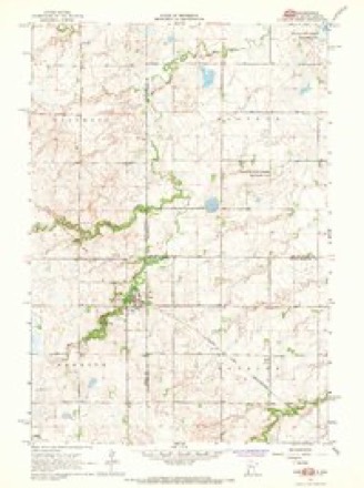
- 1967 USGS Gary quadrangle1:24000, 2 printings
- 1985 USGS Clear Lake quadrangle1:100000, 2 printings
Fires near this place
14 since 2000Regional context, not property-specific evidence. The federal wildfire occurrence database lists 14 fires within 5 miles of Gary between 2000 and 2020, burning about 134 acres in total. None started naturally. None was recorded as arson. Distance is straight-line from the map coordinates, so a fire counted here may appear on a neighbouring settlement's page as well.
| Reported cause | Fires |
|---|---|
| Missing data/not specified/undetermined | 10 |
| Debris and open burning | 2 |
| Railroad operations and maintenance | 1 |
| Smoking | 1 |
The most recent of them, most recent first, with the day each was reported and the service that recorded it.
| Date | Cause | Size | Reported by | Name on the report |
|---|---|---|---|---|
| 23 August 2012 | Missing data/not specified/undetermined | 15 acres | South Dakota Wildland Fire Suppression | GARY FIRE DEPT |
| 21 August 2012 | Missing data/not specified/undetermined | 30 acres | South Dakota Wildland Fire Suppression | CRAIG MAGEDANZ |
| 28 July 2012 | Missing data/not specified/undetermined | 1.0 acres | South Dakota Wildland Fire Suppression | GARY |
| 25 June 2000 | Debris and open burning | 6.0 acres | Gary Volunteer Fire Department | HOVEY |
| 14 June 2019 | Missing data/not specified/undetermined | under an acre | South Dakota Wildland Fire Suppression | EDGEWATER FIRE |
| 15 May 2018 | Missing data/not specified/undetermined | 5.0 acres | Minnesota Department of Natural Resources | not named |
| 4 April 2000 | Smoking | 7.0 acres | Gary Volunteer Fire Department | NEWTSON |
| 25 April 2000 | Debris and open burning | 1.0 acres | Gary Volunteer Fire Department | FAIRCHILD |
Settlements close enough to share some of these fires:
Storms near this place
22 since 1998Regional context, not property-specific evidence. The National Weather Service names Gary in 22 storm reports between 1998 and 2025: 12 hail, 6 thunderstorm wind, 4 tornado. The reports record 1 injury. Each account below is quoted exactly as the forecast office filed it, from the NOAA Storm Events Database, and each date opens the federal record of that event.
| When | Event | Place named | Harm | What the report says |
|---|---|---|---|---|
| May 2022 | Tornado (EF2) | Gary | 1 hurt | One mile south of Gary, SD a farm sustained significant tornado damage. The home on the property lost the entire roof, along with most of the external walls on the main floor of the house. Only a portion of the internal walls remained standing. The resident home|at the time was able to make it to the basement, however did sustain minor injuries when a refrigerator from the main floor fell down through the ceiling. The attached garage was completely blown off the foundation, and the pickup in the garage was pushed at least 6 feet from where it was originally parked. Nearby outbuildings sustained roof damage, including a hole in one roof that was likely caused from flying debris. The tornado continued to track north northeast of the farm into an open corn stubble field. Rotation was noted in the stubble. The debris track was spread across the field with large pieces of wood and other construction materials pierced vertically into the ground. Further to the north northeast a semi was turned 180 degrees and flipped|on its side. The debris path continued across 180th Street and was last noted in a tree grove approximately 0.3 miles from the residence. The resident also noted that the family dog was seen being swept out of the house during the tornado, but was later |found safe with only minor injuries after walking to a neighbor's farm about one mile away. |
| June 2025 | Tornado (EF0) | Gary | - | A brief, short lived tornado touched down in an open field. |
| May 2023 | Hail | Gary | - | A trained spotter 6 miles north of Gary reported that the combination of wind and hail damaged beans crops and the plants in his garden. |
| May 2022 | Thunderstorm Wind | Gary | - | Thunderstorm wind gusts, measuring 102 mph by a personal weather station, also downed trees in the area. |
| May 2022 | Thunderstorm Wind | Gary | - | Wind estimated at 70 mph brought down three large spruce trees, and a large limb fell onto a vehicle. Some light farm equipment was knocked over, and a steel garden shed was blown into the street. |
| May 2022 | Thunderstorm Wind | Gary | - | A few branches were downed by severe winds. |
| May 2022 | Tornado (EF1) | Gary | - | A residence 2 miles northwest of Gary, SD had a barn roof damaged and a horse trailer rolled multiple times. A second residence, about 3 miles northwest of Gary, had a track of damage through their farm yard. An ash tree snapped at the trunk and fell on to the corner of the house. A single stall garage, which was bolted to the foundation, was lifted off the foundation and overturned. The vehicle in the garage was not damaged. A second garage to the north lost two thirds of its roof panels. Another machine shed|had a portion of the south wall pushed in. All debris from buildings was lofted to the northeast. A mostly empty grain bin was also ripped from the foundation and tossed across 485th Ave and into the neighboring field, coming to rest about 200 yards to|the northeast. Residents were without commercial power for two days. |
| May 2022 | Thunderstorm Wind | Gary | - | Estimated 70 mph winds damaged trees. |
| August 2014 | Tornado (EF0) | Gary | - | The tornado touched down on the north shore of Lake Cochrane and traveled up to an eighth of a mile to the northeast. The tornado caused minor damage overall and was mainly concentrated in an area along Edgewater drive at Lake Cochrane. The damage was mainly to docks, boats, boat lifts, canopies, and shoreline shrubbery along with some minor tree damage. Two homes also suffered damage with one home having the western portion of the steel roof rolled back and tossed a small distance. |
| June 2025 | Hail | Gary | - | no account filed |
| September 2025 | Thunderstorm Wind | Gary | - | no account filed |
| June 2024 | Hail | Gary | - | no account filed |
| August 2024 | Thunderstorm Wind | Gary | - | no account filed |
| May 2022 | Hail | Gary | - | no account filed |
| June 2014 | Hail | Gary | - | no account filed |
| August 2012 | Hail | Gary | - | no account filed |
| May 2008 | Hail | Gary | - | no account filed |
| May 2008 | Hail | Gary | - | no account filed |
| May 2008 | Hail | Gary | - | no account filed |
| July 2003 | Hail | Gary | - | no account filed |
| September 2001 | Hail | Gary | - | no account filed |
| May 1998 | Hail | Gary | - | no account filed |
Nearest settlements
The eight closest, with where each one stands in the county. Distances are straight-line, computed from the Geographic Names Information System coordinates.
| Map | Place | Distance | Sheets |
|---|---|---|---|
| Moritz | 6.3 miles | 8 | |
| Clear Lake | 12.4 miles | 8 | |
| Brandt | 12.6 miles | 8 | |
| Altamont | 12.8 miles | 8 | |
| Tunerville | 13.7 miles | 8 | |
| Astoria | 16.9 miles | 8 | |
| Toronto | 18.1 miles | 8 | |
| Bemis | 21.0 miles | 8 |
Elsewhere
Matched on this settlement's Geographic Names Information System number rather than its name, so it cannot be a different place of the same name in another state.
| Wikipedia article on Gary | An encyclopaedic summary. Its text is share-alike, so it is linked here rather than copied. |
| Wikidata item Q2324669 | The structured record the population and elevation above come from. Public domain (CC0). |
Provenance
This settlement is recorded in the Geographic Names Information System as feature 1265643. The sheet list is computed by point-in-boundary test against the United States Geological Survey's historical topographic inventory. Both are works of the United States government and carry no copyright under 17 U.S.C. 105.
Wildfire. Short, Karen C. 2022. Spatial wildfire occurrence data for the United States, 1992-2020 [FPA_FOD_20221014]. 6th Edition. Fort Collins, CO: Forest Service Research Data Archive. https://doi.org/10.2737/RDS-2013-0009.6 Collected with United States Government funding and usable without additional permissions or fees.
Storms. NOAA National Centers for Environmental Information, Storm Events Database https://www.ncei.noaa.gov/stormevents/ A work of the United States government, no copyright under 17 U.S.C. 105. Narratives are quoted verbatim from the National Weather Service report and are not edited or summarised.