 Block
Lennox, South Dakota
10 topographic sheets cover this place, the earliest surveyed in 1897 and the latest in 1985. It stands in Lennox City. It lies in ZIP code area 57039. The Survey maps it on the Lennox quadrangle. 2,423 people lived here at the 2020 count. It stands 1,345 feet above sea level.
On record in Lennox
Buildings and businesses the archive holds for this place. Each opens its own page, with the source record it came from.
On the National Register 1 record
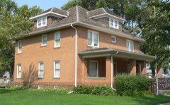 Harney Hospitallisted 1984
Population over time
2 figuresLennox grew from 2,111 to 2,423 between 2010 and 2020. These are the recorded population figures Wikidata holds for this place, reached through the Geographic Names Information System number this page is keyed on rather than by name, so they belong to this place and not to another of the same name. Most are census counts, but not all are: an early figure may be a founding or settlement estimate, and an estimate published within five years of a census is left out. The change column is computed, and is left blank where more than 20 years separate a figure from the one before it, because a gap that long is not a change between two counts.
| Year | People | Change |
|---|---|---|
| 2010 | 2,111 | |
| 2020 | 2,423 | +312 (+15%) |
Topographic sheets covering this place
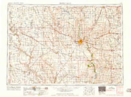
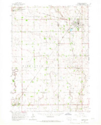
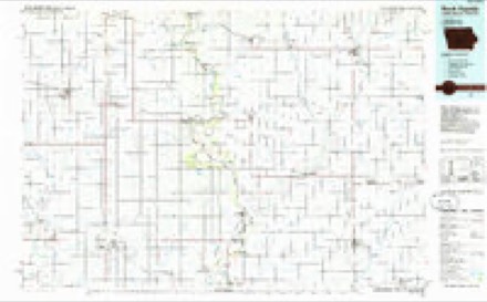
6 surveys from 10 printed sheetsMatched by testing this settlement's coordinate against the published boundary of every sheet in the United States Geological Survey's historical collection. Each opens the scanned sheet at the Survey.
- 1897 USGS Canton quadrangle1:125000
- 1900 USGS Canton quadrangle1:125000, 2 printings
- 1955 USGS Sioux Falls quadrangle1:250000, 3 printings
- 1958 USGS Sioux Falls quadrangle1:250000
- 1964 USGS Lennox quadrangle1:24000
- 1985 USGS Rock Rapids quadrangle1:100000, 2 printings
Fires near this place
25 since 1999Regional context, not property-specific evidence. The federal wildfire occurrence database lists 25 fires within 5 miles of Lennox between 1999 and 2020, burning about 218 acres in total. 1 started naturally. 1 was recorded as arson. Distance is straight-line from the map coordinates, so a fire counted here may appear on a neighbouring settlement's page as well.
| Reported cause | Fires |
|---|---|
| Debris and open burning | 13 |
| Missing data/not specified/undetermined | 8 |
| Smoking | 1 |
| Equipment and vehicle use | 1 |
| Natural | 1 |
| Arson/incendiarism | 1 |
The most recent of them, most recent first, with the day each was reported and the service that recorded it.
| Date | Cause | Size | Reported by | Name on the report |
|---|---|---|---|---|
| 1 September 2012 | Missing data/not specified/undetermined | under an acre | South Dakota Wildland Fire Suppression | MM 57 |
| 17 August 1999 | Debris and open burning | 10 acres | Parker Volunteer Fire Department | FREEZE |
| 6 July 2002 | Debris and open burning | under an acre | Tea Volunteer Fire Department | DITCH FIRE |
| 24 July 2016 | Missing data/not specified/undetermined | under an acre | South Dakota Wildland Fire Suppression | 282 |
| 16 July 2017 | Missing data/not specified/undetermined | under an acre | South Dakota Wildland Fire Suppression | HIGWAY GRASS FIRE |
| 14 July 2001 | Debris and open burning | 1.5 acres | Worthing Volunteer Fire Department | BRUNS |
| 1 June 2002 | Natural | 7.0 acres | Chancellor Volunteer Fire Department | KRUMMINGA |
| 5 May 2004 | Debris and open burning | under an acre | South Dakota Wildland Fire Suppression | not named |
Settlements close enough to share some of these fires:
Mines and quarries near this place
1 within 5 milesRegional context, not property-specific evidence. The federal mineral resources record lists 1 working within 5 miles of Lennox: 1 producer. All of them still produce. What was taken out: Sand and Gravel, Construction. Distance is straight-line from the map coordinates, so a quarry counted here may appear on a neighbouring settlement's page as well.
| Where | Site | Commodity | Status | Recorded |
|---|---|---|---|---|
| Neeman Pit | Sand and Gravel, Construction | Producer |
Storms near this place
43 since 1996Regional context, not property-specific evidence. The National Weather Service names Lennox in 43 storm reports between 1996 and 2021: 15 hail, 15 thunderstorm wind, 9 tornado, 3 flash flood. No death or injury is recorded in these reports. Each account below is quoted exactly as the forecast office filed it, from the NOAA Storm Events Database, and each date opens the federal record of that event.
| When | Event | Place named | Harm | What the report says |
|---|---|---|---|---|
| August 2021 | Thunderstorm Wind | Lennox | $3,000,000 | Most of the rubber roof liner on the section of Lennox High School with the band and shop classrooms was removed by thunderstorm winds. Interior ceilings and equipment incurred water damage. Property damage costs are a rough estimate. |
| July 2001 | Tornado (F1) | Lennox | $400,000 | A tornado damaged homes, public buildings, trees, and power lines. The American Legion building had its entire front facade ripped off, and its windows shattered. Several vehicles near the building sustained major damage from flying debris, and one was lifted and dropped partly onto another vehicle. Damage to homes included holes in permanent siding, several roofs heavily damaged, windows broken, fences blown down, garages damaged including at least one totally destroyed. Damage to public buildings included the pump house at the water tower being destroyed, the roof at the water plant was damaged, flag poles next to the ambulance building were broken, and an overhead door at the fire station was torn off. A fire truck at the fire station was damaged, and the station's window air conditioner was blown out along with some ceiling tiles inside. Power was lost to much of the city for at least an hour and a half because of the downed power lines. |
| July 2010 | Flash Flood | Lennox | $100,000 | Heavy rain in excess of four inches caused flash flooding of numerous roads, fields, low areas, homes, and businesses. The community of Shindler was one of the harder hit communities with homes and businesses flooded. Roads flooded included South Dakota Highway 11. Some gravel roads were washed out. |
| August 2021 | Tornado (EF1) | Lennox | $75,000 | Based on Sentinel satellite imagery, the tornado spun up in Turner County around 2 miles west southwest of Lennox in a field southwest of the intersection of 464th Avenue and 279th Street. The tornado tracked east-northeast for around one-half mile and crossed into Lincoln County just south of the intersection of 279th Street and 464th Avenue. After another half mile, the tornado uprooted seven large cottonwood trees and damaged numerous others at the Lenkota Country Club. The tornado continued into the western portions of Lennox north of the city park, with a majority of damage to large trees between 4th and 5th Avenue as the path turned more eastward and eventually a bit southeastward. The most significant damage occurred as the tornado approached State Highway 17, with a trampoline deposited high in a gnarled tree along South Cherry Street, and the complete destruction of a shed just east of Highway 17. The tornado lifted about a quarter mile east of Highway 17, just east of Lennox. Areas south of the path experienced strong rear-flank winds. While in Turner County, the tornado was rated EFU, while in Lincoln County it was rated EF1. The average path width for the tornado was 100 yards. Property damage costs are a rough estimate. |
| September 2019 | Thunderstorm Wind | Lennox | $50,000 | An extension of the path of wind damage from Turner County, winds from 70 to 80 mph continued to produce damage to trees and farm outbuildings until around 2 miles south of Tea. Most of the damage to structures consisted of removed siding and roof panels. |
| August 2021 | Thunderstorm Wind | Lennox | $30,000 | One shed was completely destroyed, and two were left with damaged doors, roofs and east facing walls when strong thunderstorm wind gusts plowed through a business on the south edge of Lennox. Property damage costs are a rough estimate. |
| August 2021 | Thunderstorm Wind | Lennox | $15,000 | The west facing roof was removed from a metal outbuilding by strong thunderstorm wind gusts. Property damage costs are a rough estimate. |
| May 2004 | Thunderstorm Wind | Lennox | $10,000 | Thunderstorm winds destroyed a machine shed, and overturned a boat and trailer. |
| July 2019 | Thunderstorm Wind | Lennox | $5,000 | A tree fell on a power line in Lennox, cutting off service to more than 660 customers for several hours. |
| May 2004 | Tornado (F0) | Lennox | $1,000 | A tornado destroyed a small shed. |
| August 2021 | Thunderstorm Wind | Lennox | - | A narrow path of crop damage, possibly related to a miso vortex within a broader wind field, was identified using Sentinel satellite imagery. |
| August 2021 | Thunderstorm Wind | Lennox | - | Thunderstorms winds uprooted several pine trees in a row at the Lennox Cemetery. |
| August 2021 | Thunderstorm Wind | Lennox | - | Several large trees trunks were snapped in the city park. |
| August 2021 | Thunderstorm Wind | Lennox | - | Several trees had large limbs of 3 to 6 inch diameter broken off by thunderstorm winds. A flag pole was bent. |
| August 2021 | Tornado (EFU) | Lennox | - | Based on Sentinel satellite imagery and confirmed with ground survey, a brief tornado spun up around 2 miles east of Lennox, just west of the Mount Olivet Cemetery. The tornado tracked east-northeast for less than one mile across open fields and wetlands, and dissipated 3 miles east-northeast of Lennox near the intersection of 278th Street and 468th Avenue. The average path width was 20 yards. |
| August 2021 | Thunderstorm Wind | Lennox | - | Thunderstorm wind gust was measured by a personal weather station. |
| June 2019 | Flood | Lennox | - | A continuation of flooding from May, the Vermillion River near Davis (gage site DVSS2) started at 2.60 feet above flood stage on June 1. Many rural roads near the river were inundated, with continued flooding of significant amounts of agricultural land. |
| September 2018 | Flash Flood | Lennox | - | Widespread flash flooding, with already around 5 inches of rainfall in the past 24 hours. |
| September 2018 | Flash Flood | Lennox | - | Water over numerous roads in western Lincoln County. While most roads are still passable, water is several inches deep on roads east of Lennox. |
| May 2004 | Tornado (F0) | Lennox | - | A brief tornado caused no reported damage. |
| July 2003 | Thunderstorm Wind | Lennox | - | Thunderstorm winds caused widespread tree damage, including several trees blown down. One falling tree damaged a playground fence. |
| June 2003 | Tornado (F0) | Lennox | - | A tornado caused no reported damage before crossing from Lincoln County into Turner County. |
| June 2003 | Tornado (F0) | Lennox | - | A weak tornado tracked across farmland. |
| June 2003 | Tornado (F1) | Lennox | - | A tornado damaged farm structures. |
| June 2003 | Tornado (F0) | Lennox | - | A weak tornado tracked across farmland. |
| June 2003 | Thunderstorm Wind | Lennox | - | Thunderstorm winds caused tree damage, including several large limbs and branches blown down. Power lines were blown down. resulting in a power outage. |
| July 2000 | Thunderstorm Wind | Lennox | - | Thunderstorm winds caused tree damage, including numerous branches down. |
| June 2017 | Hail | Lennox | - | no account filed |
| May 2007 | Hail | Lennox | - | no account filed |
| April 2006 | Hail | Lennox | - | no account filed |
| June 2006 | Hail | Lennox | - | no account filed |
| June 2006 | Thunderstorm Wind | Lennox | - | no account filed |
| July 2005 | Hail | Lennox | - | no account filed |
| March 2004 | Hail | Lennox | - | no account filed |
| May 2004 | Hail | Lennox | - | no account filed |
| July 2004 | Hail | Lennox | - | no account filed |
| July 2003 | Hail | Lennox | - | no account filed |
| June 2003 | Hail | Lennox | - | no account filed |
| June 2003 | Hail | Lennox | - | no account filed |
| June 2003 | Hail | Lennox | - | no account filed |
| October 2002 | Hail | Lennox | - | no account filed |
| July 2000 | Hail | Lennox | - | no account filed |
| July 1996 | Hail | Lennox | - | no account filed |
Nearest settlements
The eight closest, with where each one stands in the county. Distances are straight-line, computed from the Geographic Names Information System coordinates.
| Map | Place | Distance | Sheets |
|---|---|---|---|
| Naomi | 2.4 miles | 10 | |
| Tea | 7.0 miles | 11 | |
| Worthing | 7.1 miles | 10 | |
| Harrisburg | 11.6 miles | 10 | |
| Shindler | 15.4 miles | 10 | |
| Canton | 16.3 miles | 11 | |
| Moe | 20.3 miles | 11 | |
| Norway Center | 21.0 miles | 11 |
Elsewhere
Matched on this settlement's Geographic Names Information System number rather than its name, so it cannot be a different place of the same name in another state.
| Wikipedia article on Lennox | An encyclopaedic summary. Its text is share-alike, so it is linked here rather than copied. |
| Wikidata item Q3243599 | The structured record the population and elevation above come from. Public domain (CC0). |
Provenance
This settlement is recorded in the Geographic Names Information System as feature 1256091. The sheet list is computed by point-in-boundary test against the United States Geological Survey's historical topographic inventory. Both are works of the United States government and carry no copyright under 17 U.S.C. 105.
Wildfire. Short, Karen C. 2022. Spatial wildfire occurrence data for the United States, 1992-2020 [FPA_FOD_20221014]. 6th Edition. Fort Collins, CO: Forest Service Research Data Archive. https://doi.org/10.2737/RDS-2013-0009.6 Collected with United States Government funding and usable without additional permissions or fees.
Mines and quarries. USGS Mineral Resources Data System (MRDS) https://mrdata.usgs.gov/mrds/ A work of the United States government, no copyright under 17 U.S.C. 105.
Storms. NOAA National Centers for Environmental Information, Storm Events Database https://www.ncei.noaa.gov/stormevents/ A work of the United States government, no copyright under 17 U.S.C. 105. Narratives are quoted verbatim from the National Weather Service report and are not edited or summarised.