 Block
Polo, South Dakota
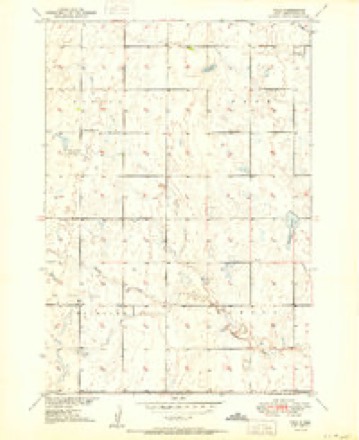
8 topographic sheets cover this place, the earliest surveyed in 1951 and the latest in 1985. It stands in the Northwest Hand unorganized territory. It lies in ZIP code area 57467. The Survey maps it on the Polo quadrangle.
Topographic sheets covering this place
4 surveys from 8 printed sheetsMatched by testing this settlement's coordinate against the published boundary of every sheet in the United States Geological Survey's historical collection. Each opens the scanned sheet at the Survey.
- 1951 USGS Polo quadrangle1:24000
- 1953 USGS Huron quadrangle1:250000, 3 printings
- 1954 USGS Huron quadrangle1:250000
- 1985 USGS Highmore quadrangle1:100000, 3 printings
Fires near this place
6 since 2000Regional context, not property-specific evidence. The federal wildfire occurrence database lists 6 fires within 5 miles of Polo between 2000 and 2014, burning about 1,332 acres in total. None started naturally. None was recorded as arson. Distance is straight-line from the map coordinates, so a fire counted here may appear on a neighbouring settlement's page as well.
| Reported cause | Fires |
|---|---|
| Debris and open burning | 4 |
| Missing data/not specified/undetermined | 1 |
| Equipment and vehicle use | 1 |
The most recent of them, most recent first, with the day each was reported and the service that recorded it.
| Date | Cause | Size | Reported by | Name on the report |
|---|---|---|---|---|
| 9 September 2003 | Missing data/not specified/undetermined | 640 acres | South Dakota Wildland Fire Suppression | DELMAR |
| 30 August 2014 | Equipment and vehicle use | 20 acres | South Dakota Wildland Fire Suppression | BRUEGGEMAN FIRE |
| 17 April 2001 | Debris and open burning | 75 acres | Orient Volunteer Fire Department | SCHLECHTER BROS. |
| 10 April 2006 | Debris and open burning | 60 acres | South Dakota Wildland Fire Suppression | not named |
| 22 February 2000 | Debris and open burning | 75 acres | Orient Volunteer Fire Department | BEILDLER BROS |
| 1 October 2008 | Debris and open burning | 462 acres | South Dakota Wildland Fire Suppression | not named |
Settlements close enough to share some of these fires:
Storms near this place
60 of 109 shownRegional context, not property-specific evidence. The National Weather Service names Polo in 109 storm reports between 1996 and 2025: 63 hail, 21 thunderstorm wind, 11 flood, 8 tornado. The reports record 1 death. Each account below is quoted exactly as the forecast office filed it, from the NOAA Storm Events Database, and each date opens the federal record of that event.
| When | Event | Place named | Harm | What the report says |
|---|---|---|---|---|
| August 2020 | Tornado (EF2) | Polo | 1 killed | The tornado initially touched down in the pasture land east of South Dakota Highway 45, roughly 0.8 miles south of 184th Street. It continued to track north for roughly 0.6 miles, damaging a tree grove and fence line. The track then turned west northwest and crossed South Dakota Highway 45, roughly 0.2 miles south of 184th street. A southbound RV pulling an enclosed trailer was struck. The trailer detached from the RV and the RV was lofted and rolled roughly 200 yards into a corn field on the west side of of South Dakota Highway 45. The driver was pronounced dead at the scene. The tornado track continued west northwest through the corn field for an estimated 0.4 miles. The tornado was at its peak width and intensity at this point. Corn was completely flattened in some areas with a distinct convergent pattern. As the tornado weakened and roped out the path took a southwest turn and persisted for roughly another 0.6 miles before coming to an end in the corn field. |
| April 2019 | Flood | Polo | $829,500 | no account filed |
| April 2023 | Flood | Polo | $150,000 | no account filed |
| June 2022 | Thunderstorm Wind | Polo | - | Five to six inch diameter tree branches were broken. |
| August 2021 | Thunderstorm Wind | Polo | - | Winds were estimated at 70 mph. |
| July 2020 | Thunderstorm Wind | Polo | - | Estimated sixty-five mph winds downed tree branches along with a few trees. |
| March 2019 | Flood | Polo | - | Snowmelt brought flooded roads with many of them damaged along with culverts throughout the county. A travel advisory was issued for all county roads. There was flooding of homes near/in the cities of Miller and Saint Lawrence along with other rural homes throughout the county. |
| July 2018 | Flash Flood | Polo | - | Rainfall from the night before along with additional rainfall from this storm brought more flash flooding to parts of northern Hand county. |
| July 2018 | Flash Flood | Polo | - | Extreme rainfall of eleven inches caused flash flooding with many roads under water. |
| July 2018 | Hail | Polo | - | Many acres of corn were stripped by quarter size hail. |
| June 2017 | Tornado (EF0) | Polo | - | Another brief tornado touched down southwest of Zell with no damage reported. Scattered debris was noted by the storm survey. |
| June 2017 | Tornado (EF1) | Polo | - | A tornado touched down southwest of Zell and snapped and uprooted trees around a farm. Several of the those trees fell onto a house that had two occupants. A roof was torn off of a barn and a machine shed was partially destroyed with debris thrown across a neighboring field. |
| June 2017 | Tornado (EF0) | Polo | - | A tornado touched down briefly in an open field. No damage was reported. |
| July 2017 | Thunderstorm Wind | Polo | - | A large metal shed had one wall and half of the roof destroyed by estimated one-hundred mph winds. |
| June 2015 | Flash Flood | Polo | - | Very heavy rains of 2 to 6 inches caused flooded creeks, fields, and roads. |
| June 2015 | Flood | Polo | - | Flooding of pasture and agricultural land, several creeks, along with a few roads continued after the earlier heavy rains subsided. |
| August 2015 | Hail | Polo | - | Large hail broke the windshield on a car driving on Highway 45. |
| August 2015 | Thunderstorm Wind | Polo | - | Seventy mph winds were estimated. |
| August 2015 | Thunderstorm Wind | Polo | - | Sixty mph winds were estimated. |
| August 2015 | Thunderstorm Wind | Polo | - | Sixty mph winds were estimated. |
| May 2014 | Flash Flood | Polo | - | Three to five inches of rain caused flooding of several sections of the roads near the intersection of Highways 26 and 45. |
| May 2014 | Flash Flood | Polo | - | Fields were under a large amount of standing water along with a few roads flooded. |
| May 2014 | Flash Flood | Polo | - | Heavy rainfall of 6.5 inches caused flash flooding of several roads. |
| August 2013 | Thunderstorm Wind | Polo | - | Eighty mph winds snapped off two large cottonwood trees. |
| June 2011 | Flood | Polo | - | Very heavy rains caused the flooding of several creeks throughout Hand county with many roads flooded and closed. Miller received extensive flooding with many pumps brought out to move the water. Sandbagging was also done around several homes. |
| May 2010 | Thunderstorm Wind | Polo | - | Seventy mph winds ripped some steel off an outbuilding and also took the deck off of the house. |
| June 2009 | Tornado (EF0) | Polo | - | A tornado touched down southeast of Polo in an open field. No damage occurred. |
| July 2008 | Tornado (EF0) | Polo | - | A tornado touched down briefly in open country northeast of Polo with no damage occurring. |
| August 2005 | Tornado (F0) | Polo | - | A tornado touched down briefly northwest of Polo with no damage reported. Path length and width were estimated. |
| August 2000 | Thunderstorm Wind | Polo | - | Seventy mph winds blew the roofs off of two barns and also downed many large tree branches. |
| June 1998 | Tornado (F0) | Polo | - | A small tornado touched down briefly northeast of Polo damaging a tree. Path length and width were estimated. |
| June 1998 | Thunderstorm Wind | Polo | - | Winds gusting to around 70 mph brought many large tree branches down. |
| August 2025 | Thunderstorm Wind | Polo | - | no account filed |
| May 2024 | Thunderstorm Wind | Polo | - | no account filed |
| May 2024 | Hail | Polo | - | no account filed |
| July 2024 | Thunderstorm Wind | Polo | - | no account filed |
| July 2023 | Hail | Polo | - | no account filed |
| July 2022 | Hail | Polo | - | no account filed |
| July 2022 | Thunderstorm Wind | Polo | - | no account filed |
| July 2022 | Thunderstorm Wind | Polo | - | no account filed |
| August 2021 | Thunderstorm Wind | Polo | - | no account filed |
| August 2020 | Hail | Polo | - | no account filed |
| June 2020 | Hail | Polo | - | no account filed |
| June 2019 | Flood | Polo | - | no account filed |
| August 2019 | Flood | Polo | - | no account filed |
| May 2019 | Flood | Polo | - | no account filed |
| July 2018 | Hail | Polo | - | no account filed |
| July 2018 | Hail | Polo | - | no account filed |
| July 2018 | Hail | Polo | - | no account filed |
| July 2018 | Hail | Polo | - | no account filed |
| July 2018 | Hail | Polo | - | no account filed |
| July 2018 | Hail | Polo | - | no account filed |
| July 2018 | Hail | Polo | - | no account filed |
| July 2018 | Hail | Polo | - | no account filed |
| September 2018 | Hail | Polo | - | no account filed |
| August 2018 | Hail | Polo | - | no account filed |
| August 2018 | Hail | Polo | - | no account filed |
| June 2017 | Hail | Polo | - | no account filed |
| June 2017 | Hail | Polo | - | no account filed |
| May 2016 | Hail | Polo | - | no account filed |
Nearest settlements
The eight closest, with where each one stands in the county. Distances are straight-line, computed from the Geographic Names Information System coordinates.
| Map | Place | Distance | Sheets |
|---|---|---|---|
| Florence (historical) | 8.8 miles | 9 | |
| Burdette | 17.2 miles | 8 | |
| Ree Heights | 18.6 miles | 9 | |
| Miller | 19.1 miles | 8 | |
| Saint Lawrence | 20.2 miles | 8 | |
| Vayland | 25.7 miles | 8 | |
| Miller Dale Colony | 26.2 miles | 7 | |
| Sweetland (historical) | 31.0 miles | 9 |
Provenance
This settlement is recorded in the Geographic Names Information System as feature 1257169. The sheet list is computed by point-in-boundary test against the United States Geological Survey's historical topographic inventory. Both are works of the United States government and carry no copyright under 17 U.S.C. 105.
Wildfire. Short, Karen C. 2022. Spatial wildfire occurrence data for the United States, 1992-2020 [FPA_FOD_20221014]. 6th Edition. Fort Collins, CO: Forest Service Research Data Archive. https://doi.org/10.2737/RDS-2013-0009.6 Collected with United States Government funding and usable without additional permissions or fees.
Storms. NOAA National Centers for Environmental Information, Storm Events Database https://www.ncei.noaa.gov/stormevents/ A work of the United States government, no copyright under 17 U.S.C. 105. Narratives are quoted verbatim from the National Weather Service report and are not edited or summarised.