 Block
Rapid City, South Dakota
19 topographic sheets cover this place, the earliest surveyed in 1893 and the latest in 1957. It stands in Rapid City City. It lies in ZIP code area 57701. It lies near Hangman Hill. The Survey maps it on the Rapid City East quadrangle. 74,703 people lived here at the 2020 count. It stands 3,232 feet above sea level.
On record in Rapid City
Buildings and businesses the archive holds for this place. Each opens its own page, with the source record it came from.
On the National Register 12 of 37 shown
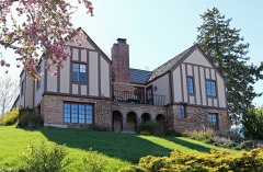 Black Hills Model Homelisted 2004
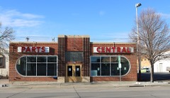 Casper Supply Company of SDlisted 2000
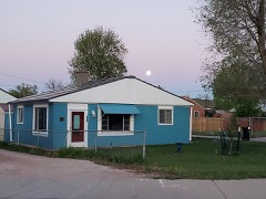 Cassidy Houselisted 1998
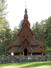 Chapel in the Hillslisted 2012
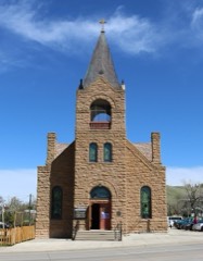 Church of the Immaculate Conceptionlisted 1975
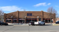 Dean Motor Companylisted 1995
 Dinosaur Parklisted 1990
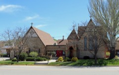 Emmanuel Episcopal Churchlisted 1975
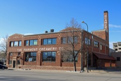 Fairmont Creamery Company Buildinglisted 2006
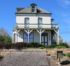 Feigel Houselisted 1997
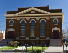 First Congregational Churchlisted 1984
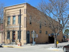 Gambrill Storage Buildinglisted 1984
Population over time
15 figuresRapid City grew from 939 to 74,703 between 1880 and 2020. These are the recorded population figures Wikidata holds for this place, reached through the Geographic Names Information System number this page is keyed on rather than by name, so they belong to this place and not to another of the same name. Most are census counts, but not all are: an early figure may be a founding or settlement estimate, and an estimate published within five years of a census is left out. The change column is computed, and is left blank where more than 20 years separate a figure from the one before it, because a gap that long is not a change between two counts.
| Year | People | Change |
|---|---|---|
| 1880 | 939 | |
| 1890 | 2,128 | +1,189 (+127%) |
| 1900 | 1,342 | -786 (-37%) |
| 1910 | 3,454 | +2,112 (+157%) |
| 1920 | 5,777 | +2,323 (+67%) |
| 1930 | 10,464 | +4,687 (+81%) |
| 1940 | 13,844 | +3,380 (+32%) |
| 1950 | 25,312 | +11,468 (+83%) |
| 1960 | 42,390 | +17,078 (+67%) |
| 1970 | 43,846 | +1,456 (+3%) |
| 1980 | 46,492 | +2,646 (+6%) |
| 1990 | 54,523 | +8,031 (+17%) |
| 2000 | 59,607 | +5,084 (+9%) |
| 2010 | 67,956 | +8,349 (+14%) |
| 2020 | 74,703 | +6,747 (+10%) |
Topographic sheets covering this place
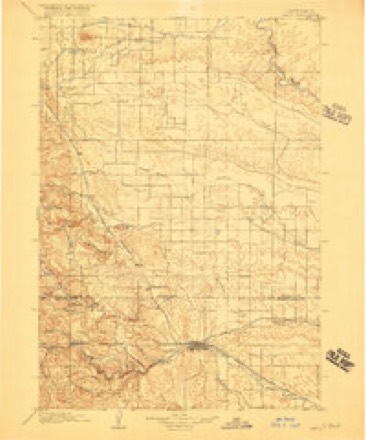
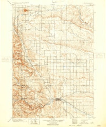
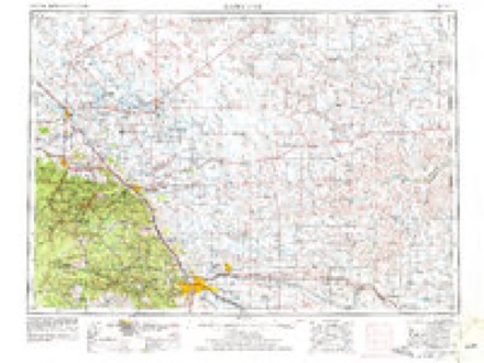
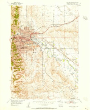
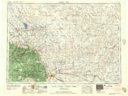
6 surveys from 19 printed sheetsMatched by testing this settlement's coordinate against the published boundary of every sheet in the United States Geological Survey's historical collection. Each opens the scanned sheet at the Survey.
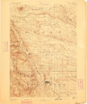
- 1893 USGS Rapid quadrangle1:125000, 2 printings
- 1898 USGS Rapid quadrangle1:125000, 2 printings
- 1903 USGS Rapid quadrangle1:125000, 4 printings
- 1953 USGS Rapid City quadrangle1:250000, 3 printings
- 1953 USGS Rapid City East quadrangle1:24000, 7 printings
- 1957 USGS Rapid City quadrangle1:250000
Fires near this place
269 since 1992Regional context, not property-specific evidence. The federal wildfire occurrence database lists 269 fires within 5 miles of Rapid City between 1992 and 2020, burning about 7,014 acres in total. 35 started naturally. 9 were recorded as arson. Distance is straight-line from the map coordinates, so a fire counted here may appear on a neighbouring settlement's page as well.
| Reported cause | Fires |
|---|---|
| Missing data/not specified/undetermined | 101 |
| Misuse of fire by a minor | 39 |
| Natural | 35 |
| Equipment and vehicle use | 33 |
| Fireworks | 16 |
| Debris and open burning | 16 |
| Smoking | 9 |
| Arson/incendiarism | 9 |
| Recreation and ceremony | 6 |
| Power generation/transmission/distribution | 3 |
| Other causes | 1 |
| Firearms and explosives use | 1 |
The most recent of them, most recent first, with the day each was reported and the service that recorded it.
| Date | Cause | Size | Reported by | Name on the report |
|---|---|---|---|---|
| 8 September 1998 | Equipment and vehicle use | 3,100 acres | Philip Volunteer Fire Department | VIALIANT |
| 7 September 2003 | Misuse of fire by a minor | under an acre | South Dakota Wildland Fire Suppression | not named |
| 6 September 2003 | Missing data/not specified/undetermined | under an acre | South Dakota Wildland Fire Suppression | not named |
| 5 September 2001 | Power generation/transmission/distribution | under an acre | South Dakota Wildland Fire Suppression | TRANSFORMER |
| 5 September 2001 | Misuse of fire by a minor | under an acre | Rapid City Fire Department | 01-3743 |
| 5 September 2001 | Equipment and vehicle use | under an acre | Rapid City Fire Department | 01-3735 |
| 5 September 1996 | Natural | under an acre | South Dakota Wildland Fire Suppression | SUN RIDGE |
| 4 September 2010 | Smoking | under an acre | South Dakota Wildland Fire Suppression | NEMO RD |
Settlements close enough to share some of these fires:
Mines and quarries near this place
10 of 17 shownRegional context, not property-specific evidence. The federal mineral resources record lists 17 workings within 5 miles of Rapid City: 13 producers, 2 past producers, 2 unknowns. 13 still produce. What was taken out: Stone, Crushed/Broken, Sand and Gravel, Construction, Limestone, Dimension, Gypsum-Anhydrite. Distance is straight-line from the map coordinates, so a quarry counted here may appear on a neighbouring settlement's page as well.
| Where | Site | Commodity | Status | Recorded |
|---|---|---|---|---|
| Hills Materials | Limestone, General | Producer | Limestone | |
| Rapid City Lime Kilns & Quarries | Calcium | Producer | ||
| South Dakota State Cement Plant | Limestone, General, Stone, Crushed/Broken | Producer | Limestone, Shale | |
| Haydite Pit | Clay | Producer | ||
| Light Aggregates Inc Kiln | Clay | Unknown | ||
| Dakota Lime & Brick Co Quarry | Limestone, Dimension | Unknown | ||
| Everist Limestone Quarry | Stone, Crushed/Broken, Limestone, Dimension | Producer | ||
| Gyp Pit | Gypsum-Anhydrite | Producer | ||
| Hills Materials Limestone Quarry | Limestone, Dimension, Stone, Crushed/Broken | Producer | ||
| Hoffman Pit | Sand and Gravel, Construction | Past Producer |
Storms near this place
60 of 620 shownRegional context, not property-specific evidence. The National Weather Service names Rapid City in 620 storm reports between 1993 and 2025: 469 hail, 103 thunderstorm wind, 17 flood, 13 flash flood. The reports record 5 injuries. Each account below is quoted exactly as the forecast office filed it, from the NOAA Storm Events Database, and each date opens the federal record of that event.
| When | Event | Place named | Harm | What the report says |
|---|---|---|---|---|
| August 2016 | Lightning | Rapid City | 1 hurt | A person was struck by lightning on Haines Avenue. |
| August 2016 | Lightning | Rapid City | 1 hurt | A person was struck by lightning at the Rushmore Crossing Shopping Center. |
| July 2016 | Thunderstorm Wind | Rapid City | 1 hurt | A tree fell on a car at the corner of New York Street and East Boulevard, injuring one person inside the car. |
| July 2003 | Lightning | Rapid City | 1 hurt | A 16 year old boy was struck by lightning in the parking lot of the Meadowbrook Golf Course. |
| August 1996 | Thunderstorm Wind | Rapid City | 1 hurt | no account filed |
| August 2013 | Hail | Rapid City | $12,000,000 | no account filed |
| August 2013 | Hail | Rapid City | $10,000,000 | Hail caused extensive damage to homes and vehicles on the west side of Rapid City. |
| August 2013 | Hail | Rapid City | $10,000,000 | Hail to the size of golf balls fell at the Rapid City National Weather Service office and across much of east Rapid City. |
| July 2013 | Hail | Rapid City | $8,000,000 | Large hail damaged automobiles and property in the area. |
| July 2013 | Hail | Rapid City | $5,000,000 | Large hail damaged vehicles and property in the area. |
| July 2013 | Hail | Rapid City | $2,000,000 | no account filed |
| June 2010 | Hail | Rapid City | $1,500,000 | no account filed |
| July 2002 | Thunderstorm Wind | Rapid City | $1,000,000 | no account filed |
| August 2011 | Hail | Rapid City | $750,000 | no account filed |
| June 2008 | Hail | Rapid City | $500,000 | Numerous automobiles were damaged by large hail in a hotel parking lot near Rushmore Mall. The hail also caused significant roof damage to Knollwood Heights Elementary and North Middle schools. |
| August 2007 | Hail | Rapid City | $500,000 | Hail to softball size broke windows and damaged roofs in the Black Gap subdivision. It also damaged vehicles and at least 70 motor homes at the Hart Ranch campgound. |
| June 2014 | Hail | Rapid City | $500,000 | no account filed |
| August 2011 | Hail | Rapid City | $500,000 | no account filed |
| August 2011 | Hail | Rapid City | $500,000 | no account filed |
| May 2013 | Flash Flood | Rapid City | $300,000 | Two to six inches of rain caused flash flooding in the Rapid City area. Rapid Creek overflowed its banks and flooded portions of the bike path and several roads. Flooding was reported along Sheridan Lake Road in the Spring Brook Acres area. Fifth Street was flooded between Minnesota Street and Catron Boulevard. Arrowhead and Meadowbrook golf courses were flooded and a cart bridge was destroyed. Water was three feet high against Meadowbrook Elementary School. A few structures along Rapid Creek were flooded near South Valley Drive. |
| July 2010 | Hail | Rapid City | $300,000 | Hail to the size of golf balls damaged automobiles and houses on the west side of Rapid City. |
| June 1997 | Flash Flood | Rapid City | $286,000 | no account filed |
| June 2015 | Hail | Rapid City | $250,000 | no account filed |
| August 2011 | Hail | Rapid City | $250,000 | no account filed |
| May 2019 | Flash Flood | Rapid City | $150,000 | Runoff from heavy rain on already saturated ground caused flash flooding on the north and east sides of Rapid City. At least three people had to be rescued after driving into flood waters, including one where a culvert washed out on Nike Road just east of Haines Avenue and north of Country Road. |
| July 2011 | Thunderstorm Wind | Rapid City | $150,000 | The combination of hail and wind damaged vehicles and shredded plants on the south side of Rapid City. |
| May 2013 | Hail | Rapid City | $150,000 | no account filed |
| July 2013 | Hail | Rapid City | $150,000 | no account filed |
| June 1997 | Flood | Rapid City | $147,000 | no account filed |
| June 2015 | Hail | Rapid City | $100,000 | Quarter to golf ball sized hail damaged automobiles. |
| September 2013 | Hail | Rapid City | $100,000 | Ping pong ball size hail caused some property damage on the northern edge of Rapid City. |
| May 2013 | Hail | Rapid City | $100,000 | no account filed |
| May 2013 | Hail | Rapid City | $100,000 | no account filed |
| June 2011 | Hail | Rapid City | $100,000 | no account filed |
| June 2010 | Hail | Rapid City | $100,000 | no account filed |
| May 2004 | Hail | Rapid City | $100,000 | no account filed |
| June 2000 | Hail | Rapid City | $100,000 | no account filed |
| May 2018 | Flash Flood | Rapid City | $50,000 | Slow moving thunderstorms moved over the Rapid City area in the late afternoon and dropped two to three inches of rain in about an hour. Runoff from the heavy rain flooded streets and low-lying areas. Rapid Creek quickly overflowed its banks near the fairgrounds. The heaviest rain fell over the Robbinsdale area, where the runoff filled a detention pond near Robbinsdale Park to a depth of 30 feet and tore up sections of asphalt on Fairlane Drive. Several vehicles were pushed by the rushing water and one vehicle ended up in the detention pond. The fire department had to perform several water rescues. |
| June 2015 | Lightning | Rapid City | $50,000 | Lightning struck an apartment building and started a fire, causing considerable damage. Time was estimated. |
| August 2007 | Hail | Rapid City | $50,000 | Hail damaged automobiles near the intersection of South Highway 16 and Catron Boulevard. |
| June 2000 | Thunderstorm Wind | Rapid City | $30,000 | Numerous large tree branches down. A few vehicles damaged by the fallen limbs. |
| May 2010 | Hail | Rapid City | $25,000 | no account filed |
| June 2016 | Lightning | Rapid City | $20,000 | Lightning struck the top of a pickup truck and started a fire in the cab. The bolt also struck the ground, causing pieces of asphalt to hit the truck. The driver was uninjured. |
| June 2011 | Hail | Rapid City | $20,000 | no account filed |
| August 2010 | Hail | Rapid City | $20,000 | no account filed |
| July 1997 | Thunderstorm Wind | Rapid City | $12,000 | Numerous tree limbs were blown down including some that were 12 inches in diameter. A building supply store received roof damage. Also, scattered power outages occurred. |
| August 2013 | Heavy Rain | Rapid City | $10,000 | Heavy rain caused minor flooding in north Rapid City. A car was washed into a ditch at the intersection of Maple Avenue and Disk Drive. Runoff flooded backyards and basements at the corner of Crestwood Drive and Racine Street. Rapid Creek rose to within a foot of its banks near the Central States Fairgrounds. The water quickly receded within 20 minutes at most locations. |
| August 2013 | Hail | Rapid City | $10,000 | Hail damaged a vehicle and shingles on the house. |
| July 2003 | Thunderstorm Wind | Rapid City | $10,000 | Numerous trees and power lines were blown down in Rapid City. |
| August 2007 | Hail | Rapid City | $10,000 | no account filed |
| June 2011 | Lightning | Rapid City | $6,000 | Lightning struck the National Weather Service office, damaging computers and equipment. |
| July 2019 | Thunderstorm Wind | Rapid City | $5,000 | A tree and large limbs fell in a backyard and on a car. |
| August 2011 | Hail | Rapid City | $5,000 | no account filed |
| May 1994 | Hail | Rapid City | $5,000 | no account filed |
| August 2007 | Hail | Rapid City | $2,000 | Two house windows were broken by large hail. |
| July 2001 | Thunderstorm Wind | Rapid City | $2,000 | Several power poles were blown down by thunderstorm winds. |
| July 2013 | Hail | Rapid City | $1,000 | Large hail cracked windows and stripped leaves off trees. |
| May 1993 | Hail | Rapid City | $500 | Hail from .5 to 1.5 inches in diameter was reported northwest through west of Rapid City and in the Johnson Siding area. |
| June 1996 | Hail | Rapid City | $500 | no account filed |
| May 1993 | Hail | Rapid City | $50 | no account filed |
Nearest settlements
The eight closest, with where each one stands in the county. Distances are straight-line, computed from the Geographic Names Information System coordinates.
| Map | Place | Distance | Sheets |
|---|---|---|---|
| Gossage Memorial | 1.2 miles | 16 | |
| Lakota Homes | 2.0 miles | 19 | |
| Sioux Village | 2.4 miles | 19 | |
| Wildwood Addition | 3.9 miles | 16 | |
| Arrowhead Estates | 3.9 miles | 16 | |
| Schaeferville | 4.4 miles | 16 | |
| Twilight Hills Addition | 4.5 miles | 19 | |
| Rapid Valley | 4.7 miles | 19 |
Elsewhere
Matched on this settlement's Geographic Names Information System number rather than its name, so it cannot be a different place of the same name in another state.
| Wikipedia article on Rapid City | An encyclopaedic summary. Its text is share-alike, so it is linked here rather than copied. |
| Wikidata item Q213325 | The structured record the population and elevation above come from. Public domain (CC0). |
Provenance
This settlement is recorded in the Geographic Names Information System as feature 1265333. The sheet list is computed by point-in-boundary test against the United States Geological Survey's historical topographic inventory. Both are works of the United States government and carry no copyright under 17 U.S.C. 105.
Wildfire. Short, Karen C. 2022. Spatial wildfire occurrence data for the United States, 1992-2020 [FPA_FOD_20221014]. 6th Edition. Fort Collins, CO: Forest Service Research Data Archive. https://doi.org/10.2737/RDS-2013-0009.6 Collected with United States Government funding and usable without additional permissions or fees.
Mines and quarries. USGS Mineral Resources Data System (MRDS) https://mrdata.usgs.gov/mrds/ A work of the United States government, no copyright under 17 U.S.C. 105.
Storms. NOAA National Centers for Environmental Information, Storm Events Database https://www.ncei.noaa.gov/stormevents/ A work of the United States government, no copyright under 17 U.S.C. 105. Narratives are quoted verbatim from the National Weather Service report and are not edited or summarised.