 Block
Slim Butte, South Dakota
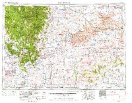
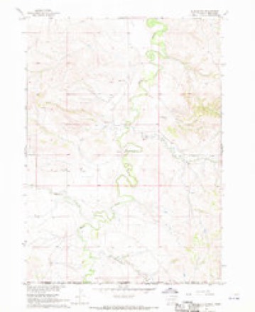
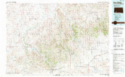
8 topographic sheets cover this place, the earliest surveyed in 1955 and the latest in 1985. It stands in the West Oglala Lakota unorganized territory. It lies in ZIP code area 57770. It stands on Janis Creek. The Survey maps it on the Slim Butte quadrangle.
Topographic sheets covering this place
3 surveys from 8 printed sheetsMatched by testing this settlement's coordinate against the published boundary of every sheet in the United States Geological Survey's historical collection. Each opens the scanned sheet at the Survey.
- 1955 USGS Hot Springs quadrangle1:250000, 5 printings
- 1967 USGS Slim Butte quadrangle1:24000
- 1985 USGS Pine Ridge quadrangle1:100000, 2 printings
Fires near this place
195 since 1992Regional context, not property-specific evidence. The federal wildfire occurrence database lists 195 fires within 5 miles of Slim Butte between 1992 and 2020, burning about 7,730 acres in total. 24 started naturally. 7 were recorded as arson. Distance is straight-line from the map coordinates, so a fire counted here may appear on a neighbouring settlement's page as well.
| Reported cause | Fires |
|---|---|
| Debris and open burning | 69 |
| Misuse of fire by a minor | 31 |
| Natural | 24 |
| Missing data/not specified/undetermined | 18 |
| Equipment and vehicle use | 16 |
| Fireworks | 10 |
| Smoking | 9 |
| Other causes | 8 |
| Arson/incendiarism | 7 |
| Recreation and ceremony | 2 |
| Power generation/transmission/distribution | 1 |
The most recent of them, most recent first, with the day each was reported and the service that recorded it.
| Date | Cause | Size | Reported by | Name on the report |
|---|---|---|---|---|
| 7 September 2003 | Debris and open burning | under an acre | Pine Ridge Agency | CHOPPER |
| 6 September 2002 | Debris and open burning | 1.0 acres | Pine Ridge Agency | COOKS |
| 5 September 2010 | Missing data/not specified/undetermined | 5.0 acres | Pine Ridge Agency | WEASEL BEAR |
| 5 September 1995 | Natural | 40 acres | Pine Ridge Agency | LIGHTNING |
| 3 September 2004 | Natural | 306 acres | Pine Ridge Agency | NORTHSOUTH |
| 3 September 1995 | Debris and open burning | 6.0 acres | Pine Ridge Agency | OLD FIELD |
| 3 September 1992 | Misuse of fire by a minor | 1.5 acres | Pine Ridge Agency | SLIMBUTTE |
| 29 September 2004 | Power generation/transmission/distribution | under an acre | Pine Ridge Agency | BROKENFUSE |
Storms near this place
25 since 1999Regional context, not property-specific evidence. The National Weather Service names Slim Butte in 25 storm reports between 1999 and 2025: 10 hail, 8 thunderstorm wind, 4 flood, 3 tornado. The reports record 1 death and 54 injuries. Each account below is quoted exactly as the forecast office filed it, from the NOAA Storm Events Database, and each date opens the federal record of that event.
| When | Event | Place named | Harm | What the report says |
|---|---|---|---|---|
| June 1999 | Tornado (F2) | Slim Butte | 1 killed, 54 hurt, $3,200,000 | This was the first of two tornadoes that swept through the town of Oglala. Spotters and law enforcement reported that the tornado went up and down several times. It remained on the ground just prior to hitting Oglala and then dissipated as it moved to the northeast. There was one fatality with 54 people receiving medical care for injuries. A church and three of its surrounding buildings were destroyed, 22 mobile homes destroyed, 30 to 50 buildings damaged and a lot of hail damage to roofs and vehicles. |
| March 2019 | Flood | Slim Butte | $500,000 | Moderate to major flooding occurred along the White River in Oglala Lakota County. Runoff from melting snow into the White River caused river ice to break up and jam. Additional flooding also occurred along White Clay Creek upstream and downstream from Oglala Dam due to the snowmelt. |
| July 2013 | Hail | Slim Butte | $5,000 | no account filed |
| July 2009 | Hail | Slim Butte | $1,000 | Golfball sized hail damaged an automobile. |
| June 2025 | Thunderstorm Wind | Slim Butte | - | Public reported estimated wind gust report. |
| August 2024 | Thunderstorm Wind | Slim Butte | - | The spotter estimated wind gusts at 60 mph. |
| August 2023 | Thunderstorm Wind | Slim Butte | - | The strong winds ripped the roof off two sheds. |
| June 2022 | Thunderstorm Wind | Slim Butte | - | Pea sized hail accompanied the storm. |
| May 2019 | Flood | Slim Butte | - | Runoff from heavy rain over northwestern Nebraska caused minor to moderate flooding of the White River from the Nebraska state line to the Badlands. |
| June 2019 | Flood | Slim Butte | - | Runoff from heavy rain over northwestern Nebraska caused minor flooding of the White River from the Nebraska-South Dakota state line to the Badlands. Both river gauges at the state line and near Oglala crested a little over flood stage in late May. |
| June 2016 | Thunderstorm Wind | Slim Butte | - | Wind gusts were estimated at 60 to 65 mph. |
| September 2016 | Thunderstorm Wind | Slim Butte | - | Wind gusts were estimated at 60 mph. |
| June 2015 | Flood | Slim Butte | - | Minor flooding occurred along the White River between the South Dakota-Nebraska state line and US Highway 18. |
| July 2013 | Thunderstorm Wind | Slim Butte | - | Wind gusts were estimated at 60 mph. |
| June 2001 | Tornado (F0) | Slim Butte | - | Brief tornado reported by public. |
| June 1999 | Tornado (F0) | Slim Butte | - | Tornado reported by State Trooper. |
| August 2023 | Thunderstorm Wind | Slim Butte | - | no account filed |
| August 2023 | Hail | Slim Butte | - | no account filed |
| June 2022 | Hail | Slim Butte | - | no account filed |
| August 2017 | Hail | Slim Butte | - | no account filed |
| June 2015 | Hail | Slim Butte | - | no account filed |
| June 2014 | Hail | Slim Butte | - | no account filed |
| July 2013 | Hail | Slim Butte | - | no account filed |
| May 2009 | Hail | Slim Butte | - | no account filed |
| June 1999 | Hail | Slim Butte | - | no account filed |
Nearest settlements
The eight closest, with where each one stands in the county. Distances are straight-line, computed from the Geographic Names Information System coordinates.
| Map | Place | Distance | Sheets |
|---|---|---|---|
| Oglala | 8.9 miles | 8 | |
| Pine Ridge | 14.4 miles | 9 | |
| Manderson | 21.6 miles | 8 | |
| Wounded Knee | 24.5 miles | 8 | |
| Denby | 25.6 miles | 8 | |
| Porcupine | 28.3 miles | 8 | |
| Evergreen | 29.3 miles | 8 | |
| Sharps Corner | 31.1 miles | 9 |
Elsewhere
Matched on this settlement's Geographic Names Information System number rather than its name, so it cannot be a different place of the same name in another state.
| Wikidata item Q141615820 | The structured record the population and elevation above come from. Public domain (CC0). |
Provenance
This settlement is recorded in the Geographic Names Information System as feature 1261067. The sheet list is computed by point-in-boundary test against the United States Geological Survey's historical topographic inventory. Both are works of the United States government and carry no copyright under 17 U.S.C. 105.
Wildfire. Short, Karen C. 2022. Spatial wildfire occurrence data for the United States, 1992-2020 [FPA_FOD_20221014]. 6th Edition. Fort Collins, CO: Forest Service Research Data Archive. https://doi.org/10.2737/RDS-2013-0009.6 Collected with United States Government funding and usable without additional permissions or fees.
Storms. NOAA National Centers for Environmental Information, Storm Events Database https://www.ncei.noaa.gov/stormevents/ A work of the United States government, no copyright under 17 U.S.C. 105. Narratives are quoted verbatim from the National Weather Service report and are not edited or summarised.