 Block
From the record
One of 13 National Register listings published here for Jerauld County · listed in 2023 · category: Building.
Sources: the National Register database, National Park Service
Listed on the National Register of Historic Places in 2023.
One of 13 National Register listings published here for Jerauld County · listed in 2023 · category: Building.
Sources: the National Register database, National Park Service
Regional context, not property-specific evidence. The federal wildfire occurrence database lists 17 fires within 5 miles of Zion Emmanuel Lutheran Church between 2002 and 2017, burning about 222 acres in total. 2 started naturally. None was recorded as arson. Distance is straight-line from the map coordinates, so a fire counted here may appear on a neighbouring settlement's page as well.
| Reported cause | Fires |
|---|---|
| Missing data/not specified/undetermined | 7 |
| Equipment and vehicle use | 6 |
| Natural | 2 |
| Power generation/transmission/distribution | 1 |
| Debris and open burning | 1 |
The most recent of them, most recent first, with the day each was reported and the service that recorded it.
| Date | Cause | Size | Reported by | Name on the report |
|---|---|---|---|---|
| 5 September 2005 | Natural | 20 acres | South Dakota Wildland Fire Suppression | not named |
| 3 September 2017 | Missing data/not specified/undetermined | under an acre | South Dakota Wildland Fire Suppression | TOM STARR |
| 6 July 2002 | Equipment and vehicle use | 100 acres | Wessington Springs Volunteer Fire Department | FEISTNER |
| 18 July 2015 | Equipment and vehicle use | 1.0 acres | South Dakota Wildland Fire Suppression | FIRESTEEL AUGER |
| 12 July 2005 | Equipment and vehicle use | 20 acres | South Dakota Wildland Fire Suppression | not named |
| 8 June 2017 | Equipment and vehicle use | under an acre | South Dakota Wildland Fire Suppression | JOHN OLINGER |
| 8 June 2015 | Equipment and vehicle use | under an acre | South Dakota Wildland Fire Suppression | JAKE CALL IN |
| 29 June 2006 | Equipment and vehicle use | 3.0 acres | South Dakota Wildland Fire Suppression | not named |
Regional context, not property-specific evidence. The federal mineral resources record lists 6 workings within 5 miles of Zion Emmanuel Lutheran Church: 6 past producers. None of them still produces. What was taken out: Sand and Gravel, Construction. Distance is straight-line from the map coordinates, so a quarry counted here may appear on a neighbouring settlement's page as well.
| Where | Site | Commodity | Status | Recorded |
|---|---|---|---|---|
| Gravel Pit | Sand and Gravel, Construction | Past Producer | ||
| Gravel Pit | Sand and Gravel, Construction | Past Producer | ||
| Gravel Pit | Sand and Gravel, Construction | Past Producer | ||
| Gravel Pit | Sand and Gravel, Construction | Past Producer | ||
| Gravel Pit | Sand and Gravel, Construction | Past Producer | ||
| Gravel Pit | Sand and Gravel, Construction | Past Producer |
Regional context, not property-specific evidence. The National Weather Service names Lane, the town this property stands in, in 29 storm reports between 2000 and 2025: 15 thunderstorm wind, 12 hail, 2 tornado. The reports record 2 injuries. Each account below is quoted exactly as the forecast office filed it, from the NOAA Storm Events Database, and each date opens the federal record of that event.
| When | Event | Place named | Harm | What the report says |
|---|---|---|---|---|
| June 2014 | Tornado (EF4) | Lane | 2 hurt, $300,000 | A tornado severely damaged two family farms, including destroying a farmhouse as the family took shelter in their basement. A couple in the house suffered minor injuries.The tornado also damaged trees, power poles, and power lines; and caused an unknown amount of crop damage. The tornado crossed briefly into Beadle County before lifting. |
| June 2003 | Tornado (F1) | Lane | $10,000 | A tornado destroyed trees and crops before crossing the county line from Jerauld into Sanborn County. |
| July 2025 | Thunderstorm Wind | Lane | - | A camper was blown over by thunderstorm wind gusts with several trees knocked down onto powerlines. |
| July 2025 | Thunderstorm Wind | Lane | - | An outbuilding and hoop barn were significantly damaged by thunderstorm winds. |
| July 2025 | Thunderstorm Wind | Lane | - | An extended period of damaging thunderstorm winds was measured by a Road Weather Information System sensor near Lane. The first severe wind gust of 62 mph occurred at 1344 CST, with a peak wind of 81 mph at 1348 CST. |
| August 2025 | Thunderstorm Wind | Lane | - | Thunderstorm wind gusts were measured by a Road Weather Information System sensor 1 mile west of Lane. |
| August 2025 | Thunderstorm Wind | Lane | - | An extended period of thunderstorm severe wind gusts was measured by a Road Weather Information System sensor 1 mile west of Lane. |
| July 2024 | Thunderstorm Wind | Lane | - | Thunderstorm wind gusts peaked at 62 mph at 202 am CST at the South Dakota Road Weather Information System site near Lane. |
| June 2022 | Thunderstorm Wind | Lane | - | A thunderstorm wind gust of 64 mph was measured by South Dakota Road Weather Information System site SD603 1 mile west of Lane. |
| June 2022 | Thunderstorm Wind | Lane | - | A thunderstorm wind gust of 75 mph was measured by South Dakota Road Weather Information System site SD603 1 mile west of Lane. |
| August 2022 | Thunderstorm Wind | Lane | - | A thunderstorm wind gust of 79 mph was measured by South Dakota Road Weather Information System site SD603 1 mile west of Lane. Crop damage is an estimate from insured losses. Information provided by the United States Department of Agriculture. |
| May 2022 | Thunderstorm Wind | Lane | - | A thunderstorm wind gust of 75 mph was measured by South Dakota Road Weather Information System site SD603 1 mile west of Lane. |
| May 2022 | Thunderstorm Wind | Lane | - | A thunderstorm wind gust of 58 mph was measured by the South Dakota Road Weather Information System site SD603 1 mile west of Lane. |
| July 2022 | Thunderstorm Wind | Lane | - | An extended period of thunderstorm wind gusts of 58 mph or greater was measured by South Dakota Road Weather Information System site SD603 1 mile west of Lane. A peak wind gust of 70 mph occurred at 1330CST. |
| August 2022 | Thunderstorm Wind | Lane | - | Ceiling panels were ripped off a porch by thunderstorm winds. |
| August 2020 | Hail | Lane | - | Hail was mostly quarter sized, with a few as large as a ping-pong ball. No strong winds occurred with the hail. |
| June 2017 | Hail | Lane | - | Also 50 to 55 mph winds. |
| July 2015 | Hail | Lane | - | Large hail damaged a few vehicles and caused an unknown amount of crop damage. |
| July 2011 | Thunderstorm Wind | Lane | - | Thunderstorm winds caused tree damage, including numerous branches blown down. |
| July 2009 | Hail | Lane | - | Large hail severely damaged corn and soybean crops. The amount of crop damage was not known. |
| July 2023 | Hail | Lane | - | no account filed |
| August 2015 | Hail | Lane | - | no account filed |
| July 2015 | Hail | Lane | - | no account filed |
| June 2014 | Hail | Lane | - | no account filed |
| July 2011 | Hail | Lane | - | no account filed |
| June 2009 | Hail | Lane | - | no account filed |
| May 2007 | Hail | Lane | - | no account filed |
| September 2006 | Hail | Lane | - | no account filed |
| July 2000 | Thunderstorm Wind | Lane | - | no account filed |
No historic map-sheet match is published for this property yet. That does not mean no map exists. This record needs a coordinate-quality review before it can be joined to a sheet boundary. Browse the county's mapped places while that work is pending.
Other National Register properties close enough to walk or drive between, ordered by distance from this one. Both positions come from the same geocoding pass that matched these properties to their map sheets.
| Photograph | Property | Distance | Listed |
|---|---|---|---|
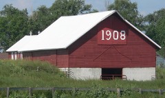 | L.P. Nielson Barn | 4.4 miles | 2004 |
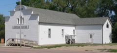 | Wessington Springs Opera House | 6.7 miles | 1976 |
 | Jerauld County Courthouse | 7.2 miles | 1993 |
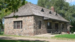 | Municipal Field House | 7.3 miles | 2000 |
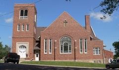 | Methodist Episcopal Church of Wessington Springs | 7.3 miles | 1999 |
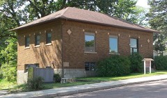 | Wessington Springs Carnegie Library | 7.3 miles | 1999 |
| National Archives record | The nomination case file for reference 100009483 in Record Group 79. |
| Jerauld County | All 13 listed properties in this county. |