 Block
From the record
One of 7 National Register listings published here for Brule County · listed in 2015 · category: Object.
Sources: the National Register database, National Park Service
Listed on the National Register of Historic Places in 2015.
One of 7 National Register listings published here for Brule County · listed in 2015 · category: Object.
Sources: the National Register database, National Park Service
Regional context, not property-specific evidence. The federal wildfire occurrence database lists 38 fires within 5 miles of Chamberlain Rest Stop Tipi between 2010 and 2020, burning about 932 acres in total. None started naturally. None was recorded as arson. Distance is straight-line from the map coordinates, so a fire counted here may appear on a neighbouring settlement's page as well.
| Reported cause | Fires |
|---|---|
| Missing data/not specified/undetermined | 33 |
| Equipment and vehicle use | 3 |
| Fireworks | 1 |
| Debris and open burning | 1 |
The most recent of them, most recent first, with the day each was reported and the service that recorded it.
| Date | Cause | Size | Reported by | Name on the report |
|---|---|---|---|---|
| 5 September 2012 | Missing data/not specified/undetermined | 1.0 acres | South Dakota Wildland Fire Suppression | RR FIRE |
| 5 September 2011 | Missing data/not specified/undetermined | under an acre | South Dakota Wildland Fire Suppression | FELTMAN |
| 4 September 2010 | Missing data/not specified/undetermined | 1.0 acres | South Dakota Wildland Fire Suppression | REST AREA FIRE |
| 4 September 2010 | Missing data/not specified/undetermined | 1.0 acres | South Dakota Wildland Fire Suppression | I-90 |
| 25 September 2013 | Missing data/not specified/undetermined | 1.0 acres | Brule County | PALMER |
| 21 September 2010 | Missing data/not specified/undetermined | 1.0 acres | South Dakota Wildland Fire Suppression | TURKEY BUZZARD |
| 10 September 2012 | Missing data/not specified/undetermined | 670 acres | South Dakota Wildland Fire Suppression | MAYER |
| 3 August 2010 | Missing data/not specified/undetermined | under an acre | South Dakota Wildland Fire Suppression | RAILROAD |
Regional context, not property-specific evidence. The federal mineral resources record lists 5 workings within 5 miles of Chamberlain Rest Stop Tipi: 4 past producers, 1 unknown. None of them still produces. What was taken out: Sand and Gravel, Construction, Manganese. Distance is straight-line from the map coordinates, so a quarry counted here may appear on a neighbouring settlement's page as well.
| Where | Site | Commodity | Status | Recorded |
|---|---|---|---|---|
| Chamberlain Manganese District | Manganese | Unknown | ||
| Glaus Pit | Sand and Gravel, Construction | Past Producer | ||
| Gravel Pit | Sand and Gravel, Construction | Past Producer | ||
| Gravel Pit | Sand and Gravel, Construction | Past Producer | ||
| Milwaukee Rr Pit | Sand and Gravel, Construction | Past Producer |
Regional context, not property-specific evidence. The National Weather Service names Chamberlain, the town this property stands in, in 57 storm reports between 1994 and 2024: 25 hail, 19 thunderstorm wind, 9 flood, 4 flash flood. No death or injury is recorded in these reports. Each account below is quoted exactly as the forecast office filed it, from the NOAA Storm Events Database, and each date opens the federal record of that event.
| When | Event | Place named | Harm | What the report says |
|---|---|---|---|---|
| June 2015 | Thunderstorm Wind | Chamberlain | $700,000 | Thunderstorm winds severely damaged a large greenhouse and produce inside the greenhouse. The winds also blew down several large trees. |
| June 2002 | Thunderstorm Wind | Chamberlain | $500,000 | Thunderstorm winds caused tree damage, including some trees blown down. The winds also damaged signs, fences and roofs, and blew many loose items around. |
| July 1996 | Thunderstorm Wind | Chamberlain | $150,000 | no account filed |
| August 2002 | Hail | Chamberlain | $100,000 | Large hail, driven by strong winds, broke windows in a hospital and other buildings, and also in numerous vehicles. The hail also stripped corn crops in the area. The amount of crop damage was not known. |
| July 2000 | Hail | Chamberlain | $10,000 | Large hail damaged crops, broke windows, and damaged paint. The amount of crop damage was not determined. |
| June 2024 | Flash Flood | Chamberlain | - | Rainfall from 2 to 4 inches over a three hour period in the early evening led to multiple roads closed due to standing water. One home was damaged by water on south Main St. near Avenue of Flags in Chamberlain. For a more comprehensive description of flood damage, please see other entries for areal and river flooding for Brule County. |
| June 2022 | Thunderstorm Wind | Chamberlain | - | A thunderstorm wind gust of 60 mph was measured by a personal weather station on the north side of Chamberlain. |
| August 2022 | Thunderstorm Wind | Chamberlain | - | A wind gust of 67 mph was measured on a personal weather station. Several large cottonwood trees were downed by wind gusts in town, and numerous other trees across the county. |
| July 2020 | Thunderstorm Wind | Chamberlain | - | A wind gust to 60 mph was recorded on a personal weather station. |
| August 2019 | Hail | Chamberlain | - | Hail was from nickel to quarter size. |
| April 2019 | Flood | Chamberlain | - | A continuation of flooding from March, higher dam releases and local runoff from occasional precipitation in late March and April maintained minor flooding of recreational lands, closing several boat ramps and flooding marinas around Chamberlain. The Missouri River at Chamberlain (gage site CBLS2) crested at 2.7 feet above flood stage on April 3. |
| June 2019 | Flood | Chamberlain | - | A continuation of flooding from May, the Missouri River at Chamberlain (gage site CBLS2) started the month with a week of major flooding, as water crested 6.06 feet above flood stage on June 2 , the third highest crest on record. American Creek Campground and Marina were inundated. Numerous recreational boat ramps were closed due to high water. A gradual decrease in water levels continued through mid-month, with the river falling below flood stage on June 21. |
| July 2019 | Flood | Chamberlain | - | The Missouri River at Chamberlain (gage site CBLS2) crested 0.20 feet above flood stage on July 11. Several recreational boat ramps were flooded. |
| March 2019 | Flood | Chamberlain | - | Snow melt and heavy rainfall resulted in flooding of a few boat docks and some camping areas near Chamberlain. The Missouri River at Chamberlain (gage site CBLS2) reached the fifth highest stage on record cresting 2.36 feet above flood stage on March 31. |
| May 2019 | Flood | Chamberlain | - | Increased releases from upstream dams along with heavy rainfall produced major flooding on the Missouri River at Chamberlain (gage site CBLS2). Several recreational boat ramps were flooded along with the American Creek Recreational Area as the river reached the third highest crest on record (5.87 feet above flood stage) on May 31. The river remained in major flood stage at the end of the month. |
| June 2018 | Thunderstorm Wind | Chamberlain | - | Damaging winds on the leading edge of thunderstorms broke 3 inch diameter limbs from trees and snapped power poles. |
| July 2016 | Thunderstorm Wind | Chamberlain | - | Thunderstorm winds caused minor tree damage. |
| September 2010 | Flood | Chamberlain | - | Continued runoff from summer heavy rains helped continue flooding along the Missouri River. Lowlands flooded included some camping and other recreational facilities. The river remained below its peak June levels. |
| June 2010 | Flood | Chamberlain | - | Runoff from heavy rain caused the Missouri River to rise slowly above flood stage. Lowlands flooded included some camping and other recreational facilities. The river crested at 3.38 feet above flood stage on June 23rd. |
| July 2010 | Flood | Chamberlain | - | Runoff from continued heavy rain helped continue flooding along the Missouri River. Lowlands flooded included some camping and other recreational facilities. The river remained below its June crest at Chamberlain. |
| August 2010 | Flood | Chamberlain | - | Runoff from heavy rain during the summer helped continue flooding along the Missouri River. Lowlands flooded included some camping and other recreational facilities. The river remained below its June crest at Chamberlain. |
| June 2008 | Flash Flood | Chamberlain | - | Heavy rainfall of around 3 inches in a short time caused flooding of numerous roads, with some roads being washed out or temporarily closed. Basements and parks were flooded in Chamberlain, with minor damage to a baseball field. Farmland was also flooded with unknown damage to crops. |
| August 2007 | Flash Flood | Chamberlain | - | Heavy rain flooded streets and yards. |
| May 2007 | Hail | Chamberlain | - | Reports of large hail were received from several sources in Chamberlain. |
| June 2006 | Thunderstorm Wind | Chamberlain | - | Thunderstorm winds caused tree damage, including several 4 to 6 inch diameter branches blown down. |
| June 2005 | Thunderstorm Wind | Chamberlain | - | Thunderstorm winds caused tree damage, including numerous branches blown down. |
| August 2004 | Thunderstorm Wind | Chamberlain | - | Thunderstorm winds caused tree damage and blew down power lines, resulting in a power outage. |
| August 2002 | Thunderstorm Wind | Chamberlain | - | Thunderstorm winds caused tree damage and tipped over a mobile home. The amount of damage was not known. |
| August 2002 | Flash Flood | Chamberlain | - | Heavy rainfall up to four and one half inches caused flooding of streets, homes, and low lying areas. At least one street in Chamberlain was damaged by rushing water breaking up the pavement. |
| July 1998 | Hail | Chamberlain | - | Large hail, accompanied by heavy rain and 50 mph winds, caused crop damage over southern Brule County. |
| June 2020 | Hail | Chamberlain | - | no account filed |
| June 2015 | Thunderstorm Wind | Chamberlain | - | no account filed |
| August 2007 | Hail | Chamberlain | - | no account filed |
| August 2007 | Hail | Chamberlain | - | no account filed |
| April 2007 | Hail | Chamberlain | - | no account filed |
| May 2005 | Thunderstorm Wind | Chamberlain | - | no account filed |
| May 2004 | Hail | Chamberlain | - | no account filed |
| July 2004 | Hail | Chamberlain | - | no account filed |
| July 2004 | Hail | Chamberlain | - | no account filed |
| September 2003 | Hail | Chamberlain | - | no account filed |
| June 2003 | Hail | Chamberlain | - | no account filed |
| June 2002 | Hail | Chamberlain | - | no account filed |
| June 2002 | Thunderstorm Wind | Chamberlain | - | no account filed |
| August 2002 | Hail | Chamberlain | - | no account filed |
| July 2002 | Hail | Chamberlain | - | no account filed |
| June 2001 | Hail | Chamberlain | - | no account filed |
| June 2001 | Hail | Chamberlain | - | no account filed |
| June 2001 | Hail | Chamberlain | - | no account filed |
| May 1999 | Hail | Chamberlain | - | no account filed |
| June 1999 | Hail | Chamberlain | - | no account filed |
| July 1998 | Thunderstorm Wind | Chamberlain | - | no account filed |
| June 1997 | Thunderstorm Wind | Chamberlain | - | no account filed |
| May 1996 | Hail | Chamberlain | - | no account filed |
| May 1996 | Thunderstorm Wind | Chamberlain | - | no account filed |
| May 1996 | Hail | Chamberlain | - | no account filed |
| July 1996 | Hail | Chamberlain | - | no account filed |
| July 1994 | Thunderstorm Wind | Chamberlain | - | no account filed |
No historic map-sheet match is published for this property yet. That does not mean no map exists. This record needs a coordinate-quality review before it can be joined to a sheet boundary. Browse the county's mapped places while that work is pending.
Other National Register properties close enough to walk or drive between, ordered by distance from this one. Both positions come from the same geocoding pass that matched these properties to their map sheets.
| Photograph | Property | Distance | Listed |
|---|---|---|---|
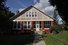 | Robert A. Crawford House | 1.2 miles | 1994 |
 | Chamberlain Bridge | 1.7 miles | 2001 |
| Edward Morrison House | 8.0 miles | 2005 |
| National Archives record | The nomination case file for reference 14001177 in Record Group 79. |
| Brule County | All 7 listed properties in this county. |