 Block
From the record
One of 16 National Register listings published here for Union County · listed in 2015 · category: Object.
Sources: the National Register database, National Park Service
Listed on the National Register of Historic Places in 2015.
One of 16 National Register listings published here for Union County · listed in 2015 · category: Object.
Sources: the National Register database, National Park Service
Regional context, not property-specific evidence. The federal wildfire occurrence database lists 35 fires within 5 miles of Junction City Rest Stop Tipi between 1999 and 2020, burning about 84 acres in total. None started naturally. None was recorded as arson. Distance is straight-line from the map coordinates, so a fire counted here may appear on a neighbouring settlement's page as well.
| Reported cause | Fires |
|---|---|
| Missing data/not specified/undetermined | 23 |
| Debris and open burning | 6 |
| Equipment and vehicle use | 2 |
| Smoking | 2 |
| Recreation and ceremony | 1 |
| Fireworks | 1 |
The most recent of them, most recent first, with the day each was reported and the service that recorded it.
| Date | Cause | Size | Reported by | Name on the report |
|---|---|---|---|---|
| 29 September 2011 | Missing data/not specified/undetermined | under an acre | South Dakota Wildland Fire Suppression | DONNLLEY |
| 25 September 1999 | Smoking | under an acre | Vermillion Volunteer Fire Department | 457 HIGHWAY 50 |
| 7 July 2007 | Equipment and vehicle use | under an acre | South Dakota Wildland Fire Suppression | not named |
| 4 July 2007 | Fireworks | under an acre | South Dakota Wildland Fire Suppression | not named |
| 31 July 1999 | Equipment and vehicle use | 2.0 acres | Woonsocket Volunteer Fire Department | MIKE WHITE |
| 1 July 2007 | Missing data/not specified/undetermined | under an acre | South Dakota Wildland Fire Suppression | not named |
| 3 June 2020 | Missing data/not specified/undetermined | under an acre | South Dakota Wildland Fire Suppression | LINE |
| 23 June 2020 | Missing data/not specified/undetermined | under an acre | South Dakota Wildland Fire Suppression | I-29 23 |
Regional context, not property-specific evidence. The National Weather Service names Junction City, the town this property stands in, in 21 storm reports between 1999 and 2025: 7 hail, 6 thunderstorm wind, 5 flood, 3 flash flood. No death or injury is recorded in these reports. Each account below is quoted exactly as the forecast office filed it, from the NOAA Storm Events Database, and each date opens the federal record of that event.
| When | Event | Place named | Harm | What the report says |
|---|---|---|---|---|
| May 2012 | Thunderstorm Wind | Junction City | $15,000 | Thunderstorm winds blew over a semi truck on Interstate 29. |
| June 2025 | Thunderstorm Wind | Junction City | - | A machine shed was destroyed with debris blown across Burbank road. A few large limbs were broken off trees. A few grain bins were dented by the wind. |
| June 2025 | Thunderstorm Wind | Junction City | - | Thunderstorm winds caused tree and structural damage to an agricultural-themed event venue. The fence at the property was also blown over. Large grain bins were also dented inward approximately 1 mile to the southeast of this property on Burbank Road. |
| July 2023 | Thunderstorm Wind | Junction City | - | Thunderstorm winds were measured on a personal weather station 6 miles east of Vermillion. |
| June 2011 | Flood | Junction City | - | Flooding from upstream spring snowmelt and subsequent heavy rain continued to worsen for most of June. Lowlands along the river including numerous roads, parks, recreational areas and homes were flooded. Much of the Dakota Dunes community was flooded, with many residents evacuating homes and businesses before the flooding worsened. Thousands of acres of usually dry land were flooded, with several farms affected and farm equipment damaged. The highest stage near Ponca, NE was 8.3 feet above flood stage on June 29th. |
| May 2011 | Flood | Junction City | - | Flooding along the Missouri River developed and then increased in late May as runoff from excessive upstream snowmelt and rain reached the area. Lowlands flooded included some roads and recreational facilities near the river, including part of a golf course at Dakota Dunes. The river reached its highest May levels at the end of the month, including a peak stage 2.5 feet above flood stage at Ponca, Nebraska. |
| July 2011 | Flood | Junction City | - | Flooding from upstream spring snowmelt and subsequent heavy rain continued at major levels through July. Lowlands along the river including numerous roads, parks, recreational areas and homes remained flooded. Most of the Dakota Dunes community remained flooded, with many residents and business owners still displaced. Thousands of acres of usually dry land, including several farms, remained flooded. The river began a very slow general fall late in the month. The highest stage near Ponca, Nebraska, was 8.3 feet above flood stage on July 11th. This was equal to the highest level recorded in June. |
| August 2011 | Flood | Junction City | - | Flooding from upstream spring snowmelt and subsequent heavy rain continued at moderate to major levels at the start of August. Lowlands along the river including numerous roads, parks, recreational areas and homes remained flooded. Thousands of acres of usually dry land, including several farms, remained flooded. Most of the Dakota Dunes community remained flooded, with many residents and business owners still displaced. The river fell slowly during the month. The highest stage near Ponca, Nebraska, was a record 8.6 feet above flood stage on August 1st. |
| September 2011 | Flood | Junction City | - | Flooding from upstream spring snowmelt and subsequent heavy rain decreased steadily, and ended late in the month. Flooding of roads, recreational areas, other parks, golf courses, and a few homes ended. The highest stage near Ponca, Nebraska, was 1.9 feet above flood stage on September 1st. |
| June 2009 | Thunderstorm Wind | Junction City | - | Thunderstorm winds caused an unknown amount of tree damage. |
| June 2009 | Thunderstorm Wind | Junction City | - | Thunderstorm winds blew a semi truck off Interstate 29. |
| April 2005 | Flash Flood | Junction City | - | Runoff from 4 inches of rain in 5 hours caused flooding of streets and low areas. |
| May 2004 | Flash Flood | Junction City | - | Torrential rains caused widespread flooding of low areas, including fields and roads. |
| June 1999 | Flash Flood | Junction City | - | Heavy rain caused flooding of low areas including Highway 50 and other streets. |
| April 2025 | Hail | Junction City | - | no account filed |
| June 2025 | Hail | Junction City | - | no account filed |
| June 2014 | Hail | Junction City | - | no account filed |
| May 2004 | Hail | Junction City | - | no account filed |
| May 2004 | Hail | Junction City | - | no account filed |
| May 2004 | Hail | Junction City | - | no account filed |
| May 2002 | Hail | Junction City | - | no account filed |
No historic map-sheet match is published for this property yet. That does not mean no map exists. This record needs a coordinate-quality review before it can be joined to a sheet boundary. Browse the county's mapped places while that work is pending.
Other National Register properties close enough to walk or drive between, ordered by distance from this one. Both positions come from the same geocoding pass that matched these properties to their map sheets.
| Photograph | Property | Distance | Listed |
|---|---|---|---|
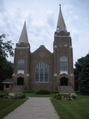 | St. Paul Lutheran Church and Cemetery | 2.6 miles | 2018 |
| South Dakota Dept. of Transportation Bridge No. 64-061-199 | 3.4 miles | 1993 | |
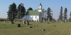 | United Brethren Church | 7.0 miles | 2001 |
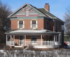 | Charles Murtha House and Brick Yard | 7.1 miles | 1982 |
| National Archives record | The nomination case file for reference 14001191 in Record Group 79. |
| Union County | All 16 listed properties in this county. |