 Block
From the record
One of 59 National Register listings published here for Pennington County · listed in 1966 · category: District · built in 1925.
Sources: the case file at the National Archives · the National Register database, National Park Service
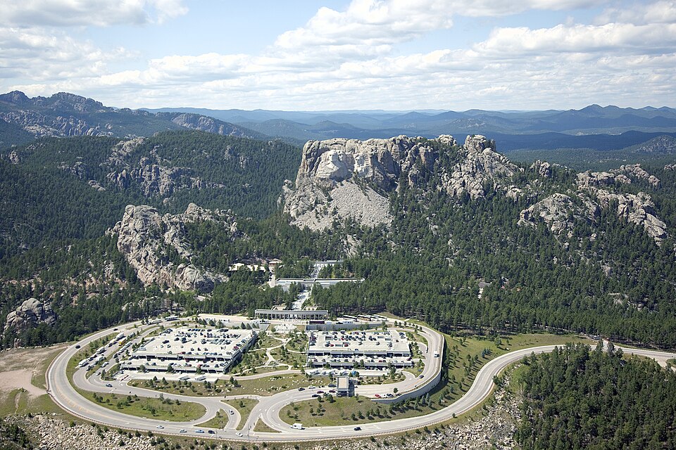
Built in 1925. Listed on the National Register of Historic Places in 1966.
One of 59 National Register listings published here for Pennington County · listed in 1966 · category: District · built in 1925.
Sources: the case file at the National Archives · the National Register database, National Park Service
Regional context, not property-specific evidence. The federal wildfire occurrence database lists 291 fires within 5 miles of Mount Rushmore National Memorial between 1992 and 2020, burning about 1,091 acres in total. 98 started naturally. 8 were recorded as arson. Distance is straight-line from the map coordinates, so a fire counted here may appear on a neighbouring settlement's page as well.
| Reported cause | Fires |
|---|---|
| Natural | 98 |
| Recreation and ceremony | 81 |
| Debris and open burning | 50 |
| Missing data/not specified/undetermined | 25 |
| Fireworks | 11 |
| Power generation/transmission/distribution | 9 |
| Arson/incendiarism | 8 |
| Smoking | 2 |
| Equipment and vehicle use | 2 |
| Misuse of fire by a minor | 2 |
| Railroad operations and maintenance | 2 |
| Other causes | 1 |
The most recent of them, most recent first, with the day each was reported and the service that recorded it.
| Date | Cause | Size | Reported by | Name on the report |
|---|---|---|---|---|
| 9 September 2003 | Natural | 1.0 acres | Black Hills National Forest | GRIZZLY BEAR |
| 8 September 2003 | Natural | under an acre | South Dakota Wildland Fire Suppression | not named |
| 8 September 1998 | Natural | under an acre | South Dakota Wildland Fire Suppression | HUGO |
| 7 September 2010 | Recreation and ceremony | under an acre | Black Hills National Forest | 650 ROAD |
| 7 September 2003 | Recreation and ceremony | under an acre | Black Hills National Forest | CALUMET DRAW |
| 6 September 2001 | Natural | under an acre | Mount Rushmore National Memorial | LONE PINE |
| 6 September 1994 | Recreation and ceremony | under an acre | Black Hills National Forest | GOVERNMENT PASTURE |
| 5 September 1997 | Natural | under an acre | South Dakota Wildland Fire Suppression | HOLE IN THE WALL |
Regional context, not property-specific evidence. The federal mineral resources record lists 178 workings within 5 miles of Mount Rushmore National Memorial: 108 past producers, 36 occurrences, 25 prospects, 5 producers. 5 still produce. What was taken out: Feldspar, Tungsten, Gold, Beryllium. Distance is straight-line from the map coordinates, so a quarry counted here may appear on a neighbouring settlement's page as well.
| Where | Site | Commodity | Status | Recorded |
|---|---|---|---|---|
| Bullion Mine Pennington County | Gold, Silver, Arsenic | Past Producer | 1877, 1930 | |
| Cuyahoga Mine | Sulfur-Pyrite, Tin | Past Producer | 1917 | |
| Dan Patch Group | Feldspar, Mica, Beryllium, Tantalum, Zinc | Past Producer | 1905 | |
| Dewey Mine MS 1699 | Mica, Feldspar, Lithium | Past Producer | ||
| Edison Mine | Lithium, Mica, Feldspar, Beryllium, Tantalum | Past Producer | 1917 | |
| Edison Mine | Tantalum, Niobium (Columbium) | Past Producer | ||
| Egyptian Group | Gold, Silver, Zinc | Past Producer | Chalcopyrite, Gold, Pyrrhotite, Silver, Sphalerite | |
| Etta Spodumene Mine | Feldspar, Mica, Lithium, Tin, Beryllium, Tantalum, Tungsten | Past Producer | 1898 | |
| Eureka | Mica, Beryllium, Feldspar | Occurrence | Beryl, Feldspar, Muscovite | |
| Glendale | Feldspar, Beryllium, Tin | Past Producer | Beryl, Cassiterite, Feldspar |
Regional context, not property-specific evidence. The National Weather Service names Keystone, the town this property stands in, in 56 storm reports between 1996 and 2024: 50 hail, 3 flash flood, 2 flood, 1 heavy rain. No death or injury is recorded in these reports. Each account below is quoted exactly as the forecast office filed it, from the NOAA Storm Events Database, and each date opens the federal record of that event.
| When | Event | Place named | Harm | What the report says |
|---|---|---|---|---|
| May 2014 | Hail | Keystone | $500,000 | Hail damaged automobiles in Keystone. |
| August 2013 | Hail | Keystone | $150,000 | no account filed |
| October 2013 | Flash Flood | Keystone | $100,000 | Law enforcement reported water over Highway 16A/Winter Street in several places in Keystone due to flooding along Grizzly Bear Creek. Flooding was observed along Battle Creek near the city park. The USGS river gauge on Grizzly Bear Creek above Keystone reported a flow around 500 cfs and a height of 6.2 feet. Flows on Battle Creek were estimated at 1300 cfs. |
| July 2005 | Flash Flood | Keystone | $10,000 | Water from heavy rain accumulated 2 inches deep in the Rushmore Cave gift shop. |
| June 1996 | Hail | Keystone | $2,000 | no account filed |
| July 2018 | Flood | Keystone | - | Runoff from heavy rain continued to cause flooding in and around Keystone. Water covered Grizzly Gulch Road, parts of Cemetery Road, and parking lots of businesses along Iron Mountain Road. Levels on Grizzly Bear Creek and Battle Creek quickly rose several feet. |
| May 2016 | Hail | Keystone | - | Penny to quarter sized hail fell with the storm. |
| May 2016 | Hail | Keystone | - | Hail to quarter size covered the ground several inches deep. |
| May 2016 | Flood | Keystone | - | Grizzly Bear Creek covered Grizzly Gulch Road, making it impassible for several hours, and caused minor flooding in Keystone. |
| May 2016 | Hail | Keystone | - | Hail to the size of quarters covered the ground from the Keystone Wye, the intersection of US Highways 16 and 16A, eastward along Highway 16. |
| July 2015 | Hail | Keystone | - | A thunderstorm left a narrow path of quarter to half inch diameter hail, with a few stones to the size of quarters and half dollars, three to six inches deep along US Highway 16 at Beretta Road southwest of Rockerville. Snowplows were used to clear the highway. |
| July 2001 | Hail | Keystone | - | Dime size hail fell for 10 minutes at Mt. Rushmore National Monument. |
| June 2024 | Hail | Keystone | - | no account filed |
| August 2023 | Hail | Keystone | - | no account filed |
| August 2023 | Hail | Keystone | - | no account filed |
| August 2023 | Hail | Keystone | - | no account filed |
| June 2022 | Hail | Keystone | - | no account filed |
| July 2020 | Hail | Keystone | - | no account filed |
| July 2019 | Hail | Keystone | - | no account filed |
| September 2018 | Hail | Keystone | - | no account filed |
| August 2016 | Hail | Keystone | - | no account filed |
| July 2016 | Hail | Keystone | - | no account filed |
| June 2015 | Hail | Keystone | - | no account filed |
| July 2015 | Hail | Keystone | - | no account filed |
| July 2015 | Hail | Keystone | - | no account filed |
| June 2015 | Hail | Keystone | - | no account filed |
| June 2014 | Hail | Keystone | - | no account filed |
| July 2014 | Hail | Keystone | - | no account filed |
| July 2014 | Hail | Keystone | - | no account filed |
| July 2013 | Hail | Keystone | - | no account filed |
| July 2011 | Hail | Keystone | - | no account filed |
| July 2009 | Hail | Keystone | - | no account filed |
| June 2007 | Hail | Keystone | - | no account filed |
| June 2005 | Hail | Keystone | - | no account filed |
| July 2005 | Hail | Keystone | - | no account filed |
| July 2004 | Hail | Keystone | - | no account filed |
| September 2004 | Hail | Keystone | - | no account filed |
| June 2003 | Hail | Keystone | - | no account filed |
| July 2003 | Heavy Rain | Keystone | - | no account filed |
| July 2003 | Hail | Keystone | - | no account filed |
| July 2003 | Hail | Keystone | - | no account filed |
| August 2002 | Hail | Keystone | - | no account filed |
| August 2002 | Hail | Keystone | - | no account filed |
| August 2002 | Hail | Keystone | - | no account filed |
| June 2001 | Hail | Keystone | - | no account filed |
| July 2001 | Flash Flood | Keystone | - | no account filed |
| August 2001 | Hail | Keystone | - | no account filed |
| July 2001 | Hail | Keystone | - | no account filed |
| July 2000 | Hail | Keystone | - | no account filed |
| June 1999 | Hail | Keystone | - | no account filed |
| June 1999 | Hail | Keystone | - | no account filed |
| June 1999 | Hail | Keystone | - | no account filed |
| June 1997 | Hail | Keystone | - | no account filed |
| July 1996 | Hail | Keystone | - | no account filed |
| June 1996 | Hail | Keystone | - | no account filed |
| June 1996 | Hail | Keystone | - | no account filed |
No historic map-sheet match is published for this property yet. That does not mean no map exists. This record needs a coordinate-quality review before it can be joined to a sheet boundary. Browse the county's mapped places while that work is pending.
Other National Register properties close enough to walk or drive between, ordered by distance from this one. Both positions come from the same geocoding pass that matched these properties to their map sheets.
| Photograph | Property | Distance | Listed |
|---|---|---|---|
| Lewis Byron House | 1.8 miles | 1982 | |
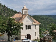 | Keystone School | 2.2 miles | 1981 |
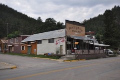 | Keystone Trading Company Store | 2.3 miles | 1982 |
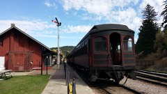 | Burlington and Quincy High Line Hill City to Keystone Branch | 3.3 miles | 2003 |
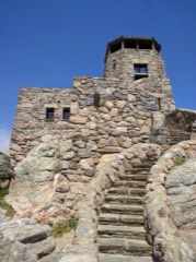 | Harney Peak Lookout Tower, Dam, Pumphouse and Stairway | 3.9 miles | 1983 |
| Otho Mining District | 4.3 miles | 2004 |
| National Archives record | The nomination case file for reference 66000718 in Record Group 79. |
| Pennington County | All 59 listed properties in this county. |