 Block
From the record
One of 59 National Register listings published here for Pennington County · listed in 1977 · category: Building.
Sources: the case file at the National Archives · the National Register database, National Park Service
Listed on the National Register of Historic Places in 1977.
One of 59 National Register listings published here for Pennington County · listed in 1977 · category: Building.
Sources: the case file at the National Archives · the National Register database, National Park Service
Regional context, not property-specific evidence. The federal wildfire occurrence database lists 229 fires within 5 miles of Von Woehrmann Building between 1992 and 2020, burning about 2,747 acres in total. 87 started naturally. 2 were recorded as arson. Distance is straight-line from the map coordinates, so a fire counted here may appear on a neighbouring settlement's page as well.
| Reported cause | Fires |
|---|---|
| Natural | 87 |
| Debris and open burning | 42 |
| Recreation and ceremony | 31 |
| Missing data/not specified/undetermined | 31 |
| Power generation/transmission/distribution | 13 |
| Equipment and vehicle use | 9 |
| Railroad operations and maintenance | 4 |
| Smoking | 3 |
| Other causes | 3 |
| Misuse of fire by a minor | 3 |
| Arson/incendiarism | 2 |
| Fireworks | 1 |
The most recent of them, most recent first, with the day each was reported and the service that recorded it.
| Date | Cause | Size | Reported by | Name on the report |
|---|---|---|---|---|
| 9 September 2012 | Railroad operations and maintenance | under an acre | Black Hills National Forest | TIN MILL |
| 6 September 2011 | Equipment and vehicle use | under an acre | Black Hills National Forest | LOG CABIN |
| 6 September 2000 | Natural | 15 acres | Black Hills National Forest | SHERIDAN 2 |
| 5 September 2000 | Natural | under an acre | Black Hills National Forest | 385 |
| 5 September 1996 | Natural | under an acre | Black Hills National Forest | MIRACLE |
| 5 September 1995 | Natural | under an acre | Black Hills National Forest | 425 |
| 5 September 1995 | Natural | under an acre | Black Hills National Forest | UNION |
| 3 September 2006 | Recreation and ceremony | under an acre | Black Hills National Forest | RENO RESERVOIR |
Regional context, not property-specific evidence. The federal mineral resources record lists 173 workings within 5 miles of Von Woehrmann Building: 80 past producers, 50 occurrences, 35 prospects, 5 unknowns. 3 still produce. What was taken out: Tin, Tungsten, Gold, Silver. Distance is straight-line from the map coordinates, so a quarry counted here may appear on a neighbouring settlement's page as well.
| Where | Site | Commodity | Status | Recorded |
|---|---|---|---|---|
| Annie No. 1 Lode | Tungsten, Tin, Mica, Feldspar, Graphite | Past Producer | Cassiterite, Feldspar, Graphite, Muscovite, Wolframite | |
| Century Lode Claim | Lithium, Tin | Past Producer | Amblygonite, Cassiterite, Spodumene | |
| Clara Belle | Gold, Tin, Silver | Past Producer | 1886 | |
| Clara Belle | Gold, Tin, Silver | Unknown | ||
| Dewey Mine MS 1699 | Mica, Feldspar, Lithium | Past Producer | ||
| El Dorado | Gold, Tin, Tungsten, Silver | Past Producer | 1890 | |
| El Dorado MS 2014 | Gold, Tungsten, Tin, Silver | Past Producer | ||
| First Find Claim | Tin, Niobium (Columbium) | Prospect | 1890 | |
| First Find Lode | Tin, Tantalum, Niobium (Columbium) | Occurrence | Cassiterite | |
| Forest City Claim | Tin, Silver, Gold | Occurrence | 1886, 1901 |
Regional context, not property-specific evidence. The National Weather Service names Hill City, the town this property stands in, in 114 storm reports between 1993 and 2025: 96 hail, 11 thunderstorm wind, 4 flood, 1 wildfire. No death or injury is recorded in these reports. Each account below is quoted exactly as the forecast office filed it, from the NOAA Storm Events Database, and each date opens the federal record of that event.
| When | Event | Place named | Harm | What the report says |
|---|---|---|---|---|
| August 2013 | Hail | Hill City | $6,000,000 | Golf ball size hail was reported from Hill City to Palmer Gulch southeast of town, causing extensive damage to vehicles and property. |
| May 2019 | Flood | Hill City | $750,000 | Runoff from heavy rain flooded creeks and inundated roads. Water covered part of Winter Street/US Highway 16A in Keystone. Water was reported over Old Hill City Road near Keystone, Grizzly Gulch Road, Mountain Park Road, Spring Creek Road, Lower Spring Creek Road, Rockwood Road, South Valley Drive, Orchard Lane, Reservoir Road, Green Valley Drive, Lamb Road, Anderson Road, Antelope Creek Road three miles south of SD Highway 44, Neva Way, 143rd Avenue, 156th Street south of highway 14-16, and 159th Street. |
| June 2015 | Flood | Hill City | $700,000 | Many roads were flooded by heavy rain and high stream levels. On the north side of Rapid City, 143rd Avenue was underwater near Neva Way. In Rapid Valley; Reservoir Road, Green Valley Drive between Reservoir Road and Greenfield Road, South Valley Drive, the east end of Dunn Road, Anderson Road, South Radar Hill Road, and Antelope Creek Road were flooded. Around Box Elder; Elk Vale Road just north of Interstate 90, 155th Street south of Highway 14-16, and the South Ellsworth Road bridge were flooded. Hammerquist Road and 157th Street in the Caputa area were closed. Palmer Gulch Road east of Hill City was underwater. Old Hill City Road and the Needles Highway (SD Highway 87) from Playhouse Road to Sylvan Campground were flooded in various areas. At Hart Ranch, the golf course sustained flooding and debris damaged foot bridges. Spring Creek reached the bottom of the bridge at Mulligan Mile Crossing. High water damaged private bridges in Magic Canyon west of Rapid City. |
| July 2007 | Hail | Hill City | $500,000 | Baseball sized hail broke building windows and automobile windshields in Hill City. The hail accumulated six to eight inches deep. |
| June 2011 | Hail | Hill City | $250,000 | no account filed |
| June 2014 | Hail | Hill City | $150,000 | Many vehicles were damaged by the large hail. |
| August 2013 | Tornado (EF1) | Hill City | $25,000 | A small tornado touched down south of Hill City near the Mickelson Trail. It continued to the south, crossing the Needles Highway (SD Highway 87) east of US Highway 16/385. The tornado blew down and snapped numerous large Ponderosa Pine trees and blew a few shingles off a house. The trees fell onto power lines, which caused the poles to fall. |
| July 2004 | Hail | Hill City | $20,000 | no account filed |
| June 2015 | Flash Flood | Hill City | $10,000 | Most streets in Hill City were covered with water and debris. Water was at least a foot deep on Allen Gulch Road, Railway Avenue, and East Main Street and Deerfield Road at Marshall Gulch was closed. Major Lake Drive, Chute Rooster Drive, and Smokey Drive were damaged by the flooding. |
| May 1998 | Hail | Hill City | $500 | Hail broke car windshield. |
| June 2025 | Thunderstorm Wind | Hill City | - | Spotter reported an estimated wind gust. |
| June 2025 | Thunderstorm Wind | Hill City | - | Public reported estimated wind gust. |
| July 2022 | Hail | Hill City | - | Hail to ping pong ball size lasted around 20 minutes. |
| August 2021 | Hail | Hill City | - | Hail caused considerable damage at the Mount Rushmore KOA Campground. |
| July 2018 | Hail | Hill City | - | Nickel sized hail covered the ground. |
| July 2018 | Hail | Hill City | - | Hail covered the ground. |
| June 2017 | Thunderstorm Wind | Hill City | - | A tree blew down onto US Highway 16 south of Hill City. |
| June 2017 | Thunderstorm Wind | Hill City | - | Several small trees were downed by the wind at the Medicine Mountain Boy Scout Camp. |
| June 2016 | Hail | Hill City | - | Golf ball sized hail fell at the Medicine Mountain Boy Scout Camp. |
| May 2015 | Flood | Hill City | - | Runoff from heavy rain caused minor flooding along Spring Creek, both upstream and downstream from Sheridan Lake, and along Newton Fork northwest of Hill City. Releases from Pactola Reservoir reached 500 cubic feet per second, and combined with heavy rain, caused minor flooding along Rapid Creek downstream from Pactola Dam to the Cheyenne River. The flooding continued into early June. |
| June 2015 | Hail | Hill City | - | Hail to the size of golf balls covered the ground. |
| June 2015 | Flood | Hill City | - | Runoff from heavy rain caused flooding along Spring Creek between Hill City and Sheridan Lake. |
| June 2012 | Thunderstorm Wind | Hill City | - | Winds were estimated at 60 mph. |
| July 2004 | Hail | Hill City | - | Hail covered the ground. |
| June 2003 | Hail | Hill City | - | Hail to the size golf balls fell for 20 minutes. |
| May 2002 | Hail | Hill City | - | A single severe thunderstorm moved across the Black Hills portion of Pennington County, producing nickle sized hail. |
| July 2024 | Hail | Hill City | - | no account filed |
| July 2023 | Hail | Hill City | - | no account filed |
| July 2023 | Hail | Hill City | - | no account filed |
| May 2022 | Hail | Hill City | - | no account filed |
| July 2022 | Hail | Hill City | - | no account filed |
| June 2022 | Hail | Hill City | - | no account filed |
| July 2021 | Hail | Hill City | - | no account filed |
| August 2021 | Hail | Hill City | - | no account filed |
| August 2021 | Hail | Hill City | - | no account filed |
| August 2021 | Hail | Hill City | - | no account filed |
| May 2020 | Hail | Hill City | - | no account filed |
| May 2020 | Hail | Hill City | - | no account filed |
| July 2020 | Hail | Hill City | - | no account filed |
| June 2020 | Thunderstorm Wind | Hill City | - | no account filed |
| June 2020 | Hail | Hill City | - | no account filed |
| August 2019 | Hail | Hill City | - | no account filed |
| August 2019 | Hail | Hill City | - | no account filed |
| August 2019 | Hail | Hill City | - | no account filed |
| July 2018 | Hail | Hill City | - | no account filed |
| July 2018 | Hail | Hill City | - | no account filed |
| July 2018 | Hail | Hill City | - | no account filed |
| July 2018 | Hail | Hill City | - | no account filed |
| July 2018 | Hail | Hill City | - | no account filed |
| July 2018 | Hail | Hill City | - | no account filed |
| June 2017 | Hail | Hill City | - | no account filed |
| June 2017 | Thunderstorm Wind | Hill City | - | no account filed |
| June 2017 | Hail | Hill City | - | no account filed |
| May 2016 | Hail | Hill City | - | no account filed |
| August 2016 | Hail | Hill City | - | no account filed |
| July 2016 | Hail | Hill City | - | no account filed |
| July 2016 | Hail | Hill City | - | no account filed |
| July 2016 | Hail | Hill City | - | no account filed |
| June 2015 | Hail | Hill City | - | no account filed |
| June 2015 | Hail | Hill City | - | no account filed |
No historic map-sheet match is published for this property yet. That does not mean no map exists. This record needs a coordinate-quality review before it can be joined to a sheet boundary. Browse the county's mapped places while that work is pending.
Other National Register properties close enough to walk or drive between, ordered by distance from this one. Both positions come from the same geocoding pass that matched these properties to their map sheets.
| Photograph | Property | Distance | Listed |
|---|---|---|---|
 | C. E. McEachron General Merchandise | 0.2 miles | 1994 |
 | Harney Peak Hotel | 0.3 miles | 1977 |
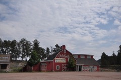 | Harney Peak Tin Mining Company Buildings | 0.7 miles | 1977 |
| Golden Summit Mine Foreman's Cabin | 2.2 miles | 2012 | |
 | Burlington and Quincy High Line Hill City to Keystone Branch | 4.0 miles | 2003 |
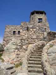 | Harney Peak Lookout Tower, Dam, Pumphouse and Stairway | 4.9 miles | 1983 |
| National Archives record | The nomination case file for reference 77001253 in Record Group 79. |
| Pennington County | All 59 listed properties in this county. |