 Block
From the record
9 National Register listings published here.
Sources: the National Register database, National Park Service
101 topographic sheets cover 43 settlements here, and 9 properties are on the National Register of Historic Places.
9 National Register listings published here.
Sources: the National Register database, National Park Service
Every property in this county listed on the National Register of Historic Places, with the year it was listed and the federal nomination document.
| Photograph | Property | Type | Listed | Reference |
|---|---|---|---|---|
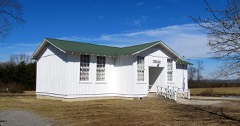 | Bellview School | building | 1999 | 99000279 |
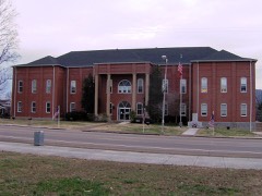 | Bledsoe County Courthouse | building | 1995 | 95000346 |
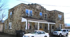 | Bledsoe County Jail | building | 2008 | 08001049 |
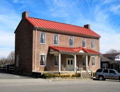 | John Bridgman House | building | 1993 | 93000567 |
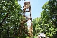 | Fall Creek Falls Fire Lookout Tower | building | 2015 | 15000444 |
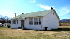 | Lincoln School | building | 1993 | 93000648 |
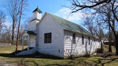 | Pikeville Chapel African Methodist Episcopal Zion Church | building | 1999 | 99001444 |
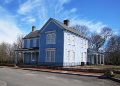 | Dr. James A. Ross House | building | 1999 | 99000758 |
| South Main Street Historic District | district | 1994 | 94000375 |
Every wildfire the federal occurrence database records inside this county: 899 of them, burning about 14,009 acres. 5 started naturally and 535 were recorded as arson. Each settlement page carries the fires within five miles of it.
| Reported cause | Fires |
|---|---|
| Arson/incendiarism | 535 |
| Debris and open burning | 250 |
| Missing data/not specified/undetermined | 62 |
| Equipment and vehicle use | 21 |
| Recreation and ceremony | 10 |
| Other causes | 7 |
| Power generation/transmission/distribution | 5 |
| Natural | 5 |
| Railroad operations and maintenance | 3 |
| Fireworks | 1 |
The five largest, by the area the report gives. Five of them were set deliberately.
| Date | Cause | Size | Reported by | Name on the report |
|---|---|---|---|---|
| 12 November 2016 | Missing data/not specified/undetermined | 2,018 acres | Tennessee Division of Forestry | BENCH BLUFF |
| 31 October 2001 | Arson/incendiarism | 1,120 acres | Tennessee Division of Forestry | not named |
| 11 November 2005 | Debris and open burning | 500 acres | Tennessee Division of Forestry | not named |
| 1 November 2016 | Arson/incendiarism | 334 acres | Tennessee Division of Forestry | BROCKDALE RD. |
| 21 April 2007 | Debris and open burning | 297 acres | Tennessee Division of Forestry | HELL HOLE |
| 8 March 2006 | Arson/incendiarism | 285 acres | Tennessee Division of Forestry | not named |
| 28 April 2001 | Arson/incendiarism | 262 acres | Tennessee Division of Forestry | not named |
| 27 August 2011 | Arson/incendiarism | 170 acres | Tennessee Division of Forestry | BLAINE SMITH RD |
Every settlement page carries the fires within five miles of it - see the settlement index below.
The NOAA Storm Events Database holds 289 reports for this county, causing 4 deaths, 10 injuries and about $21,350,230 in recorded property damage. Each settlement page carries the reports that name it.
| Kind of event | Reports |
|---|---|
| Thunderstorm Wind | 170 |
| Hail | 65 |
| Flash Flood | 34 |
| Flood | 9 |
| Tornado | 8 |
| Funnel Cloud | 3 |
The most serious of them, by death, then injury, then recorded damage. The accounts are quoted exactly as the forecast office filed them.
| When | Event | Place named | Harm | What the report says |
|---|---|---|---|---|
| April 2011 | Tornado (EF4) | Hendon | 4 killed, 10 hurt, $15,000,000 | New Harmony Tornado. A NWS storm survey reported a tornado path in Sequatchie county and continued its track northeast into and across southeastern Bledsoe County. It had a path length of 16.3 miles in Bledsoe county and a 1/2 mile path width. The 190 mph wind destroyed several homes up on Waldens Ridge, with continuous damage noted into Rhea county. Numerous trees and barns were also downed in the path of the large tornado. Vehicles were picked up and thrown. ||Four people died in the Pitts Gap area just before the tornado reached New Harmony. The fatalities included a married couple--a 43 year old woman and a 39 year old man in their mobile home. A man, his wife (64 years old), and her sister (70 years old, visiting from Nashville) were in a camper, camping on Waldens Ridge when the tornado struck, killing the two sisters, and injuring the man. Another 10 people were injured. |
| May 2003 | Flash Flood | Countywide | $3,920,000 | no account filed |
| February 2019 | Flash Flood | Pikeville | $850,000 | Multiple roads closed throughout the county. Evacuations in the northern part of the county. All told, there was about $850,000 in damages across Bledsoe County from this flooding event. |
| June 1983 | Tornado (F1) | not stated | $250,000 | no account filed |
| April 1955 | Tornado (F1) | not stated | $250,000 | no account filed |
| November 2002 | Tornado (F1) | Pikeville | $100,000 | no account filed |
| April 2011 | Tornado (EF1) | Pailo | $75,000 | N Dunlap Tornado. A NWS storm survey reported an EF1 tornado continued into Bledsoe county, Tennessee, just northeast of Mount Airy, Tennessee. The tornado tracked to near Highway 603 and the Lower East Valley Road in Bledsoe County where it dissipated. It had a path width of 80 yards and a path length of 1.47 miles in Bledsoe county. The 100 mph wind damage a few roofs and downed numerous trees. |
| April 2007 | Thunderstorm Wind | Saratoga Spgs | $65,000 | Several large trees were reported down, a mobile home was destroyed, and a garage roof was blown off in the northwest portion of the county. |
| May 1999 | Flood | Pikeville | $50,000 | Numerous secondary roads washed out. |
| March 1997 | Thunderstorm Wind | Brayton | $50,000 | no account filed |
| June 2011 | Thunderstorm Wind | Pikeville | $30,000 | Emergency manager personnel reported trees downed by thunderstorm wind countywide. Wind also damaged homes in Pikeville. |
| July 2006 | Thunderstorm Wind | Countywide | $25,000 | no account filed |
| July 2005 | Thunderstorm Wind | Pikeville | $25,000 | no account filed |
| July 2004 | Thunderstorm Wind | Countywide | $25,000 | no account filed |
| July 2004 | Thunderstorm Wind | Pikeville | $25,000 | no account filed |
| May 1976 | Tornado (F0) | not stated | $25,000 | no account filed |
| June 2010 | Thunderstorm Wind | Pikeville | $20,000 | Emergency management personnel reported numerous trees and powerlines downed by thunderstorm winds countywide. |
| August 2010 | Thunderstorm Wind | Pikeville | $20,000 | Emergency management personnel reported numerous trees and powerlines downed by thunderstorm wind near the intersection on Big Spring Gap Mountain Road and Beaver Hill Road north of Pikeville. |
| July 2004 | Thunderstorm Wind | Brayton | $20,000 | no account filed |
| July 2002 | Thunderstorm Wind | South Portion | $20,000 | no account filed |
| November 2002 | Thunderstorm Wind | Countywide | $20,000 | no account filed |
| January 1999 | Thunderstorm Wind | Pikeville | $20,000 | no account filed |
| June 2014 | Thunderstorm Wind | Pikeville | $15,000 | Emergency manager personnel reported several trees downed by thunderstorm wind in Pikeville on Upper East Valley Road as well as Old Dayton Highway and Lockford Road. A roof on a TDOT building in Pikeville was also damaged. |
| June 2014 | Flash Flood | Pikeville | $15,000 | Law enforcement personnel reported several roads covered and closed by thunderstorms countywide. |
| October 2009 | Thunderstorm Wind | Pikeville | $15,000 | Law enforcement officials reported numerous trees downed by thunderstorm winds countywide. |
| August 2005 | Thunderstorm Wind | Brayton | $15,000 | Several trees down near Brayton. |
| November 2003 | Thunderstorm Wind | Pikeville | $15,000 | no account filed |
| December 2000 | Thunderstorm Wind | Countywide | $15,000 | no account filed |
| July 2004 | Thunderstorm Wind | Pikeville | $12,000 | no account filed |
| May 2013 | Flash Flood | Pikeville | $10,000 | Extensive flooding over the northern half of the county. |
| April 2013 | Flash Flood | Melvine | $10,000 | Several roads closed or partially washed out. Portions of Big Springs Gap Rd...Beaver Hill Rd...and Upper East Valley Rd. One swift water rescue where a vehicle was washed off a bridge. |
| June 2012 | Thunderstorm Wind | Pikeville | $10,000 | Utility company personnel reported several locations with powerlines knocked down by large tree limbs and trees by thunderstorm wind along Highway 127 and upper East Valley Road northeast of Pikeville near Cooper Mill. |
| June 2010 | Flash Flood | Pikeville | $10,000 | Emergency management personnel reported many roads across the county, especially near Pikeville covered by high water from a slow moving thunderstorms. |
| April 2009 | Thunderstorm Wind | Pikeville | $10,000 | Law enforcement officials reported a few trees downed by thunderstorm winds countywide. |
| August 2007 | Thunderstorm Wind | Luminary | $10,000 | The sheriffs office reported several trees downed by thunderstorm winds on Morgan Road in the Luminary area. |
| April 2006 | Thunderstorm Wind | Pikeville | $10,000 | Several trees down in Fall Creek State Falls. |
| May 2004 | Thunderstorm Wind | Pikeville | $10,000 | no account filed |
| May 2003 | Thunderstorm Wind | Pikeville | $10,000 | no account filed |
| May 2002 | Thunderstorm Wind | Pikeville | $10,000 | no account filed |
| May 2000 | Thunderstorm Wind | Pikeville | $10,000 | no account filed |
| May 1999 | Thunderstorm Wind | Brayton | $10,000 | no account filed |
| April 1996 | Thunderstorm Wind | Summer City | $10,000 | no account filed |
| April 2015 | Thunderstorm Wind | Saratoga Spgs | $8,000 | The public reported several trees were downed by thunderstorm wind in northwest Bledsoe county. |
| April 2013 | Thunderstorm Wind | Pikeville | $8,000 | Emergency management personnel reported several trees were downed by thunderstorm wind in Pikeville and surrounding areas. |
| June 2006 | Thunderstorm Wind | Pikeville | $8,000 | A few trees down in Fall Creek Falls State Park. |
| May 2006 | Hail | Pailo | $8,000 | no account filed |
| March 2005 | Thunderstorm Wind | Pikeville | $8,000 | no account filed |
| January 2002 | Thunderstorm Wind | Countywide | $7,000 | A few trees down. |
| July 2005 | Thunderstorm Wind | Pikeville | $6,000 | no account filed |
| May 2003 | Thunderstorm Wind | Pikeville | $6,000 | no account filed |
| May 2003 | Thunderstorm Wind | Pikeville | $6,000 | no account filed |
| December 2015 | Flood | Melvine | $5,000 | Melvin Crossroads Road flooded with water over the hood of a vehicle. Rescue required. |
| April 2014 | Thunderstorm Wind | Pikeville | $5,000 | Emergency manager personnel reported a few large trees downed by thunderstorm wind west on Pikeville in the Griffith Community. |
| April 2014 | Thunderstorm Wind | Pikeville | $5,000 | Emergency manager personnel reported a couple trees downed by thunderstorm wind 5 miles west of Pikeville in the Griffiths Community. |
| April 2014 | Thunderstorm Wind | Pikeville | $5,000 | Emergence manager personnel reported a couple of trees downed by thunderstorm wind 5 miles southeast of Pikeville in the New Harmony Community. |
| May 2013 | Flash Flood | Pikeville | $5,000 | Several roads closed or impassable across the county. |
| June 2011 | Thunderstorm Wind | Pikeville | $5,000 | Law enforcement personnel reported several trees downed by thunderstorm wind in and around Pikeville. |
| April 2011 | Thunderstorm Wind | Pikeville | $5,000 | Law enforcement personnel reported a few trees downed by thunderstorm wind in Pikeville. |
| August 2010 | Thunderstorm Wind | Pikeville | $5,000 | Law enforcement personnel reported several trees downed by thunderstorm winds on Mill Dam Road and Upper East Valley Road northeast of Pikeville. |
| February 2009 | Thunderstorm Wind | Pikeville | $5,000 | Law enforcement personnel reported several trees downed by thunderstorm winds in Pikeville. |
The Survey's mineral resources record lists 4 workings inside this county. 2 still produce and 2 are closed or unrecorded. Each settlement page carries the workings within five miles of it.
| Commodity | Workings |
|---|---|
| Zinc | 2 |
| Stone, Crushed/Broken, Limestone, General | 1 |
| Stone, Crushed/Broken | 1 |
The least common of them first, because a county's hundredth gravel pit says nothing its first ten did not.
| Where | Site | Commodity | Status | Recorded |
|---|---|---|---|---|
| Bledsoe County Highway Dept. Quarry | Stone, Crushed/Broken, Limestone, General | Producer | ||
| County Quarry | Stone, Crushed/Broken | Producer | ||
| Deep Well-Sphalerite Occurrance | Zinc | Occurrence | ||
| Deep Well-Sphalerite Occurrence | Zinc | Occurrence | Sphalerite |
Named settlements recorded in the Geographic Names Information System, each with the topographic sheets covering it. Villages, hamlets and abandoned places alike. Each is shown with the nearest named watercourse or landform and the survey quadrangle it falls on.
District 2 · 37367 · On Cold Spring Cove Branch · Billingsley Gap quadrangle
23 sheets, 1892 to 1981
District 3 · 37332 · On Double Branch · Morgan Springs quadrangle
24 sheets, 1892 to 1981
District 1 · 37367 · On Thompson Creek · Billingsley Gap quadrangle
23 sheets, 1892 to 1981
No longer a settlement
District 5 · 38572 · On Big Branch · Herbert Domain quadrangle
21 sheets, 1892 to 1981
No longer a settlement
District 5 · 37367 · On Wolfpen Creek · Billingsley Gap quadrangle
23 sheets, 1892 to 1981
No longer a settlement
District 1 · 37367 · On Keener Branch · Herbert Domain quadrangle
21 sheets, 1892 to 1981
District 1 · 37367 · On Hitchcox Mountain · Smartt Mountain quadrangle
22 sheets, 1892 to 1981
District 1 · 37367 · On Wheeler Branch · Billingsley Gap quadrangle
23 sheets, 1892 to 1981
District 1 · 37367 · Near Sullivan Cove · Brockdell quadrangle
23 sheets, 1892 to 1981
District 5 · 37367 · Near Nussom Knob · Billingsley Gap quadrangle
23 sheets, 1892 to 1981
No longer a settlement
District 2 · 37381 · On Lick Branch · Melvine quadrangle
23 sheets, 1892 to 1981
No longer a settlement
District 1 · 37367 · On Whiteside Branch · Billingsley Gap quadrangle
23 sheets, 1892 to 1981
District 5 · 37367 · Near Tamp Gilbert Flat · Billingsley Gap quadrangle
23 sheets, 1892 to 1981
No longer a settlement
District 5 · 37367 · Near Cowen Knob · Billingsley Gap quadrangle
23 sheets, 1892 to 1981
No longer a settlement
District 6 · 37367 · On Maise Creek · Brockdell quadrangle
23 sheets, 1892 to 1981
District 3 · 37338 · On Skiles Branch · Brayton quadrangle
27 sheets, 1888 to 1988
No longer a settlement
District 3 · 37367 · On Corder Branch · Morgan Springs quadrangle
24 sheets, 1892 to 1981
District 2 · 37381 · On Cooper Branch · Melvine quadrangle
23 sheets, 1892 to 1981
No longer a settlement
The vanished settlements of Bledsoe County: the places named above that are no longer on the map.