 Block
From the record
7 National Register listings published here.
Sources: the National Register database, National Park Service
73 topographic sheets cover 61 settlements here, and 7 properties are on the National Register of Historic Places.
7 National Register listings published here.
Sources: the National Register database, National Park Service
Every property in this county listed on the National Register of Historic Places, with the year it was listed and the federal nomination document.
| Photograph | Property | Type | Listed | Reference |
|---|---|---|---|---|
 | Court Theatre | building | 2012 | 12000115 |
 | First Cumberland Presbyterian Church-McKenzie | building | 1993 | 93000476 |
| Hillsman House | building | 1982 | 82003955 | |
| Leach Fire Lookout Tower | building | 2017 | 100001821 | |
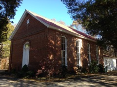 | Long Rock Methodist Episcopal Church, South | building | 2010 | 10000466 |
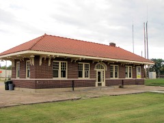 | McKenzie Depot | building | 1996 | 96000336 |
| Webb Public School | building | 2024 | 100010300 |
Every wildfire the federal occurrence database records inside this county: 530 of them, burning about 2,035 acres. 8 started naturally and 57 were recorded as arson. Each settlement page carries the fires within five miles of it.
| Reported cause | Fires |
|---|---|
| Debris and open burning | 245 |
| Equipment and vehicle use | 83 |
| Missing data/not specified/undetermined | 58 |
| Arson/incendiarism | 57 |
| Smoking | 20 |
| Railroad operations and maintenance | 18 |
| Recreation and ceremony | 13 |
| Misuse of fire by a minor | 10 |
| Power generation/transmission/distribution | 8 |
| Other causes | 8 |
| Natural | 8 |
| Fireworks | 2 |
The five largest, by the area the report gives. One of them was set deliberately.
| Date | Cause | Size | Reported by | Name on the report |
|---|---|---|---|---|
| 9 November 1999 | Debris and open burning | 132 acres | Tennessee Division of Forestry | not named |
| 10 April 2014 | Equipment and vehicle use | 87 acres | Tennessee Division of Forestry | TODD |
| 11 April 2001 | Debris and open burning | 85 acres | Tennessee Division of Forestry | not named |
| 24 August 2007 | Equipment and vehicle use | 61 acres | Tennessee Division of Forestry | ROBERTSON FIRE |
| 12 September 1999 | Recreation and ceremony | 49 acres | Tennessee Division of Forestry | not named |
| 11 March 2007 | Arson/incendiarism | 39 acres | Tennessee Division of Forestry | TOM BELL FIRE |
| 11 October 2010 | Debris and open burning | 37 acres | Tennessee Division of Forestry | GOLF COURSE |
| 5 October 2010 | Equipment and vehicle use | 29 acres | Tennessee Division of Forestry | WILLARD |
Every settlement page carries the fires within five miles of it - see the settlement index below.
The NOAA Storm Events Database holds 330 reports for this county, causing 10 deaths, 194 injuries and about $26,213,801 in recorded property damage. Each settlement page carries the reports that name it.
| Kind of event | Reports |
|---|---|
| Thunderstorm Wind | 166 |
| Hail | 93 |
| Flash Flood | 36 |
| Tornado | 26 |
| Lightning | 5 |
| Flood | 3 |
| Heavy Rain | 1 |
The most serious of them, by death, then injury, then recorded damage. The accounts are quoted exactly as the forecast office filed them.
| When | Event | Place named | Harm | What the report says |
|---|---|---|---|---|
| May 1971 | Tornado (F4) | not stated | 3 killed, 137 hurt, $2,500,000 | no account filed |
| November 2002 | Tornado (F2) | Terry | 2 killed, 6 hurt, $500,000 | The tornado touched down near the town of Terry and tracked northeast. The tornado hit a mobile home park near the town of Leach. Two persons were killed in one of mobile homes in the park. Three houses, two businesses and a farm building were destroyed. Forty homes and other buildings were damaged. |
| March 1952 | Tornado (F2) | not stated | 1 killed, 8 hurt, $250,000 | no account filed |
| October 1984 | Tornado (F1) | not stated | 1 killed, 2 hurt, $2,500,000 | no account filed |
| January 1999 | Tornado (F1) | Atwood | 1 killed, 1 hurt, $750,000 | The tornado started in Atwood and moved northeast. Two mobile homes were destroyed in McLemoresville. Two mobile homes were destroyed and eight others were damaged in Atwood. A house under construction was destroyed near hollow Rock. Numerous trees and power lines were blown down. |
| May 2010 | Flash Flood | Yuma | 1 killed, $4,500,000 | Very heavy rain up to 20 inches fell across Carroll County producing widespread flash flooding. Small streams and creeks overflowed their banks. At least 25 roads were flooded or washed out as a result. In total, eleven homes sustained damage from the flooding. Three of those were totally destroyed. Thirty-six businesses also sustained damage with nine being totally destroyed. Several other buildings including apartment complexes, farm buildings, and mobile homes also received damage. One fatality occurred when a vehicle was washed off the roadway as the driver tried to drive through flood waters. Water swept more than 20 used cars off of a car lot in downtown Huntingdon. Railroad tracks across the county sustained damage as well. The flash flooding event transitioned into a flood event as the heavy rain allowed rivers to rise rapidly and overflow their banks. |
| July 2002 | Lightning | Buena Vista | 1 killed | One man was killed by a lightning strike while outside working at his home. |
| March 1952 | Tornado (F3) | not stated | 19 hurt, $250,000 | no account filed |
| April 2006 | Tornado (F2) | Clarksburg | 5 hurt, $2,000,000 | The tornado moved out of Henderson County and continued northeast into Carroll County. The town of Yuma was significantly affected by this tornado with the highest concentration of damage occurring in the residential area between Yuma Baptist Church and the south side of Highway 424. There were five injuries as a result of the tornado. Fifteen homes were destroyed and twenty-nine homes were damaged. The Yuma Community Center, a former school building, was destroyed. The Yuma Church of Christ sustained significant roof damage. Numerous trees and power lines were also knocked down. The tornado continued to travel northeast past Yuma and eventually lifted at the Natchez Trace State Park near Hester Trail Road. |
| October 1984 | Thunderstorm Wind | not stated | 5 hurt | no account filed |
| May 2003 | Tornado (F1) | Atwood | 3 hurt, $2,000,000 | The town touched down in the town of Atwood and moved northeast. Six homes were destroyed and another 57 were damaged. Five commercial buildings were also damaged. |
| March 1952 | Tornado (F3) | not stated | 3 hurt, $250,000 | no account filed |
| May 2008 | Flash Flood | Mc Kenzie | 2 hurt, $75,000 | Heavy rain caused a rush of water under Carroll Lake Road causing two vehicles to be swept into the water. A 30 foot section of the road collapsed creating a 15 foot drop into flowing water. Two injuries occurred. |
| December 1977 | Tornado (F1) | not stated | 1 hurt, $250,000 | no account filed |
| April 1996 | Thunderstorm Wind | Mc Kenzie | 1 hurt, $110,000 | no account filed |
| November 1970 | Tornado (F1) | not stated | 1 hurt, $25,000 | no account filed |
| March 1997 | Tornado (F2) | Atwood | $2,000,000 | no account filed |
| April 2011 | Thunderstorm Wind | Mc Lemoresville | $1,400,000 | Straight line winds produced widespread damage across Carroll County between McLemoresville and Vale. Numerous trees and power lines were knocked down. Several homes sustained damage from fallen trees. One home between Huntingdon and McLemoresville was destroyed. |
| April 2011 | Thunderstorm Wind | Atwood | $1,210,000 | Straight line winds caused widespread damage across parts of Carroll County including Huntingdon. Two mobile homes, two businesses and two farm buildings were destroyed. Twenty-eight homes and one public building suffered minor or major damage. Many trees were knocked down as well. |
| April 2006 | Tornado (F3) | Mc Kenzie | $1,040,000 | The tornado tracked east out of Weakley County into Carroll County. The tornado eventually lifted five miles south southeast of McKenzie. The area just south of McKenzie experienced the worst damage. Thirty-four homes, two apartments, one shop building, and nine farm buildings were damaged. Pilgrim's Rest Church, located near Christmasville, was destroyed. Grain silos were destroyed and numerous trees and power lines were downed. The tornado produce primarily F1 type damage in Carroll County. |
| July 2017 | Tornado (EF1) | Howley | $750,000 | A brief EF-1 tornado of 100 to 105 mph winds occurred in southwest Carroll County Wednesday evening between the communities of Cedar Grove and Huntingdon. This tornado produced widespread tree damage, mainly along and east of Highway 70 from Highway 424 northeast to Water Tower Road. In addition to the tree damage, several homes and single wide mobile homes sustained damage, primarily to roof structures. Overall approximately 15-20 buildings and outbuildings were damaged by this tornado. |
| March 2020 | Tornado (EF2) | Hico | $500,000 | The tornado formed just southwest of the Carroll County Airport and moved east, crossing Highway 77 near the intersection with Highway 219. The tornado lifted near Highway 114 near Allen Creek. Numerous trees were knocked down along the tornado path. Several houses, barns, and grain bins were damaged. The worst damage was on Chapel Hill Road. Peak winds were estimated at 125 mph. |
| April 1998 | Hail | Huntingdon | $500,000 | At least 1,000 homes were damaged by the baseball size hail. The hail accumulated as much as two feet in some areas. |
| May 1984 | Tornado (F1) | not stated | $250,000 | no account filed |
| May 1971 | Tornado (F1) | not stated | $250,000 | no account filed |
| March 2022 | Tornado (EF1) | Leach | $200,000 | The tornado initially touched down near Ledsinger Road uprooting trees. The Tornado moved northeast causing significant tree damage on Voss Lane. The tornado continued northeast, crossing Highway 70 north of Tate Loop causing significant damage on the south end of Skyline Lane. Several houses sustained roof damage, blown-out windows, and widespread tree damage. The tornado continued northeast crossing Veterans Drive South. The tornado damaged a metal building on Main Street and then crossed Veterans Drive North. A house suffered roof damage and trees were uprooted on Northwood Drive before the tornado lifted. Peak winds were estimated at 95 mph. |
| June 2014 | Flash Flood | Leach | $200,000 | Three to four inches of rain fell across Carroll County. As a result, numerous roads and streets were flooded in Huntingdon. A few people were stranded in cars. Elsewhere in Carroll County, culverts and roads were washed out. |
| February 2018 | Thunderstorm Wind | Macedonia | $80,000 | Trees and power lines down across the county. A tree down on house. |
| March 2023 | Thunderstorm Wind | Terry | $75,000 | Numerous trees and several structures received damage from straight-line winds estimated as high as 85 mph. This damage began just southwest of Huntingdon with additional, more widespread damage in the communities of Hollow Rock and Bruceton. |
| May 2003 | Thunderstorm Wind | Yuma | $75,000 | Two mobile homes were completely destroyed. Fifteen other homes were damaged. |
| August 2023 | Thunderstorm Wind | Lavinia | $50,000 | Multiple trees were knocked down in Cedar Grove along Highway 70. The intersection of Highway 70 and Highway 104 was impassable. Part of a roof blew off a large barn near Huntingdon. A large oak tree fell on a small barn. Multiple trees were knocked down and power outages occurred across Carroll County. |
| January 2020 | Thunderstorm Wind | Bruceton | $50,000 | Numerous large trees were uprooted in Bruceton. Two trees fell on a house and another tree fell on an outbuilding. Fences were damaged throughout the town and business signs were folded over on US 70. |
| June 2020 | Tornado (EF0) | Scott Hill | $50,000 | A weak tornado touched down on Leach Road and traveled southeast crossing Purdy Road and Poplar Springs Road near the Thousand Lakes Community. The tornado continued southeast toward Highway 114 where two homes suffered roof damage. Trees were uprooted and snapped along the path, but overall damage was intermittent along the track. Peak winds were estimated at 80 mph. |
| May 2013 | Flash Flood | Vale | $50,000 | Heavy rain produced flash flooding across much of northern and western Carroll County. About 20 roads were closed due to flooding. A couple of homes on Williams Street and Northwood Drive in Huntingdon were evacuated due to flooding. |
| July 2009 | Flash Flood | Bethel | $50,000 | Heavy rain washed out portions of Carter Drive in Huntingdon including a large culvert. |
| May 2009 | Flash Flood | Smyrna | $50,000 | Over 8 inches of rain produced flash flooding across much of Carroll County including the city of Huntingdon. Damage to the county road system totaled over $40,000 and 35 percent of the roads has minor to major damage. Multiple roads were closed including Briar Creek Road, Dollar Road, Johnny Cook Road, Maytown Road and Roundhouse Road. Seven culverts were washed out and one bridge embankment was damaged. Other washouts throughout the county needed repair. In the city of Huntingdon a few roads were closed including Carter Road and Third Avenue, South. The parking lot at the Huntingdon Pre-K Headstart was covered by a foot of water. Highway 22 between McKenzie and Huntingdon was partially underwater. |
| June 2006 | Thunderstorm Wind | Mc Kenzie | $50,000 | Straight line winds produced damage at the Carroll Lake Golf Course and the surrounding neighborhood just south of McKenzie. A building that was housing golf carts was destroyed. The entrance to the golf course's restaurant was destroyed, causing some roof damage to the building. In the nearby neighborhood, a garage was lifted off the ground, moved 15 feet, ad came to rest on a pickup truck. Trees were also knocked down in this neighborhood as well as in locations 5 miles northwest of Huntingdon. |
| November 2005 | Thunderstorm Wind | Bruceton | $50,000 | A house was badly damaged and a barn were blown down. |
| July 2003 | Thunderstorm Wind | Countywide | $50,000 | Several homes, one business and the Buena Vista Post Office were badly damaged. Some trees and power lines were blown down. |
| November 2001 | Thunderstorm Wind | Mc Lemoresville | $50,000 | Several homes and a barn were damaged. Numerous trees and power lines were knocked down. |
| May 2000 | Thunderstorm Wind | Countywide | $40,000 | Numerous trees were blown down across the county. Some of the trees fell on houses damaging at least two of them. |
| March 2023 | Tornado (EF0) | Mc Lemoresville | $30,000 | A tornado briefly touched down off of US-70 along Highway 436. It ripped a few shingles off of a single-family home and then went on to down large limbs on trees. An occlusion led to the northward motion of the tornado as it damaged another roof of a home and then led to the major loss of roof panels to a small metal outbuilding before lifting. A special thanks goes out to Carroll County Emergency Management for their assistance in locating damage on the survey. Peak winds were estimated at 85 mph. |
| March 2017 | Thunderstorm Wind | Huntingdon | $30,000 | Large tree blown onto home. |
| March 2017 | Tornado (EF0) | Concord | $30,000 | Tornadic damage was evident along Anark Road approximately a half mile east of Highway 22. Intermittent damage to trees and stroage buildings was noted along the track. The last damage was observed east of Walker Hill Road and north of Pate Road. Peak winds estimated at 70 mph. |
| February 2011 | Tornado (EF2) | Shiloh | $25,000 | A tornado touched down about 2 miles northwest of Parsons Tennessee and scattered damage was found through forest and pasture land with large trees uprooted and snapped. The tornado then continued into Decatur County. |
| April 2006 | Thunderstorm Wind | Bruceton | $25,000 | Straight line winds destroyed a machine shop and produced minor damage to several residences. One home had its roof and deck blown away. Numerous trees were also downed. |
| June 2004 | Thunderstorm Wind | Countywide | $25,000 | Several homes were damaged. Many trees and power poles were knocked down across the county. |
| August 2003 | Thunderstorm Wind | Countywide | $25,000 | Many trees and power lines were knocked down. A picnic pavilion was demolished by fallen trees. |
| August 2001 | Thunderstorm Wind | Trezevant | $25,000 | Several trees and power lines were blown down. One large tree fell on a mobile home causing damage to the home. |
| February 1999 | Thunderstorm Wind | Mc Kenzie | $25,000 | A section of the roof to a hospital was destroyed. A shed was blown against a house. |
| April 1998 | Thunderstorm Wind | Cedar Grove | $25,000 | One house lost part of its roof and its carport was torn off. Five large trees were also blown down. |
| November 1997 | Hail | Leach | $25,000 | Several homes were damaged with one home having 17 windows in it broken. |
| January 1988 | Tornado (F1) | not stated | $25,000 | no account filed |
| June 2025 | Flash Flood | Lavinia | $20,000 | Reported several roads closed across Carroll County. Brewer Rd was washed out. |
| June 2022 | Thunderstorm Wind | Clarksburg | $20,000 | Large tree limbs snapped, large trees uprooted. Carport destroyed. |
| June 2004 | Thunderstorm Wind | Atwood | $20,000 | Several homes received minor damage. Some trees were knocked down. |
| September 2002 | Flash Flood | Countywide | $20,000 | A 42 inch diameter culvert was washed out. Several homes were flooded which forced some people to be evacuated. |
| November 2001 | Thunderstorm Wind | Lavinia | $20,000 | Some trees and power lines were knocked down. |
| February 1999 | Thunderstorm Wind | Mc Kenzie | $20,000 | A batting cage and scoreboard were toppled and a wooden fence was damaged. A large machine shed was ripped from its foundation. Many trees and power lines were knocked down. |
| April 2006 | Hail | Huntingdon | $20,000 | no account filed |
The Survey's mineral resources record lists 102 workings inside this county. 20 still produce and 82 are closed or unrecorded. Each settlement page carries the workings within five miles of it.
| Commodity | Workings |
|---|---|
| Clay | 54 |
| Ball Clay | 16 |
| Kaolin | 10 |
| Silica | 10 |
| Sand and Gravel, Construction | 9 |
| Fire Clay (Refractory) | 2 |
| Titanium, Metal, Zirconium, REE, Thorium, Kyanite | 1 |
| Aluminum | 1 |
| Water, Free, Silica, Titanium, Iron | 1 |
The least common of them first, because a county's hundredth gravel pit says nothing its first ten did not.
| Where | Site | Commodity | Status | Recorded |
|---|---|---|---|---|
| Ackerman Kaolin | Aluminum, Water, Free, Silica, Titanium, Iron | Prospect | Surface | |
| Natchez Trace Deposit | Titanium, Metal, Zirconium, REE, Thorium, Kyanite | Prospect | 1956 | |
| Cooper Pit | Fire Clay (Refractory) | Past Producer | ||
| Keaton Prospect | Fire Clay (Refractory) | Prospect | ||
| A. Nunnelly Pit | Silica, Sand and Gravel, Construction | Past Producer | ||
| Bruceton Pit | Sand and Gravel, Construction | Past Producer | Sedimentary | |
| Bruceton Pit | Sand and Gravel, Construction | Producer | ||
| Carroll County Mines | Sand and Gravel, Construction | Producer | ||
| Number 6 Brower and Wright Pit | Sand and Gravel, Construction | Past Producer | Sedimentary | |
| Number 6 Brower and Wright Pit | Sand and Gravel, Construction | Past Producer | ||
| Sand Pit | Sand and Gravel, Construction | Past Producer | ||
| Sand Pit | Sand and Gravel, Construction | Past Producer | ||
| Wright and Bower Pit | Sand and Gravel, Construction | Past Producer | Sedimentary | |
| #6 Brower & Wright Pit | Silica | Producer | Unconsolidated Sediments | |
| Currin Property Prospect | Kaolin | Prospect | ||
| Dewitt Farm Prospect | Kaolin | Prospect | ||
| Henry Scott Prospect | Kaolin | Prospect | ||
| Holcomb Pit | Silica | Producer | Unconsolidated Sediments | |
| Holcomb Pit | Silica | Past Producer | ||
| Kaolin Mine | Kaolin | Past Producer | ||
| Kaolin Prospect | Kaolin | Prospect | ||
| Kaolin Prospect | Kaolin | Occurrence | ||
| Ringold Kaolin Mine | Kaolin | Past Producer | ||
| Ross Farm Prospect | Kaolin | Occurrence | ||
| Rowland Pit #14 | Silica | Producer | Unconsolidated Sediments | |
| Rowland Pit #15 | Silica | Producer | Unconsolidated Sediments | |
| Rowland Pit Number 14 | Silica | Past Producer | ||
| Rowland Pit Number 15 | Silica | Past Producer | ||
| Spinks Clay No. 15 Pit | Kaolin | Producer | 1971 | |
| U.S.D. Clay No. 7 Pit | Kaolin | Producer | 1960 | |
| Wright & Brower Pit | Silica | Producer | Unconsolidated Sediments | |
| Wright and Bower Pit | Silica | Past Producer | ||
| Adamson No. 5 Pit | Ball Clay | Past Producer | ||
| Adamson Pit No. 1 | Ball Clay | Past Producer | ||
| Adamson Pit No. 2 | Ball Clay | Past Producer | ||
| Carrol County Operations | Ball Clay | Producer | ||
| Glenn Kennedy Prospect | Ball Clay | Prospect | ||
| Huntingdon Tennessee Ball Clay | Ball Clay | Producer | Sedimentary | |
| K-T Clay No. 10 | Ball Clay | Producer | 1955 | |
| K-T Clay No. 8 | Ball Clay | Producer | 1945 | |
| K-T Clay No. 9 | Ball Clay | Producer | 1955 | |
| Mcclaren Prospect | Ball Clay | Prospect | ||
| Negro Fairgrounds Prospect | Ball Clay | Prospect | ||
| Organ and Gowan Prospects | Ball Clay | Prospect | ||
| Thomas Farm Pits | Ball Clay | Past Producer | ||
| Usd Clay No. 3 Pit | Ball Clay | Producer | ||
| W.F. Akin Farm Prospect | Ball Clay | Prospect | ||
| Williams and Dalton Pits | Ball Clay | Past Producer | ||
| Andy Pate Pit | Clay | Past Producer | ||
| Bill Barnhart Pit | Clay | Past Producer | ||
| Brier Creek Prospect | Clay | Occurrence | ||
| Buena Vista Prospect | Clay | Occurrence | ||
| Carroll County Mines | Clay | Past Producer | ||
| Cope Moore Prospect | Clay | Prospect | ||
| Cozart Prospect , #1 Outcrop | Clay | Prospect | ||
| Cozart Prospect, #2 Outcrop | Clay | Prospect | ||
| G.M. Blair Farm Prospect | Clay | Occurrence | ||
| Garver and Maddox Prospect | Clay | Prospect | ||
| Henry Davidson Prospect | Clay | Prospect | ||
| Hodge Pit | Clay | Past Producer | ||
| Huckleberry Schoolhouse Prospect | Clay | Prospect | ||
| Huntingdon Prospect | Clay | Prospect | ||
| Huntingdon Prospect | Clay | Prospect | ||
| Huntingdon Prospect | Clay | Prospect | ||
| Huntingdon Tennessee Ball Caly Pit | Clay | Past Producer | Sedimentary | |
| J.A. Brandon Prospect | Clay | Occurrence | ||
| Jim Cleaver Pit | Clay | Past Producer | ||
| Kellogg Mine | Clay | Past Producer | ||
| Kentucky-Tennessee Clay No. 10 Pit | Clay | Past Producer | Sedimentary | |
| Kentucky-Tennessee Clay No. 10 Pit | Clay | Past Producer | ||
| Kentucky-Tennessee Clay No. 8 Pit | Clay | Past Producer | Sedimentary | |
| Kentucky-Tennessee Clay No. 8 Pit | Clay | Producer | ||
| Kentucky-Tennessee Clay No. 9 Pit | Clay | Past Producer | Sedimentary | |
| Kentucky-Tennessee Clay No. 9 Pit | Clay | Producer | ||
| King and Barnett Prospects | Clay | Prospect | ||
| Laycook Prospect | Clay | Prospect | ||
| Liberty Church Prospect | Clay | Occurrence | ||
| McKenzie Pits Colston & Moore | Clay | Past Producer | ||
| McKenzie Prospect | Clay | Occurrence | ||
| Mrs W A Thompson Pit #1 | Clay | Past Producer | ||
| Mrs W A Thompson Pit #2 | Clay | Past Producer | ||
| Mrs. Polly Chandler Pit | Clay | Past Producer | ||
| North Huckleberry Schoolhouse Prosp | Clay | Occurrence | ||
| North Huntingdon Prospect | Clay | Prospect | ||
| Northwest Huntingdon Prospect | Clay | Prospect | ||
| Northwest Huntingdon Prospect | Clay | Prospect | ||
| R.J. Turner Prospect | Clay | Prospect | ||
| Southwest Huntingdon Prospect | Clay | Occurrence | ||
| Spinks Clay Number 15 Pit | Clay | Past Producer | Sedimentary | |
| Spinks Clay Number 15 Pit | Clay | Past Producer | Sedimentary | |
| Spinks Clay Number 15 Pit | Clay | Producer | ||
| Teachout-Falkner Pits | Clay | Past Producer | ||
| Todd Farm Prospect | Clay | Prospect | ||
| Trezevant Pit | Clay | Past Producer | ||
| U.G. Butler Farm Prospect | Clay | Prospect | ||
| U.S.D. Clay Number 3 Pit | Clay | Past Producer | Sedimentary | |
| U.S.D. Clay Number 3 Pit | Clay | Producer | ||
| U.S.D. Clay Number 7 Pit | Clay | Past Producer | Sedimentary | |
| U.S.D. Clay Number 7 Pit | Clay | Producer | ||
| W.A. Weaver Prospect | Clay | Occurrence | ||
| W.T. Grove Place Prospect | Clay | Occurrence | ||
| Williams and Hobbs Pit | Clay | Past Producer |
Named settlements recorded in the Geographic Names Information System, each with the topographic sheets covering it. Villages, hamlets and abandoned places alike. Each is shown with the nearest named watercourse or landform and the survey quadrangle it falls on.
District 4 · 38342 · Near Pea Ridge · Vale quadrangle
11 sheets, 1936 to 1986
No longer a settlement
District 2 · 38344 · On Grassy Hollow Creek · McLemoresville quadrangle
8 sheets, 1956 to 1986
District 1 · 38321 · On McHayneys Mill Creek · Cedar Grove quadrangle
7 sheets, 1956 to 1986
District 6 · 38387 · On Little Bacon Creek · Buena Vista quadrangle
10 sheets, 1936 to 1986
District 6 · 38344 · On Butler Branch · Palmer Shelter quadrangle
9 sheets, 1936 to 1986
District 1 · 38321 · On McHayneys Mill Creek · Cedar Grove quadrangle
7 sheets, 1956 to 1986
District 6 · 38387 · On Thomas Branch · Seventeen Creek quadrangle
10 sheets, 1936 to 1986
No longer a settlement
District 2 · 38235 · On White Creek · McLemoresville quadrangle
8 sheets, 1956 to 1986
District 3 · 38318 · On Dawson Branch · Seventeen Creek quadrangle
10 sheets, 1936 to 1986
District 4 · 38342 · On Brooks Branch · Vale quadrangle
11 sheets, 1936 to 1986
No longer a settlement
District 3 · 38317 · On Hollow Rock Branch · Bruceton quadrangle
11 sheets, 1936 to 1986
No longer a settlement
District 6 · 38387 · On Little Bacon Creek · Buena Vista quadrangle
10 sheets, 1936 to 1986
District 1 · 38305 · On Moss Creek · Cedar Grove quadrangle
7 sheets, 1956 to 1986
No longer a settlement
The vanished settlements of Carroll County: the places named above that are no longer on the map.