 Block
From the record
13 National Register listings published here, 1 of them a National Historic Landmark.
Sources: the National Register database, National Park Service
105 topographic sheets cover 90 settlements here, and 13 properties are on the National Register of Historic Places.
13 National Register listings published here, 1 of them a National Historic Landmark.
Sources: the National Register database, National Park Service
Every property in this county listed on the National Register of Historic Places, with the year it was listed and the federal nomination document.
| Photograph | Property | Type | Listed | Reference |
|---|---|---|---|---|
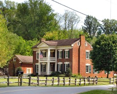 | Rueben Brooks Farmstead | building | 2001 | 01000344 |
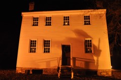 | John and Landon Carter House | building | 1972 | 72001230 |
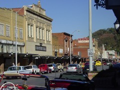 | Elizabethton Historic District | district | 1973 | 73001754 |
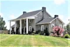 | Henson Hunt House | building | 1979 | 79002414 |
| Miller Farmstead | district | 2014 | 14000449 | |
| Renfro-Allen Farm | district | 1996 | 96000333 | |
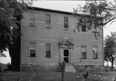 | Sabine Hill | building | 1973 | 73001755 |
| Shelving Rock Encampment | site | 2009 | 09000533 | |
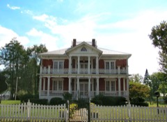 | Simerly-Butler House | building | 1996 | 96001315 |
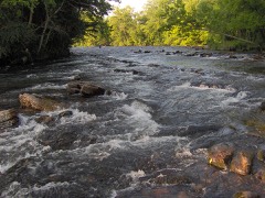 | Sycamore Shoals | site | 1966 | 66000721 |
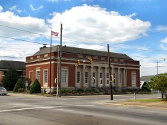 | U.S. Post Office | building | 1983 | 83003024 |
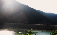 | Watauga Hydroelectric Project | district | 2017 | 100001463 |
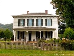 | John T. Wilder House | building | 1986 | 86000400 |
Every wildfire the federal occurrence database records inside this county: 352 of them, burning about 9,480 acres. 8 started naturally and 186 were recorded as arson. Each settlement page carries the fires within five miles of it.
| Reported cause | Fires |
|---|---|
| Arson/incendiarism | 186 |
| Debris and open burning | 98 |
| Missing data/not specified/undetermined | 25 |
| Recreation and ceremony | 15 |
| Natural | 8 |
| Equipment and vehicle use | 7 |
| Other causes | 5 |
| Power generation/transmission/distribution | 2 |
| Fireworks | 2 |
| Smoking | 2 |
| Misuse of fire by a minor | 2 |
The five largest, by the area the report gives. Three of them were set deliberately.
| Date | Cause | Size | Reported by | Name on the report |
|---|---|---|---|---|
| 5 November 2000 | Arson/incendiarism | 2,050 acres | Cherokee National Forest | BLEVINS |
| 18 April 2016 | Missing data/not specified/undetermined | 1,727 acres | Cherokee National Forest | RAILROAD GRADE 2016 |
| 5 April 2010 | Arson/incendiarism | 880 acres | Cherokee National Forest | JENKINS HOLLOW |
| 4 November 2000 | Missing data/not specified/undetermined | 340 acres | Cherokee National Forest | WHITEROCK |
| 17 March 1995 | Arson/incendiarism | 330 acres | Cherokee National Forest | not named |
| 26 August 2007 | Natural | 244 acres | Cherokee National Forest | PETERS RIDGE |
| 22 April 1999 | Debris and open burning | 240 acres | Cherokee National Forest | HOLSTON MOUNTAIN |
| 3 April 2007 | Debris and open burning | 213 acres | Cherokee National Forest | BERNIE LEWIS |
Every settlement page carries the fires within five miles of it - see the settlement index below.
The NOAA Storm Events Database holds 184 reports for this county, causing 9 deaths, no injuries and about $85,637,650 in recorded property damage. Each settlement page carries the reports that name it.
| Kind of event | Reports |
|---|---|
| Thunderstorm Wind | 111 |
| Hail | 32 |
| Flash Flood | 31 |
| Tornado | 4 |
| Flood | 4 |
| Lightning | 1 |
| Heavy Rain | 1 |
The most serious of them, by death, then injury, then recorded damage. The accounts are quoted exactly as the forecast office filed them.
| When | Event | Place named | Harm | What the report says |
|---|---|---|---|---|
| January 1998 | Flash Flood | Countywide | 7 killed, $20,000,000 | no account filed |
| July 2016 | Thunderstorm Wind | Dennis Cove | 2 killed | A married couple was killed by a falling tree at their campsite near the south shore of Watauga Lake. They were beside their tent under an awning they had arranged. Numerous trees were downed in the area. Victims included a male aged 60 and a female aged 47. |
| September 2024 | Flash Flood | O Brien | $62,500,000 | Heavy rain resulted in releases from Watauga Dam that began to flash flood garages and yards of riverside homes along Watauga Drive in Elizabethton around 10:30 am EST. Flash flooding flowing down the Doe River from the Roan Mountain vicinity began to flood homes and roads in the Valley Forge area around 11:25 am EST. Flooding of areas near the Doe River in Elizabethton began around 11:45 am EST when the stage exceeded 9.5 feet. Much of Elizabethton along either side of North Main and South Main Streets flooded as the Doe exceeded 10 feet. Billy Bob Garrison Field had as much as two feet of water. Homes and businesses flooded on North East Street (adjacent to North Main), where vehicles were moved and flipped by flood waters. At 1:50 pm EST, Sycamore Shoals Hospital on the west side of Elizabethton was evacuated. The Doe River and its flash flooding impacts peaked at 1:30 pm EST with a crest of 10.78 feet, and fell below 9.5 feet at 4 pm EST. The Watauga River crested at 13.57 feet at 2:15 pm EST, and flooding continued into the next day. |
| February 2019 | Flood | Poga | $1,500,000 | Flooding in the Poga, Elk Mill, and Little Milligan communities. Mudslide closed Hwy 321 at Watauga Point Road. All told, there was about 1.5 million dollars in flood damage across Carter County for the overall event. |
| October 2017 | Flash Flood | Roan Mtn | $525,000 | About a half dozen homes flooded. One swift water rescue occurred on Hampton Creek and Highway 143. Flooring damaged at a school. Nearly 3 inches of rain fell over the high terrain near Burbank between 1 PM and 4 PM. |
| May 2002 | Tornado (F1) | Unaka | $100,000 | no account filed |
| June 1998 | Tornado (F0) | Buladeen | $75,000 | no account filed |
| October 2010 | Thunderstorm Wind | Elizabethton | $50,000 | The Elizabethton Star newspaper reported numerous trees and powerlines downed by thunderstorm winds across the county. In addition many homes... businesses... schools... and vehicles were also damaged by the wind. |
| June 1995 | Hail | Western Carter Co | $50,000 | Baseball-size hail was reported on the campus of Milligan College. |
| May 2004 | Flash Flood | Valley Forge | $33,000 | Heavy rain and water flowing from flooded streams caused mud slides and rock debris to wash across several roads in Valley Forge. County reports that 30 men worked non-stop for six days to clear debris off roadways and make them passable, again. |
| May 2004 | Thunderstorm Wind | Elizabethton | $30,000 | no account filed |
| May 2004 | Thunderstorm Wind | Elizabethton | $30,000 | no account filed |
| August 2012 | Flash Flood | Elizabethton | $25,000 | Flooding closed many roads across the city of Elizabethton and the county. |
| June 2009 | Thunderstorm Wind | Elizabethton | $25,000 | The emergency manager reported numerous trees and powerlines downed by thunderstorm winds countywide. |
| July 2005 | Thunderstorm Wind | Countywide | $25,000 | no account filed |
| July 2002 | Thunderstorm Wind | Elizabethton | $25,000 | no account filed |
| June 1989 | Tornado (F1) | not stated | $25,000 | no account filed |
| May 2013 | Flash Flood | Hampton | $20,000 | Ritter Town Road and Browns Branch Road impacted by water and debris. Some homes with water in basements. A few evacuations occurred. Car stranded in water. |
| April 2011 | Tornado (EF0) | Milligan College | $20,000 | An EF-0 tornado with maximum winds of 80 mph downed several trees throughout its path. |
| April 2011 | Thunderstorm Wind | Hampton | $20,000 | Law enforcement personnel reported numerous trees downed by thunderstorm wind in Hampton. |
| August 2010 | Thunderstorm Wind | Elizabethton | $20,000 | Law enforcement personnel reported numerous trees and powerlines downed by thunderstorm winds on Highway 19E, Old Rail Road and Town Road south of Elizabethton. |
| June 2008 | Thunderstorm Wind | Elizabethton | $20,000 | Dispatch reported numerous trees downed by thunderstorm winds in Elizabethton and the northern portion of the county. A tree fell on a mobile home in Elizabethton. |
| May 2006 | Thunderstorm Wind | Milligan College | $20,000 | no account filed |
| September 2006 | Thunderstorm Wind | Elizabethton | $20,000 | no account filed |
| May 2005 | Thunderstorm Wind | Elizabethton | $20,000 | no account filed |
| November 2005 | Thunderstorm Wind | Roan Mtn | $20,000 | no account filed |
| July 2004 | Thunderstorm Wind | Countywide | $20,000 | no account filed |
| June 1998 | Thunderstorm Wind | Elizabethton | $20,000 | no account filed |
| June 2003 | Thunderstorm Wind | Elizabethton | $16,000 | no account filed |
| June 2013 | Thunderstorm Wind | Elizabethton | $15,000 | Law enforcement personnel reported trees and powerlines downed by thunderstorm wind |countywide. |
| May 2013 | Flash Flood | Hampton | $15,000 | Roads washed out by flash flooding. |
| October 2010 | Thunderstorm Wind | Okolona | $15,000 | Law enforcement personnel reported numerous trees downed by thunderstorm winds northeast of Unicoi along Sciota Road. |
| February 2009 | Thunderstorm Wind | O Brien | $15,000 | Law enforcement personnel reported numerous trees downed by thunderstorm winds between Elizabethton and Roan Mountain. |
| April 2006 | Thunderstorm Wind | Countywide | $15,000 | Numerous trees down countywide. |
| June 2008 | Thunderstorm Wind | Milligan College | $12,000 | Power company reported several trees and powerlines downed by thunderstorm winds near Elizabethton. |
| May 2006 | Thunderstorm Wind | Elizabethton | $12,000 | no account filed |
| July 2005 | Thunderstorm Wind | Elizabethton | $12,000 | no account filed |
| July 2005 | Thunderstorm Wind | Elizabethton | $12,000 | no account filed |
| May 2003 | Thunderstorm Wind | Elizabethton | $12,000 | no account filed |
| March 1997 | Thunderstorm Wind | Countywide | $11,000 | no account filed |
| May 2004 | Flash Flood | Hampton | $10,250 | Rittertown Road and Greenbrier Road were both flooded and closed. One home's basement in the 1100 block of Rittertown Road was flooded. Several homes in the area, which were not near streams, had water up to their foundations. |
| October 2017 | Flash Flood | Roan Mtn | $10,000 | Unfinished church fellowship building flooded at Old Highway 143 and Cherry Street. Watermark indicated over a foot of standing water in the building. Nearby chain link fences were toppled by the force of water-borne debris. |
| June 2010 | Thunderstorm Wind | Elizabethton | $10,000 | Law enforcement personnel reported several trees downed by thunderstorm winds across the western half of the county. |
| June 2009 | Thunderstorm Wind | Elizabethton | $10,000 | Law enforcement personnel reported several trees downed by thunderstorm winds countywide. |
| June 2007 | Thunderstorm Wind | Biltmore | $10,000 | A few trees were downed by thunderstorm winds near the Carter/Sullivan county line. |
| April 2006 | Thunderstorm Wind | Countywide | $10,000 | A few trees down countywide. |
| May 2004 | Flash Flood | Elizabethton | $10,000 | Gap Creek Road flooded, endangering the water pumping station, which had to be temporarily shut down. |
| May 2001 | Thunderstorm Wind | Elizabethton | $10,000 | Trees and power lines down on Highway 91. |
| June 1995 | Thunderstorm Wind | Elizabethton | $10,000 | Numerous trees and power poles were blown down. One fallen tree punctured a hole through the roof of a house. |
| May 2002 | Thunderstorm Wind | Elizabethton | $10,000 | no account filed |
| July 2002 | Thunderstorm Wind | Elizabethton | $10,000 | no account filed |
| July 2002 | Thunderstorm Wind | Oak Grove | $10,000 | no account filed |
| June 2013 | Thunderstorm Wind | Elizabethton | $8,000 | Law enforcement personnel reported several trees downed by thunderstorm wind 4 miles southeast of Elizabethton. |
| June 2009 | Thunderstorm Wind | Winner | $8,000 | Law enforcement personnel reported several trees downed by thunderstorms northeast of Elizabethton. |
| June 2009 | Thunderstorm Wind | Winner | $8,000 | Law enforcement personnel reported several trees downed by thunderstorm winds countywide. |
| May 2003 | Thunderstorm Wind | Elizabethton | $8,000 | no account filed |
| June 1995 | Thunderstorm Wind | Elizabethton | $7,000 | Several trees and power lines were knocked down. One tree fell on a car. |
| October 2017 | Flash Flood | Roan Mtn | $5,000 | Roan Mountain State Park Gristmill Visitor Center parking lot, picnic area, and basement flooded. HVAC system ruined. |
| June 2014 | Thunderstorm Wind | Johnson City | $5,000 | Law enforcement personnel reported a few trees downed by thunderstorm wind 4 miles southeast of Johnson City in the Okolona area. |
| June 2010 | Thunderstorm Wind | Elizabethton | $5,000 | Law enforcement personnel reported a few trees downed by thunderstorm winds southwest of Elizabethton. |
The Survey's mineral resources record lists 154 workings inside this county. 2 still produce and 152 are closed or unrecorded. Each settlement page carries the workings within five miles of it.
| Commodity | Workings |
|---|---|
| Manganese | 68 |
| Iron | 62 |
| Manganese, Iron | 7 |
| Aluminum | 5 |
| Iron, Manganese | 5 |
| Zinc, Lead | 3 |
| Ball Clay | 2 |
| Sulfur-Pyrite | 2 |
| Barium-Barite | 2 |
| Sulfur | 2 |
| Stone, Crushed/Broken | 2 |
| Zinc, Lead, Sulfur-Pyrite, Copper | 1 |
| Iron, Fluorine-Fluorite | 1 |
| Iron, Fluorine-Fluorite, Sulfur-Pyrite | 1 |
The least common of them first, because a county's hundredth gravel pit says nothing its first ten did not.
| Where | Site | Commodity | Status | Recorded |
|---|---|---|---|---|
| Black Bear Hematitic Magnetite Prospect | Iron, Fluorine-Fluorite | Occurrence | Hematite, Magnetite | |
| Black Bear Prospect | Iron, Fluorine-Fluorite | Occurrence | ||
| Blue Spring | Iron, Manganese, Cobalt, Nickel | Past Producer | ||
| Blue Spring Mine-Stony Cr.Dist. | Iron, Cobalt, Manganese | Past Producer | 1880 | |
| Blue Springs Manganese Mine | Manganese, Iron, Cobalt | Past Producer | 1885 | |
| Finney and Teegarden Hematitic Magnetite Mine | Iron, Fluorine-Fluorite, Sulfur-Pyrite | Occurrence | ||
| Hodge Ore Banks | Iron, Manganese, Cobalt, Nickel | Past Producer | ||
| Hodge Ore Banks | Iron, Nickel, Cobalt | Past Producer | ||
| Sam Mccracken Spring | Mercury | Occurrence | ||
| Watauga Point Zinc Prospect | Zinc, Lead, Sulfur-Pyrite, Copper | Occurrence | 1900 | |
| Watauga Stone Pit #40 | Stone, Crushed/Broken, Limestone, General | Producer | Limestone | |
| Granite Quarry | Stone, Crushed/Broken | Past Producer | ||
| Hatcher Pyrite Mine | Sulfur-Pyrite | Past Producer | 1900 | |
| Hatcher Pyrite Mine | Sulfur | Past Producer | ||
| Helenmode Pyrite Mine | Sulfur-Pyrite | Past Producer | 1900 | |
| Helenmode Pyrite Mine | Sulfur | Past Producer | ||
| Nidifer Branch Barite Prospect | Barium-Barite | Occurrence | Barite | |
| Nidifer Branch Barite Prospect | Barium-Barite | Occurrence | ||
| Watauga Bauxite Mine | Aluminum, Ball Clay | Past Producer | 1904, 1912 | |
| Watauga Bauxite Mine | Aluminum, Ball Clay | Past Producer | ||
| Watauga Quarry Pit #40 | Stone, Crushed/Broken | Producer | ||
| Carden Lyons | Zinc, Lead | Prospect | ||
| Carden Zinc Prospect | Zinc, Lead | Occurrence | Galena, Sphalerite | |
| Watauga Point | Zinc, Lead | Prospect | ||
| Elizabethton, Tenn. Bauxite | Aluminum | Past Producer | Bauxite, Gibbsite | |
| Griffin Prospect | Iron, Manganese | Occurrence | 1905 | |
| Hodge Ore Banks | Iron, Manganese | Past Producer | 1890 | |
| Little Stony Creek Mine | Iron, Manganese | Past Producer | 1951 | |
| Red Bird Hill Bauxite Mine | Aluminum, Iron | Past Producer | 1918 | |
| Red Bird Hill Bauxite Mine | Aluminum, Iron | Past Producer | ||
| Taylor Ore Bank | Iron, Manganese | Past Producer | 1909 | |
| Blue Springs Mine | Manganese, Iron | Past Producer | Residual | |
| Bowers Manganese Mine | Manganese, Iron | Past Producer | ||
| Bowers Mine | Manganese, Iron | Past Producer | Residual | |
| Cardens Bluff Manganese Mine | Manganese, Iron | Past Producer | 1914 | |
| Little Stony Creek Mine | Manganese, Iron | Past Producer | Residual | |
| Valley Forge Mine | Manganese, Iron | Past Producer | Residual | |
| Black's Prospect | Iron | Prospect | ||
| Campbell Magnetite Prospect | Iron | Occurrence | Magnetite | |
| Cedar Hill Manganese Mine | Manganese, Iron | Past Producer | 1862 | |
| Chestnut Ridge Magnetite Prospects | Iron | Past Producer | 1887 | |
| Dr. Smith Prospect | Iron | Prospect | ||
| Elk Mine | Manganese, Iron | Past Producer | Residual | |
| Ellis Magnetite Mine | Iron | Past Producer | 1917 | |
| Ellis Mine | Iron | Past Producer | ||
| Ellis/Patrick/Red Rock Mines | Iron | Past Producer | Vein | |
| Finney & Teegarden Hem . Mag. Mine | Iron | Prospect | ||
| G.W. Stout Prospect | Iron | Prospect | ||
| Greenlee and Ray and Tester Magnetite Mine | Iron | Past Producer | Magnetite | |
| Harold Prospect | Manganese, Iron | Prospect | ||
| Heatherly Prospect | Iron, Manganese | Past Producer | ||
| Heupscup Ridge Magnetite Prospects | Iron | Past Producer | Magnetite | |
| Heupscup Ridge Prospects | Iron | Prospect | ||
| Heupscur Ridge Anomaly | Iron | Occurrence | ||
| Hodge Iron Ore Bank | Iron | Past Producer | Residual | |
| Hodge Iron Ore Banks | Iron, Manganese | Past Producer | 1890 | |
| Horse Shoe Magnetite Prospect | Iron | Occurrence | Magnetite | |
| Howard Anomaly | Iron | Occurrence | ||
| Hurley Mine | Iron | Past Producer | ||
| Julian Magnetite Prospect | Iron | Past Producer | Magnetite | |
| Limonite Ore Bank | Iron | Past Producer | 1907 | |
| Limonite Ore Bank | Iron | Past Producer | Residual | |
| Limonite Ore Bank | Iron | Past Producer | ||
| Little Stony Creek Mine | Iron, Manganese | Past Producer | 1862 | |
| Lost Cove Prospect | Iron | Prospect | ||
| Lunsford Hematitic Magnetite Prospe | Iron | Prospect | ||
| Lunsford Hematitic Magnetite Prospect | Iron | Occurrence | Hematite, Magnetite | |
| Mays Ridge Hem. Magnetite Prospect | Iron | Prospect | ||
| Mays Ridge Hematitic Magnetite Prospect | Iron | Occurrence | Hematite, Magnetite | |
| Miller Magnetite Prospect | Iron | Occurrence | Hematite, Magnetite | |
| Miller Magnetite Prospect | Iron | Prospect | ||
| Montgomery and Cordell Prospect | Iron | Prospect | ||
| Nidifer Prospect | Iron, Manganese | Prospect | ||
| Old Forge Magnetite Mine | Iron | Past Producer | Magnetite | |
| Old Forge Magnetite Mine | Iron | Past Producer | Vein | |
| Patrick Magnetite Mine | Iron | Past Producer | 1903 | |
| Patrick Mine | Iron | Past Producer | ||
| Peg Leg Magnetite Mine | Iron | Past Producer | 1692 | |
| Peg Leg Mine | Iron | Past Producer | Vein | |
| Queens Station Bank | Iron | Past Producer | ||
| Rabbit Station Hem. Mag. Prospect | Iron | Occurrence | ||
| Rabbit Station Hematitic Magnetite Prospect | Iron | Occurrence | Hematite, Magnetite | |
| Red Rock Magnetite Mine | Iron | Past Producer | Magnetite | |
| Red Rock Mine | Iron | Past Producer | ||
| School House Prospect | Iron | Prospect | ||
| Taylor Iron Ore Bank | Iron | Past Producer | 1890 | |
| Taylor Iron Ore Bank | Iron | Past Producer | Residual | |
| Teegarden Magnetite Mine | Iron | Past Producer | 1917 | |
| Valley Forge Manganese Mine | Manganese, Iron | Past Producer | 1917 | |
| Vance Anomaly | Iron | Occurrence | ||
| Whitehead Prospect | Iron | Prospect | ||
| Wilder Magnetite Mine | Iron | Past Producer | 1880 | |
| Wilder Mine | Iron | Past Producer | Vein | |
| Wilder Mine | Iron | Past Producer | ||
| Bear Wallow Manganese Mine | Manganese | Past Producer | 1926 | |
| Bear Wallow Mine | Manganese | Past Producer | Residual | |
| Bear Wallow Mine | Manganese | Past Producer | 1926 | |
| Blevin Mn Mine | Manganese | Past Producer | Residual | |
| Blevins Manganese Mine | Manganese | Past Producer | 1917 | |
| Blevins Mine | Manganese | Past Producer | 1927 | |
| Blevins Prospect | Manganese | Prospect | 1951 | |
| Bowers Branch Prospect | Manganese | Prospect | 1951 | |
| Bowers Mine | Manganese | Past Producer | 1927 | |
| Carden Prospect | Manganese | Prospect | 1951 | |
| Cardens Bluff Mine | Manganese | Past Producer | Residual | |
| Cardens Bluff Mine | Manganese | Past Producer | 1917 | |
| Cedar Hill Mine | Manganese | Past Producer | Residual | |
| Cedar Hill Mine | Manganese | Past Producer | 1932 | |
| Duvall Prospect | Manganese | Prospect | 1951 | |
| Elk Manganese Mine | Manganese | Past Producer | 1918 | |
| Elk Mine | Manganese | Past Producer | 1918 | |
| Fork Mountain and Harold Prospect | Manganese | Prospect | 1951 | |
| Griffith Prospect | Manganese | Prospect | 1951 | |
| Grindstaff Prospect | Manganese | Prospect | 1951 | |
| Hardin Prospect | Manganese | Prospect | 1951 | |
| Hatcher Prospect | Manganese | Prospect | ||
| Hodge Manganese Prospect | Manganese | Occurrence | ||
| Hyder Prospect | Manganese | Prospect | 1951 | |
| Jenkins Manganese Mine | Manganese | Past Producer | 1917 | |
| Jenkins Mine | Manganese | Past Producer | Residual | |
| Jenkins Mine | Manganese | Past Producer | 1942 | |
| Jess Heatherly Prospect | Manganese | Past Producer | 1951 | |
| Keenburg Prospect | Manganese | Prospect | ||
| Lipps Ridge Prospect | Manganese | Prospect | 1951 | |
| Lyons Prospect | Manganese | Prospect | 1951 | |
| Middle Ridge Manganese Mine | Manganese | Past Producer | 1925 | |
| Middle Ridge Mine | Manganese | Past Producer | 1925 | |
| Middle Ridge/Taylor Ridge Mines | Manganese | Past Producer | Residual | |
| Miller Prospect | Manganese | Prospect | 1951 | |
| Naves Prospect | Manganese | Past Producer | 1942 | |
| Patton Manganese Mine | Manganese | Past Producer | 1908 | |
| Patton Mine | Manganese | Past Producer | 1917 | |
| Patton/Winter Mines | Manganese | Past Producer | Residual | |
| Red Bird Hill Prospects | Manganese | Prospect | 1951 | |
| Ritts Ridge Manganese Prospect | Manganese | Occurrence | ||
| Ritts Ridge Prospect | Manganese | Prospect | 1951 | |
| Sams Cove Prospect | Manganese | Prospect | 1951 | |
| Siam Prospect | Manganese | Prospect | 1951 | |
| Stokes Hodge Prospect | Manganese | Prospect | 1951 | |
| Taylor Prospect | Manganese | Past Producer | 1951 | |
| Taylor Ridge Manganese Mine | Manganese | Past Producer | 1925 | |
| Taylor Ridge Mine | Manganese | Past Producer | 1925 | |
| Teaser and Ray Prospect | Manganese | Past Producer | 1936 | |
| Treadway Manganese Prospect | Manganese | Occurrence | 1918 | |
| Treadway Prospect | Manganese | Prospect | 1951 | |
| Turkeytown Prospect | Manganese | Prospect | 1951 | |
| Valley Forge Mine | Manganese | Past Producer | 1933 | |
| Vester Prospect | Manganese | Prospect | 1951 | |
| White Manganese Prospect | Manganese | Occurrence | 1929 | |
| White Manganese Prospect | Manganese | Prospect | ||
| Winter Manganese Mine | Manganese | Past Producer | 1917 | |
| Winter Mine | Manganese | Past Producer | 1934 | |
| Yokum Prospect | Manganese | Prospect | 1951 | |
| Younce Prospect | Manganese | Prospect | 1951 |
Named settlements recorded in the Geographic Names Information System, each with the topographic sheets covering it. Villages, hamlets and abandoned places alike. Each is shown with the nearest named watercourse or landform and the survey quadrangle it falls on.
District 2 · 37687 · Near Chestnut Ridge · Iron Mountain Gap quadrangle
19 sheets, 1891 to 2003
District 7 · 37643 · On Scaffold Branch · Elizabethton quadrangle
21 sheets, 1891 to 1980
District 2 · 37687 · On Hays Branch · White Rocks Mountain quadrangle
19 sheets, 1891 to 2003
District 2 · 37687 · On Whitehead Branch · Iron Mountain Gap quadrangle
19 sheets, 1891 to 2003
District 1 · 37643 · Near Ore Bank Hollow · Watauga Dam quadrangle
22 sheets, 1891 to 2003
District 2 · 37687 · Near Wilder Mine Hollow · Elk Park quadrangle
22 sheets, 1893 to 1994
District 5 · 37601 · Near Hootowl Hollow · Johnson City quadrangle
22 sheets, 1891 to 2003
District 2 · 37687 · On Five Poplar Branch · White Rocks Mountain quadrangle
19 sheets, 1891 to 2003
District 6 · 37658 · On Dry Branch · Watauga Dam quadrangle
22 sheets, 1891 to 2003
No longer a settlement
District 4 · 37643 · Near Edwards Island · Elizabethton quadrangle
21 sheets, 1891 to 1980
District 2 · 37687 · Near Clarke Mountain · Iron Mountain Gap quadrangle
19 sheets, 1891 to 2003
District 2 · 37687 · On Cove Creek · White Rocks Mountain quadrangle
19 sheets, 1891 to 2003
District 2 · 37687 · On George Creek · White Rocks Mountain quadrangle
19 sheets, 1891 to 2003
District 4 · 37643 · On South Pierce Branch · Elizabethton quadrangle
21 sheets, 1891 to 1980
District 4 · 37643 · Near Edwards Island · Elizabethton quadrangle
21 sheets, 1891 to 1980
District 4 · 37643 · Near Edwards Island · Elizabethton quadrangle
21 sheets, 1891 to 1980
District 2 · 37687 · On Morgan Branch · White Rocks Mountain quadrangle
19 sheets, 1891 to 2003
District 2 · 37658 · On Clarke Creek · Iron Mountain Gap quadrangle
19 sheets, 1891 to 2003
District 2 · 37658 · On Clarke Creek · Iron Mountain Gap quadrangle
19 sheets, 1891 to 2003
District 6 · 37658 · On Tigue Branch · Watauga Dam quadrangle
22 sheets, 1891 to 2003
No longer a settlement
District 5 · 37601 · On Honeycomb Creek · Johnson City quadrangle
22 sheets, 1891 to 2003
District 2 · 37687 · Near Bearwallow Hollow · White Rocks Mountain quadrangle
19 sheets, 1891 to 2003
District 5 · 37601 · Near Hootowl Hollow · Johnson City quadrangle
22 sheets, 1891 to 2003
District 1 · 37643 · On Little Laurel Branch · Watauga Dam quadrangle
22 sheets, 1891 to 2003
District 2 · 37687 · Near Big Pine Mountain · White Rocks Mountain quadrangle
19 sheets, 1891 to 2003
No longer a settlement
District 2 · 37687 · Near Big Pine Mountain · White Rocks Mountain quadrangle
19 sheets, 1891 to 2003
District 6 · 37640 · Near Hatley Hollow · Watauga Dam quadrangle
22 sheets, 1891 to 2003
No longer a settlement
District 6 · 37640 · Near Smith Hollow · Watauga Dam quadrangle
22 sheets, 1891 to 2003
District 5 · 37601 · Near Hootowl Hollow · Johnson City quadrangle
22 sheets, 1891 to 2003
District 2 · 37687 · Near Winter Hollow · White Rocks Mountain quadrangle
19 sheets, 1891 to 2003
District 2 · 37658 · Near Byrd Hollow · Iron Mountain Gap quadrangle
19 sheets, 1891 to 2003
District 2 · 37687 · Near Whiteoak Ridge · White Rocks Mountain quadrangle
19 sheets, 1891 to 2003
No longer a settlement
District 5 · 37601 · On Pugh Branch · Johnson City quadrangle
22 sheets, 1891 to 2003
District 2 · 37687 · Near Heaton Creek Ridge · White Rocks Mountain quadrangle
19 sheets, 1891 to 2003
District 2 · 37658 · On Fiddlers Branch · Iron Mountain Gap quadrangle
19 sheets, 1891 to 2003
District 2 · 37687 · Near Stillhouse Hollow · Iron Mountain Gap quadrangle
19 sheets, 1891 to 2003
District 5 · 37601 · Near Hootowl Hollow · Johnson City quadrangle
22 sheets, 1891 to 2003
District 7 · 37601 · Near Little Mountain · Johnson City quadrangle
22 sheets, 1891 to 2003
District 4 · 37643 · On Rocky Branch · Elizabethton quadrangle
21 sheets, 1891 to 1980
District 1 · 37643 · On Richardson Branch · Elizabethton quadrangle
21 sheets, 1891 to 1980
No longer a settlement
District 2 · 37687 · On Buck Creek · White Rocks Mountain quadrangle
19 sheets, 1891 to 2003
District 2 · 37687 · On Shell Creek · White Rocks Mountain quadrangle
19 sheets, 1891 to 2003
District 5 · 37601 · On Dry Creek · Johnson City quadrangle
22 sheets, 1891 to 2003
District 2 · 37687 · On Heaton Creek · White Rocks Mountain quadrangle
19 sheets, 1891 to 2003
District 2 · 37658 · On Tiger Creek · Iron Mountain Gap quadrangle
19 sheets, 1891 to 2003
District 2 · 37658 · On Clarke Creek · Iron Mountain Gap quadrangle
19 sheets, 1891 to 2003
District 2 · 37687 · Near Perkins Hollow · White Rocks Mountain quadrangle
19 sheets, 1891 to 2003
District 6 · 37643 · Near Chambers Hollow · Elizabethton quadrangle
21 sheets, 1891 to 1980
District 4 · 37643 · Near Edwards Island · Elizabethton quadrangle
21 sheets, 1891 to 1980
District 1 · 37643 · On Sand Spring Branch · Keenburg quadrangle
21 sheets, 1891 to 2003
District 2 · 37687 · Near Whitehead Hollow · Iron Mountain Gap quadrangle
19 sheets, 1891 to 2003
District 2 · 37687 · On Whitehead Branch · Iron Mountain Gap quadrangle
19 sheets, 1891 to 2003
District 6 · 37640 · Near White Hollow · Watauga Dam quadrangle
22 sheets, 1891 to 2003
No longer a settlement
The vanished settlements of Carter County: the places named above that are no longer on the map.