 Block
From the record
12 National Register listings published here.
Sources: the National Register database, National Park Service
109 topographic sheets cover 75 settlements here, and 12 properties are on the National Register of Historic Places.
12 National Register listings published here.
Sources: the National Register database, National Park Service
Every property in this county listed on the National Register of Historic Places, with the year it was listed and the federal nomination document.
| Photograph | Property | Type | Listed | Reference |
|---|---|---|---|---|
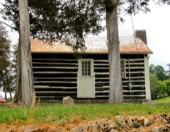 | Big Spring Union Church | building | 1975 | 75001739 |
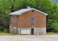 | Claiborne County Jail | building | 2007 | 07000175 |
| Cumberland Gap Historic District | district | 1990 | 90000321 | |
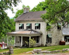 | Graham-Kivette House (Boundary Decrease) | building | 1991 | 91001578 |
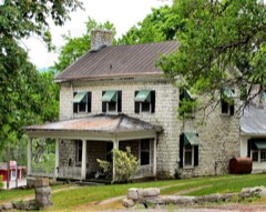 | Graham-Kivette House | building | 1975 | 75001740 |
 | Grant-Lee Hall | building | 1978 | 78002575 |
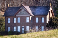 | Kesterson-Watkins House | building | 1982 | 82003958 |
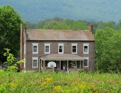 | Kincaid House | building | 1982 | 82003957 |
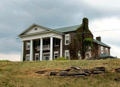 | Kincaid-Ausmus House | building | 1975 | 75001737 |
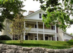 | McClain-Ellison House | building | 1975 | 75001738 |
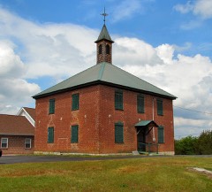 | Powell Valley Male Academy | building | 1995 | 95000053 |
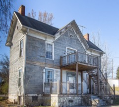 | Wier, James, House, | building | 1979 | 79002419 |
Every wildfire the federal occurrence database records inside this county: 423 of them, burning about 14,944 acres. 3 started naturally and 188 were recorded as arson. Each settlement page carries the fires within five miles of it.
| Reported cause | Fires |
|---|---|
| Arson/incendiarism | 188 |
| Debris and open burning | 139 |
| Missing data/not specified/undetermined | 55 |
| Smoking | 10 |
| Equipment and vehicle use | 9 |
| Other causes | 7 |
| Power generation/transmission/distribution | 5 |
| Misuse of fire by a minor | 4 |
| Natural | 3 |
| Railroad operations and maintenance | 2 |
| Recreation and ceremony | 1 |
The five largest, by the area the report gives. 6 of them were set deliberately.
| Date | Cause | Size | Reported by | Name on the report |
|---|---|---|---|---|
| 21 November 2000 | Arson/incendiarism | 4,040 acres | Tennessee Division of Forestry | not named |
| 17 April 2008 | Debris and open burning | 1,441 acres | Tennessee Division of Forestry | not named |
| 24 November 1998 | Arson/incendiarism | 800 acres | Tennessee Division of Forestry | not named |
| 7 December 2005 | Arson/incendiarism | 650 acres | Tennessee Division of Forestry | not named |
| 19 April 2016 | Arson/incendiarism | 600 acres | Tennessee Division of Forestry | ROSES CREEK |
| 29 November 2006 | Equipment and vehicle use | 400 acres | Tennessee Division of Forestry | not named |
| 24 October 2000 | Arson/incendiarism | 380 acres | Tennessee Division of Forestry | not named |
| 24 April 2014 | Arson/incendiarism | 288 acres | Tennessee Division of Forestry | TACKETT & VALLEY CREEK FIRE |
Every settlement page carries the fires within five miles of it - see the settlement index below.
The NOAA Storm Events Database holds 290 reports for this county, causing 2 deaths, 18 injuries and about $4,976,200 in recorded property damage. Each settlement page carries the reports that name it.
| Kind of event | Reports |
|---|---|
| Thunderstorm Wind | 203 |
| Hail | 46 |
| Flash Flood | 18 |
| Flood | 10 |
| Tornado | 10 |
| Funnel Cloud | 1 |
| Lightning | 1 |
| Debris Flow | 1 |
The most serious of them, by death, then injury, then recorded damage. The accounts are quoted exactly as the forecast office filed them.
| When | Event | Place named | Harm | What the report says |
|---|---|---|---|---|
| June 2011 | Flash Flood | Tazewell | 1 killed, $100,000 | Emergency management personnel reported heavy rain from thunderstorms produced flooding to at least 20 homes from Harrogate to Tazewell. One person drowned in Harrogate. |
| May 2024 | Thunderstorm Wind | Lone Mtn | 1 killed | Several trees were blown down across the county by thunderstorm wind gusts, with one tree falling through a home. A separate tree fell on a car killing the occupant at the intersection of Lone Mountain Rd and Jennings Lane. |
| April 2007 | Tornado (EF1) | New Tazewell | 7 hurt, $1,200,000 | A tornado rated EF1 started five miles northwest of New Tazewell and ended five miles south of Tazewell. The length was approximately 12 miles long and 150 yards wide. The greatest damage occurred across New Tazewell where several trailers were blown off their foundations. Also, trees were blown down county-wide. |
| April 2007 | Tornado (EF1) | Tazewell | 7 hurt, $425,000 | An EF1 tornado touched down on Fords Chapel Road between New Hope Road and Barren Creek Road. A few trees were snapped in this area. The tornado tracked northeast along Barren Creek Road where multiple mobile homes were damaged, one blown over and destroyed. Tree damage was extensive along Barren Creek Road, with large trees both snapped and uprooted. Some homes were also damaged, with a patio roof blown back and shingles and siding blown off. The tornado tracked parallel to Highway 33, snapping trees and causing minor damage to homes in subdivisions on Mountain Road, Rutherford Drive, Harmon Road, and Rowe Street. The tornado crossed Highway 33 near the city limits of New Tazewell before dissipating. |
| March 2012 | Tornado (EF2) | Fibre | 4 hurt, $500,000 | An EF-2 tornado with a maximum wind speed of 120 mph created a damage path 2.6 miles in length and 250 yards wide across the northern part of Harrogate. Along the tornado track, 5 homes were destroyed, 7 suffered major damage, and 17 had minor damage. Also, four residents were injured in the storm. |
| March 2021 | Flash Flood | Tazewell | $1,200,000 | Numerous roadways were flooded and many were impassable across the county. Total damages across the county reached $1.2 million for this flood event, mostly for roads and bridges. |
| April 1998 | Flash Flood | Countywide | $250,000 | no account filed |
| March 2012 | Tornado (EF1) | Union | $100,000 | This tornado formed in Claiborne County, TN, then moved northeast into Lee County, VA. In Claiborne County, the tornado was rated as EF1 with maximum winds of 90 mph. It damaged 5 homes, with one home receiving major damage. It also downed numerous trees. ||The combined tornado path for Claiborne and Lee Counties extended 4.9 miles. |
| February 2011 | Flood | Tazewell | $50,000 | Flooding occurred across a large part of the county with water covering several roads and producing damage to several county roads. Several roads and a a bridge suffered minor to moderate damage due to the flooding. |
| May 1998 | Funnel Cloud | Clairfield | $50,000 | no account filed |
| April 1998 | Thunderstorm Wind | Harrogate | $35,000 | no account filed |
| June 2011 | Flash Flood | Harrogate | $30,000 | Law enforcement personnel reported heavy rain from thunderstorms produced flooding of creeks and roads across eastern portions of the county. |
| November 2002 | Thunderstorm Wind | Forge Ridge | $30,000 | no account filed |
| December 2000 | Thunderstorm Wind | Clairfield | $25,000 | Trees and power lines down |
| May 2006 | Thunderstorm Wind | Tazewell | $25,000 | no account filed |
| September 2006 | Thunderstorm Wind | Countywide | $25,000 | no account filed |
| July 2004 | Thunderstorm Wind | Tazewell | $25,000 | no account filed |
| July 2010 | Lightning | New Tazewell | $24,000 | Twelve miniature horses and one donkey were killed in a lightning strike as they huddled underneath a large oak tree during a thunderstorm at the Beason Mini Spring Farm. |
| June 2011 | Thunderstorm Wind | Harrogate | $20,000 | Law enforcement personnel reported numerous trees downed by thunderstorm wind across the eastern portions of the county. |
| June 2011 | Thunderstorm Wind | Sand Lick | $20,000 | Law enforcement personnel reported numerous trees downed by thunderstorm wind countywide. |
| June 2009 | Thunderstorm Wind | Russell Mill | $20,000 | Law enforcement personnel reported numerous trees downed by thunderstorm winds west of Tazewell along Highway 63. |
| June 2005 | Thunderstorm Wind | Harrogate | $20,000 | Numerous trees and powerlines down in the Harrogate area |
| June 1997 | Thunderstorm Wind | Countywide | $20,000 | Trees down all over Harrogate blocking Highway 25E between Tazewell and Harrogate. Roofs blown off trailers in southern part of county in Powell Valley area. Trees and powerlines down throughout county. |
| July 2006 | Thunderstorm Wind | Lone Mtn | $20,000 | no account filed |
| May 2005 | Thunderstorm Wind | Countywide | $20,000 | no account filed |
| May 2004 | Thunderstorm Wind | Springdale | $20,000 | no account filed |
| May 2004 | Thunderstorm Wind | Tazewell | $20,000 | no account filed |
| July 2004 | Thunderstorm Wind | Countywide | $20,000 | no account filed |
| November 2002 | Thunderstorm Wind | New Tazewell | $20,000 | no account filed |
| May 2002 | Thunderstorm Wind | Countywide | $20,000 | no account filed |
| October 2001 | Thunderstorm Wind | Countywide | $19,000 | Trees and power lines down. |
| July 2005 | Thunderstorm Wind | Harrogate | $18,000 | no account filed |
| January 2002 | Thunderstorm Wind | Countywide | $17,000 | Trees and power lines down. |
| June 2014 | Thunderstorm Wind | Arthur | $15,000 | Law enforcement personnel reported many trees and powerlines downed by thunderstorms wind countywide. Small hail was also reported in the western part of the county. |
| April 2014 | Thunderstorm Wind | Harrogate | $15,000 | Trained spotter reported a roof blown off a barn by thunderstorm wind on LMU property in Harrogate. In addition, a road sign blown into a vehicle near the intersection of Routes 63 and 25. |
| April 2011 | Thunderstorm Wind | Tazewell | $15,000 | Law enforcement personnel reported several trees and powerlines downed by thunderstorm wind across the eastern third of the county. |
| June 2007 | Thunderstorm Wind | Tazewell | $15,000 | A few trees were downed by thunderstorm winds in and around the Tazewell area. |
| June 2007 | Thunderstorm Wind | Tazewell | $15,000 | Numerous trees were downed by thunderstorm winds southwest of Tazewell. |
| June 2005 | Thunderstorm Wind | Tazewell | $15,000 | Several trees and powerlines down across the western half of the county. Reported by LaFollette Utilities. |
| June 2004 | Thunderstorm Wind | Tazewell | $15,000 | Several trees down countywide on roadways |
| July 2001 | Thunderstorm Wind | Tazewell | $15,000 | Trees and power lines down. |
| May 2005 | Thunderstorm Wind | Cumberland Gap | $15,000 | no account filed |
| July 2005 | Thunderstorm Wind | Speedwell | $15,000 | no account filed |
| May 2004 | Thunderstorm Wind | Tazewell | $15,000 | no account filed |
| July 2004 | Thunderstorm Wind | Speedwell | $15,000 | no account filed |
| June 2002 | Thunderstorm Wind | Tazewell | $15,000 | no account filed |
| November 2002 | Thunderstorm Wind | Countywide | $15,000 | no account filed |
| November 2002 | Thunderstorm Wind | Speedwell | $15,000 | no account filed |
| June 1998 | Thunderstorm Wind | Tazewell | $15,000 | no account filed |
| March 1996 | Thunderstorm Wind | New Tazewell | $15,000 | no account filed |
| June 2008 | Thunderstorm Wind | Springdale | $12,000 | Highway department reported numerous trees, limbs and debris downed by thunderstorm winds east of Tazewell. |
| June 2003 | Thunderstorm Wind | Countywide | $12,000 | no account filed |
| August 2014 | Thunderstorm Wind | Tazewell | $10,000 | Law enforcement personnel reported several trees downed by thunderstorm wind 2 miles southwest of Tazewell. |
| June 2011 | Thunderstorm Wind | Arthur | $10,000 | Law enforcement personnel reported several trees downed by thunderstorm wind in Arthur. |
| June 2011 | Thunderstorm Wind | Tazewell | $10,000 | Law enforcement personnel reported several trees downed by thunderstorm wind on Highway 25E 5 miles southeast of Tazewell. |
| October 2009 | Thunderstorm Wind | Tazewell | $10,000 | Law enforcement officials reported several trees downed by thunderstorm winds across the western half of the county. |
| June 2008 | Thunderstorm Wind | Sycamore Hall | $10,000 | Highway department reported numerous trees, limbs and debris downed by thunderstorm winds east of Tazewell. |
| June 2007 | Thunderstorm Wind | Clairfield | $10,000 | A few trees were reported down in Clairfield. |
| April 2006 | Thunderstorm Wind | Clairfield | $10,000 | Several trees down near Clairfield. |
| April 2006 | Thunderstorm Wind | Clairfield | $10,000 | Several trees down in Claifield. |
The Survey's mineral resources record lists 172 workings inside this county. 3 still produce and 169 are closed or unrecorded. Each settlement page carries the workings within five miles of it.
| Commodity | Workings |
|---|---|
| Zinc | 48 |
| Lead | 19 |
| Zinc, Lead | 19 |
| Zinc, Lead, Iron | 18 |
| Iron | 16 |
| Zinc, Lead, Sulfur-Pyrite | 15 |
| Lead, Zinc | 11 |
| Zinc, Iron | 7 |
| Lead, Zinc, Iron | 5 |
| Iron, Zinc | 4 |
| Zinc, Sulfur-Pyrite | 4 |
| Lead, Iron | 3 |
| Zinc, Lead, Sulfur-Pyrite, Iron | 3 |
| Iron, Lead | 3 |
The least common of them first, because a county's hundredth gravel pit says nothing its first ten did not.
| Where | Site | Commodity | Status | Recorded |
|---|---|---|---|---|
| J. D. Braden Prospect | Iron, Lead, Zinc | Occurrence | Galena, Pyrite, Smithsonite | |
| Kings Bend Inside | Copper, Lead, Zinc | Prospect | ||
| Northern Howard Lynch | Iron, Sulfur-Pyrite, Lead, Zinc | Prospect | ||
| Powell River Zinc & Lead Mine | Lead, Zinc, Cadmium, Iron | Past Producer | ||
| Robert Bruce | Sulfur-Pyrite, Zinc, Lead | Prospect | ||
| Straight Creek Zinc Dist. Prospect | Zinc, Iron, Lead, Cadmium | Occurrence | ||
| Tazewell Plant #558 | Stone, Crushed/Broken, Limestone, General | Producer | Limestone | |
| West L. F. Snyder | Sulfur-Pyrite, Lead, Zinc | Prospect | ||
| Claiborne County Quarry | Stone, Crushed/Broken | Past Producer | ||
| Lindsay | Sulfur-Pyrite, Zinc | Prospect | ||
| New Fortner Branch | Lead, Sulfur-Pyrite | Occurrence | ||
| North J. B. Ford | Sulfur-Pyrite, Zinc | Prospect | ||
| Old Fortner Branch | Lead, Sulfur-Pyrite | Occurrence | ||
| Tazewell Plant #558 & Quarry | Stone, Crushed/Broken | Producer | ||
| Bunch Hollow Mine | Zinc, Iron, Lead | Past Producer | ||
| Fortner Branch Prospects | Lead, Iron | Occurrence | Pyrite | |
| Kings Bend Mine | Zinc, Iron, Lead | Past Producer | ||
| Lewis Phelps Prospect | Zinc, Iron, Lead | Occurrence | ||
| Odell | Zinc, Lead, Sulfur-Pyrite, Iron | Prospect | ||
| Ritchie | Zinc, Lead, Sulfur-Pyrite, Iron | Prospect | ||
| S. J. Robinson | Lead, Iron | Prospect | ||
| S. J. Robinson Prospect | Lead, Iron | Occurrence | Galena, Limonite | |
| Southern Howard Lynch | Zinc, Lead, Sulfur-Pyrite, Iron | Prospect | ||
| Crutchfield | Iron, Zinc | Prospect | ||
| Crutchfield Prospect | Iron, Zinc | Occurrence | Limonite, Smithsonite | |
| East J. B. Ford | Zinc, Sulfur-Pyrite | Prospect | ||
| J. B. Ford Prospects | Iron, Zinc | Occurrence | 1918 | |
| Love Heirs Prospect | Lead, Iron, Zinc | Prospect | ||
| Rupert Hopper | Zinc, Sulfur-Pyrite | Prospect | ||
| South J. B. Ford | Zinc, Sulfur-Pyrite | Prospect | ||
| W. P. Jones | Zinc, Sulfur-Pyrite | Prospect | ||
| F. M. Day Prospect | Lead, Zinc, Iron | Occurrence | 1918 | |
| Fortner Prospect, Northern | Lead, Zinc, Iron | Occurrence | 1940 | |
| Gap Creek Prospect | Lead, Zinc, Iron | Occurrence | Galena, Pyrite, Smithsonite, Sphalerite | |
| Matt Evans Prospect | Lead, Zinc, Iron | Occurrence | Calamine, Galena, Sphalerite | |
| Ritchie Prospect | Lead, Zinc, Iron | Occurrence | 1910 | |
| Chad Wilson | Zinc, Iron | Prospect | ||
| Chad Wilson Prospect | Zinc, Iron | Occurrence | 1920 | |
| Combs Station Prospect | Zinc, Iron | Occurrence | ||
| Lindsay Prospect | Zinc, Iron | Occurrence | Pyrite, Sphalerite | |
| Rupert Hopper Prospect | Zinc, Iron | Occurrence | Limonite, Pyrite, Sphalerite | |
| W. Burch Prospect | Zinc, Iron | Occurrence | 1892 | |
| W. P. Jones Prospect | Zinc, Iron | Occurrence | 1933 | |
| Bunch | Lead, Zinc | Prospect | ||
| Caldwell Mine | Lead, Zinc | Past Producer | ||
| Charles Braden Prospect Western | Lead, Zinc | Occurrence | 1925 | |
| Ford Prospect | Lead, Zinc | Occurrence | Galena, Sphalerite | |
| H. B. Johnson Prospect | Lead, Zinc | Occurrence | Galena, Sphalerite | |
| Honeysuck Prospect | Lead, Zinc | Occurrence | Galena, Smithsonite | |
| New Prospect/Russell/Cox Mines | Lead, Zinc | Past Producer | ||
| O.B. Jones Prospect | Lead, Zinc | Occurrence | 1916 | |
| R. E. Johnson | Lead, Zinc | Prospect | ||
| R. E. Johnson Prospect | Lead, Zinc | Occurrence | Galena | |
| B. G. Goin | Zinc, Lead, Sulfur-Pyrite | Prospect | ||
| East L. F. Snyder | Zinc, Lead, Sulfur-Pyrite | Prospect | ||
| F. M. Day | Zinc, Lead, Sulfur-Pyrite | Prospect | ||
| Ford | Zinc, Lead, Sulfur-Pyrite | Prospect | ||
| Gap Creek | Zinc, Lead, Sulfur-Pyrite | Prospect | ||
| Gardner - Tva | Zinc, Lead, Sulfur-Pyrite | Prospect | ||
| Gardner On Powell River | Zinc, Lead, Sulfur-Pyrite | Prospect | ||
| J. D. Braden | Zinc, Lead, Sulfur-Pyrite | Prospect | ||
| J. F. Lynch | Zinc, Lead, Sulfur-Pyrite | Prospect | ||
| Logan | Zinc, Lead, Sulfur-Pyrite | Prospect | ||
| Matt Evans | Zinc, Lead, Sulfur-Pyrite | Prospect | ||
| Northern Fortner | Zinc, Lead, Sulfur-Pyrite | Prospect | ||
| Tuttle | Zinc, Lead, Sulfur-Pyrite | Prospect | ||
| Widener | Zinc, Lead, Sulfur-Pyrite | Prospect | ||
| William Medley and C. Leach | Zinc, Lead, Sulfur-Pyrite | Prospect | ||
| Bunch Hollow Mine | Zinc, Lead, Iron | Past Producer | 1935, 1939 | |
| Cawood Occurrence | Iron | Occurrence | Limonite | |
| Cawood Occurrence | Iron | Occurrence | ||
| Combs Station Prospect | Zinc, Iron | Occurrence | ||
| Floyd Carey Prospect | Iron | Occurrence | Limonite | |
| Floyd Carey Prospect | Iron | Occurrence | ||
| J. M. Hopper Occurrence | Iron | Occurrence | Pyrite | |
| J. M. Hopper Occurrence | Iron | Occurrence | ||
| Kings Bend Northern | Iron | Occurrence | ||
| Kings Bend Prospect Northern | Iron | Occurrence | Limonite | |
| Mayes-Jones Occurrance | Iron | Occurrence | Limonite | |
| Mayes-Jones Occurrance | Iron | Occurrence | ||
| Straight Creek Mine | Zinc, Lead, Iron | Past Producer | 1880 | |
| W. Burch Prospect | Zinc, Iron | Occurrence | ||
| W. M. Russell Prospect | Iron | Occurrence | Limonite | |
| W. M. Russell Prospect | Iron | Occurrence | ||
| B. G. Goin Prospect | Zinc, Lead, Iron | Occurrence | Galena, Pyrite, Sphalerite | |
| Ford Prospect | Zinc, Lead, Iron | Occurrence | Galena, Pyrite, Sphalerite | |
| Gardner Prospect | Zinc, Lead, Iron | Occurrence | Galena, Pyrite, Sphalerite | |
| Gardner-Tva Prospect | Zinc, Lead, Iron | Occurrence | Galena, Pyrite, Sphalerite | |
| Howard Lynch Prospects Northern & Southern | Zinc, Lead, Iron | Occurrence | Galena, Limonite, Pyrite, Smithsonite | |
| J. F. Lynch Prospect | Zinc, Lead, Iron | Occurrence | Galena, Pyrite, Sphalerite | |
| Kings Bend Mine | Zinc, Lead, Iron | Producer | 1937 | |
| L. F. Snyder Prospects | Zinc, Lead, Iron | Occurrence | Galena, Pyrite, Sphalerite | |
| Lewis Phelps Prospect | Zinc, Lead, Iron | Occurrence | Calamine, Galena, Greenockite, Pyrite, Smithsonite, Sphalerite | |
| Logan Prospect | Zinc, Lead, Iron | Occurrence | 1913 | |
| Medley and Leach Prospect | Zinc, Lead, Iron | Occurrence | Galena, Pyrite, Sphalerite | |
| Odell Prospect | Zinc, Lead, Iron | Occurrence | Galena, Limonite, Marcasite, Pyrite, Smithsonite | |
| Robert Bruce Prospect | Zinc, Lead, Iron | Occurrence | Galena, Pyrite, Sphalerite | |
| Robert Welch | Zinc, Lead, Iron | Prospect | ||
| Robert Welch Prospect | Zinc, Lead, Iron | Occurrence | Galena, Limonite, Smithsonite | |
| Straight Creek | Zinc, Lead, Iron | Past Producer | ||
| Tuttle Prospect | Zinc, Lead, Iron | Occurrence | Galena, Pyrite, Sphalerite | |
| W. P. Day Prospect | Zinc, Lead, Iron | Occurrence | 1918 | |
| Big Branch Hollow | Zinc, Lead | Prospect | ||
| Bunch Hollow Mine | Lead | Past Producer | ||
| C. Proffitt | Lead | Prospect | ||
| C. Profitt Prospect | Lead | Occurrence | Galena | |
| C.A. Harris Prospect | Zinc, Lead | Prospect | ||
| Charles Braden Eastern | Zinc, Lead | Unknown | ||
| Charles Braden Occurrence Eastern | Zinc, Lead | Occurrence | Galena, Sphalerite | |
| Deane | Zinc, Lead | Prospect | ||
| Deane Prospect | Zinc, Lead | Occurrence | Galena, Sphalerite | |
| F. Carey Prospect | Lead | Occurrence | Galena | |
| F. Carey Prospect | Lead | Occurrence | ||
| Fortner Prospect, Southern | Lead | Occurrence | 1918 | |
| G. L. Phelps | Zinc, Lead | Prospect | ||
| H. B. Johnson | Zinc, Lead | Prospect | ||
| Honeysuck Prospect | Lead, Zinc | Occurrence | ||
| J. D. Keck | Zinc, Lead | Prospect | ||
| J. P. Welch Prospects | Zinc, Lead | Past Producer | Galena, Sphalerite | |
| J. P. Welch Prospects | Zinc, Lead | Occurrence | ||
| J.D. Keck Prospect | Zinc, Lead | Occurrence | 1916 | |
| Jennings | Zinc, Lead | Prospect | ||
| Kings Bend Mine | Zinc, Lead | Past Producer | ||
| O. B. Jones Prospect | Zinc, Lead | Occurrence | ||
| Robert Keck | Zinc, Lead | Prospect | ||
| Robert Keck Prospect | Zinc, Lead | Occurrence | 1918 | |
| Rose Prospect | Zinc, Lead | Prospect | ||
| Shot Wilson | Lead | Prospect | ||
| Shot Wilson Prospect | Lead | Occurrence | Galena | |
| Southern Fortner | Lead | Prospect | ||
| Straight Creek Mine | Zinc, Lead | Past Producer | ||
| Treece | Zinc, Lead | Prospect | ||
| Treece Prospect | Zinc, Lead | Occurrence | Galena, Sphalerite | |
| Universal Exploration Co. Prospect | Zinc, Lead | Prospect | ||
| W. J. Lynch | Lead | Prospect | ||
| W. J. Lynch Prospect | Lead | Occurrence | Galena | |
| Western Charles Braden | Zinc, Lead | Prospect | ||
| Charles Lundy | Zinc | Prospect | ||
| Charles Lundy Prospect | Zinc | Occurrence | Sphalerite | |
| Cline | Zinc | Occurrence | ||
| Cline Prospect | Zinc | Occurrence | Sphalerite | |
| D. F. Tolliver Occurrence | Zinc | Occurrence | ||
| D. F. Tolliver Occurrence North | Zinc | Occurrence | ||
| Due | Zinc | Prospect | ||
| Due Prospect | Zinc | Occurrence | Smithsonite | |
| Eastern I. Smith | Zinc | Unknown | ||
| Ford East | Zinc | Unknown | ||
| Ford, East Occurrence | Zinc | Occurrence | Sphalerite | |
| Fred Smith | Zinc | Prospect | ||
| Fred Smith Prospect | Zinc | Occurrence | Sphalerite | |
| G.L. Phelps Prospects | Zinc | Occurrence | 1892 | |
| Gardner - Minton Prospects | Zinc | Occurrence | 1913 | |
| Gardner-Minton Prospects | Zinc | Prospect | ||
| I. Smith Occurrences | Zinc | Occurrence | Sphalerite | |
| Johnson | Zinc | Occurrence | ||
| Johnson Prospect | Zinc | Occurrence | Sphalerite | |
| Kings Bend Prospect Inside | Zinc | Occurrence | Smithsonite | |
| Kings Bend Prospect, West | Zinc | Occurrence | ||
| Kings Bend Prospect, West Side | Zinc | Occurrence | Smithsonite | |
| Langford | Zinc | Occurrence | ||
| Langford Prospect | Zinc | Occurrence | Sphalerite | |
| Northern W. M. Duncan | Zinc | Prospect | ||
| R. I. Smith Prospect, Western | Zinc | Occurrence | ||
| S. Jones | Zinc | Prospect | ||
| S. Jones Prospect | Zinc | Occurrence | Sphalerite | |
| S.H. Brown Lease | Zinc | Prospect | ||
| Shipley | Zinc | Unknown | ||
| Shipley Occurrence | Zinc | Occurrence | Sphalerite | |
| Southern W. M. Duncan | Zinc | Prospect | ||
| W. M. Duncan Prospects, Northern & Southern | Zinc | Occurrence | Sphalerite | |
| Western Kings Bend | Zinc | Prospect | ||
| William Jennings Prospect | Zinc | Occurrence | 1916 |
Named settlements recorded in the Geographic Names Information System, each with the topographic sheets covering it. Villages, hamlets and abandoned places alike. Each is shown with the nearest named watercourse or landform and the survey quadrangle it falls on.
District 1 · 37879 · On Murphy Branch · Tazewell quadrangle
15 sheets, 1897 to 1981
No longer a settlement
District 9 · 40965 · On Sugan Branch · Fork Ridge quadrangle
18 sheets, 1886 to 1977
District 4 · 37879 · Near Little Caney Valley · Howard Quarter quadrangle
18 sheets, 1883 to 1981
District 2 · 37825 · On Meyers Branch · Clouds quadrangle
20 sheets, 1897 to 1981
No longer a settlement
District 4 · 37879 · Near Cedar Fork Valley · Coleman Gap quadrangle
23 sheets, 1887 to 1977
District 4 · 37879 · On West Fork Hoop Creek · Coleman Gap quadrangle
23 sheets, 1887 to 1977
District 4 · 37879 · On South Fork Sycamore Creek · Howard Quarter quadrangle
18 sheets, 1883 to 1981
District 2 · 37825 · On Big Barren Creek · Powder Springs quadrangle
16 sheets, 1897 to 1981
District 2 · 37825 · Near Polecat Hollow · Clouds quadrangle
20 sheets, 1897 to 1981
No longer a settlement
District 7 · 37724 · On Yellow Branch · Middlesboro South quadrangle
28 sheets, 1886 to 1977
District 4 · 37879 · On Cedar Fork Creek · Tazewell quadrangle
15 sheets, 1897 to 1981
District 7 · 37752 · Near Gobblers Knob · Middlesboro South quadrangle
28 sheets, 1886 to 1977
District 8 · 37870 · On Lower Fall Branch · Ausmus quadrangle
17 sheets, 1897 to 1981
No longer a settlement
District 4 · 37879 · Near River Ridge · Howard Quarter quadrangle
18 sheets, 1883 to 1981
District 7 · 37752 · Near Pine Hill Hollow · Middlesboro South quadrangle
28 sheets, 1886 to 1977
District 4 · 37879 · On Hodges Branch · Tazewell quadrangle
15 sheets, 1897 to 1981
No longer a settlement
District 7 · 37870 · Near Poor Valley · Middlesboro South quadrangle
28 sheets, 1886 to 1977
District 8 · 37870 · On Russell Branch · Fork Ridge quadrangle
18 sheets, 1886 to 1977
District 6 · 37879 · On Water Prong · Middlesboro South quadrangle
28 sheets, 1886 to 1977
District 4 · 37869 · Near Powell Mountain · Coleman Gap quadrangle
23 sheets, 1887 to 1977
The vanished settlements of Claiborne County: the places named above that are no longer on the map.