 Block
From the record
14 National Register listings published here.
Sources: the National Register database, National Park Service
131 topographic sheets cover 79 settlements here, and 14 properties are on the National Register of Historic Places.
14 National Register listings published here.
Sources: the National Register database, National Park Service
Every property in this county listed on the National Register of Historic Places, with the year it was listed and the federal nomination document.
| Photograph | Property | Type | Listed | Reference |
|---|---|---|---|---|
| Beechwood Hall | building | 1975 | 75001741 | |
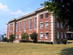 | Cocke County Courthouse | building | 1995 | 95000538 |
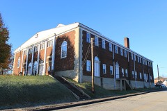 | Cocke County Memorial Building | building | 1997 | 97001139 |
 | Walter C. Cureton House | building | 2001 | 01001325 |
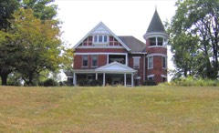 | Elm Hill | building | 1975 | 75001742 |
| English Mountain Fire Lookout Tower | building | 2015 | 15000832 | |
| Laurel Springs Primitive Baptist Church | building | 2021 | 100006382 | |
 | Mount Cammerer Fire Lookout | building | 2019 | 100004091 |
| Neas Farm | district | 2004 | 04000152 | |
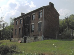 | O'Dell House | building | 1975 | 75001744 |
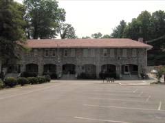 | Rhea-Mims Hotel | building | 1998 | 98000822 |
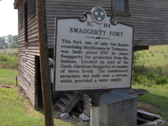 | Swaggerty Blockhouse | building | 1973 | 73001756 |
| Vinson House | building | 1975 | 75001745 | |
| Yett-Ellison House | building | 1975 | 75001746 |
Every wildfire the federal occurrence database records inside this county: 273 of them, burning about 16,621 acres. 25 started naturally and 129 were recorded as arson. Each settlement page carries the fires within five miles of it.
| Reported cause | Fires |
|---|---|
| Arson/incendiarism | 129 |
| Debris and open burning | 60 |
| Missing data/not specified/undetermined | 31 |
| Natural | 25 |
| Equipment and vehicle use | 9 |
| Recreation and ceremony | 6 |
| Misuse of fire by a minor | 4 |
| Power generation/transmission/distribution | 3 |
| Other causes | 3 |
| Smoking | 2 |
| Railroad operations and maintenance | 1 |
The five largest, by the area the report gives. Four of them were set deliberately.
| Date | Cause | Size | Reported by | Name on the report |
|---|---|---|---|---|
| 4 April 2016 | Debris and open burning | 2,436 acres | Cherokee National Forest | HALLS TOP |
| 10 November 2001 | Arson/incendiarism | 2,200 acres | Cherokee National Forest | GREEN MTN. |
| 20 August 2008 | Natural | 2,000 acres | Cherokee National Forest | OLD 15TH |
| 11 November 2016 | Missing data/not specified/undetermined | 1,076 acres | Tennessee Division of Forestry | NEDDY MOUNTAIN ROAD |
| 13 September 2002 | Arson/incendiarism | 1,025 acres | Cherokee National Forest | ROCKY TOP GAP |
| 20 November 1994 | Arson/incendiarism | 875 acres | Cherokee National Forest | BLUFFTON #2 |
| 4 November 2013 | Arson/incendiarism | 864 acres | Cherokee National Forest | HALLS TOP |
| 10 April 2012 | Other causes | 528 acres | Tennessee Division of Forestry | CONDO FIRE |
Every settlement page carries the fires within five miles of it - see the settlement index below.
The NOAA Storm Events Database holds 264 reports for this county, causing 3 deaths, 13 injuries and about $4,640,800 in recorded property damage. Each settlement page carries the reports that name it.
| Kind of event | Reports |
|---|---|
| Thunderstorm Wind | 192 |
| Hail | 37 |
| Flash Flood | 17 |
| Flood | 10 |
| Tornado | 6 |
| Lightning | 2 |
The most serious of them, by death, then injury, then recorded damage. The accounts are quoted exactly as the forecast office filed them.
| When | Event | Place named | Harm | What the report says |
|---|---|---|---|---|
| September 2024 | Flood | Liberty Hill | 2 killed | Flooding on the Cocke County side from the massive flood wave on the Nolichucky River near Lowland. The Lowland river gauge was above its previous record crest for nearly 20 hours, cresting at 35.16 feet at 10:15 am EST on the 28th, 9 feet above its previous record. Damaging flooding occurred, but in mostly rural and agricultural areas. As the river swelled out of its banks in the area where it becomes the border between Greene and Cocke counties, it flooded Goodwater Road around midnight where an elderly couple were swept away in their vehicle trying to escape. All told, Cocke County estimates $24.3 million in total county damages, which are included in the entry for the Pigeon River record flooding. |
| March 1963 | Tornado (F2) | not stated | 1 killed, 1 hurt, $250,000 | no account filed |
| February 1976 | Tornado (F2) | not stated | 10 hurt, $2,500,000 | no account filed |
| January 2023 | Thunderstorm Wind | Northport | 1 hurt | A portion of the roof was blown off of Newport Grammar School, and some windows were broken. One student sustained a minor injury. |
| May 2004 | Lightning | Del Rio | 1 hurt | no account filed |
| June 2025 | Flash Flood | Grassy Fork | $500,000 | Interstate 40 was closed by flooding and debris near mile marker 451, just west of the North Carolina state line. Multiple vehicles were stranded and water rescues were ongoing. |
| July 1999 | Flash Flood | Del Rio | $225,000 | no account filed |
| April 2011 | Tornado (EF1) | Clevenger | $100,000 | An EF1 tornado touched downed near Newport. It formed near the Jefferson and Cocke county line at Highway 441 then tracked across the county to near Newport where it dissipated. The max wind of 90 mph caused damage to the local hospital and downed numerous trees. |
| June 2001 | Thunderstorm Wind | Del Rio | $50,000 | no account filed |
| July 1997 | Thunderstorm Wind | Countywide | $50,000 | no account filed |
| July 2005 | Thunderstorm Wind | Cosby | $35,000 | no account filed |
| April 2011 | Tornado (EF1) | Tom Town | $30,000 | A NWS storm survey reported an EF1 tornado touched down near Del Rio. It formed near Toms Creek Road then tracked to near Spicewood Flats Road where it dissipated. The 100 mph wind downed numerous trees. |
| February 2011 | Flood | Parrottsville | $30,000 | Amateur radio personnel reported heavy rain from a thunderstorm produced flooding on Fish Hatchery Road and widespread agricultural flooding. |
| April 2011 | Thunderstorm Wind | Newport | $30,000 | Law enforcement personnel reported numerous trees downed and damage to Cocke County High School by thunderstorm wind in Newport. |
| June 2009 | Thunderstorm Wind | Newport | $25,000 | Law enforcement personnel reported numerous trees and powerlines downed by thunderstorm winds countywide. A home in Newport was damaged when a tree fell on it. |
| April 2006 | Thunderstorm Wind | Newport | $25,000 | A large oak tree fell onto the front of a church in Newport. A few other trees down across the county. |
| May 2006 | Thunderstorm Wind | Newport | $25,000 | no account filed |
| July 2002 | Thunderstorm Wind | Newport | $25,000 | no account filed |
| September 2024 | Flood | Hartford | $24,300 | The river gauge on the Pigeon River at Newport exceeded the 12 foot major flood stage at 5:30 am EST on the 27th. (This stage is not unusual, and has happened over a dozen times in the 2000s.) However, the gauge remained above major flood stage for 23 hours, cresting at 29.57 feet at 5:07 pm EST on the 27th, more than 6 feet above the previous record crest that stood for over 120 years. As the flood wave moved down from the state line, it destroyed portions of I-40 and a popular rafting venue. A river gauge near Hartford was destroyed, and flooding in Hartford occurred. Structures and agricultural land near Edwina were ruined. Numerous structures in and around the river in the vicinity of Newport were destroyed or damaged. Substantial and damaging flooding occurred in downtown Newport. All damages for Cocke County (which suffered two other river floods elsewhere) will be included in this entry. Rumors during the afternoon of the 27th that Walters Dam had failed were false, but its power station outside of Hartford had to be evacuated due to the excessive river flooding. |
| April 2011 | Tornado (EF0) | Hartford | $20,000 | A NWS storm survey reported an EF0 tornado touched down briefly near Hartford. It formed and also dissipated near Big Creek Road. The 80 mph wind downed several trees and one outbuilding was destroyed. |
| April 2011 | Thunderstorm Wind | Del Rio | $20,000 | Amateur radio personnel reported numerous trees downed by thunderstorm wind in Del Rio. |
| April 2007 | Thunderstorm Wind | Parrottsville | $20,000 | Several trees were reported down and a wind gust was estimated at 60 mph. |
| August 2005 | Thunderstorm Wind | Bybee | $20,000 | Numerous trees down on powerlines along Hwy 160 near Bybee. |
| July 2006 | Thunderstorm Wind | Newport | $20,000 | no account filed |
| May 2004 | Thunderstorm Wind | Del Rio | $20,000 | no account filed |
| May 2004 | Thunderstorm Wind | Newport | $20,000 | no account filed |
| July 2004 | Thunderstorm Wind | Countywide | $20,000 | no account filed |
| May 2004 | Thunderstorm Wind | Newport | $18,000 | no account filed |
| April 2006 | Thunderstorm Wind | Parrottsville | $17,000 | Several trees down in Parrottsville along with a few toppled mailboxes and signs. |
| February 2000 | Thunderstorm Wind | Newport | $16,000 | no account filed |
| August 2009 | Thunderstorm Wind | Newport | $15,000 | Law enforcement officials reported numerous trees downed by thunderstorm winds countywide. |
| June 2005 | Thunderstorm Wind | Newport | $15,000 | A few trees and powerlines down across the city. |
| August 2005 | Thunderstorm Wind | Bybee | $15,000 | Several trees and powerlines down in and around Rankin. |
| July 2001 | Thunderstorm Wind | Parrottsville | $15,000 | Trees and power lines down. |
| July 2006 | Thunderstorm Wind | Parrottsville | $15,000 | no account filed |
| May 2004 | Thunderstorm Wind | Parrottsville | $15,000 | no account filed |
| May 1997 | Thunderstorm Wind | Countywide | $15,000 | no account filed |
| March 1996 | Thunderstorm Wind | Newport | $15,000 | no account filed |
| August 2000 | Thunderstorm Wind | Hartford | $14,000 | no account filed |
| June 2010 | Thunderstorm Wind | Parrottsville | $12,000 | Law enforcement personnel reported numerous trees downed by thunderstorm winds in Parrottsville. |
| June 2009 | Thunderstorm Wind | Newport | $12,000 | The newspaper reported several trees and powerlines downed by thunderstorm winds countywide. |
| April 2006 | Thunderstorm Wind | Bybee | $12,000 | Numerous trees down in Bybee and Parrotsville. |
| June 2005 | Thunderstorm Wind | Newport | $12,000 | Tree fell on a vehicle on Converse Street in Newport. |
| June 1997 | Thunderstorm Wind | Countywide | $12,000 | Trees down on powerlines on Wilhite Road near the Cocke county line. |
| May 2003 | Thunderstorm Wind | Parrottsville | $12,000 | no account filed |
| June 1997 | Thunderstorm Wind | Hartford | $12,000 | no account filed |
| April 2011 | Thunderstorm Wind | Cosby | $10,000 | Law enforcement personnel reported a few trees downed by thunderstorm wind in Cosby...Del Rio and Grassy Fork. |
| June 2007 | Flash Flood | Newport | $10,000 | High water closed East Broadway Street, Main Street, and McMahan Avenue. Water also partially flooded a local bank. |
| June 2007 | Thunderstorm Wind | Newport | $10,000 | A spotter reported a tree and several powerlines down in Newport from thunderstorm winds. |
| August 2007 | Thunderstorm Wind | Cosby | $10,000 | The sheriffs office reported several trees downed by thunderstorm winds near Cosby. |
| August 2007 | Thunderstorm Wind | Newport | $10,000 | The sheriffs dispatch reported several large trees downed by thunderstorm winds near the intersection of Airport Road and Knob Creek Road in the community of Briar Thicket. |
| June 2006 | Thunderstorm Wind | Countywide | $10,000 | A few trees down countywide. |
| November 2000 | Thunderstorm Wind | Newport | $10,000 | Trees and power lines down. |
| August 1995 | Thunderstorm Wind | Countywide | $10,000 | Numerous trees were knocked down. |
| April 2003 | Thunderstorm Wind | Newport | $10,000 | no account filed |
| June 2003 | Thunderstorm Wind | Newport | $10,000 | no account filed |
| June 2002 | Thunderstorm Wind | Cosby | $10,000 | no account filed |
| May 2002 | Thunderstorm Wind | Newport | $10,000 | no account filed |
| July 2002 | Thunderstorm Wind | Newport | $10,000 | no account filed |
| August 2000 | Thunderstorm Wind | Newport | $10,000 | no account filed |
The Survey's mineral resources record lists 74 workings inside this county. 3 still produce and 71 are closed or unrecorded. Each settlement page carries the workings within five miles of it.
| Commodity | Workings |
|---|---|
| Barium-Barite | 44 |
| Iron | 16 |
| Manganese | 14 |
| Iron, Sulfur-Pyrite | 3 |
| Fluorine-Fluorite | 3 |
| Iron, Sulfur | 3 |
| Copper | 2 |
| Kaolin | 2 |
| Stone, Crushed/Broken, Limestone, General | 1 |
| Fluorine-Fluorite, Sulfur-Pyrite, Copper | 1 |
| Fluorine-Fluorite, Barium-Barite, Iron | 1 |
| Sulfur-Pyrite | 1 |
| Titanium, Metal, Zirconium | 1 |
| Sulfur-Pyrite, Iron, Fluorine-Fluorite | 1 |
The least common of them first, because a county's hundredth gravel pit says nothing its first ten did not.
| Where | Site | Commodity | Status | Recorded |
|---|---|---|---|---|
| C.E. Leatherwood Property | Graphite, Copper, Lead | Prospect | ||
| Dry Fork Barite Prospect | Fluorine-Fluorite, Barium-Barite, Iron | Occurrence | 1916 | |
| Dry Fork Barite Prospect | Barium-Barite, Fluorine-Fluorite, Iron | Occurrence | ||
| East Meyer Barite Mine | Barium-Barite, Sulfur-Pyrite | Past Producer | 1885 | |
| East Meyer Barite Mine | Barium-Barite, Sulfur | Past Producer | ||
| Krebs Barite Mine | Barium-Barite, Sulfur-Pyrite, Iron, Fluorine-Fluorite | Past Producer | 1903 | |
| Krebs Barite Mine | Barium-Barite, Fluorine-Fluorite, Sulfur, Iron | Past Producer | ||
| Quartzite Quarry | Stone, Dimension | Past Producer | ||
| Smith Quarry | Stone, Crushed/Broken, Limestone, General | Producer | Dolomite | |
| Smith Quarry | Stone, Crushed/Broken | Producer | ||
| Snowbird Mtn. Placer | Titanium, Metal, Zirconium | Occurrence | Ilmenite, Zircon | |
| Williams Barite Mine | Barium-Barite, Fluorine-Fluorite, Sulfur-Pyrite, Copper | Past Producer | 1901 | |
| Williams Barite Mine | Barium-Barite, Copper, Fluorine-Fluorite, Sulfur | Past Producer | ||
| Willis | Zinc | Prospect | ||
| Dickey Kaolin Mine | Kaolin | Prospect | ||
| Freeman | Copper | Prospect | ||
| J.A. Willis Property | Copper | Prospect | ||
| Kaolin Prospect | Kaolin | Prospect | ||
| Mccoy Prospect | Barium-Barite, Fluorine-Fluorite | Prospect | ||
| Moccasin Gap Barite Mine | Barium-Barite, Iron, Sulfur-Pyrite | Past Producer | 1926 | |
| Moccasin Gap Barite Mine | Barium-Barite, Iron, Sulfur | Past Producer | ||
| Oliver Barite Mine | Barium-Barite, Iron, Sulfur-Pyrite | Past Producer | 1885, 1916 | |
| Oliver Barite Mine | Barium-Barite, Iron, Sulfur | Past Producer | ||
| Stone Barite Mine | Barium-Barite, Iron, Sulfur-Pyrite | Past Producer | 1916 | |
| Stone Barite Mine | Barium-Barite, Iron, Sulfur | Past Producer | ||
| Williams Mine | Barium-Barite, Fluorine-Fluorite | Producer | Barite, Fluorite | |
| Williams Mine | Barium-Barite, Fluorine-Fluorite | Past Producer | ||
| Adams Mine | Manganese | Past Producer | 1908 | |
| Adams/Blanchard/Waddell | Manganese | Past Producer | Residual | |
| Allen Stockley Prospect | Manganese, Iron | Prospect | ||
| Blanchard Mine | Manganese | Past Producer | 1902 | |
| Burnett Gap Prospect | Manganese | Prospect | 1951 | |
| Huff Prospect | Manganese | Prospect | 1918 | |
| Jones and Mcmahon Prospect | Manganese | Occurrence | ||
| Long Creek Prospect | Manganese | Unknown | 1951 | |
| Newport Area | Manganese | Past Producer | Residual | |
| Newport Mine | Manganese | Past Producer | 1917 | |
| Raines Mine | Manganese | Prospect | ||
| Waddell Mine | Manganese | Past Producer | 1918 | |
| Wood Mine | Manganese | Past Producer | Residual | |
| Wood Mine | Manganese | Past Producer | 1906 | |
| Cross Mountain Barite Prospect | Barium-Barite, Iron | Past Producer | 1900 | |
| Cross Mountain Barite Prospect | Barium-Barite, Iron | Prospect | ||
| Hurr Mine | Iron | Past Producer | ||
| Mine Ridge | Iron | Past Producer | ||
| Mooneyham Barite Mine | Barium-Barite, Iron | Past Producer | 1895 | |
| Mooneyham Barite Mine | Barium-Barite, Iron | Past Producer | ||
| Mud Tunnel Hollow Barite Mine | Barium-Barite, Iron | Past Producer | 1885 | |
| Mud Tunnel Hollow Barite Mine | Barium-Barite, Iron | Past Producer | ||
| Orebank Ridge | Iron | Past Producer | ||
| Pigeonroost Branch Barite Mine | Barium-Barite, Iron | Past Producer | Barite, Limonite, Pyrite | |
| Pigeonroost Branch Barite Mine | Barium-Barite, Iron | Past Producer | ||
| W.A. Bradshaw Property | Iron | Prospect | ||
| West Meyer Barite Mine | Barium-Barite, Iron | Past Producer | 1885 | |
| West Meyer Barite Mine | Barium-Barite, Iron | Past Producer | ||
| Wolf Creek Prospects | Iron | Prospect | ||
| Bee Branch Prospect | Barium-Barite | Prospect | ||
| Beetree Knob Barite Prospect | Barium-Barite | Occurrence | Vein | |
| Beetree Knob Barite Prospect | Barium-Barite | Occurrence | ||
| Brushy Mountain Barite Prospect | Barium-Barite | Occurrence | Vein | |
| Brushy Mountain Barite Prospect | Barium-Barite | Occurrence | ||
| Darky Tom Barite Mine | Barium-Barite | Past Producer | 1885 | |
| Darky Tom Mine | Barium-Barite | Past Producer | ||
| East Meyer Barite Mine | Barium-Barite | Past Producer | Vein | |
| Huff Barite Prospects | Barium-Barite | Occurrence | Vein | |
| Huff Barite Prospects | Barium-Barite | Occurrence | ||
| Moccasin Gap Barite Mine | Barium-Barite | Past Producer | Vein | |
| Mud Tunnel Hollow Barite Mine | Barium-Barite | Past Producer | Vein | |
| Spence Barite Mine | Barium-Barite | Past Producer | 1900 | |
| Spence Barite Mine | Barium-Barite | Past Producer | ||
| Stone Barite Mine | Barium-Barite | Past Producer | Vein | |
| White Rock Hollow Barite Mine | Barium-Barite | Past Producer | 1885, 1916 | |
| White Rock Hollow Barite Mine | Barium-Barite | Past Producer | ||
| Williams Barite Mine/Krebs Barite Mine | Barium-Barite | Past Producer |
Named settlements recorded in the Geographic Names Information System, each with the topographic sheets covering it. Villages, hamlets and abandoned places alike. Each is shown with the nearest named watercourse or landform and the survey quadrangle it falls on.
District 2 · 37843 · On Freshour Branch · Neddy Mountain quadrangle
23 sheets, 1893 to 1983
District 2 · 37821 · On Yellow Springs Branch · Newport quadrangle
23 sheets, 1893 to 1983
District 5 · 37722 · On South Fork Bogard Creek · Jones Cove quadrangle
25 sheets, 1893 to 1983
No longer a settlement
District 2 · 37821 · Near Broad Axe Hill · Neddy Mountain quadrangle
23 sheets, 1893 to 1983
District 3 · 37713 · Near Phillips Hollow · Parrottsville quadrangle
19 sheets, 1883 to 1981
District 4 · 37821 · Near Sand Mountain · Chestnut Hill quadrangle
25 sheets, 1893 to 1983
District 1 · 37821 · Near Tannery Island · Newport quadrangle
23 sheets, 1893 to 1983
District 1 · 37727 · On Morgan Branch · Neddy Mountain quadrangle
23 sheets, 1893 to 1983
District 1 · 37727 · On Gulf Fork Big Creek · Neddy Mountain quadrangle
23 sheets, 1893 to 1983
District 1 · 37753 · Near Panther Mountain · Hartford quadrangle
26 sheets, 1893 to 2003
District 2 · 37843 · On White Branch · Neddy Mountain quadrangle
23 sheets, 1893 to 1983
District 3 · 37821 · On North Fork McCowan Creek · Rankin quadrangle
18 sheets, 1883 to 1981
District 3 · 37821 · Near Hurley Island · Springvale quadrangle
19 sheets, 1883 to 1981
No longer a settlement
District 1 · 37727 · On Bailey Branch · Paint Rock quadrangle
27 sheets, 1894 to 2003
No longer a settlement
District 3 · 37821 · Near Rankin Bottoms · Rankin quadrangle
18 sheets, 1883 to 1981
No longer a settlement
District 4 · 37821 · Near English Mountain · Chestnut Hill quadrangle
25 sheets, 1893 to 1983
District 1 · 37753 · On Grassy Fork · Waterville quadrangle
26 sheets, 1893 to 2003
No longer a settlement
District 1 · 37753 · On Naillon Branch · Hartford quadrangle
26 sheets, 1893 to 2003
No longer a settlement
District 2 · 37843 · Near Barger Hollow · Parrottsville quadrangle
19 sheets, 1883 to 1981
District 1 · 37821 · Near Chicken Hollow · Newport quadrangle
23 sheets, 1893 to 1983
District 2 · 37843 · On South Fork Clear Creek · Parrottsville quadrangle
19 sheets, 1883 to 1981
District 5 · 37722 · On South Fork Bogard Creek · Jones Cove quadrangle
25 sheets, 1893 to 1983
District 1 · 37727 · By Chimney Rocks · Paint Rock quadrangle
27 sheets, 1894 to 2003
No longer a settlement
District 2 · 37821 · On Pigeonroost Branch · Neddy Mountain quadrangle
23 sheets, 1893 to 1983
The vanished settlements of Cocke County: the places named above that are no longer on the map.