 Block
From the record
12 National Register listings published here.
Sources: the National Register database, National Park Service
55 topographic sheets cover 38 settlements here, and 12 properties are on the National Register of Historic Places.
12 National Register listings published here.
Sources: the National Register database, National Park Service
Every property in this county listed on the National Register of Historic Places, with the year it was listed and the federal nomination document.
| Photograph | Property | Type | Listed | Reference |
|---|---|---|---|---|
| Bolivar-Somerville Stage Road | structure | 2005 | 05000802 | |
 | Crawford General Store | building | 1975 | 75001752 |
| Crawford's Experiment Farm | building | 1991 | 91000247 | |
 | Immanuel Church | building | 1972 | 72001239 |
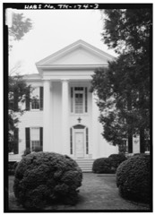 | La Grange Historic District | district | 1975 | 75001751 |
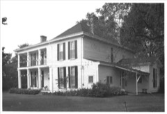 | Lucerne | building | 1977 | 77001269 |
| Mebane-Nuckolls House | building | 1985 | 85002910 | |
 | Miller House | building | 1978 | 78002587 |
| Oakland Presbyterian Church | building | 2002 | 02000235 | |
 | Rossville Historic District | district | 2001 | 01000726 |
 | Somerville Historic District | district | 1982 | 82003968 |
| Williston Historic District | district | 1995 | 95001409 |
Every wildfire the federal occurrence database records inside this county: 273 of them, burning about 3,387 acres. 1 started naturally and 62 were recorded as arson. Each settlement page carries the fires within five miles of it.
| Reported cause | Fires |
|---|---|
| Debris and open burning | 154 |
| Arson/incendiarism | 62 |
| Equipment and vehicle use | 24 |
| Missing data/not specified/undetermined | 13 |
| Railroad operations and maintenance | 9 |
| Smoking | 5 |
| Recreation and ceremony | 3 |
| Other causes | 1 |
| Natural | 1 |
| Misuse of fire by a minor | 1 |
The five largest, by the area the report gives. Two of them were set deliberately.
| Date | Cause | Size | Reported by | Name on the report |
|---|---|---|---|---|
| 15 September 1999 | Smoking | 269 acres | Tennessee Division of Forestry | not named |
| 29 June 1998 | Arson/incendiarism | 135 acres | Tennessee Division of Forestry | not named |
| 24 March 2005 | Debris and open burning | 119 acres | Tennessee Division of Forestry | SUGAR HILL FIRE |
| 9 March 2006 | Debris and open burning | 114 acres | Tennessee Division of Forestry | not named |
| 17 March 2006 | Debris and open burning | 112 acres | Tennessee Division of Forestry | not named |
| 19 October 2000 | Equipment and vehicle use | 102 acres | Tennessee Division of Forestry | not named |
| 12 March 2006 | Arson/incendiarism | 94 acres | Tennessee Division of Forestry | not named |
| 30 August 2011 | Equipment and vehicle use | 88 acres | Tennessee Division of Forestry | PARKS RD |
Every settlement page carries the fires within five miles of it - see the settlement index below.
The NOAA Storm Events Database holds 356 reports for this county, causing 14 deaths, 108 injuries and about $7,813,721 in recorded property damage. Each settlement page carries the reports that name it.
| Kind of event | Reports |
|---|---|
| Thunderstorm Wind | 188 |
| Hail | 110 |
| Flash Flood | 26 |
| Tornado | 23 |
| Flood | 5 |
| Lightning | 4 |
The most serious of them, by death, then injury, then recorded damage. The accounts are quoted exactly as the forecast office filed them.
| When | Event | Place named | Harm | What the report says |
|---|---|---|---|---|
| March 1952 | Tornado (F4) | not stated | 7 killed, 50 hurt, $250,000 | no account filed |
| January 1988 | Tornado (F3) | not stated | 3 killed, 24 hurt, $2,500,000 | no account filed |
| April 2025 | Tornado (EF2) | Forty Five | 2 killed, 3 hurt, $100,000 | The tornado then crossed into Tennessee in Fayette County, along Sweet Road and Yager Road, where a manufactured home was destroyed, as well as more uprooted trees and snapped trunks. More sporadic tree damage was observed south of La Grange along Highway 18 before crossing into Hardeman County. Peak winds were estimated between 120-130 mph in Fayette County. |
| February 2008 | Tornado (EF3) | Yum Yum | 1 killed, $100,000 | A tornado touched down near Akin Road. Shortly after touchdown, the tornado crossed Yum Yum Road. A man sitting in his truck in a shed was killed when the tornado struck the shed. The truck tumbled at least 40 feet and was severely damaged. Other vehicles were tossed about from the tornado. Substantial damage to large trees in the area occurred as well. The tornado continued northeast and crossed into Haywood County, Tennessee. |
| July 2018 | Lightning | Griffen | 1 killed | A man was killed while mowing the lawn when lightning struck a nearby tree off Feathers Chapel Drive. |
| May 1971 | Tornado (F2) | not stated | 22 hurt, $250,000 | no account filed |
| April 2006 | Tornado (F1) | Longtown | 2 hurt, $200,000 | A tornado briefly touched down near the town of Longtown and moved east. Ten homes and two businesses were damaged, along with many barns and outbuildings. Numerous trees and power lines were downed. |
| November 2001 | Thunderstorm Wind | Laconia | 2 hurt, $100,000 | One mobile home, a shop and a few barns were destroyed. Twenty-five houses were damaged. Many trees and power lines were knocked down. |
| July 2003 | Thunderstorm Wind | Countywide | 1 hurt, $1,000,000 | Several businesses and homes were damaged. One person was injured when a tree fell on their car. Numerous trees, power poles and power lines were blown down across the county resulting in some homes losing power for several hours. |
| November 1973 | Tornado (F2) | not stated | 1 hurt, $250,000 | no account filed |
| April 2013 | Tornado (EF1) | Belmont | 1 hurt, $100,000 | The tornado touched down just northeast of Exit 35 on Interstate 40 near Belmont. A large barn and several outbuildings were destroyed. The tornado tracked northeast producing damage to a rural church by pushing it 15 feet from its foundation. Numerous trees were snapped and uprooted along the damage path. The tornado lifted in a wooded area just to the north of Old 59 Drive. One minor injury occurred at a residence just before the tornado lifted. |
| November 2000 | Thunderstorm Wind | Moscow | 1 hurt, $40,000 | Two mobile homes were destroyed. Twelve other homes were damaged. |
| July 2000 | Thunderstorm Wind | Piperton | 1 hurt, $5,000 | Several trees were blown down. One tree fell on a car injuring the driver. |
| June 2009 | Flash Flood | Oakland | $300,000 | Heavy rain produced flash flooding in the North Woods Subidivison off of Highway 194 in Oakland. Numerous homes had standing water inside. Streets were flooded as well. |
| April 2011 | Flood | Piperton | $250,000 | Heavy rain caused the Wolf River at Rossville to go above flood stage. Numeous roads were flooded and a few bridges were washed out in Southern Fayette County from Piperton to LaGrange including portions of Highway 194, Laconia Road, Highway 196, LaGrange Road and Highway 220. Two houses in Rossville were flooded as well. |
| May 2010 | Thunderstorm Wind | Oakland | $250,000 | Straight line winds produced roof and structural damage to about seven homes near the Fair Oaks Golf Course just north of Oakland. Large trees were uprooted as well. |
| May 2010 | Flash Flood | Canadaville | $250,000 | Very heavy rain, up to 10 inches, fell across Fayette County. Small streams and creeks quickly overflowed causing numerous roads to be flooded or washed out. In total, about 20 homes and three businesses received flood damage across the county. The hardest hit area was the North Woods Subdivision in Oakland. However, the cities of Rossville, Hickory Withe, and Somerville also had homes or businesses flooded. Several vehicles were stranded in flood waters as well. |
| November 1998 | Tornado (F1) | Liberty Hill | $250,000 | The tornado touched down twice. The first touchdown occurred about .5 miles northeast of the town of Liberty Hill and was on the ground for about 100 yards. The tornado touched down again about 2 miles northeast and stayed on the ground for a little over 3 miles. Two conventional homes and three mobile homes were demolished. Twenty-five other homes were damaged. Several barns were demolished and other farm structures were damaged. Numerous trees were knocked down as well. |
| June 2023 | Thunderstorm Wind | Canadaville | $200,000 | Trees uprooted and snapped throughout southern Fayette County. |
| April 2006 | Thunderstorm Wind | Braden | $125,000 | Two homes were destroyed and one home was blown off of its foundation in Braden. A mobile home was overturned and a grain silo was destroyed in Braden. Gas station pumps were damaged near Exit 35 on Interstate 40. Shingles were ripped off of roofs and large trees were downed in Somerville. |
| March 2020 | Thunderstorm Wind | Hickory Withe | $100,000 | Straight-line winds knocked down a few trees around Fayette County. The damage was mostly focused on Oakland. Winds broke 12 power poles in Oakland with multiple power lines down. |
| July 2009 | Flash Flood | Oakland | $100,000 | Heavy rain produced flash flooding around Oakland. Several homes in the North Woods Subdivision were flooded as a result. |
| February 2000 | Thunderstorm Wind | Moscow | $60,000 | A mobile home was destroyed and a roof was blown off of another house. Two other homes were severly damaged. Several trees and power lines were blown down. |
| November 2001 | Thunderstorm Wind | Oakland | $50,000 | Numerous power lines and some trees were knocked down. |
| July 1995 | Thunderstorm Wind | not stated | $50,000 | A house under construction collapsed. Six to eight trees were knocked down. |
| January 2020 | Tornado (EF0) | Williston | $30,000 | This brief tornado developed just west of Duscoe Road southeast of Williston. The tornado uprooted trees and caused minor damage to a residence as it crossed Duscoe Road. Along Ebenezer Loop, the tornado caused minor damage to a mobile home and uprooted trees. The final damage was noted along Mount Pisgah Road. Peak winds were estimated at 80 mph. |
| June 2023 | Thunderstorm Wind | La Grange | $25,000 | Trees were knocked down near Ames Plantation. |
| June 2023 | Thunderstorm Wind | Somerville | $25,000 | A large tree was knocked down and several trees were snapped in downtown Somerville. |
| February 2008 | Tornado (EF0) | Hickory Withe | $25,000 | The tornado tracked from Shelby County and produced damage on Donelson Road where one house was stripped of some siding and roof shingles. A couple of windows were also blown out. Several trees were snapped 10 to 20 feet above the ground and many other trees were uprooted. The tornado then tracked northeast and produced minor damage in the Orr Road and Harrell Road area before lifting. |
| July 2002 | Thunderstorm Wind | Lambert | $25,000 | One mobile home was flipped over. One house had its roof blown off. Numerous trees were blown down. |
| April 2006 | Hail | Rossville | $25,000 | no account filed |
| April 2006 | Hail | Oakland | $25,000 | no account filed |
| June 1989 | Tornado (F1) | not stated | $25,000 | no account filed |
| February 1965 | Tornado (F2) | not stated | $25,000 | no account filed |
| August 2023 | Thunderstorm Wind | Somerville | $20,000 | Several utility poles were snapped along Highway 76 just north of town. Large trees were downed as well. |
| May 2022 | Thunderstorm Wind | Somerville | $20,000 | Seven utility poles down on Old Jackson Road near the Loosahatchie River. |
| March 2022 | Thunderstorm Wind | Rossville | $20,000 | Powerline down across the road on Highway 57. A house suffered roof damage and several outbuildings were damaged along Highway 57. |
| October 2002 | Flash Flood | Countywide | $20,000 | Several homes were flooded. Numerous roads across the county were flooded. |
| May 1995 | Thunderstorm Wind | Somerville | $20,000 | A storage building was damaged. Several trees and power ,lines were blown down. |
| March 1996 | Thunderstorm Wind | Somerville | $20,000 | no account filed |
| January 2020 | Thunderstorm Wind | Braden | $15,000 | Large trees were knocked down on Braden Road and Highway 59. Four utility poles were knocked down at the Mason substation on Gainesville Road. |
| February 2018 | Thunderstorm Wind | Macon | $15,000 | Some trees down across the county. |
| June 2000 | Thunderstorm Wind | Oakland | $15,000 | A carport collapsed on top of a vehicle near Oakland. Numerous trees were blown down near Somerville. |
| June 1998 | Thunderstorm Wind | Moscow | $15,000 | One trailer was destroyed just east of Moscow. Several trees were knocked down in Moscow and La Grange. |
| June 2023 | Thunderstorm Wind | La Grange | $10,000 | Large tree limbs and power poles were broken south of LaGrange. |
| June 2023 | Thunderstorm Wind | Hickory Withe | $10,000 | Trees were knocked down near the intersection of Highway 196 and Orr Road. |
| March 2022 | Thunderstorm Wind | Williston | $10,000 | Powerline and trees down along highway 76. |
| November 2022 | Thunderstorm Wind | Hays Crossing | $10,000 | Multiple trees down across Hewlett Road. |
| March 2022 | Thunderstorm Wind | Moscow | $10,000 | Large pine tree down off Mckinstry Road and a large tree down off Watkins Drive. |
| January 2021 | Tornado (EF0) | Elba | $10,000 | Tornado developed just west of Chulahoma Road and crossed Chulahoma Road and the northern extent of Coney Road before dissipating. Tornado caused predominately tree damage. Peak winds estimated at 85 mph. |
| April 2020 | Thunderstorm Wind | Somerville | $10,000 | A tree was knocked down on a vehicle in Somerville. |
| June 2017 | Thunderstorm Wind | Williston | $10,000 | Several trees snapped along Ebenezer Loop just east of Williston. |
| June 2016 | Thunderstorm Wind | Piperton | $10,000 | Multiple trees down on Commerce Road south of Highway 57. Also a few trees and a powerpole down on Fletcher Drive. |
| February 2007 | Flash Flood | Piperton | $10,000 | Heavy rain caused flash flooding near Piperton. Highway 196 was closed due to flooding and a car washed off a roadway 100 yards north of Highway 57. |
| April 2003 | Thunderstorm Wind | Oakland | $10,000 | A 12' by 30' patio covering was blown apart. A couple of trees were blown down. |
| March 2002 | Flash Flood | Countywide | $10,000 | One bridge was flooded. Several roads were closed due to flooding. |
| February 2001 | Thunderstorm Wind | Oakland | $10,000 | Some trees and power lines were knocked down. |
| October 2001 | Thunderstorm Wind | Braden | $10,000 | Numerous trees were knocked down. |
| August 2000 | Thunderstorm Wind | Laconia | $10,000 | Several trees and power lines were knocked down. |
| April 1998 | Thunderstorm Wind | Countywide | $10,000 | Numerous trees were knocked down across the county. |
The Survey's mineral resources record lists 41 workings inside this county. 9 still produce and 32 are closed or unrecorded. Each settlement page carries the workings within five miles of it.
| Commodity | Workings |
|---|---|
| Sand and Gravel, Construction | 23 |
| Clay | 10 |
| Fire Clay (Refractory) | 4 |
| Ball Clay | 3 |
| Kaolin | 1 |
The least common of them first, because a county's hundredth gravel pit says nothing its first ten did not.
| Where | Site | Commodity | Status | Recorded |
|---|---|---|---|---|
| Lagrange Prospect | Kaolin | Prospect | ||
| M.W. Parks Prospect | Ball Clay | Prospect | ||
| Oakland Prospect | Ball Clay | Prospect | ||
| Pulliam Farm Prospect | Ball Clay | Prospect | ||
| Clay Pit | Fire Clay (Refractory) | Past Producer | ||
| J.T. Burns Prospect | Fire Clay (Refractory) | Prospect | ||
| Jim Davenport Pit | Fire Clay (Refractory) | Past Producer | ||
| Mcnanee Pit | Fire Clay (Refractory) | Past Producer | ||
| Ames Farm Prospect | Clay | Prospect | ||
| East Moscow Prospect | Clay | Occurrence | ||
| Follis Pit | Clay | Past Producer | ||
| Ike Chase Prospect | Clay | Prospect | ||
| Northwest Moscow Prospect | Clay | Occurrence | ||
| Old Follis Pits | Clay | Past Producer | ||
| South Somerville Prospect | Clay | Occurrence | ||
| West Lagrange Prospect | Clay | Prospect | ||
| West Somerville Prospect | Clay | Occurrence | ||
| Williston Prospect | Clay | Occurrence | ||
| #11 Scott Pit Jones | Sand and Gravel, Construction | Producer | Unconsolidated Sediments | |
| #2 Macon Sand Pit | Sand and Gravel, Construction | Producer | 1970 | |
| Beacon Pit | Sand and Gravel, Construction | Producer | ||
| Braden Pit | Sand and Gravel, Construction | Producer | Unconsolidated Sediments | |
| Braden Pit | Sand and Gravel, Construction | Past Producer | Sedimentary | |
| Braden Pit | Sand and Gravel, Construction | Past Producer | ||
| Fayette County Mine | Sand and Gravel, Construction | Producer | Unconsolidated Sediments | |
| Fayette County Mine | Sand and Gravel, Construction | Past Producer | Sedimentary | |
| Fayette County Mine | Sand and Gravel, Construction | Past Producer | ||
| Number 11 Scott Pit | Sand and Gravel, Construction | Past Producer | Sedimentary | |
| Number 11 Scott Pit | Sand and Gravel, Construction | Past Producer | ||
| Number 2 Macon Sand Pit | Sand and Gravel, Construction | Past Producer | Sedimentary | |
| Number 2 Macon Sand Pit | Sand and Gravel, Construction | Past Producer | ||
| Sand Pit | Sand and Gravel, Construction | Past Producer | ||
| Sand Pit | Sand and Gravel, Construction | Past Producer | ||
| Sand Pit | Sand and Gravel, Construction | Past Producer | ||
| Tibbs Fowler Construction Co. Pit | Sand and Gravel, Construction | Producer | Unconsolidated Sediments | |
| Tibbs Pit | Sand and Gravel, Construction | Past Producer | Sedimentary | |
| Tibbs Pit | Sand and Gravel, Construction | Producer | ||
| Tibbs Warren Bros. Co. Pit | Sand and Gravel, Construction | Past Producer | Unconsolidated Sediments | |
| Whitworth Pit | Sand and Gravel, Construction | Producer | Unconsolidated Sediments | |
| Whitworth Pit | Sand and Gravel, Construction | Past Producer | Sedimentary | |
| Whitworth Pit | Sand and Gravel, Construction | Producer |
Named settlements recorded in the Geographic Names Information System, each with the topographic sheets covering it. Villages, hamlets and abandoned places alike. Each is shown with the nearest named watercourse or landform and the survey quadrangle it falls on.
District 10 · 38068 · On Shepard Creek · Somerville quadrangle
9 sheets, 1949 to 1986
District 5 · 38066 · On Morrison Creek · Rossville quadrangle
11 sheets, 1943 to 1986
District 10 · 38068 · On McKinnie Creek · Hickory Valley quadrangle
8 sheets, 1951 to 1986
No longer a settlement
The vanished settlements of Fayette County: the places named above that are no longer on the map.