 Block
From the record
20 National Register listings published here.
Sources: the National Register database, National Park Service
57 topographic sheets cover 64 settlements here, and 20 properties are on the National Register of Historic Places.
20 National Register listings published here.
Sources: the National Register database, National Park Service
Every property in this county listed on the National Register of Historic Places, with the year it was listed and the federal nomination document.
| Photograph | Property | Type | Listed | Reference |
|---|---|---|---|---|
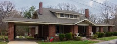 | Bonds House | building | 2010 | 10000473 |
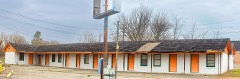 | Booker T. Motel | building | 2018 | 100002750 |
| Browning House | building | 1974 | 74001912 | |
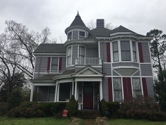 | Dodson House | building | 1982 | 82003969 |
| First Methodist Episcopal Church, South | building | 2008 | 08000702 | |
 | Julius Freed House | building | 1994 | 94000301 |
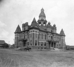 | Gibson County Courthouse | building | 1976 | 76001777 |
| Gibson County Training School | building | 2012 | 12000117 | |
| Medina City Hall | building | 2004 | 04000674 | |
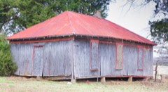 | Mt. Zion Negro School | building | 2017 | 100001823 |
| Oakland Cemetery | site | 2007 | 07000186 | |
| Peabody High School | building | 1984 | 84000326 | |
 | Senter-Rooks House | building | 1980 | 80003797 |
| Sitka School | building | 2020 | 100005137 | |
 | Skullbone Store | building | 1999 | 99001369 |
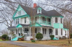 | Col. Robert Z. Taylor House | building | 1982 | 82003970 |
| Trenton Historic District | district | 1982 | 82003971 | |
 | US Post Office | building | 1987 | 87001169 |
 | US Post Office | building | 1988 | 88001576 |
| Union Central School | building | 1985 | 85001490 |
Every wildfire the federal occurrence database records inside this county: 167 of them, burning about 1,343 acres. 2 started naturally and 14 were recorded as arson. Each settlement page carries the fires within five miles of it.
| Reported cause | Fires |
|---|---|
| Debris and open burning | 104 |
| Equipment and vehicle use | 25 |
| Arson/incendiarism | 14 |
| Missing data/not specified/undetermined | 9 |
| Smoking | 7 |
| Other causes | 3 |
| Natural | 2 |
| Misuse of fire by a minor | 2 |
| Railroad operations and maintenance | 1 |
The five largest, by the area the report gives. One of them was set deliberately.
| Date | Cause | Size | Reported by | Name on the report |
|---|---|---|---|---|
| 16 September 1999 | Debris and open burning | 104 acres | Tennessee Division of Forestry | not named |
| 8 February 2001 | Debris and open burning | 52 acres | Tennessee Division of Forestry | not named |
| 14 March 2005 | Debris and open burning | 42 acres | Tennessee Division of Forestry | not named |
| 13 October 2010 | Equipment and vehicle use | 38 acres | Tennessee Division of Forestry | DINWINEDIE FIRE |
| 1 September 2018 | Debris and open burning | 36 acres | Tennessee Division of Forestry | TWENTY THREE |
| 8 December 2020 | Missing data/not specified/undetermined | 35 acres | Tennessee Division of Forestry | RX - RALPH JONES WILDLIFE - GIBSON COUNTY SOUTH FL |
| 15 August 2012 | Arson/incendiarism | 35 acres | Tennessee Division of Forestry | BASE LINE |
| 17 August 2000 | Equipment and vehicle use | 34 acres | Tennessee Division of Forestry | not named |
Every settlement page carries the fires within five miles of it - see the settlement index below.
The NOAA Storm Events Database holds 400 reports for this county, causing 14 deaths, 66 injuries and about $565,526,550 in recorded property damage. Each settlement page carries the reports that name it.
| Kind of event | Reports |
|---|---|
| Thunderstorm Wind | 168 |
| Hail | 132 |
| Flash Flood | 51 |
| Tornado | 35 |
| Lightning | 8 |
| Flood | 6 |
The most serious of them, by death, then injury, then recorded damage. The accounts are quoted exactly as the forecast office filed them.
| When | Event | Place named | Harm | What the report says |
|---|---|---|---|---|
| April 2006 | Tornado (F3) | Dyer | 6 killed, 42 hurt, $25,000,000 | This tornado was also spawned by the same supercell that produced the killer Dyer County tornado. The F3 tornado tracked east across Gibson County. The tornado then continued east into Weakley County. The hardest hit area was the city of Bradford. There were six fatalities in Bradford along with forty-four injuries. Approximately two hundred fifty homes were damaged and seventy-five homes were destroyed. The Bradford Police Department was completely destroyed. Other businesses were also severely damaged. |
| April 2006 | Tornado (F3) | Rutherford | 2 killed, 6 hurt, $15,000,000 | This tornado was the second of two F3 tornadoes that affected Gibson County on April 2nd. The tornado touched down just south of the Obion and Gibson County line and tracked southeast. The tornado lifted just east of Rutherford near the intersection of China Grove Rd and Highway 105. Two fatalities occurred as a result of this tornado along with six injuries. Approximately two hundred fifty homes were damaged and six were destroyed. Cars were tossed into open fields. |
| March 1952 | Tornado (F2) | not stated | 2 killed, 2 hurt, $25,000 | no account filed |
| August 2002 | Lightning | Dyer | 2 killed | Two persons will killed when lightning struck their farm. |
| May 2010 | Flash Flood | Humboldt | 1 killed, $9,000,000 | Very heavy rain produced widespread flash flooding in Gibson County. Rainfall amounts were estimated between 10 to 15 inches. As many as 16 roads were flooded or washed out. Highway 79 between Milan and the Carroll County line was covered by as much as 8 feet of water. In total, 137 homes sustained some kind of flood damage in Gibson County. Of those homes, six were completely destroyed. Eighty-seven businesses received damage with two businesses being completely destroyed. A few apartment complexes, mobile homes and other public buildings sustained damage as well. One fatality occurred as the waters quickly rose and swept one person off their feet. The flash flood event transitioned into a flood event as the heavy rain caused the North Fork Forked Deer and the Middle Fork Forked Deer River to overflow their banks. |
| January 1988 | Tornado (F2) | not stated | 1 killed, $250,000 | no account filed |
| May 1979 | Tornado (F2) | not stated | 5 hurt, $250,000 | no account filed |
| April 1998 | Thunderstorm Wind | Gann | 3 hurt, $1,000 | A few trees were knocked down. |
| April 2011 | Thunderstorm Wind | Frog Jump | 2 hurt, $3,560,000 | Straight line winds caused widespread damage across Gibson County. Sixteen homes, fourteen mobile homes and one public building were destroyed. Sixteen homes, one public building and three businesses suffered major damage. Forty-five homes and seven businesses suffered minor damage. Many trees, power lines and signs were also knocked down. |
| December 1957 | Tornado (F1) | not stated | 2 hurt, $25,000 | no account filed |
| December 2023 | Tornado (EF1) | Gregory | 1 hurt, $750,000 | The first evidence of tornado damage was near Bells Chapel Road near Jim Dedmon Road in Gibson County where numerous hardwood trees were snapped. The tornado generally moved east to northeast at times. A home on Bells Chapel Road sustained roof damage and a carport was destroyed. A small barn lost most of its roofing and snapped hardwood trees were also noted nearby. The tornado crossed Highway 105 and produced roof and wall damage to homes on Joe Lumpkin Road. The tornado continued to move to the northeast and crossed Highway 45 hitting the Gibson County Rescue 9 station. A semi-truck and van were overturned as the tornado crossed Highway 45. Significant roof damage and collapsed walls occurred at this location along with numerous snapped hardwood trees. Additional damage was noted on Walnut Grove Road to hardwood trees with some structural damage to a barn and carport.|The tornado moved to the northeast and crossed into Weakley County. |
| May 1967 | Tornado (F1) | not stated | 1 hurt, $250,000 | no account filed |
| May 2021 | Lightning | Grizzard | 1 hurt | A farmer was inside a milk barn on Reed Road near Dyer. The farmer was milking cows when lightning struck the barn. He was holding a metal railing attached to the barn. The farmer was transported to the local hospital and only suffered minor injuries. |
| October 1984 | Thunderstorm Wind | not stated | 1 hurt | no account filed |
| May 2010 | Flood | Neboville | $500,000,000 | Heavy rainfall in excess of 10-15 inches produced flash flooding which later transitioned to a flood event across Gibson County. The North Fork Forked Deer quickly rose to record levels. Water spilled out of its banks and flooded areas near Trenton and Milan. Numerous homes and businesses were flooded as a result. |
| December 2021 | Tornado (EF3) | Cool Spgs | $4,000,000 | The tornado crossed from Dyer County into Gibson County and continued northeast, uprooting and snapping trees. Several homes had significant roof damage as the tornado moved across rural parts of the county. The tornado strengthened as it approached the city of Kenton causing significant damage to numerous homes. The tornado then crossed into Obion County. Peak winds were estimated at 140 mph in Gibson County. |
| November 2002 | Thunderstorm Wind | Medina | $1,400,000 | Strong straight-line winds produced significant damage in the town of Medina. The south wall of the Medina Elementary School gymnasium was blown down. The scoreboard at the Medina football field was blown down. Two homes and one public building were destroyed. Several semi-tractor trailer trucks and other vehicles were blown over. Sixty-two other homes were damaged. |
| February 2025 | Tornado (EF2) | Tuckers Corner | $500,000 | An EF-2 tornado began just east of Laneview Concord Road southeast of Tuckers Corner in Gibson County around 7:01 PM CST on February 15. A tree fell on a home near the corner of Twin Creek Road and Thetford Road. The tornado continued just north of Thetford Road, causing tree damage including multiple uprooted trees and large branches snapped through a slightly wooded area. The tornado crossed Thetford Road, with additional tree damage noted. The tornado appeared to intensify as it crossed Milan Hwy (Hwy 45E), with the most severe damage occurring between Milan Hwy and Mt. Pisgah Road. Several homes were damaged in this area. Multiple homes on Mt. Pisgah Rd had large sections of their roofs removed and were surrounded by significant tree damage and debris. A barn was also destroyed and shifted off the foundation on Mt. Pisgah Rd. Damage mostly in the form of snapped and uprooted trees continued northeastward toward Idlewild Hollyleaf Rd. The tornado led to additional trees snapped along Walnut Grove Road (the last notable damage), before lifting just to the east around 7:11 PM CST. Peak wind estimated at 115 mph. |
| May 2010 | Tornado (EF2) | Humboldt | $500,000 | A tornado touched down on the south side of Humboldt and several houses received roof, siding and garage door damage. One home in Humboldt received partial roof loss and garage damage while the storage shed and wooden swing set were completely destroyed. Several power poles were knocked down before a winery received tree and vine damage. Some tiles were stripped off the business home at the winery. One rural home suffered more extensive damage near the end of the track with partial roof loss, porch removal and brick veneer ripped off the northeast corner of the home. Windows were also blown out on the home with a large well built brick supported carport completely destroyed. A well built 40 foot by 40 foot wood and metal shed on the property was completely destroyed with the wood support beams snapped off one foot above the concrete slab. A tour bus nearby was lifted and turned 180 degrees. A semi trailer on the property was also flipped over. Numerous large trees along the path were either uprooted or damaged. A few smaller trees were snapped off one to two feet above the ground. Several power lines were also knocked down before the tornado lifted near Pleasant Hill Road. |
| March 2007 | Lightning | Humboldt | $500,000 | A lightning strike caused a chemical fire to start at the Helena Chemical Plant in Humboldt. The chemical fire destroyed the plant. About 400 to 500 employees of nearby plants as well as some 100 nearby residents were evacuated. |
| November 2005 | Tornado (F1) | Eaton | $500,000 | The tornado moved into Gibson County from Crockett County and continued northeast. Around 25 homes and several businesses in the town of Dyer were damaged. Several mobile homes and utility sheds were damaged. Some homes suffered shingle damage. |
| June 1994 | Tornado (F1) | Rutherford | $500,000 | Six homes and two business were destroyed. Fifty other houses and business were damaged. Numerous trees were knocked down as well. |
| April 1993 | Thunderstorm Wind | Trenton | $500,000 | Eight houses were damaged or destroyed. Several power lines were knocked down. |
| March 2020 | Tornado (EF1) | Idlewild | $250,000 | Damage to homes and mobile homes was observed from just west of Highway 45E to Highway 105 near the Gibson-Carroll County line. Numerous trees were also damaged along this path. The most significant damage was observed along Gann Road between Goosefoot and Belews Chapel Road. Peak winds were estimated at 95 mph. |
| February 2008 | Thunderstorm Wind | Trenton | $150,000 | Straight line winds produced roof damage to at least 10 homes in the Quail Ridge area outside of Trenton. Trees were uprooted and a gazebo damaged as well in the area. In the downtown court square of Trenton, roof damage occurred to buildings and windows were broken from the wind. A tree fell on a vehicle at a home on High Street. |
| July 2013 | Thunderstorm Wind | Humboldt | $120,000 | Straight line winds blew an eighteen wheeler over in Humboldt. In addition, a small plane was blown over at the Humboldt Municipal Airport. A power pole was snapped near the Humboldt city limits and a tree was blown down on Windy City Road. |
| May 2000 | Thunderstorm Wind | Trenton | $110,000 | An apartment building lost half of its roof. Many trees were knocked down. |
| November 2010 | Tornado (EF0) | Avondale | $100,000 | A tornado briefly touched down along Jim Bob Scruggs Road, outside of Humboldt, and traveled east across Dollar Road and then lifted. The tornado caused damage to a dozen homes. Many of the homes had widespread roof damage. Multiple sheds were destroyed and several trees were snapped as well. |
| March 2006 | Lightning | Yorkville | $100,000 | The Yorkville Cumberland Presbyterian Church was destroyed by a fire that started after a lightning strike. |
| May 2003 | Tornado (F1) | Brazil | $100,000 | The tornado touched down in the central part of Gibson county. One home was destroyed and several others were damaged. |
| May 2003 | Tornado (F1) | Medina | $100,000 | The tornado touched down in the southeast part of the county and moved northeast. Two homes were destroyed and several other were damaged. |
| March 1997 | Tornado (F4) | Yorkville | $100,000 | no account filed |
| April 2025 | Tornado (EF1) | Cool Spgs | $75,000 | A tornado touched down near the intersection of Bermuda Grass Road and Baseline Road, where multiple trees were snapped at the tops with damage to the roof of a single-family home. The tornado continued northeastward, leading to additional trees snapped near their tops and additional roof damage to some homes along Morella Road. One home along Morella Road had the siding peeled from the side, with damage to a nearby carport. Additional damage to trees and some homes was noted along Tull Road, Les Ross Road before crossing into Obion County. Peak winds were estimated to be 95 mph in Gibson County. |
| February 2008 | Thunderstorm Wind | Bradford | $75,000 | Straight line winds blew a tractor's shed down into a storage bin off of Taylor Road, outside of Bradford. In addition, a storage and shop building off of Taylor Road, that contained classic cars and a small tractor, sustained substantial damage as well. The classic cars and small tractor were crushed by the building. Off of Lillie Brown Road, a barn was totally demolished and blown into a mobile home. Several trees and power lines were knocked down as well by the winds. |
| January 1999 | Thunderstorm Wind | Humboldt | $75,000 | A couple of houses had their roofs blown off. Some windows were also blown out. A crop duster was flipped up. Some large tree limbs were knocked down as well. |
| March 2017 | Thunderstorm Wind | Idlewild | $60,000 | Large trees down along Mulberry Grove Road near Bradford. Some structural damage and some trees on houses and sheds. |
| June 2017 | Flash Flood | Trenton | $60,000 | Apartment complex being evacuated due to flooding. |
| February 2008 | Thunderstorm Wind | Dyer | $55,000 | Straight line winds uprooted trees on South Main Street and Elm Street in Dyer bringing power lines down as well. One tree fell on a house and car causing damage. An awning was damaged at the Little General on Main Street. In the Walnut Grove community, a trailer was completely torn apart by the winds. A neighboring house received damage to the roof and carport. In addition, a shed and playhouse were damaged as well on the property. |
| March 2022 | Tornado (EF1) | Medina | $50,000 | The tornado crossed from Madison County into Gibson County damaging several outbuildings and knocking down numerous trees on Highway 152. Powerlines were down across Highway 152. The last area of damage was found off of Latham Chapel Road where several barns and outbuildings were damaged. |
| March 2021 | Lightning | Trenton | $50,000 | A lightning strike resulted in a structure fire in Gibson County. |
| May 2020 | Flash Flood | Medina | $50,000 | Heavy rain caused flash flooding in southern Gibson County. Intersections were flooded in Humbdolt and water was high enough to stall cars. Significant street flooding occurred in Medina. Pleasant Hill road was flooded. |
| May 2003 | Tornado (F0) | Neboville | $50,000 | The tornado touched down near Neboville and moved northeast. Several homes were damaged. |
| August 1995 | Thunderstorm Wind | Dyer | $50,000 | A roof was blown off of a store. Several trees and power lines were blown down. |
| May 2003 | Thunderstorm Wind | Medina | $40,000 | A mobile home was flipped upside down. A roof and a porch were blown off of a house. Many trees were knocked down. |
| March 2017 | Thunderstorm Wind | Milan | $30,000 | Metal roof removed from structure and blown on neighbor's home. |
| April 1996 | Thunderstorm Wind | Walnut Grove | $30,000 | no account filed |
| February 2023 | Flash Flood | Trenton | $25,000 | Sammons Road and Harpers Chapel Road were washed out due to flash flooding. |
| February 2018 | Tornado (EF0) | Georgetown | $25,000 | A weak tornado tracked through rural areas knocking down trees. |
| January 2005 | Thunderstorm Wind | Countywide | $25,000 | A Mexican restaurant in Trenton had a portion of its roof ripped off. A barn was demolished near Yorkville.A storage building was destroyed in Milan. Several large cedar trees were blown down. |
| May 2003 | Tornado (F1) | Milan | $25,000 | A tornado touched down near Trenton and tracked northeast. A scoreboard was destroyed and a barn was damaged. Several trees were blown down. |
| November 2001 | Thunderstorm Wind | Humboldt | $25,000 | A grain bin and a hog barn were destroyed. Numerous trees were knocked down. |
| February 1999 | Thunderstorm Wind | Yorkville | $25,000 | A house lost part of its roof. Some outbuildings were also damaged. A few trees were knocked down. |
| January 1997 | Thunderstorm Wind | Gibson | $25,000 | no account filed |
| March 1997 | Tornado (F2) | Humboldt | $25,000 | no account filed |
| November 1989 | Tornado (F2) | not stated | $25,000 | no account filed |
| November 1977 | Tornado (F1) | not stated | $25,000 | no account filed |
| May 1971 | Tornado (F4) | not stated | $25,000 | no account filed |
| December 1957 | Tornado (F1) | not stated | $25,000 | no account filed |
| December 1957 | Tornado (F2) | not stated | $25,000 | no account filed |
| May 2023 | Thunderstorm Wind | Trenton | $20,000 | Several trees were uprooted or snapped in Trenton. At least one home was damaged by a downed tree. |
The Survey's mineral resources record lists 20 workings inside this county. 2 still produce and 18 are closed or unrecorded. Each settlement page carries the workings within five miles of it.
| Commodity | Workings |
|---|---|
| Ball Clay | 9 |
| Clay | 9 |
| Fire Clay (Refractory) | 1 |
| Aluminum, Iron, Silica, Water, Free | 1 |
The least common of them first, because a county's hundredth gravel pit says nothing its first ten did not.
| Where | Site | Commodity | Status | Recorded |
|---|---|---|---|---|
| Gibson County Grenada Ball Clay | Aluminum, Iron, Silica, Water, Free | Prospect | ||
| R.F. Barnes Prospect | Fire Clay (Refractory) | Prospect | ||
| Billops Prospect | Ball Clay | Occurrence | ||
| Deward Palmer Prospect | Clay | Prospect | ||
| Hicks Heirs Farm Prospect | Clay | Occurrence | ||
| Humboldt Pit | Clay | Past Producer | ||
| Jim Mays Prospect | Clay | Prospect | ||
| K-T Clay No. 12 Pit | Ball Clay | Producer | 1960 | |
| Kentucky-Tennessee Clay No. 12 Pit | Clay | Past Producer | Sedimentary | |
| Kentucky-Tennessee Clay No. 12 Pit | Clay | Unknown | ||
| Lowery Clay Mine | Clay | Producer | ||
| Milan Pit | Clay | Past Producer | ||
| Mrs. M.J. Stewart Prospect | Ball Clay | Prospect | ||
| Prospect | Ball Clay | Prospect | ||
| Prospect Pit | Ball Clay | Prospect | ||
| Prospect Pit | Ball Clay | Prospect | ||
| Trenton Prospect | Clay | Past Producer | ||
| W.R. Thetford Prospect | Ball Clay | Prospect | ||
| William Murray Farm Prospect | Ball Clay | Prospect | ||
| Willie Hickman Farm Prospect | Ball Clay | Occurrence |
Named settlements recorded in the Geographic Names Information System, each with the topographic sheets covering it. Villages, hamlets and abandoned places alike. Each is shown with the nearest named watercourse or landform and the survey quadrangle it falls on.
District 6 · 38358 · On West Fork Wolf Creek · Spring Creek quadrangle
9 sheets, 1956 to 1986
District 11 · 38220 · On Thompson Creek · Trezevant West quadrangle
10 sheets, 1956 to 1986
District 16 · 38059 · On Squirt Creek · Yorkville quadrangle
7 sheets, 1956 to 1983
No longer a settlement
District 11 · 38358 · On Wolf Creek · Atwood quadrangle
10 sheets, 1956 to 1986
No longer a settlement
District 16 · On Squirt Creek · Yorkville quadrangle
7 sheets, 1956 to 1983
No longer a settlement
The vanished settlements of Gibson County: the places named above that are no longer on the map.