Block
From the record
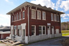
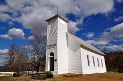
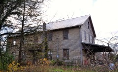
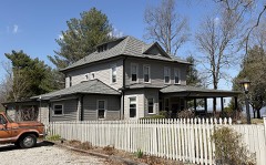
25 National Register listings published here.
Sources: the National Register database, National Park Service
79 topographic sheets cover 42 settlements here, and 25 properties are on the National Register of Historic Places.
25 National Register listings published here.
Sources: the National Register database, National Park Service
Every property in this county listed on the National Register of Historic Places, with the year it was listed and the federal nomination document.
Every wildfire the federal occurrence database records inside this county: 1,721 of them, burning about 26,996 acres. None started naturally and 1,214 were recorded as arson. Each settlement page carries the fires within five miles of it.
| Reported cause | Fires |
|---|---|
| Arson/incendiarism | 1214 |
| Debris and open burning | 333 |
| Missing data/not specified/undetermined | 106 |
| Equipment and vehicle use | 28 |
| Recreation and ceremony | 13 |
| Misuse of fire by a minor | 8 |
| Smoking | 8 |
| Other causes | 7 |
| Power generation/transmission/distribution | 2 |
| Fireworks | 1 |
| Railroad operations and maintenance | 1 |
The five largest, by the area the report gives. 7 of them were set deliberately.
| Date | Cause | Size | Reported by | Name on the report |
|---|---|---|---|---|
| 10 November 2001 | Arson/incendiarism | 1,560 acres | Tennessee Division of Forestry | not named |
| 1 April 2014 | Arson/incendiarism | 748 acres | Tennessee Division of Forestry | PINEY CREEK AIR PARK |
| 3 April 1997 | Arson/incendiarism | 515 acres | Tennessee Division of Forestry | not named |
| 1 November 2001 | Arson/incendiarism | 332 acres | Tennessee Division of Forestry | not named |
| 6 January 2012 | Debris and open burning | 300 acres | Tennessee Division of Forestry | NORTH POINT FARMS LLC |
| 31 October 2001 | Arson/incendiarism | 297 acres | Tennessee Division of Forestry | not named |
| 18 November 2001 | Arson/incendiarism | 296 acres | Tennessee Division of Forestry | not named |
| 19 November 2001 | Arson/incendiarism | 296 acres | Tennessee Division of Forestry | not named |
Every settlement page carries the fires within five miles of it - see the settlement index below.
The NOAA Storm Events Database holds 187 reports for this county, causing no deaths, 8 injuries and about $4,194,620 in recorded property damage. Each settlement page carries the reports that name it.
| Kind of event | Reports |
|---|---|
| Thunderstorm Wind | 107 |
| Hail | 48 |
| Flash Flood | 20 |
| Tornado | 9 |
| Flood | 2 |
| Lightning | 1 |
The most serious of them, by death, then injury, then recorded damage. The accounts are quoted exactly as the forecast office filed them.
| When | Event | Place named | Harm | What the report says |
|---|---|---|---|---|
| June 1994 | Tornado (F2) | Altamont to | 6 hurt, $500,000 | A tornado touched down several just west of Altamont. One house and several mobile homes were destroyed. Numerous trees were uprooted. |
| February 1952 | Tornado (F3) | not stated | 2 hurt, $250,000 | no account filed |
| November 2018 | Tornado (EF2) | Pelham | $750,000 | Although a NWS storm survey originally determined the damage path across Franklin, Coffee, and Grundy Counties to be one long-track tornado, high-resolution satellite imagery from NASA Sport and Google Earth in May 2019 clearly showed that the original track was actually two separate tornadoes. This major EF-2 tornado, which began in Franklin County near Tims Ford Lake, weakened considerably to EF-0 as it entered the extreme southeastern portion of Coffee County, with just a few trees blown down along Rutledge Hill Road. The worst damage was along Coker Road where a barn was destroyed, another barn suffered roof damage, and the front porch of a home was ripped off causing minor roof damage. After taking a sharp bend to the east, the tornado caused severe damage to an outbuilding on Boyd Road. Several outbuildings were destroyed and a house sustained roof damage when its front porch was ripped off. Numerous more trees were blown down further to the east on Rutledge Hill Road and along and onto I-24, which caused a multi-vehicle accident at mile marker 126. Another barn suffered roof damage on Sims Lane before the tornado moved into Grundy County. The tornado then intensified rapidly to EF-2 in extreme southwest Grundy County, with a nearly-finished brand new home almost completely destroyed on Conry Circle. Two nearby homes suffered significant roof and siding damage, and a barn lost nearly all of its roof. Debris from all of these buildings was blown up to 500 yards to the east and northeast. Further to the east, a mobile home on Frank Wilson Road was knocked off its piers into a garage. The tornado the tracked up and down a nearly 1600 foot tall ridge before reaching Homer White Road, heavily damaging two barns and destroying an outbuilding. Curving more to the northeast, the tornado ripped off the roof of a brick home on Highway 50. Luckily, the house occupants were taking shelter and were not injured. Two adjacent outbuildings were severely damaged, and other nearby homes and barns suffered minor damage. Debris from these buildings was blown up to 500 yards to the northeast. The tornado continued to cause a wide swath of wind damage to trees and buildings along Highway 50 before crossing Schoolhouse Hollow and Nunley Hollow and climbing nearly 1000 feet in elevation onto the Cumberland Plateau. Google Earth and NASA Sport satellite imagery showed hundreds of trees continued to be blown down off to the east as the tornado crossed Highway 108, Eagle Lake Road, and passed along the west side of Eagle Lake before finally lifting just north of Eagle Lake. Total path length of this tornado across Franklin County, southeast Coffee County, and into central Grundy County was 29.50 miles. Winds were estimated up to 115 mph. |
| March 2025 | Thunderstorm Wind | Palmer | $500,000 | A NWS survey team determined that the damage near Palmer was caused by straight-line winds with maximum wind speeds of 95 mph. The width of the damage path was determined to be over a mile wide. These very strong downsloping microburst winds blew straight into Palmer, causing many trees to be uprooted and snapped along with some structural damage in the area. All trees fell in generally the same direction with no narrow tornado path found. Damages are a rough estimate. |
| April 2025 | Tornado (EF1) | Monteagle | $500,000 | An EF-1 tornado formed over northern Monteagle, first producing damage along Wrens Nest Road. The tornado moved east into Summerfield and continued along Highway 41 into Tracy City. The tornado then strengthened as it entered into Tracy City with significant tree damage observed along the path as well as some damage to structures noted at the tornado's peak. The stands of a ball field in Tracy City had its metal roofing completely removed and blown into various areas of the park. Other structure damage noted was a roof blown completely off of a home as well as numerous homes with roof damage caused by fallen trees. There was also damage to several farm outbuildings, some of which lost their roofs or were collapsed. The tornado lifted south of Tracy City with the final damage observed near King Road. Damages are a rough estimate. |
| May 2024 | Flash Flood | Barkertown | $500,000 | Heavy rain caused flash flooding in Grundy County. Near Palmer, a section of Barker Cove Road was washed away. Near Beersheba Springs, Highway 56 was flooded and impassable. Damages are a rough estimate. |
| November 2018 | Tornado (EF1) | Counter Pen | $250,000 | Although a NWS storm survey originally determined the damage path across Franklin, Coffee, and Grundy Counties to be one long-track tornado, high-resolution satellite imagery from NASA Sport and Google Earth in May 2019 clearly showed that the original track was actually made up of two separate tornadoes. This large, strong EF-1 tornado touched down in a forested area with no road access about 1 mile northeast of the Highway 108 and Highway 50 intersection, which was also around 1 mile north of the previous tornado as it was weakening and occluding. Satellite imagery showed thousands of trees were blown down in large convergent swaths along a trochoidal loop-type track as the tornado passed 2 miles south of Altamont. The tornado continued snapping and uprooting hundreds of trees it crossed Highway 56, Colony Road, and 20th Avenue North, with some trees falling onto and damaging homes, and others blocking area roadways. A carport was also blown over on Reeves Road. Once again tracking through uninhabited forests, the tornado continued to blow down hundreds more trees for several miles, eventually crossing Stage Coach Road and Lovell Road. The tornado dissipated into a large downburst as it crossed Highway 399 into Sequatchie County. Winds were estimated up to 110 mph. |
| November 2018 | Thunderstorm Wind | Barkertown | $100,000 | High resolution satellite imagery from Google Earth in May 2019 determined a severe downburst struck the Savage Gulf State Natural Area near the Sequatchie County line, then continued eastward into Sequatchie County. Hundreds of trees were blown down along a 2 mile long by 500 yards wide path in this forested area with no road access. Based on the damage, this may have been a third tornado developing north of the previous tornado as it dissipated in extreme eastern Grundy County. Winds were estimated up to 100 mph. |
| May 2020 | Thunderstorm Wind | Altamont | $52,620 | Numerous trees and power lines were blown down across Grundy County, including trees that were blown down in front of the courthouse in Altamont. |
| April 2025 | Thunderstorm Wind | Monteagle | $50,000 | Severe thunderstorm winds downed numerous trees and powerlines across the Monteagle, Summerfield, and Tracy City areas. Damages are a rough estimate. |
| May 2024 | Thunderstorm Wind | Palmer | $50,000 | A tSpotter reported a few trees were blown down across Grundy County. Damages are a rough estimate. |
| December 2021 | Tornado (EF0) | Dogtown | $50,000 | The tornado touched down in Coalmont and quickly produced 90 mph winds that uprooted many trees on Freemont Road. It moved northeast and blew out the walls of a metal building structure and downed additional trees on 20th Avenue South near Highway 108. The tornado weakened as it crossed the highway and continued northeast. It uprooted and snapped trees east of Gruetli-Laager before lifting near Cullen Savage Road north of Barkertown Road. |
| August 1997 | Thunderstorm Wind | Beersheba Spgs | $50,000 | The northeast part of the county was hit by strong thunderstorm winds from the Tarlton area to Beersheba Springs. Newspaper accounts reported 2 homes were damaged when trees fell on them on Highway 56.Also, strong winds destroyed a building at Hillis Nursery on Highway 56. |
| April 2011 | Thunderstorm Wind | Laager | $40,000 | Trees and power lines were blown down in the Coalmont, Gruetli-Laager, and Palmer. |
| May 2024 | Thunderstorm Wind | Tarlton | $35,000 | Facebook photos showed extensive tree damage and snapped power poles along Cove Creek Road north of Beersheba Springs. Damages are a rough estimate. |
| May 2004 | Tornado (F1) | Tracy City | $30,000 | A tornado blew a porch off a trailer. Also, a tree fell on another trailer. 5 homes lost shingles on its roof.A metal shed was blown away. The damage to the tornado started in Tracy City on Lankfordtown Rd. |
| April 1996 | Thunderstorm Wind | Altamont | $30,000 | no account filed |
| July 2024 | Thunderstorm Wind | Altamont | $25,000 | Severe thunderstorm winds tore off metal sheet roofing from the Altamont City Hall. Damages are a rough estimate. |
| November 2018 | Thunderstorm Wind | Barkertown | $25,000 | A NWS storm survey along with high resolution satellite imagery from Google Earth in May 2019 determined the second Grundy County tornado dissipated into a large, severe downburst near the Grundy/Sequatchie County line. Dozens of trees were blown down along and south of Highway 399 in extreme eastern Grundy County, with damage then continuing northeastward into Sequatchie County. Winds were estimated up to 100 mph. |
| July 2012 | Thunderstorm Wind | Altamont | $25,000 | Multiple trees were downed across the county. |
| April 2011 | Thunderstorm Wind | Tracy City | $25,000 | Trees were blown down in several areas near Tracy City. One tree also fell on a house. Specific details concerning any damage to the house were unknown. |
| February 1955 | Tornado (F1) | not stated | $25,000 | no account filed |
| July 2018 | Thunderstorm Wind | Altamont | $20,000 | Grundy County Emergency Management reports and photos showed an intense microburst snapped and uprooted numerous trees around Altamont. Some trees fell onto homes and cars, and several roads were blocked by fallen trees including Highway 50 and Main Street. A few homes also had parts of their roofs blown off. |
| February 2009 | Thunderstorm Wind | Beersheba Spgs | $12,000 | Emergency Management reported numerous trees blown down county wide. |
| December 2021 | Thunderstorm Wind | Barkertown | $10,000 | Several trees were blown down in the Barkertown area along Brown Cemetery Road, Rifle Range Road, and adjacent forests. |
| March 2020 | Flash Flood | Pelham | $10,000 | Several roads were flooded and closed in Pelham with one bridge damaged by flood waters. |
| March 2019 | Thunderstorm Wind | Counter Pen | $10,000 | Highway 50 was shut down between Pelham and Altamont due to trees and power lines blown down across the roadways in three separate locations. One tree fell onto a car. |
| June 2019 | Thunderstorm Wind | Tracy City | $10,000 | Trees and power lines were blown down across the county, especially in Tracy City and Monteagle. |
| November 2018 | Thunderstorm Wind | Freemont | $10,000 | Facebook reports and photos indicate a swath of wind damage, likely from the rear flank downdraft of the EF-2 tornado passing off to the north, snapped and uprooted dozens of trees on the west side of Eagle Lake along Eagle Lake Road north of Highway 108. |
| March 2017 | Hail | Counter Pen | $10,000 | Hail ranging in size from 1.5 inches to nearly 2 inches in diameter was reported on Pelham Mountain. Numerous homes and vehicles were damaged by the hail. |
| June 2016 | Thunderstorm Wind | Altamont | $10,000 | Tons of trees down throughout Grundy County. |
| November 2016 | Thunderstorm Wind | Monteagle | $10,000 | A carport was blown off into power lines at Mountain Auto Sales on Highway 41 just east of Monteagle. In addition, several trees and power lines were blown down along Highway 41 and Dubose Street in the same area with both roadways blocked and closed. Grundy County schools were closed 11/30 due to the storm damage between Monteagle and Tracy City. |
| April 2015 | Thunderstorm Wind | Altamont | $10,000 | Trees and power lines were blown down across Grundy County. |
| June 2014 | Thunderstorm Wind | Laager | $10,000 | Numerous trees were blown down around Gruetli-Laager including on 40th Avenue, 60th Avenue, Highway 108, and Highway 399. |
| January 2013 | Thunderstorm Wind | Altamont | $10,000 | A few trees were downed across the county. |
| August 2012 | Thunderstorm Wind | Altamont | $10,000 | Several trees and power lines were blown down throughout Grundy County. |
| June 2011 | Thunderstorm Wind | Monteagle | $10,000 | Numerous trees were blown down with some falling on power lines in Monteagle, including on Central Avenue, Lee Avenue, and Summerville Road. |
| August 2010 | Thunderstorm Wind | Palmer | $10,000 | Trees were reported downed in southeastern part of the county. |
| June 2009 | Flash Flood | Tarlton | $10,000 | County roads were reported flooded with road closures. |
| April 2006 | Thunderstorm Wind | West Portion | $10,000 | Tree down. One fell on a vehicle. |
| June 2005 | Lightning | Altamont | $10,000 | Five Holstein milk cows were killed along with their unborn calves as a result of a lightning strike at the Cox Diary in Altamont. Mr. Cox stated this was the second time in 42 years of running the diary that this has happened. The other incident occurred about 12 years ago with a loss of 10 cows. |
| April 2011 | Tornado (EF0) | Gruetli | $9,000 | Several trees were snapped and an outbuilding suffered roof damage along Fletcher Strip Road. |
| May 2025 | Thunderstorm Wind | Clouse Hill | $5,000 | Strong thunderstorm winds downed a few trees on Chevy Road just south of Clouse Hill Road north of Monteagle. Damage is a rough estimate. |
| January 2020 | Thunderstorm Wind | Palmer | $5,000 | Trees and power lines were blown down in north-central and eastern Grundy County. |
| April 2019 | Thunderstorm Wind | Coalmont | $5,000 | Trees were blown down across roads and onto power lines throughout Grundy County. Numerous trees were blown down in and around Coalmont that blocked Lockhart Town Road, Sweeton Hill Road, Roddy Springs Road, and Coke Oven Road. |
| April 2019 | Thunderstorm Wind | Sanders Crossing | $5,000 | Power lines and poles were blown down that blocked Highway 56 between Coalmont and Tracy City. |
| April 2019 | Thunderstorm Wind | Gruetli | $5,000 | Trees and power lines were blown down in Gruetli-Laager, with one tree falling onto a house. Downed trees also blocked Dog Town Road between Coalmont and Gruetli-Laager. |
| February 2019 | Flash Flood | Hixon | $5,000 | Social media photos showed part of Firetower Road was washed out. |
| March 2018 | Flash Flood | Marvin Chapel | $5,000 | Payne's Cove Road and Clouse Hill Road were flooded and closed east of Pelham between Highway 50 and Payne's Cove. A rock slide also fell onto part of Highway 56 near Beersheba Springs. |
| March 2017 | Thunderstorm Wind | Altamont | $5,000 | Trees and power lines were blown down across Grundy County with several power outages. |
| April 2015 | Thunderstorm Wind | Monteagle | $5,000 | Numerous trees were blown down in Monteagle with some falling on houses. |
| April 2015 | Thunderstorm Wind | Payne Cove | $5,000 | Numerous trees were blown down in Payne Cove. |
| February 2014 | Thunderstorm Wind | Laager | $5,000 | Several trees were blown down on roads around Gruetli-Laager and Palmer including on Colony Road. |
| March 1995 | Thunderstorm Wind | Tracy City | $5,000 | A bank sign was destroyed. Several trees were blown down. |
| May 2018 | Thunderstorm Wind | Tracy City | $4,000 | Trees and power lines were blown down on Main Street at 14th Avenue as well as Homer Layne Road at Highway 150 in Tracy City. |
| May 2021 | Thunderstorm Wind | Clouse Hill | $3,000 | Trees were blown down on Summerfield Road and near the South Cumberland Visitors Center. |
| February 2020 | Thunderstorm Wind | Marvin Chapel | $3,000 | Trees were blown down near the Skymont Scout Reservation and several power outages were reported throughout Grundy County. |
| March 2019 | Thunderstorm Wind | Counter Pen | $3,000 | Trees were blown down on Highway 108. |
| March 2019 | Thunderstorm Wind | Cumberland Hgts | $3,000 | Trees and power lines were blown down on Esther Drive off Colony Road. |
| February 2019 | Thunderstorm Wind | Cumberland Hgts | $3,000 | Trees and power lines were blown down on Colony Road with power outages in the area. |
The Survey's mineral resources record lists 4 workings inside this county. 2 still produce and 2 are closed or unrecorded. Each settlement page carries the workings within five miles of it.
| Commodity | Workings |
|---|---|
| Zinc | 2 |
| Stone, Crushed/Broken, Limestone, General | 1 |
| Stone, Crushed/Broken | 1 |
The least common of them first, because a county's hundredth gravel pit says nothing its first ten did not.
| Where | Site | Commodity | Status | Recorded |
|---|---|---|---|---|
| Grundy Limestone Company Pit No. 84 | Stone, Crushed/Broken, Limestone, General | Producer | Limestone | |
| Old State Quarry Pit #8 | Stone, Crushed/Broken | Producer | ||
| Deep Well-Spalerite Occurrence | Zinc | Occurrence | ||
| Deep Well-Sphalerite Occurrence | Zinc | Occurrence | Sphalerite |
Named settlements recorded in the Geographic Names Information System, each with the topographic sheets covering it. Villages, hamlets and abandoned places alike. Each is shown with the nearest named watercourse or landform and the survey quadrangle it falls on.
District 1 · 37365 · On Middle Prong Collins River · Collins quadrangle
21 sheets, 1895 to 1988
District 1 · 37305 · On Schoolhouse Creek · Altamont quadrangle
22 sheets, 1895 to 1997
District 1 · 37366 · Near Broad Mountain (Historical) · Burrow Cove quadrangle
24 sheets, 1895 to 1988
District 1 · 37313 · On Armstrong Creek · Altamont quadrangle
22 sheets, 1895 to 1997
District 2 · 37339 · Near Tennessee Valley Divide · Tracy City quadrangle
21 sheets, 1895 to 1988
District 1 · 37110 · Near Little Mountain · Irving College quadrangle
18 sheets, 1893 to 1981
No longer a settlement
District 1 · 37357 · Near Flatbench Point · Cane Hollow quadrangle
19 sheets, 1895 to 1988
District 3 · 37387 · On Little Fiery Gizzard Creek · White City quadrangle
21 sheets, 1895 to 1988
District 1 · 37110 · Near Gross Cove · Irving College quadrangle
18 sheets, 1893 to 1981
37339 · On Berner Creek · Altamont quadrangle
22 sheets, 1895 to 1997
No longer a settlement
District 3 · 37387 · Near West Ramsey · Burrow Cove quadrangle
24 sheets, 1895 to 1988
District 3 · 37387 · Near Cannon Hollow · Tracy City quadrangle
21 sheets, 1895 to 1988
District 3 · 37356 · Near The Hurricane · Burrow Cove quadrangle
24 sheets, 1895 to 1988
District 2 · 37313 · Near Farmer Camp Hill · Tracy City quadrangle
21 sheets, 1895 to 1988
District 3 · 37387 · On Little Fiery Gizzard Creek · Tracy City quadrangle
21 sheets, 1895 to 1988
The vanished settlements of Grundy County: the places named above that are no longer on the map.