 Block
From the record
6 National Register listings published here.
Sources: the National Register database, National Park Service
35 topographic sheets cover 40 settlements here, and 6 properties are on the National Register of Historic Places.
6 National Register listings published here.
Sources: the National Register database, National Park Service
Every property in this county listed on the National Register of Historic Places, with the year it was listed and the federal nomination document.
| Photograph | Property | Type | Listed | Reference |
|---|---|---|---|---|
| Carverdale Farms | district | 2018 | 100002754 | |
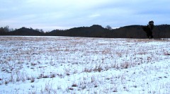 | Fort Blount-Williamsburg Site | site | 1974 | 74001918 |
| Gainesboro Historic District | district | 1990 | 90001570 | |
| Gainesboro Residential Historic District | district | 2001 | 01000728 | |
| Jackson County High School | building | 2009 | 09000535 | |
| T.B. Sutton General Store | building | 2019 | 100003902 |
Every wildfire the federal occurrence database records inside this county: 162 of them, burning about 2,260 acres. 1 started naturally and 99 were recorded as arson. Each settlement page carries the fires within five miles of it.
| Reported cause | Fires |
|---|---|
| Arson/incendiarism | 99 |
| Debris and open burning | 49 |
| Missing data/not specified/undetermined | 8 |
| Equipment and vehicle use | 3 |
| Smoking | 1 |
| Natural | 1 |
| Recreation and ceremony | 1 |
The five largest, by the area the report gives. 6 of them were set deliberately.
| Date | Cause | Size | Reported by | Name on the report |
|---|---|---|---|---|
| 30 March 2015 | Arson/incendiarism | 181 acres | Tennessee Division of Forestry | HANCE HOLLOW FIRE |
| 3 November 2001 | Arson/incendiarism | 178 acres | Tennessee Division of Forestry | not named |
| 14 November 1999 | Arson/incendiarism | 160 acres | Tennessee Division of Forestry | not named |
| 18 April 2005 | Arson/incendiarism | 121 acres | Tennessee Division of Forestry | LONG HOLLOW RIDGE FIRE |
| 25 November 2005 | Equipment and vehicle use | 118 acres | Tennessee Division of Forestry | HANCE HOLLOW FIRE |
| 18 November 2001 | Arson/incendiarism | 112 acres | Tennessee Division of Forestry | not named |
| 9 March 2000 | Debris and open burning | 95 acres | Tennessee Division of Forestry | not named |
| 11 November 2001 | Arson/incendiarism | 90 acres | Tennessee Division of Forestry | not named |
Every settlement page carries the fires within five miles of it - see the settlement index below.
The NOAA Storm Events Database holds 212 reports for this county, causing 2 deaths, 22 injuries and about $15,383,820 in recorded property damage. Each settlement page carries the reports that name it.
| Kind of event | Reports |
|---|---|
| Thunderstorm Wind | 131 |
| Hail | 39 |
| Flash Flood | 23 |
| Tornado | 11 |
| Lightning | 3 |
| Funnel Cloud | 2 |
| Flood | 2 |
| Heavy Rain | 1 |
The most serious of them, by death, then injury, then recorded damage. The accounts are quoted exactly as the forecast office filed them.
| When | Event | Place named | Harm | What the report says |
|---|---|---|---|---|
| June 1979 | Tornado (F1) | not stated | 2 killed, 1 hurt, $25,000 | no account filed |
| March 2012 | Tornado (EF2) | Mt Union | 20 hurt, $2,000,000 | An EF2 tornado with maximum wind speeds around 125 mph began south of Sims Lane in southeast Jackson County and moved northeast across the Dodson Branch community. A home and outbuilding were damaged and several trees and power lines were blown down on Mabry School Road. Increasing to one half mile wide, the tornado moved across the Dodson Branch community along Highway 135 between Zion Road and Maynard Hollow Road. Numerous homes and outbuildings were damaged or destroyed in this area with 20 minor injuries reported. Hundreds of trees and several power lines were also blown down. The tornado continued northeast across Allen Drive, Plum Hollow Lane, and Smith Chapel Road, damaging several more homes, before entering northern Putnam County. |
| July 2012 | Lightning | Gainesboro | 1 hurt | Fifty year old female was struck by lightning on Anderson Lane. She refused to be transported to a local hospital in an ambulance but her family transported her to the hospital. Final condition of female was unknown. |
| August 2010 | Flood | Nameless | $10,000,000 | Defeated Creek rose over its banks. Portions of State Highway 85 were covered with approximately 8 inches of water. The Gladdice Fire Department Building appeared to be flooded. Cummins Mill Road was flooded. Swiftly moving water was reported crossing Rush Fork Road in Bloomington Springs.||Newspapers reported that most roads leading into the Blackburn Fork Creek area had been washed away. In all, 35-45 homes were damaged. Three homes and another was washed away in the Roaring River area. There were also several water rescues, including a 69 year old women whose home had been washed away several hours before on Blackburn Ford Road and near a rising creek in the southern part of the county. County schools were closed on Thursday, August 19th due to the flooding.|Pavement was reported to have been peeled away in long stretches like strips of black tape and the exposed earth has been gouged into knee-deep gullies. This is where hundreds and hundreds of tall trees were uprooted, where shattered parts of trees, masses of driftwood and other debris were all hurled down downstream by the torrent of flood water and dropped in tangled piles as big as houses all along the channel of Blackburn Fork, some standing high beside the road that generally parallels the creek, with some still blocking the road.||Newspapers also reported several small private bridges and roadways across small creeks, along with a 153 foot public bridge, were destroyed or received major damage. Multiple home furnishing and grooming supplies were found outside all over the place in some parts of the county. |
| February 2025 | Tornado (EF2) | Center Grove | $1,000,000 | This EF-2 tornado touched down just east of Highway 56 north of Center Grove in Jackson County where dozens of trees were snapped and uprooted as well as some minor roof damage to a single family|home. The tornado continued east-northeast and caused significant roof damage to a manufactured home along JC Johnson Lane. From here, the tornado crossed Seven Knobs Road where it intensified, causing significant timber damage west of Blackburn Fork Road. Even more trees were snapped and uprooted as the tornado continued east along Lynn Hill Road. A barn was destroyed along Zion Road before dissipating just east of that area. Damages are a rough estimate. |
| January 1997 | Tornado (F2) | Mt Union | $500,000 | The tornado destroyed 4 homes and damaged 6 others. It also destroyed 6 mobile homes and damaged 2 others. Numerous barns and outbuildings were destroyed. Most of the damage occurred on Mayberry School Road and Dodson Branch Road. The tornado path length and width are approximations. |
| March 2021 | Flash Flood | Gainesboro | $424,630 | Several roads were flooded and closed across the county, including Ash Lane near the Jackson County 911/EMA office in Gainesboro. |
| April 1974 | Tornado (F1) | not stated | $250,000 | no account filed |
| February 2019 | Lightning | Gladdice | $100,000 | Lightning struck an abandoned house in the Gladdice community at Gladdice Highway and Smith Bend Lane. The resulting fire completely destroyed the home. |
| July 2015 | Flash Flood | North Spgs | $100,000 | Major flash flooding affected much of Jackson County from the evening of July 2 into the morning hours on July 3. Several roads were flooded including Pine Lick Road along Pine Lick Creek, and Keeling Branch Highway near Whitleyville. One water rescue was conducted on Brimstone Creek Road. |
| February 2014 | Thunderstorm Wind | Gainesboro Arpt | $100,000 | Jackson County 911 Center reported the Jackson County High School gym roof was blown off. The press box at the nearby football stadium was also damaged with a few trees blown down in the area. Aerial photos indicated damage was from a small but intense microburst with debris was blown from south to north. Winds were estimated up to 80 mph. |
| April 1998 | Tornado (F2) | North Spgs | $100,000 | 3 barns were completely destroyed, several houses, a church, and other barns lost roofs. |
| June 2013 | Thunderstorm Wind | Gainesboro | $50,000 | Numerous trees, phone lines, and power lines were blown down across Jackson County with widespread power outages. Multiple trees were blocking roadways and had fallen on rooftops and outbuildings. The roof of the old City Hall building in Gainesboro caved in causing the structure to collapse. |
| July 2010 | Thunderstorm Wind | Gainesboro Arpt | $50,000 | For 2.7 miles along York Highway northeast of Gainesboro, numerous trees were snapped and some uprooted by straight line winds. |
| March 1996 | Thunderstorm Wind | Gainesboro | $50,000 | no account filed |
| May 2020 | Thunderstorm Wind | Gainesboro | $44,690 | Numerous trees and power lines were blown down across Jackson County. |
| July 2019 | Flash Flood | North Spgs | $25,000 | Jackson County 911 Center reported several roadways were washed out by flooding across the county, especially in low lying areas. |
| September 2019 | Lightning | Freewill | $25,000 | A house was struck by lightning on 7 Knobs Road. The resulting fire caused significant damage to the home. |
| June 2018 | Flash Flood | Gainesboro | $25,000 | Tennessee Emergency Management Agency reported numerous roads were flooded across Gainesboro. Jackson County Emergency Management and Facebook photos and videos also showed several buildings flooded across Gainesboro, including the EMS station on Murray Street, the Jackson County Rescue Squad facility on Highway 56 at School Drive, and a storage facility along Highway 56 at Doc Creek Lane. |
| July 2012 | Thunderstorm Wind | Gainesboro | $25,000 | Numerous trees and power lines were downed throughout the county. |
| October 2010 | Thunderstorm Wind | Gainesboro | $25,000 | Straight line winds caused downed trees and power lines across the county. |
| February 2009 | Thunderstorm Wind | Gainesboro | $25,000 | Trees and power lines down county wide with power out in town. |
| September 2025 | Thunderstorm Wind | Gainesboro | $20,000 | Severe thunderstorm winds downed trees and powerlines across several location in Jackson County. Damages are a rough estimate. |
| April 2011 | Tornado (EF0) | Mt Union | $20,000 | EF-0 tornado with maximum wind speeds between 75 and 80 mph crossed Highway 111 near the Rickman Community. Dozens of trees were snapped or uprooted. Some of the trees fell on homes and vehicles. |
| December 2015 | Thunderstorm Wind | New Hope | $15,000 | Around one dozen trees blown down across the county. Trees were blown down blocking Highway 85 near the Jackson/Overton County Line. Another tree was uprooted on Haney Circle around 7 miles south-southeast of Gainesboro. |
| May 2011 | Thunderstorm Wind | Gainesboro | $15,000 | Several trees were downed in Gainesboro and power was also knocked out. |
| December 2021 | Thunderstorm Wind | Granville | $10,000 | Trees were blown down across Jackson County with many blown down in the Granville area. |
| February 2019 | Flash Flood | Gainesboro | $10,000 | A Facebook video showed flooding inside and around Gainesboro Elementary School on the south side of Gainesboro. |
| February 2019 | Flash Flood | Gainesboro Arpt | $10,000 | Jackson County 911 Center reported widespread flash flooding across the county with mudslides in many areas, including on Dodson Branch Highway which briefly covered the road. A firetruck responding to fire at an abandoned home struck by lightning on Smith Bend Lane at Gladdice Highway became stuck in flood waters. |
| June 2019 | Thunderstorm Wind | Gainesboro | $10,000 | Widespread tree damage and power lines blown down across Jackson County. The entire county was without power. |
| March 2017 | Thunderstorm Wind | Dodson Branch | $10,000 | A Facebook report and photo showed much of the metal roof on a small home at 386 William Hawkins Lane near Dodson Branch was blown off. |
| May 2017 | Thunderstorm Wind | Gainesboro | $10,000 | Multiple trees were blown down on power lines, houses, and across roadways throughout Jackson County. Several roadways were blocked with vehicle accidents reported. Power was knocked out to nearly the entire county. |
| July 2016 | Thunderstorm Wind | Gainesboro | $10,000 | Trees were blown down all across Gainesboro and numerous trees were also blown down across the rest of Jackson County. |
| July 2015 | Thunderstorm Wind | Gainesboro | $10,000 | Trees were blown down and a roof was blown off a storage facility in Gainesboro. |
| July 2015 | Thunderstorm Wind | Granville | $10,000 | Trees and power lines were blown down all along Granville Highway between the Smith County line and Gainesboro. |
| July 2015 | Flash Flood | Gainesboro | $10,000 | Several streets and the Gainesboro Elementary School were flooded in Gainesboro. |
| February 2014 | Thunderstorm Wind | Gainesboro | $10,000 | Jackson County 911 Center reported numerous trees and power lines blown down across the county with widespread power outages. |
| January 2013 | Thunderstorm Wind | Gainesboro | $10,000 | A few trees falling on power lines caused power outages across northeast and eastern portions of the county. |
| May 2013 | Thunderstorm Wind | Gainesboro | $10,000 | Local police reported trees downed across Jackson county. Power was also reported out across half the county. |
| April 2011 | Thunderstorm Wind | Gainesboro Arpt | $10,000 | Several trees were either snapped or uprooted. |
| April 2011 | Tornado (EF1) | Whitleyville | $10,000 | Thousands of trees were snapped or uprooted in a narrow path from along State Highway 56 near the South Fork Road intersection northeast to State Highway 53 just south of the Clay County line. Maximum wind speeds were near 100 mph. |
| April 2011 | Thunderstorm Wind | Gainesboro | $10,000 | Several trees were reported to have been downed. |
| July 2009 | Flash Flood | Old Antioch | $10,000 | Jackson County Sheriff Office reported several secondary roads were flooded off of State Highway 53 in the northeast part of the county. Newspaper also reported that two vehicles were trapped in high flood waters. Both drivers were rescued without any injuries being reported. |
| November 2007 | Tornado (EF1) | Union Hill | $10,000 | Damage to a home from the tornado. The house, located on Green Road, loss its front porch. A few trees were uprooted. One tree was snapped at its trunk. |
| March 1996 | Thunderstorm Wind | Countywide | $10,000 | no account filed |
| September 2024 | Thunderstorm Wind | Gainesboro | $5,000 | Severe thunderstorm winds downed a few trees in the Gladdice area. Damages are a rough estimate. |
| July 2022 | Thunderstorm Wind | Sugar Creek | $5,000 | Facebook report of numerous trees blown down on Highway 53 between Gainesboro and Celina. |
| December 2021 | Tornado (EF0) | Corinth | $5,000 | This EF-0 tornado touched down on Bright Avenue in South Carthage and moved northeast along the east side of Carthage uprooting several small trees and snapping large tree limbs on Upper Ferry Road, McGinness Avenue, Hillcrest Drive, Skyline Drive, Ridgeway Drive, and Cumberland Mine Road. The tornado then crossed the Horseshoe Bend of the Cumberland River blowing down several trees, then moved across McClures Bend of the Cumberland River and caused tree damage and moderate roof damage to a structure on McClures Bend Lane. The tornado continued east, crossing Sullivan Bend and the Cumberland River yet again before lifting on Waynick Road in Jackson County where it caused minor tree damage. Total path length of this tornado was 7.35 miles. |
| December 2021 | Thunderstorm Wind | Gainesboro | $5,000 | A 40 foot by 60 foot pole barn was destroyed in Gainesboro. |
| February 2021 | Thunderstorm Wind | Gainesboro | $5,000 | Trees were blown down across several roads throughout the county. |
| February 2021 | Flash Flood | Antioch | $5,000 | A mother and her 11 year old daughter were rescued from a vehicle trapped in high water on Flatt Dyer Road. No injuries. |
| January 2020 | Thunderstorm Wind | Old Antioch | $5,000 | A Facebook video showed high winds blowing skirting off a mobile home on Sugar Creek Road at Pleasant Hill Cemetery Lane. Numerous trees were blown down around the cemetery. |
| July 2019 | Thunderstorm Wind | Gainesboro | $5,000 | Jackson County 911 reported several trees down with roads blocked across the county. Time estimated. |
| August 2018 | Thunderstorm Wind | Gainesboro | $5,000 | Multiple trees and power lines were blown down in Gainesboro and the eastern part of Jackson County. |
| May 2018 | Thunderstorm Wind | Gainesboro | $5,000 | Jackson County 911 Center reported a few trees and power lines were blown down across the county with some roadways blocked. Minor flooding also reported. |
| December 2016 | Thunderstorm Wind | North Spgs | $5,000 | Power lines and possibly poles down on Pine Lick Road in the Whitleyville area. |
| December 2016 | Thunderstorm Wind | Dodson Branch | $5,000 | Several trees and power lines down with widespread power outages in the Dodson Branch area. |
| May 2014 | Thunderstorm Wind | Gainesboro | $5,000 | Trees reported down in the city limits of Gainesboro. |
| May 2014 | Thunderstorm Wind | Gainesboro Arpt | $5,000 | Trees were reported down with power outages in the Fairview community near the Jackson County and Overton county line. |
| April 2013 | Thunderstorm Wind | North Spgs | $5,000 | Trees and power lines were blown down in northwest Jackson County in the Jennings Creek area. |
The Survey's mineral resources record lists 43 workings inside this county. None of them still produces: all are closed or unrecorded. Each settlement page carries the workings within five miles of it.
| Commodity | Workings |
|---|---|
| Uranium | 17 |
| Oil Shale | 17 |
| Uranium, Oil Shale | 15 |
| Zinc | 7 |
| Dolomite | 7 |
| Oil Shale, Uranium | 2 |
| Cadmium | 2 |
| Limestone, General | 1 |
| Stone, Crushed/Broken | 1 |
The least common of them first, because a county's hundredth gravel pit says nothing its first ten did not.
| Where | Site | Commodity | Status | Recorded |
|---|---|---|---|---|
| Gainesboro Quarry | Limestone, General | Past Producer | Sedimentary | |
| Gainesboro Quarry | Stone, Crushed/Broken | Past Producer | ||
| Cumberland Deposit | Zinc, Cadmium, Dolomite | Prospect | 1970 | |
| Outcrop Sample For Uranium | Oil Shale, Uranium | Occurrence | ||
| Outcrop Sample For Uranium | Oil Shale, Uranium | Occurrence | ||
| Right Fork | Zinc, Cadmium, Dolomite | Prospect | 1968 | |
| Cub Creek | Zinc, Dolomite | Prospect | 1972 | |
| Cumberland | Zinc, Dolomite | Unknown | 1969 | |
| East Gainesboro | Zinc, Dolomite | Prospect | 1978 | |
| Gainesboro | Zinc, Dolomite | Prospect | 1974 | |
| Roaring River | Zinc, Dolomite | Prospect | 1972 | |
| Outcrop Sample For Uranium | Uranium, Oil Shale | Occurrence | ||
| Outcrop Sample For Uranium | Uranium, Oil Shale | Occurrence | ||
| Outcrop Sample For Uranium | Uranium, Oil Shale | Occurrence | ||
| Outcrop Sample For Uranium | Uranium, Oil Shale | Occurrence | ||
| Outcrop Sample For Uranium | Uranium, Oil Shale | Occurrence | ||
| Outcrop Sample For Uranium | Uranium, Oil Shale | Occurrence | ||
| Outcrop Sample For Uranium | Uranium, Oil Shale | Occurrence | ||
| Outcrop Sample For Uranium | Uranium, Oil Shale | Occurrence | ||
| Outcrop Sample For Uranium | Uranium, Oil Shale | Occurrence | ||
| Outcrop Sample For Uranium | Uranium, Oil Shale | Occurrence | ||
| Outcrop Sample For Uranium | Uranium, Oil Shale | Occurrence | ||
| Outcrop Sample For Uranium | Uranium, Oil Shale | Occurrence | ||
| Outcrop Sample For Uranium | Uranium, Oil Shale | Occurrence | ||
| Outcrop Sample For Uranium | Uranium, Oil Shale | Occurrence | ||
| Outcrop Sample For Uranium | Uranium, Oil Shale | Occurrence | ||
| Outcrop Sample For Uranium | Uranium, Oil Shale | Occurrence | ||
| Outcrop Sample For Uranium | Uranium, Oil Shale | Occurrence | ||
| Outcrop Sample For Uranium | Uranium, Oil Shale | Occurrence | ||
| Outcrop Sample For Uranium | Uranium, Oil Shale | Occurrence | ||
| Outcrop Sample For Uranium | Uranium, Oil Shale | Occurrence | ||
| Outcrop Sample For Uranium | Uranium, Oil Shale | Occurrence | ||
| Outcrop Sample For Uranium | Uranium, Oil Shale | Occurrence | ||
| Outcrop Sample For Uranium | Uranium, Oil Shale | Occurrence | ||
| Outcrop Sample For Uranium | Uranium, Oil Shale | Occurrence | ||
| Outcrop Sample For Uranium | Uranium, Oil Shale | Occurrence | ||
| Outcrop Sample For Uranium | Uranium, Oil Shale | Occurrence | ||
| Outcrop Sample For Uranium | Uranium, Oil Shale | Occurrence | ||
| Outcrop Sample For Uranium | Uranium, Oil Shale | Occurrence | ||
| Outcrop Sample For Uranium | Uranium, Oil Shale | Occurrence | ||
| Outcrop Sample For Uranium | Uranium, Oil Shale | Occurrence | ||
| Outcrop Sample For Uranium | Uranium, Oil Shale | Occurrence | ||
| Outcrop Sample For Uranium | Uranium, Oil Shale | Occurrence |
Named settlements recorded in the Geographic Names Information System, each with the topographic sheets covering it. Villages, hamlets and abandoned places alike. Each is shown with the nearest named watercourse or landform and the survey quadrangle it falls on.
District 6 · 37145 · Near Cotton Hollow · Granville quadrangle
11 sheets, 1932 to 1982
No longer a settlement
District 5 · 38564 · Near Lower Holleman Island (historical) · Granville quadrangle
11 sheets, 1932 to 1982
No longer a settlement
District 3 · 38501 · Near Hardscrabble Hollow · Dodson Branch quadrangle
9 sheets, 1925 to 1982
District 5 · 38562 · Near Shakerag Hollow · Gainesboro quadrangle
11 sheets, 1925 to 1982
District 3 · 38562 · Near Tom Allen Hollow · Dodson Branch quadrangle
9 sheets, 1925 to 1982
District 6 · 38562 · On Little Salt Lick Creek · Granville quadrangle
11 sheets, 1932 to 1982
District 6 · 38588 · On Haydenburg Ridge · Whitleyville quadrangle
10 sheets, 1925 to 1982
District 2 · 38562 · On Pigeonroost Branch · Whitleyville quadrangle
10 sheets, 1925 to 1982
District 5 · 38545 · On Little Puncheoncamp Branch · Baxter quadrangle
10 sheets, 1943 to 1982
No longer a settlement
District 3 · 38562 · Near Martin Ridge · Dodson Branch quadrangle
9 sheets, 1925 to 1982
No longer a settlement
District 1 · 38562 · Near Sugartown Ridge · Gainesboro quadrangle
11 sheets, 1925 to 1982
District 1 · 38562 · Near Hurricane Hollow · Dodson Branch quadrangle
9 sheets, 1925 to 1982
District 4 · 38501 · Near Twelve Corners Hollow · Dodson Branch quadrangle
9 sheets, 1925 to 1982
District 2 · 38562 · On Gaw Branch · Dodson Branch quadrangle
9 sheets, 1925 to 1982
No longer a settlement
District 6 · 38588 · Near Tackett Island · Gainesboro quadrangle
11 sheets, 1925 to 1982
District 6 · 38588 · Near Happy Hollow · Whitleyville quadrangle
10 sheets, 1925 to 1982
The vanished settlements of Jackson County: the places named above that are no longer on the map.