 Block
From the record
21 National Register listings published here.
Sources: the National Register database, National Park Service
80 topographic sheets cover 60 settlements here, and 21 properties are on the National Register of Historic Places.
21 National Register listings published here.
Sources: the National Register database, National Park Service
Every property in this county listed on the National Register of Historic Places, with the year it was listed and the federal nomination document.
| Photograph | Property | Type | Listed | Reference |
|---|---|---|---|---|
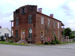 | Blair's Ferry Storehouse | building | 1977 | 77001277 |
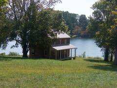 | Bowman House | building | 1970 | 70000610 |
| Cannon-Calloway House | building | 1970 | 70000611 | |
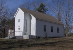 | Craigs Chapel AME Zion Church | district | 2001 | 01000256 |
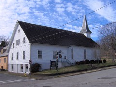 | Cumberland Presbyterian Church of Loudon | building | 1982 | 82003988 |
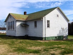 | Dunbar Public School | building | 2007 | 07001196 |
| Fort Loudon Hydroelectric Project | district | 2017 | 100001469 | |
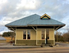 | Greenback Depot | building | 2013 | 13000950 |
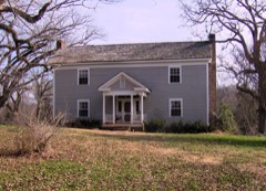 | William H. Griffitts House | building | 1989 | 89000141 |
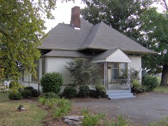 | Lenoir City Company | building | 1982 | 82003987 |
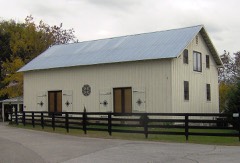 | Lenoir Cotton Mill Warehouse | building | 2006 | 06000584 |
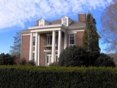 | Albert Lenoir House | building | 1973 | 73001808 |
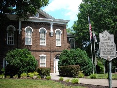 | Loudon County Courthouse | building | 1975 | 75001768 |
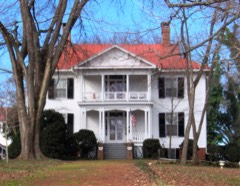 | Mason Place | building | 1989 | 89002029 |
| McCollum Farm | building | 1978 | 78002605 | |
| Melton Hill Hydroelectric Project | district | 2017 | 100001470 | |
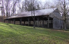 | National Campground | building | 1972 | 72001243 |
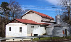 | Robinson Mill | building | 1984 | 84003592 |
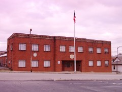 | War Memorial Building | building | 2011 | 11000979 |
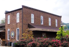 | Wilson, Orme, and Company Storehouse | building | 1980 | 80003845 |
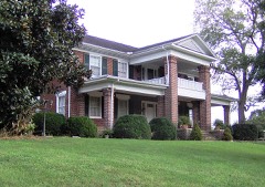 | Winton, John House | building | 2003 | 03000665 |
Every wildfire the federal occurrence database records inside this county: 170 of them, burning about 1,090 acres. 2 started naturally and 40 were recorded as arson. Each settlement page carries the fires within five miles of it.
| Reported cause | Fires |
|---|---|
| Debris and open burning | 87 |
| Arson/incendiarism | 40 |
| Missing data/not specified/undetermined | 20 |
| Smoking | 7 |
| Misuse of fire by a minor | 4 |
| Equipment and vehicle use | 3 |
| Natural | 2 |
| Power generation/transmission/distribution | 2 |
| Railroad operations and maintenance | 2 |
| Other causes | 1 |
| Recreation and ceremony | 1 |
| Fireworks | 1 |
The five largest, by the area the report gives. Two of them were set deliberately.
| Date | Cause | Size | Reported by | Name on the report |
|---|---|---|---|---|
| 11 March 2013 | Power generation/transmission/distribution | 136 acres | Tennessee Division of Forestry | ROCKY TOP |
| 2 October 1998 | Arson/incendiarism | 100 acres | Tennessee Division of Forestry | not named |
| 5 November 2007 | Debris and open burning | 85 acres | Tennessee Division of Forestry | RUNNING |
| 6 March 2007 | Arson/incendiarism | 50 acres | Tennessee Division of Forestry | NOTCHIE HILL RD |
| 3 March 2008 | Debris and open burning | 35 acres | Tennessee Division of Forestry | not named |
| 28 February 2000 | Debris and open burning | 35 acres | Tennessee Division of Forestry | not named |
| 18 September 2001 | Debris and open burning | 30 acres | Tennessee Division of Forestry | not named |
| 17 April 2008 | Railroad operations and maintenance | 30 acres | Tennessee Division of Forestry | not named |
Every settlement page carries the fires within five miles of it - see the settlement index below.
The NOAA Storm Events Database holds 326 reports for this county, causing 2 deaths, 60 injuries and about $12,139,751 in recorded property damage. Each settlement page carries the reports that name it.
| Kind of event | Reports |
|---|---|
| Thunderstorm Wind | 226 |
| Hail | 65 |
| Flash Flood | 17 |
| Tornado | 9 |
| Funnel Cloud | 5 |
| Flood | 3 |
| Lightning | 1 |
The most serious of them, by death, then injury, then recorded damage. The accounts are quoted exactly as the forecast office filed them.
| When | Event | Place named | Harm | What the report says |
|---|---|---|---|---|
| February 1993 | Tornado (F3) | not stated | 1 killed, 55 hurt, $5,000,000 | The tornado that started in Roane County continued into Loudon County and moved through the town of Lenoir City. Between 15 and 20 homes were destroyed and another 144 homes were damaged. Eighteen businesses were damaged or destroyed. A woman was killed as the tornado destroyed her home. Numerous trees and power lines were knocked down. (F82P) |
| June 2005 | Thunderstorm Wind | Lenoir City | 1 killed | A man riding in a golf cart was killed when a large limb from a tree fell and struck the moving cart. |
| May 2025 | Tornado (EF0) | Luttrell | 3 hurt, $100,000 | An EF0 tornado touched down in southern Loudon County in the early morning hours with max winds of 85 mph. Tornado was in Loudon County for roughly 1 mile before exiting into northern Monroe County east of Holt Road. Several injuries occurred when either the tornado itself or the rear flank downdraft winds rolled a camper RV several times up and over a wooden service post. In addition to the RV on the south side of the damage swath, several trees suffered damage, there was roof damage to small structures and a barn, and the tornado left cycloidal markings in the field beyond the RV and houses. When the tornado reached the tree line at the edge of Loudon, several trees had large branches broken off. |
| April 1974 | Tornado (F2) | not stated | 2 hurt, $250,000 | no account filed |
| May 2003 | Flash Flood | Countywide | $3,920,000 | Numerous roads flooded and closed countywide. Also, mudslides occurred. |
| August 2023 | Thunderstorm Wind | Loudon | $500,000 | Loudon County High sustained significant roof damage to the gymnasium. The roof decking was ripped off the building. The only other structural damage on site was to the ticket booth, which also had the roof lifted off and destroyed. |
| April 1994 | Hail | Lenoir City | $500,000 | A few trees were knocked down. Golf ball-size hail damaged about 30 vehicles at a car dealership. Several other cars were damaged as well. A large greenhouse was also damaged by the hail. |
| April 1998 | Flash Flood | Lenoir City | $250,000 | no account filed |
| May 1984 | Tornado (F2) | not stated | $250,000 | no account filed |
| April 2010 | Thunderstorm Wind | Greenback | $120,000 | The Daily Times newspaper in Maryville reported a home was destroyed and several trees and powerlines downed by thunderstorm winds near Greenback. |
| August 2006 | Lightning | Greenback | $60,000 | Lightning struck and barn in Greenback. The barn was destroyed by fire as well as the hay and farm equipment inside. |
| August 2014 | Thunderstorm Wind | Philadelphia | $40,000 | Law enforcement personnel reported multiple trees downed by thunderstorm wind in Philadelphia. At least barn was also damaged or destroyed. |
| April 2010 | Tornado (EF1) | Greenback | $30,000 | The NWS storm survey determined the tornado entered from Monroe County tracked across extreme southern Loudon County then continued east into Blount County. It was classified as an EF1 tornado with winds estimated at 100 mph and a path width of 100 yards. The tornado snapped around 20 trees in extreme southern Loudon County near Greenback. |
| May 2005 | Thunderstorm Wind | Countywide | $30,000 | no account filed |
| July 2005 | Thunderstorm Wind | Countywide | $30,000 | no account filed |
| August 2002 | Thunderstorm Wind | Countywide | $30,000 | no account filed |
| February 2012 | Thunderstorm Wind | Greenback | $25,000 | Emergency management personnel reported several trees downed by thunderstorm wind as well as structural damage to a storage building in Greenback. |
| April 2011 | Thunderstorm Wind | Loudon | $25,000 | Law enforcement personnel reported numerous trees and powerlines downed by thunderstorm wind across the eastern half of the county. |
| June 2011 | Thunderstorm Wind | Lenoir City | $25,000 | Law enforcement personnel reported numerous trees downed by thunderstorm wind in Lenoir City. |
| October 2010 | Tornado (EF1) | Greenback | $25,000 | An EF-1 tornado with maximum winds of 90 miles an hour, produced scattered tree damage with several trees twisted and downed in its path. Two small outbuildings were also destroyed by the tornado. |
| July 2006 | Thunderstorm Wind | Countywide | $25,000 | no account filed |
| July 2006 | Thunderstorm Wind | Countywide | $25,000 | no account filed |
| July 2002 | Thunderstorm Wind | Lenoir City | $25,000 | no account filed |
| July 2002 | Thunderstorm Wind | Countywide | $25,000 | no account filed |
| January 2002 | Thunderstorm Wind | Countywide | $21,000 | Trees and power lines down. |
| February 2009 | Thunderstorm Wind | Jena | $20,000 | The highway department personnel reported numerous trees and powerlines downed by thunderstorm winds around Greenback. |
| June 2009 | Thunderstorm Wind | Loudon | $20,000 | Utility company personnel reported several trees and powerlines downed by thunderstorm winds countywide. |
| April 2008 | Thunderstorm Wind | Highland Park | $20,000 | The utility company reported numerous trees and powerlines downed by thunderstorm winds in Lenoir City. |
| August 2005 | Thunderstorm Wind | Lenoir City | $20,000 | Numerous trees down in and around Lenoir City. |
| May 2005 | Thunderstorm Wind | Lenoir City | $20,000 | no account filed |
| July 2004 | Thunderstorm Wind | Lenoir City | $20,000 | no account filed |
| July 2004 | Thunderstorm Wind | Loudon | $20,000 | no account filed |
| November 2002 | Thunderstorm Wind | Loudon | $20,000 | no account filed |
| November 2002 | Thunderstorm Wind | Lenoir City | $20,000 | no account filed |
| August 1999 | Thunderstorm Wind | Lenoir City | $20,000 | no account filed |
| July 1999 | Thunderstorm Wind | Loudon | $19,000 | no account filed |
| August 2006 | Thunderstorm Wind | Greenback | $18,000 | Several trees down in Greenback. One tree fell on a home in Greenback damaging the roof. |
| August 2005 | Thunderstorm Wind | Loudon | $18,000 | A few trees down on powerlines. Reported by Ft Loudon Electric. |
| June 1998 | Thunderstorm Wind | Loudon | $18,000 | no account filed |
| February 2014 | Thunderstorm Wind | Loudon | $15,000 | The public reported a barn roof blown off and a garage door blown in 5 miles west of Loudon. In addition, a 3 foot diameter was downed by the wind along Highway 72. |
| April 2007 | Thunderstorm Wind | Philadelphia | $15,000 | Several trees were reported down in Philadelphia and a storm spotter measured wind speed at 73 mph. |
| June 2007 | Thunderstorm Wind | Greenback | $15,000 | Thunderstorm winds downed a few trees and powerlines in Greenback and the surrounding area. |
| December 2005 | Thunderstorm Wind | Lenoir City | $15,000 | Several trees down countywide |
| July 2005 | Thunderstorm Wind | Lenoir City | $15,000 | no account filed |
| May 2002 | Thunderstorm Wind | Loudon | $15,000 | no account filed |
| August 2002 | Thunderstorm Wind | Countywide | $15,000 | no account filed |
| October 2001 | Thunderstorm Wind | Loudon | $14,000 | Trees and power lines down. |
| June 2009 | Thunderstorm Wind | Piney | $12,000 | Law enforcement officials reported numerous trees downed by thunderstorm winds from Tellico Village to Greenback. |
| April 2006 | Thunderstorm Wind | Lenoir City | $12,000 | Several trees down in Lenoir City. |
| June 2005 | Thunderstorm Wind | Countywide | $12,000 | Several trees downed countywide. |
| May 2004 | Thunderstorm Wind | Lenoir City | $12,000 | no account filed |
| July 1999 | Thunderstorm Wind | Lenoir City | $12,000 | no account filed |
| June 2014 | Thunderstorm Wind | Loudon | $10,000 | Law enforcement personnel reported many trees downed by thunderstorms wind countywide. |
| April 2014 | Thunderstorm Wind | Loudon | $10,000 | Law enforcement personnel reported several trees downed by thunderstorm wind countywide. |
| June 2011 | Thunderstorm Wind | Loudon | $10,000 | Law enforcement personnel reported several trees downed by thunderstorm wind countywide. |
| April 2011 | Tornado (EF0) | Greenback | $10,000 | A NWS Storm Survey reported an EF0 tornado touched down near West Greenback. It had a path width of 50 yards and a path length of 1.0 miles. The max wind of 70 mph downed several trees. |
| June 2009 | Thunderstorm Wind | Loudon | $10,000 | Law enforcement personnel reported several trees downed by thunderstorm winds in Loudon. One tree fell on a parked car. |
| June 2009 | Thunderstorm Wind | Davis | $10,000 | Amateur radio personnel reported several trees and powerlines downed by thunderstorm winds countywide. |
| June 2009 | Thunderstorm Wind | Davis | $10,000 | Amateur radio operators reported several trees and powerlines downed by thunderstorm winds countywide. |
| June 2006 | Thunderstorm Wind | Erie | $10,000 | A few trees down in Erie. |
The Survey's mineral resources record lists 73 workings inside this county. 5 still produce and 68 are closed or unrecorded. Each settlement page carries the workings within five miles of it.
| Commodity | Workings |
|---|---|
| Barium-Barite | 49 |
| Stone, Crushed/Broken | 5 |
| Manganese | 4 |
| Marble, Dimension | 4 |
| Clay | 3 |
| Iron | 3 |
| Lead, Zinc, Iron, Fluorine-Fluorite | 2 |
| Zinc | 2 |
| Fluorine-Fluorite | 2 |
| Limestone, General | 2 |
| Lead | 2 |
| Barium-Barite, Iron | 1 |
| Barium-Barite, Lead, Zinc | 1 |
| Barium-Barite, Zinc | 1 |
The least common of them first, because a county's hundredth gravel pit says nothing its first ten did not.
| Where | Site | Commodity | Status | Recorded |
|---|---|---|---|---|
| Greenback Rock Quarry Inc | Stone, Dimension | Producer | ||
| Heaton Barite Prospect | Barium-Barite, Iron | Occurrence | Barite, Limonite | |
| Unitia Barite and Lead Prospect | Barium-Barite, Lead, Zinc | Occurrence | 1905 | |
| Unitia Prospect | Lead, Barium-Barite, Zinc | Prospect | ||
| C C Patrick Prospect | Barium-Barite, Lead, Zinc, Iron, Fluorine-Fluorite | Past Producer | ||
| C.C. Patrick Prospect | Barium-Barite, Lead, Zinc, Iron, Fluorine-Fluorite | Past Producer | 1914 | |
| Greenway Quarry | Limestone, General | Past Producer | Sedimentary | |
| Johnson Mine | Barium-Barite, Zinc | Past Producer | 1917 | |
| Johnson Mine | Barium-Barite, Zinc | Past Producer | ||
| Loudon Quarry | Limestone, General | Past Producer | Sedimentary | |
| Minton Mine | Barium-Barite, Fluorine-Fluorite | Past Producer | Barite, Fluorite | |
| Minton Mine | Barium-Barite, Fluorine-Fluorite | Past Producer | ||
| Unita Barite and Lead Prospect | Lead | Past Producer | ||
| Cates Prospect | Iron, Manganese | Prospect | ||
| General Portland Cement Co Mine | Clay | Unknown | ||
| Heaton Barite Prospect | Barium-Barite, Iron | Occurrence | ||
| Old Hickory Brick Number 1 Pit | Clay | Past Producer | Sedimentary | |
| Old Hickory Brick Number 1 Pit | Clay | Unknown | ||
| Sheffield Steel/ Lenior City, Tn. | Iron | Plant | ||
| Alexander Quarry | Marble, Dimension | Past Producer | ||
| Alexander Quarry | Marble, Dimension | Past Producer | ||
| Andies Quarry | Marble, Dimension | Past Producer | ||
| Galbraith Mine | Manganese | Past Producer | 1918 | |
| Galbraith Mine Henley | Manganese | Past Producer | Residual | |
| Hammontree Property | Manganese | Prospect | 1951 | |
| Locust Bluff Quarry | Marble, Dimension | Prospect | ||
| Andies Quarry | Stone, Crushed/Broken | Past Producer | ||
| Greenway Quarry | Stone, Crushed/Broken | Past Producer | ||
| Loudon County Plant #547 | Stone, Crushed/Broken | Past Producer | Limestone | |
| Loudon Quarry | Stone, Crushed/Broken | Past Producer | ||
| Old Hickory Brick No. 1 | Stone, Crushed/Broken | Producer | Sedimentary | |
| B. C. Wood Barite Mine | Barium-Barite | Producer | Barite | |
| B.C. Wood Barite Mine | Barium-Barite | Past Producer | ||
| B.C. Wood Barite Mine | Barium-Barite | Past Producer | ||
| Baer Mine | Barium-Barite | Past Producer | Barite | |
| Baer Mine | Barium-Barite | Past Producer | ||
| Barr Mine | Barium-Barite | Past Producer | Barite | |
| Barr Mine | Barium-Barite | Past Producer | ||
| Brown Mine | Barium-Barite | Past Producer | Barite | |
| Brown Mine | Barium-Barite | Past Producer | ||
| C.C. Patrick Prospects | Barium-Barite | Past Producer | Residual | |
| Carter Prospect | Barium-Barite | Occurrence | Barite | |
| Carter Prospect | Barium-Barite | Occurrence | ||
| Cedar Fork Mine | Barium-Barite | Past Producer | ||
| Crush Mine | Barium-Barite | Past Producer | ||
| Culveyhouse Mine | Barium-Barite | Past Producer | Barite | |
| Culveyhouse Mine | Barium-Barite | Past Producer | ||
| Dawson Prospect | Barium-Barite | Occurrence | Barite | |
| Dawson Prospect | Barium-Barite | Occurrence | ||
| E. Mantooth Prospect | Barium-Barite | Occurrence | Barite | |
| E. Mantooth Prospect | Barium-Barite | Occurrence | ||
| Gilman Mine | Barium-Barite | Past Producer | Barite | |
| Gilman Mine | Barium-Barite | Past Producer | ||
| Mantooth Mine | Barium-Barite | Past Producer | Barite | |
| Mantooth Mine | Barium-Barite | Past Producer | ||
| Matlock Barite Mine | Barium-Barite | Past Producer | Residual | |
| Matlock Barite Mine | Barium-Barite | Past Producer | ||
| Matlock Mine | Barium-Barite | Past Producer | Residual | |
| Pfiffer Mine | Barium-Barite | Past Producer | Barite | |
| Pfiffer Mine | Barium-Barite | Past Producer | ||
| Rose Mine | Barium-Barite | Past Producer | Barite | |
| Rose Mine | Barium-Barite | Past Producer | ||
| Smith Mine | Barium-Barite | Producer | ||
| Stockton Prospect | Barium-Barite | Occurrence | Barite | |
| Stockton Prospect | Barium-Barite | Prospect | ||
| T. Lee Prospect | Barium-Barite | Occurrence | Barite | |
| T. Lee Prospect | Barium-Barite | Occurrence | ||
| Thompson Mine | Barium-Barite | Past Producer | ||
| Thompson Mine | Barium-Barite | Past Producer | ||
| Wilson Mine | Barium-Barite | Past Producer | Barite | |
| Wilson Mine | Barium-Barite | Past Producer | ||
| Wilson Prospect | Barium-Barite | Occurrence | Barite | |
| Wilson Prospect | Barium-Barite | Occurrence |
Named settlements recorded in the Geographic Names Information System, each with the topographic sheets covering it. Villages, hamlets and abandoned places alike. Each is shown with the nearest named watercourse or landform and the survey quadrangle it falls on.
District 3 · 37742 · Near Lotterdale Knob · Meadow quadrangle
20 sheets, 1895 to 1981
No longer a settlement
District 5 · 37771 · On Chestnut Ridge · Lenoir City quadrangle
24 sheets, 1895 to 1981
District 6 · 37772 · Near Big Island (historical) · Concord quadrangle
26 sheets, 1895 to 1981
District 3 · 37742 · Near Chapel HIll · Meadow quadrangle
20 sheets, 1895 to 1981
No longer a settlement
District 5 · 37772 · Near Possum Valley Ridge · Concord quadrangle
26 sheets, 1895 to 1981
District 5 · 37771 · Near Little Mountain · Lenoir City quadrangle
24 sheets, 1895 to 1981
District 5 · 37771 · Near Little Mountain · Lenoir City quadrangle
24 sheets, 1895 to 1981
District 5 · 37772 · Near Possum Valley Ridge · Concord quadrangle
26 sheets, 1895 to 1981
District 3 · 37742 · Near Carpenters Island (historical) · Meadow quadrangle
20 sheets, 1895 to 1981
No longer a settlement
District 5 · 37771 · Near Browder Hollow · Lenoir City quadrangle
24 sheets, 1895 to 1981
District 1 · 37774 · On Dry Valley Branch · Philadelphia quadrangle
19 sheets, 1895 to 1981
District 1 · 37774 · Near Hotchkiss Valley · Lenoir City quadrangle
24 sheets, 1895 to 1981
District 7 · 37774 · Near Carpenters Island (historical) · Meadow quadrangle
20 sheets, 1895 to 1981
No longer a settlement
District 5 · 37771 · Near Little Mountain · Lenoir City quadrangle
24 sheets, 1895 to 1981
District 1 · 37774 · On Poplar Springs Ridge · Loudon quadrangle
21 sheets, 1895 to 1981
District 2 · 37771 · Near Browder Hollow · Lenoir City quadrangle
24 sheets, 1895 to 1981
District 1 · 37771 · Near Huntsville Hollow · Lenoir City quadrangle
24 sheets, 1895 to 1981
District 5 · 37771 · On Hope Creek · Lenoir City quadrangle
24 sheets, 1895 to 1981
No longer a settlement
District 5 · 37771 · Near Bradbury Valley · Bethel Valley quadrangle
24 sheets, 1895 to 1998
The vanished settlements of Loudon County: the places named above that are no longer on the map.