Block
From the record
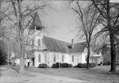
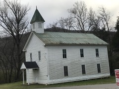
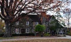
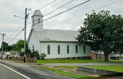
21 National Register listings published here.
Sources: the National Register database, National Park Service
166 topographic sheets cover 51 settlements here, and 21 properties are on the National Register of Historic Places.
21 National Register listings published here.
Sources: the National Register database, National Park Service
Every property in this county listed on the National Register of Historic Places, with the year it was listed and the federal nomination document.
Every wildfire the federal occurrence database records inside this county: 922 of them, burning about 22,574 acres. 5 started naturally and 493 were recorded as arson. Each settlement page carries the fires within five miles of it.
| Reported cause | Fires |
|---|---|
| Arson/incendiarism | 493 |
| Debris and open burning | 231 |
| Missing data/not specified/undetermined | 79 |
| Recreation and ceremony | 27 |
| Equipment and vehicle use | 23 |
| Railroad operations and maintenance | 22 |
| Smoking | 16 |
| Power generation/transmission/distribution | 8 |
| Other causes | 7 |
| Misuse of fire by a minor | 6 |
| Natural | 5 |
| Fireworks | 5 |
The five largest, by the area the report gives. Four of them were set deliberately.
| Date | Cause | Size | Reported by | Name on the report |
|---|---|---|---|---|
| 4 November 2001 | Railroad operations and maintenance | 1,100 acres | Tennessee Division of Forestry | not named |
| 22 February 2007 | Arson/incendiarism | 1,075 acres | Tennessee Division of Forestry | POT POINT |
| 30 October 2016 | Missing data/not specified/undetermined | 950 acres | Tennessee Division of Forestry | BRIDGE CREEK ROAD |
| 1 November 2016 | Arson/incendiarism | 934 acres | Tennessee Division of Forestry | KERN BRANCH FIRE |
| 11 November 2016 | Missing data/not specified/undetermined | 735 acres | Tennessee Division of Forestry | CLIFF TOPPS |
| 6 November 2016 | Arson/incendiarism | 735 acres | Tennessee Division of Forestry | COPPINGER COVE FIRE |
| 28 November 1998 | Arson/incendiarism | 630 acres | Tennessee Division of Forestry | not named |
| 31 October 2016 | Recreation and ceremony | 412 acres | Tennessee Division of Forestry | PINE HILL FIRE |
Every settlement page carries the fires within five miles of it - see the settlement index below.
The NOAA Storm Events Database holds 383 reports for this county, causing 5 deaths, 25 injuries and about $31,858,650 in recorded property damage. Each settlement page carries the reports that name it.
| Kind of event | Reports |
|---|---|
| Thunderstorm Wind | 260 |
| Hail | 75 |
| Tornado | 21 |
| Flash Flood | 18 |
| Flood | 8 |
| Lightning | 1 |
The most serious of them, by death, then injury, then recorded damage. The accounts are quoted exactly as the forecast office filed them.
| When | Event | Place named | Harm | What the report says |
|---|---|---|---|---|
| February 2014 | Thunderstorm Wind | South Pittsburg | 2 killed, 1 hurt | Emergency manager reported several trees downed by thunderstorm wind across the county. In addition, one person was injured with structural damage to a mobile home. |
| December 2015 | Flash Flood | South Pittsburg | 1 killed, $280,000 | Roads flooded. Businesses flooded downtown as water rushed down South Pittsburg Mountain into the community. Flood waters contained debris. One fatality occurred as an onlooker was swept into an underground culvert. |
| April 2020 | Flash Flood | Kimball | 1 killed | Vehicle on Kimball Cove Road came to a flooded bridge over Kimball Cove Branch. The two occupants left the vehicle, and one was washed downstream and perished. |
| December 2018 | Flash Flood | Martin Spgs | 1 killed | Hikers sheltering in a cave overnight attempted to cross two branches of flooding Cave Cove Creek via a log during heavy rain to try to return to their vehicle. One female was swept away and drowned. |
| November 2007 | Tornado (EF2) | Kimball | 9 hurt, $2,500,000 | Nine injuries resulted from the EF2 rated tornado which heavily damaged the roof of the Kimball Baptist Church as well as damaging several vehicles in the church parking lot. The tornado also destroyed several modular homes between Main Street and Interstate 24. Peak wind speed was estimated at 130 mph with a path width of 200 yards. Path length was 2 miles. |
| April 1986 | Tornado (F1) | not stated | 6 hurt, $250,000 | no account filed |
| March 1963 | Tornado (F2) | not stated | 6 hurt, $250,000 | no account filed |
| May 1995 | Tornado (F0) | Whitwell | 1 hurt, $100,000 | Four mobile homes were destroyed with one person injured while seeking shelter in one of the mobile homes. Many trees and power lines were knocked down. One fallen tree damaged a nearby car. |
| April 1995 | Tornado (F1) | Haletown | 1 hurt, $50,000 | A tornado touched down near Interstate 24 in the vicinty of Haletown. A large truck was overturned injuring the driver. A nearby fireworks store and campground were damaged. A few buildings in the area suffered roof damage. Several trees were knocked down. |
| November 1989 | Thunderstorm Wind | not stated | 1 hurt | no account filed |
| May 2003 | Flash Flood | Countywide | $11,620,000 | Widespread flooding, road closures, damage, evacuations. |
| May 2003 | Flash Flood | Countywide | $11,620,000 | Widespread flooding, road closures, damage, evacuations. |
| February 2019 | Flood | Martin Spgs | $3,500,000 | Cave Cove Road flooded. All told, there was about 3.5 million dollars in flooding damages to infrastructure and roads across Marion County for the overall event. |
| March 1998 | Thunderstorm Wind | Jasper | $100,000 | Strong thunderstorm winds blew the roof off the cafeteria of the Jasper Middle School. Many trees were blown down. Some of these trees fell on cars and homes. A portable toilet at a construction site landed inside a woman's car. Building damage was done to a chiropractor's office. About 15 roads were closed due to downed trees around Jasper. |
| July 1997 | Thunderstorm Wind | Sequatchie | $100,000 | A huge tree was uprooted. It fell on a fence and 6 cars. The tree also pulled off part of a roof.Several homes sustained roof damage when the storm moved through Sequatchie. |
| July 2013 | Flash Flood | South Pittsburg | $50,000 | Three feet of water running down several South Pittsburg streets. Water flowing through homes. |
| July 2006 | Thunderstorm Wind | Countywide | $35,000 | no account filed |
| April 2011 | Tornado (EF2) | Moore Crossing | $30,000 | A NWS storm survey reported an EF2 tornado continued its path from Alabama and entered the border near Lakeview Drive and moved northeast across Nickajack Lake near Haletown and ended near the Tennessee River. It had path width of 800 yards and a path length of 10 miles. The max wind of 115 mph downed numerous trees. |
| March 1995 | Tornado (F0) | South Pittsburg | $30,000 | A small tornado blew some trees into several homes. |
| July 2005 | Thunderstorm Wind | Countywide | $30,000 | no account filed |
| May 2004 | Thunderstorm Wind | South Pittsburg | $30,000 | no account filed |
| June 2014 | Thunderstorm Wind | South Pittsburg | $25,000 | Law enforcement personnel reported trees and powerlines downed by thunderstorms wind across the county. Some of the trees fell on homes. |
| June 2014 | Thunderstorm Wind | Jasper | $25,000 | Law enforcement personnel reported trees and powerlines downed by thunderstorms wind across the county. Some of the tress fell on homes. |
| April 2011 | Tornado (EF1) | Alaten | $25,000 | A NWS storm survey reported an EF1 tornado track from near the Georgia state line near Macedonia Road. The path continued to the northeast to near Highway 156 before dissipating. The 90 mph wind downed numerous trees. |
| July 2010 | Lightning | South Pittsburg | $25,000 | A historic building in downtown South Pittsburg received extensive damage due to a lightning strike late Sunday evening. The building located at 238 Cedar Avenue, suffered explosive damage to a decorative portion of the top of the building when the strike occurred. |
| October 2009 | Thunderstorm Wind | Jasper | $25,000 | Law enforcement officials reported numerous trees and powerlines downed by thunderstorm winds countywide. |
| April 2007 | Thunderstorm Wind | Martin Spgs | $25,000 | Several trees were reported down at various locations throughout the county. |
| September 2006 | Thunderstorm Wind | South Portion | $25,000 | no account filed |
| July 2004 | Thunderstorm Wind | Whitwell | $25,000 | no account filed |
| October 1984 | Tornado (F0) | not stated | $25,000 | no account filed |
| June 1982 | Tornado (F1) | not stated | $25,000 | no account filed |
| July 1980 | Tornado (F1) | not stated | $25,000 | no account filed |
| February 2011 | Tornado (EF0) | South Pittsburg | $20,000 | A short lived tornado touched down near South Pittsburg, downing two trees and partially damaged a small roof. The maximum wind speed with the tornado was 70 mph. |
| June 2011 | Thunderstorm Wind | Whitwell | $20,000 | Law enforcement personnel reported many trees and powerlines downed by thunderstorm wind in Whitwell. |
| April 2011 | Thunderstorm Wind | South Pittsburg | $20,000 | Emergency manager personnel reported numerous trees downed by thunderstorm wind 2 miles south of South Pittsburg in the Midway community. |
| June 2011 | Thunderstorm Wind | South Pittsburg | $20,000 | Law enforcement personnel reported numerous trees and powerlines downed by thunderstorm wind in South Pittsburg. |
| June 2010 | Thunderstorm Wind | South Pittsburg | $20,000 | Law enforcement personnel reported numerous trees and powerlines downed by thunderstorm winds across much of the western half of the county. |
| October 2009 | Tornado (EF0) | Jasper | $20,000 | An EF0 tornado touched down near Jasper and had a continuous two mile path before dissipating. The path width was 30 yards. The maximum wind speed was 80 miles. The tornado downed numerous trees. |
| April 2007 | Thunderstorm Wind | Jasper | $20,000 | Several trees were reported down in various locations across the county. |
| May 2006 | Thunderstorm Wind | Jasper | $20,000 | no account filed |
| May 2003 | Thunderstorm Wind | Countywide | $20,000 | no account filed |
| May 2002 | Thunderstorm Wind | Countywide | $20,000 | no account filed |
| July 2002 | Thunderstorm Wind | Jasper | $20,000 | no account filed |
| November 2000 | Thunderstorm Wind | Countywide | $20,000 | no account filed |
| June 1999 | Thunderstorm Wind | South Pittsburg | $19,000 | no account filed |
| June 2006 | Thunderstorm Wind | Countywide | $18,000 | Numerous trees down countywide. Several cars in Jasper damaged by falling limbs. |
| August 2005 | Thunderstorm Wind | Countywide | $18,000 | Trees down countywide. |
| August 2005 | Thunderstorm Wind | Jasper | $18,000 | Trees down countywide. |
| August 2005 | Thunderstorm Wind | Whitwell | $18,000 | Three large limbs downed three powerlines in Ketner Mill area. Reported by Sequatchie Valley Power. |
| June 2003 | Thunderstorm Wind | Jasper | $18,000 | no account filed |
| February 2020 | Flood | Whitwell | $17,000 | Old Dunlap Road was closed. Ketner Mill Road was partially washed out. |
| June 2010 | Thunderstorm Wind | Jasper | $15,000 | Law enforcement personnel reported several trees and powerlines downed by thunderstorm winds in and around Jasper. |
| April 2009 | Thunderstorm Wind | Glover Hill | $15,000 | Law enforcement officials reported several trees and powerlines downed by thunderstorm winds in Jasper. |
| April 2009 | Thunderstorm Wind | Whitwell | $15,000 | Law enforcement officials reported several trees and powerlines downed by thunderstorm winds in Whitwell. |
| February 2008 | Thunderstorm Wind | Jasper | $15,000 | The Marion County highway department reported numerous trees down across the north half of the county. |
| August 2005 | Thunderstorm Wind | Jasper | $15,000 | One tree down and a large limb downed a powerline in Jasper. Reported by Sequatchie Valley Power. |
| March 2006 | Thunderstorm Wind | West Portion | $15,000 | no account filed |
| May 2006 | Thunderstorm Wind | Sequatchie | $15,000 | no account filed |
| May 2006 | Thunderstorm Wind | Jasper | $15,000 | no account filed |
| July 2004 | Thunderstorm Wind | Jasper | $15,000 | no account filed |
The Survey's mineral resources record lists 20 workings inside this county. 10 still produce and 10 are closed or unrecorded. Each settlement page carries the workings within five miles of it.
| Commodity | Workings |
|---|---|
| Stone, Crushed/Broken | 6 |
| Iron | 6 |
| Stone, Crushed/Broken, Limestone, General | 4 |
| Stone | 1 |
| Silica, Iron | 1 |
| Limestone, General | 1 |
| Sand and Gravel, Construction | 1 |
The least common of them first, because a county's hundredth gravel pit says nothing its first ten did not.
| Where | Site | Commodity | Status | Recorded |
|---|---|---|---|---|
| Nickajack Plant | Stone | Past Producer | ||
| No 1 Mine | Sand and Gravel, Construction | Producer | ||
| Tennessee Metallurgical Corp | Silica, Iron | Plant | ||
| Thomas and Associates | Limestone, General | Past Producer | ||
| Bennetts Lake Quarry | Stone, Crushed/Broken, Limestone, General | Producer | Limestone | |
| Richard City Quarry Penn-Dixie Cement Corp. | Stone, Crushed/Broken, Limestone, General | Producer | Limestone | |
| Signal Mountain Plant #521 | Stone, Crushed/Broken, Limestone, General | Producer | Limestone | |
| South Pittsburg Quarry | Stone, Crushed/Broken, Limestone, General | Producer | Limestone | |
| Bennetts Lake Quarry | Stone, Crushed/Broken | Producer | ||
| Inman Mines | Iron | Past Producer | ||
| Jasper Job | Stone, Crushed/Broken | Producer | ||
| Marion Quarry | Stone, Crushed/Broken | Producer | ||
| Nickajack Plant | Stone, Crushed/Broken | Past Producer | Limestone | |
| Nixon No. 1 Mine | Iron | Past Producer | ||
| Nixon No. 2 Mine | Iron | Past Producer | ||
| Patten Entries | Iron | Past Producer | ||
| Richard City Quarry | Stone, Crushed/Broken | Plant | ||
| Signal Mountain Pit & Plant #521 | Stone, Crushed/Broken | Past Producer | ||
| Tennessee Coal & Iron No. 2 Mine | Iron | Past Producer | ||
| Tennessee Coal & Iron No. 3 Mine | Iron | Past Producer |
Named settlements recorded in the Geographic Names Information System, each with the topographic sheets covering it. Villages, hamlets and abandoned places alike. Each is shown with the nearest named watercourse or landform and the survey quadrangle it falls on.
District 2 · 37380 · On Kimball Cove Branch · South Pittsburg quadrangle
24 sheets, 1895 to 1988
District 2 · 37419 · Near Scout Hollow · Chattanooga quadrangle
36 sheets, 1888 to 1988
District 3 · 37347 · By Fullerton Bluff · South Pittsburg quadrangle
24 sheets, 1895 to 1988
District 3 · 37347 · On Standifer Branch · South Pittsburg quadrangle
24 sheets, 1895 to 1988
District 2 · 37380 · Near Raulstons Cove · South Pittsburg quadrangle
24 sheets, 1895 to 1988
No longer a settlement
District 5 · 37397 · On Gulf Springs Branch · Whitwell quadrangle
21 sheets, 1895 to 1988
District 2 · 37380 · On Cave Cove Creek · Monteagle quadrangle
22 sheets, 1895 to 1988
District 4 · 37397 · Near Bennett Hollow · Sequatchie quadrangle
21 sheets, 1895 to 1988
District 4 · 37397 · On Coon Branch · Whitwell quadrangle
21 sheets, 1895 to 1988
No longer a settlement
District 1 · 37380 · Near Blevins Hollow · South Pittsburg quadrangle
24 sheets, 1895 to 1988
District 1 · 37380 · On Hogjaw Creek · New Home quadrangle
25 sheets, 1886 to 1982
No longer a settlement
District 3 · 37347 · On Little Sequatchie River · Sequatchie quadrangle
21 sheets, 1895 to 1988
District 5 · 37397 · On Looneys Creek · Ketner Gap quadrangle
26 sheets, 1888 to 1988
District 3 · 37347 · Near Anderson Ridge · Sequatchie quadrangle
21 sheets, 1895 to 1988
District 1 · 37380 · Near Happy Hollow · South Pittsburg quadrangle
24 sheets, 1895 to 1988
District 1 · 37380 · Near Patton Hollow · Bridgeport quadrangle
24 sheets, 1886 to 1981
District 4 · 37374 · Near Water Fall Cove · Sequatchie quadrangle
21 sheets, 1895 to 1988
District 1 · 37380 · On Graham Cove Branch · New Home quadrangle
25 sheets, 1886 to 1982
No longer a settlement
District 1 · 37380 · Near Clute Hill · South Pittsburg quadrangle
24 sheets, 1895 to 1988
District 4 · 37405 · On Meager Spring Branch · Ketner Gap quadrangle
26 sheets, 1888 to 1988
District 5 · 37397 · On Shelton Creek · Ketner Gap quadrangle
26 sheets, 1888 to 1988
District 1 · 37380 · Near Hise Cove · South Pittsburg quadrangle
24 sheets, 1895 to 1988
The vanished settlements of Marion County: the places named above that are no longer on the map.