 Block
From the record
19 National Register listings published here.
Sources: the National Register database, National Park Service
121 topographic sheets cover 95 settlements here, and 19 properties are on the National Register of Historic Places.
19 National Register listings published here.
Sources: the National Register database, National Park Service
Every property in this county listed on the National Register of Historic Places, with the year it was listed and the federal nomination document.
| Photograph | Property | Type | Listed | Reference |
|---|---|---|---|---|
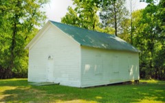 | Beth Salem Presbyterian Church | building | 2000 | 00000728 |
| Elijah Cate House | building | 1982 | 82003993 | |
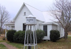 | James W. Chesnutt House | building | 2001 | 01001081 |
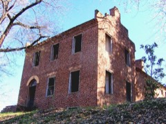 | Samuel Cleage House | building | 1975 | 75002069 |
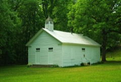 | Clear Springs Cumberland Presbyterian Church | building | 2007 | 06001337 |
| Englewood Water Tower | structure | 2020 | 100005141 | |
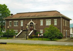 | Etowah Carnegie Library | building | 2003 | 03000132 |
 | Etowah Depot | building | 1977 | 77001513 |
| Etowah Historic District | district | 1996 | 96000818 | |
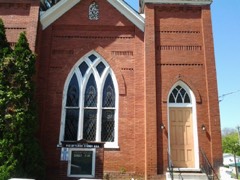 | First United Presbyterian Church | building | 2008 | 08000701 |
| M.A. Helm House | building | 2013 | 13000951 | |
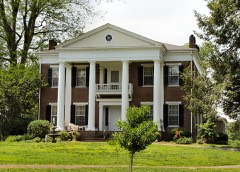 | Alexander H. Keith House | building | 1986 | 86001381 |
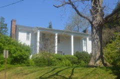 | William Lowry House | building | 1984 | 84003596 |
| McClatchey-Gettys Farm | building | 1982 | 82001731 | |
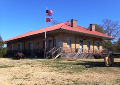 | Niota Depot | building | 1975 | 75002105 |
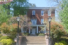 | Old College | building | 1983 | 83004259 |
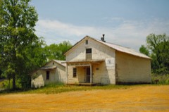 | Trew General Merchandise Store | building | 1976 | 76002159 |
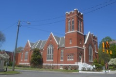 | Trinity United Methodist Church | building | 2009 | 09000537 |
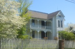 | John A. Turley House | building | 1999 | 99000366 |
Every wildfire the federal occurrence database records inside this county: 458 of them, burning about 5,799 acres. 6 started naturally and 176 were recorded as arson. Each settlement page carries the fires within five miles of it.
| Reported cause | Fires |
|---|---|
| Debris and open burning | 195 |
| Arson/incendiarism | 176 |
| Missing data/not specified/undetermined | 39 |
| Equipment and vehicle use | 14 |
| Recreation and ceremony | 13 |
| Natural | 6 |
| Railroad operations and maintenance | 6 |
| Misuse of fire by a minor | 3 |
| Other causes | 3 |
| Power generation/transmission/distribution | 2 |
| Smoking | 1 |
The five largest, by the area the report gives. Four of them were set deliberately.
| Date | Cause | Size | Reported by | Name on the report |
|---|---|---|---|---|
| 6 July 2012 | Power generation/transmission/distribution | 1,600 acres | Cherokee National Forest | POWER LINE |
| 26 May 2007 | Missing data/not specified/undetermined | 297 acres | Cherokee National Forest | BIG STARR |
| 14 August 2007 | Missing data/not specified/undetermined | 219 acres | Tennessee Division of Forestry | LAMONTVILLE 41 |
| 18 November 2001 | Arson/incendiarism | 115 acres | Tennessee Division of Forestry | not named |
| 5 September 2002 | Missing data/not specified/undetermined | 110 acres | Tennessee Division of Forestry | BEN LINER HOLLW FIRE |
| 16 November 2001 | Arson/incendiarism | 105 acres | Tennessee Division of Forestry | not named |
| 18 June 2001 | Arson/incendiarism | 105 acres | Tennessee Division of Forestry | not named |
| 12 September 2002 | Arson/incendiarism | 98 acres | Tennessee Division of Forestry | not named |
Every settlement page carries the fires within five miles of it - see the settlement index below.
The NOAA Storm Events Database holds 484 reports for this county, causing 1 death, 121 injuries and about $25,084,001 in recorded property damage. Each settlement page carries the reports that name it.
| Kind of event | Reports |
|---|---|
| Thunderstorm Wind | 310 |
| Hail | 99 |
| Flash Flood | 27 |
| Tornado | 22 |
| Flood | 13 |
| Funnel Cloud | 10 |
| Heavy Rain | 2 |
| Lightning | 1 |
The most serious of them, by death, then injury, then recorded damage. The accounts are quoted exactly as the forecast office filed them.
| When | Event | Place named | Harm | What the report says |
|---|---|---|---|---|
| April 1974 | Tornado (F1) | not stated | 1 killed, 32 hurt, $2,500 | no account filed |
| April 1974 | Tornado (F3) | not stated | 50 hurt, $250,000 | no account filed |
| November 2016 | Tornado (EF2) | Poplar Hill | 20 hurt | The tornado developed near the intersection of county road 700 and 705 where some minor tree damage was observed. The tornado maintained its intensity as it paralleled Cedar Springs Road and damaged a covered walkway just to the south of Athens along South Jackson Street. It continued to the northeast with the most catastrophic damage along its path occurring along Old Athens Madisonville Road where a few mobile homes were destroyed. The tornado weakened as it moved to the northeast with mostly tree damage; eventually lifting around the intersection of TN-307 and County Road 350. Two people were killed and twenty were injured as the tornado moved across the county. |
| March 2012 | Tornado (EF2) | Coghill | 7 hurt, $2,000,000 | Harrison Tornado - Segment #4. The Harrison Tornado continued to intensify again as it crossed from Polk into McMinn County. It was an EF1 at 100 MPH when it crossed the county line but quickly elevated to an EF2, and reached its maximum strength only about 1 1/2 miles inside McMinn County as an EF2 at 130 MPH where it caused heavy damage to several rural homes.||The tornado then continued to the northeast slowly weakening, crossed U.S. Highway 411, then started to climb the terrain on the north end of Starr Mountain where it dissipated. This storm went on to produce another tornado in Monroe County.||In McMinn County 37 homes and mobile homes were damaged. Four homes and seven mobile homes were destroyed. Property damages totaled about $2 Million. There were 7 injuries.||This tornado ended in McMinn County, but crossed parts of four counties, had an over pathlength of 41 miles and caused 44 injuries. |
| April 2011 | Tornado (EF2) | Luskville | 5 hurt, $200,000 | Ringgold-Apison Tornado. The tornado continued from Polk into McMinn County. The tornado re-intensified causing EF2 damage with 130 mph estimated max winds. Near the intersection of County Road 750 and County Road 966 two houses and a mobile home were destroyed and five people were injured. The tornado finally dissipated southwest of the McMinn County Airport. ||This prolific tornado started in Catoosa County, GA, accounted for 21 fatalities and tracked 57 miles over 5 parts of counties; 46 miles and 4 counties in Tennessee. |
| December 1977 | Tornado (F1) | not stated | 1 hurt, $250,000 | no account filed |
| April 1974 | Tornado (F3) | not stated | 1 hurt, $250,000 | no account filed |
| April 2009 | Thunderstorm Wind | Athens | 1 hurt, $25,000 | An individual reported a tree fell on a home and vehicle from thunderstorm winds in Athens. One person in the home was hospitalized with a neck injury. |
| March 1963 | Tornado (F2) | not stated | 1 hurt, $25,000 | no account filed |
| June 2003 | Thunderstorm Wind | Countywide | 1 hurt, $20,000 | no account filed |
| November 2017 | Thunderstorm Wind | Riceville | 1 hurt | Several trees were reported down along county road 100. Additionally, a resident was injured when a single wide mobile home was blown off of its foundation on the county road 100. |
| July 2003 | Thunderstorm Wind | Athens | 1 hurt | no account filed |
| May 2003 | Flash Flood | Countywide | $16,740,000 | Widespread flooding, road closures, damage, evacuations. |
| February 1986 | Tornado (F3) | not stated | $2,500,000 | no account filed |
| February 1993 | Thunderstorm Wind | Etowah | $500,000 | A factory had its windows and doors blown out. |
| February 1952 | Tornado (F2) | not stated | $250,000 | no account filed |
| April 2011 | Tornado (EF1) | Manila | $200,000 | Englewood-S. Madisonville Tornado. A NWS storm survey reported an EF1 tornado touched down northeast of Englewood. It formed near Carl Lee Road in McMinn County and tracked into Monroe County before dissipating. It had a path width of 200 yards. The 100 mph wind damaged several homes and downed numerous trees and powerlines. |
| April 2011 | Tornado (EF1) | Dentville | $100,000 | Cleveland-to-Etowah Tornado. A NWS storm survey reported an EF1 tornado continued out of Polk county into McMinn county, before it dissipated south of Etowah. The max wind of 90 mph downed several trees and damaged a few roofs on homes in southeast McMinn county. In total, this tornado tracked about 28 miles in three counties. |
| July 2002 | Thunderstorm Wind | Athens | $70,000 | no account filed |
| June 1999 | Thunderstorm Wind | Athens | $50,000 | no account filed |
| June 2011 | Thunderstorm Wind | Athens | $40,000 | A trained spotter reported several homes damaged by thunderstorm wind on County Route 100 west of Athens. Numerous trees were also downed by the wind. |
| July 2006 | Thunderstorm Wind | Countywide | $35,000 | no account filed |
| September 2002 | Flash Flood | Athens | $35,000 | no account filed |
| April 2011 | Thunderstorm Wind | Coghill | $30,000 | A trained spotter reported a roof blown off a home and several trees downed by thunderstorm wind in the Cog Hill Community. |
| June 2008 | Thunderstorm Wind | Sanford | $30,000 | Dispatch reported numerous trees downed by thunderstorm winds countywide. A roof was blown off a house at Calhoun. |
| June 2007 | Thunderstorm Wind | Etowah | $30,000 | A roof was blown off a house near Etowah, plus several trees and powerlines were down in the area from thunderstorm winds. |
| June 1999 | Thunderstorm Wind | Countywide | $30,000 | no account filed |
| April 2012 | Thunderstorm Wind | Athens | $25,000 | Emergency management personnel reported a home on County Highway 119 near Athens had structural damage by thunderstorm winds. |
| April 2011 | Thunderstorm Wind | Englewood | $25,000 | Amateur radio personnel reported numerous trees and powerlines downed by thunderstorm wind on Highway 165 in Englewood. |
| June 2001 | Thunderstorm Wind | Athens | $25,000 | Tree down on a house. |
| September 2006 | Thunderstorm Wind | Countywide | $25,000 | no account filed |
| March 2005 | Thunderstorm Wind | Athens | $25,000 | no account filed |
| May 2005 | Thunderstorm Wind | Athens | $25,000 | no account filed |
| July 2005 | Thunderstorm Wind | Countywide | $25,000 | no account filed |
| August 2014 | Thunderstorm Wind | Riceville | $20,000 | Law enforcement personnel reported many trees downed by thunderstorm wind near Riceville. |
| June 2010 | Thunderstorm Wind | Athens | $20,000 | Utility company personnel reported numerous trees and powerlines downed by thunderstorm winds across the northwestern portions of the county. |
| April 2010 | Thunderstorm Wind | Athens | $20,000 | The Daily Post-Athenian newspaper reported several trees and powerlines downed by thunderstorms winds across the county. Around 2000 homes lost power. |
| February 2009 | Thunderstorm Wind | Reagan | $20,000 | Law enforcement personnel reported numerous trees and powerlines downed by thunderstorm winds in the Regan area. |
| February 2009 | Thunderstorm Wind | Athens | $20,000 | Law enforcement personnel reported numerous trees and powerlines downed by thunderstorm winds across the county. |
| April 2009 | Thunderstorm Wind | Calhoun | $20,000 | Emergency management personnel reported several homes damaged by thunderstorm winds in the Calhoun area. |
| May 2006 | Thunderstorm Wind | Niota | $20,000 | no account filed |
| September 2006 | Thunderstorm Wind | Countywide | $20,000 | no account filed |
| May 2003 | Thunderstorm Wind | Countywide | $20,000 | no account filed |
| May 2003 | Thunderstorm Wind | Athens | $20,000 | no account filed |
| May 2002 | Thunderstorm Wind | Countywide | $20,000 | no account filed |
| July 1997 | Thunderstorm Wind | Countywide | $20,000 | no account filed |
| April 1996 | Thunderstorm Wind | Countywide | $20,000 | no account filed |
| June 1998 | Thunderstorm Wind | Athens | $19,000 | no account filed |
| October 2009 | Thunderstorm Wind | Riceville | $18,000 | A trained spotter reported several trees and powerlines downed by thunderstorm winds in Riceville. |
| February 2009 | Thunderstorm Wind | Niota | $18,000 | Law enforcement personnel reported several trees downed by thunderstorm winds in the Niota area. A home also had minor roof damage. |
| July 2005 | Thunderstorm Wind | Niota | $18,000 | no account filed |
| July 2005 | Thunderstorm Wind | Englewood | $18,000 | no account filed |
| December 2025 | Thunderstorm Wind | Niota | $15,000 | Strong to severe thunderstorm wind gusts blew off a roof of a metal pole barn. |
| June 2011 | Thunderstorm Wind | Etowah | $15,000 | Amateur radio personnel reported several trees downed by thunderstorm wind in Etowah. |
| June 2009 | Thunderstorm Wind | Fairview | $15,000 | Law enforcement personnel reported several trees and powerlines downed by thunderstorm winds countywide from Athens to Englewood. |
| June 2009 | Thunderstorm Wind | Piney Grove | $15,000 | Utility company personnel reported several trees and powerlines downed by thunderstorm winds countywide. |
| June 2009 | Thunderstorm Wind | Athens | $15,000 | Law enforcement officials reported several trees and powerlines downed by thunderstorm winds in Athens and the rest of the county. |
| June 2007 | Thunderstorm Wind | Englewood | $15,000 | Several trees in Englewood and the surrounding area were downed by thunderstorm winds. |
| June 2007 | Thunderstorm Wind | Niota | $15,000 | Thunderstorm winds downed several trees near Niota with one tree down on a house. |
| June 2005 | Thunderstorm Wind | Niota | $15,000 | A tree fell in Niota downing powerlines and falling on a car. |
The Survey's mineral resources record lists 105 workings inside this county. 9 still produce and 96 are closed or unrecorded. Each settlement page carries the workings within five miles of it.
| Commodity | Workings |
|---|---|
| Barium-Barite | 70 |
| Iron | 11 |
| Sand and Gravel, Construction | 7 |
| Manganese | 5 |
| Stone, Crushed/Broken | 3 |
| Stone, Crushed/Broken, Limestone, General | 2 |
| Lead, Zinc | 2 |
| Limestone, General | 2 |
| Zinc | 2 |
| Fluorine-Fluorite | 2 |
| Zinc, Fluorine-Fluorite, Barium-Barite | 1 |
| Sulfur-Pyrite | 1 |
| Calcium | 1 |
| Barium-Barite, Fluorine-Fluorite | 1 |
The least common of them first, because a county's hundredth gravel pit says nothing its first ten did not.
| Where | Site | Commodity | Status | Recorded |
|---|---|---|---|---|
| C. Cate Bank, R. G. Patty Mine | Sulfur | Past Producer | ||
| C. Cate Bank. R.G. Patty Bank | Iron, Sulfur-Pyrite | Past Producer | Limonite, Pyrite | |
| Calhoun Limekiln | Calcium | Plant | ||
| Tva Drill Hole Oostanaula | Zinc, Barium-Barite, Fluorine-Fluorite | Occurrence | ||
| Tva Drill Hole Oostanaula Creek 9 + 82 | Zinc, Fluorine-Fluorite, Barium-Barite | Occurrence | 1965 | |
| Athens Quarry | Stone, Crushed/Broken, Limestone, General | Producer | 1965 | |
| Floyd Webb Stone Company Quarry | Limestone, General | Past Producer | Sedimentary | |
| Mine No. 1 | Limestone, General | Producer | ||
| Shelton Barite Mine | Barium-Barite, Lead, Zinc | Past Producer | 1840 | |
| Shelton Barite Mine | Barium-Barite, Lead, Zinc | Past Producer | ||
| Stephens Deposit | Fluorine-Fluorite, Zinc, Barium-Barite | Prospect | 1973 | |
| U.S.Flourspar Mine | Fluorine-Fluorite | Past Producer | ||
| Webb Stone Co. Quarry Pit #332 | Stone, Crushed/Broken, Limestone, General | Producer | Limestone | |
| Athens Quarry | Stone, Crushed/Broken | Producer | ||
| Floyd Webb Stone Company Quarry | Stone, Crushed/Broken | Past Producer | ||
| Webb Stone Co. Quarry Pit #332 | Stone, Crushed/Broken | Producer | ||
| Bishop and Associates Prospect | Manganese | Prospect | 1951 | |
| Gilbert and S.H. Jones Prospects | Manganese | Prospect | 1951 | |
| Hansard Prospect | Manganese | Past Producer | 1951 | |
| Pierce Prospect | Manganese | Prospect | ||
| Reed and Webb Prospects | Manganese | Occurrence | ||
| Athens Mine | Sand and Gravel, Construction | Past Producer | ||
| Calhoun Plant | Sand and Gravel, Construction | Producer | ||
| Hiwassee Sand Co. Dredge-Summer | Sand and Gravel, Construction | Past Producer | Sedimentary | |
| Hiwassee Sand Co. Dredge-Summer | Sand and Gravel, Construction | Past Producer | ||
| Hiwassee Sand Co. Dredge-Winte | Sand and Gravel, Construction | Past Producer | ||
| Hiwassee Sand Co. Dredge-Winter | Sand and Gravel, Construction | Past Producer | Sedimentary | |
| Hiwassee Sand Company, Calhoun Plant Dredge Operation | Sand and Gravel, Construction | Producer | Unconsolidated Sediments | |
| C.Cate Bank & R.G. Patty Bank | Iron | Past Producer | Residual | |
| Calhoun Area | Iron | Past Producer | Residual | |
| Goodsprings Mine | Iron | Past Producer | Residual | |
| Goodsprings-Bethel Iron Mine | Iron | Past Producer | 1959 | |
| Goodsprings-Bethel Iron Mine | Iron | Past Producer | ||
| Mcspadden Mine | Iron | Past Producer | ||
| Nonaburg Iron Mine | Iron | Past Producer | 1959 | |
| Nonaburg Iron Mine | Iron | Past Producer | ||
| Oostanaula Creek Area | Iron | Past Producer | Residual | |
| Unnamed Prospect | Iron | Prospect | ||
| Anderson Mine | Barium-Barite | Past Producer | Barite | |
| Anderson Mine | Barium-Barite | Past Producer | ||
| Benton Barite Mine | Barium-Barite | Past Producer | Barite | |
| Benton Barite Mine | Barium-Barite | Past Producer | ||
| Benton Mine | Barium-Barite | Past Producer | Residual | |
| Calhoun Mine | Barium-Barite | Past Producer | ||
| Carter Mine | Barium-Barite | Past Producer | Barite | |
| Carter Mine | Barium-Barite | Past Producer | ||
| Dupont Mine | Barium-Barite | Past Producer | Barite | |
| Dupont Mine | Barium-Barite | Past Producer | ||
| Garrison Mine | Barium-Barite | Past Producer | Barite | |
| Garrison Mine | Barium-Barite | Past Producer | ||
| Gilman Ba Mine | Barium-Barite | Past Producer | Residual | |
| Gilman Barite Mine | Barium-Barite | Past Producer | Barite | |
| Gilman Barite Mine | Barium-Barite | Past Producer | ||
| Godsey Mine A | Barium-Barite | Past Producer | ||
| Godsey Mine B | Barium-Barite | Past Producer | ||
| Green Barite Mines | Barium-Barite | Past Producer | Barite | |
| Green Barite Mines | Barium-Barite | Past Producer | ||
| Guffy Barite Mine | Barium-Barite | Past Producer | Barite | |
| Guffy Barite Mine | Barium-Barite | Past Producer | ||
| Guffy Mine | Barium-Barite | Past Producer | Residual | |
| H. J. Moore Barite Mine | Barium-Barite | Past Producer | ||
| H.J. Moore Barite Mine | Barium-Barite | Past Producer | Barite | |
| Holt Mine | Barium-Barite | Past Producer | Barite | |
| Holt Mine | Barium-Barite | Past Producer | ||
| J.M. Godsey Mines | Barium-Barite | Past Producer | Barite | |
| Jones Mine | Barium-Barite | Past Producer | Barite | |
| Jones Mine | Barium-Barite | Past Producer | ||
| Kyker Mine | Barium-Barite | Past Producer | Barite | |
| Kyker Mine | Barium-Barite | Past Producer | ||
| L. A. Wood Barite Mine | Barium-Barite | Past Producer | ||
| L.A. Wood Barite Mine | Barium-Barite | Past Producer | Barite | |
| Linkenfields Mine | Barium-Barite | Past Producer | Barite | |
| Linkenfields Mine | Barium-Barite | Past Producer | ||
| Mcmanus Mine | Barium-Barite | Past Producer | ||
| Potter Barite Mines | Barium-Barite | Past Producer | Barite | |
| Potter Barite Mines | Barium-Barite | Past Producer | ||
| R. D. Malone Barite Prospect | Barium-Barite | Occurrence | ||
| R.D. Malone Barite Prospect | Barium-Barite | Occurrence | Barite | |
| Richardson Mine | Barium-Barite | Past Producer | Barite | |
| Richardson Mine | Barium-Barite | Past Producer | ||
| Richesin Barite Mine | Barium-Barite | Past Producer | Barite | |
| Richesin Barite Mine | Barium-Barite | Past Producer | ||
| Riddle Mine | Barium-Barite | Past Producer | Barite | |
| Riddle Mine | Barium-Barite | Past Producer | ||
| Sweetwater Barite Mine & Mill | Barium-Barite | Plant | ||
| Unnamed | Barium-Barite | Past Producer | Residual | |
| Unnamed Barite Mine | Barium-Barite | Past Producer | Barite | |
| Unnamed Barite Mine | Barium-Barite | Past Producer | Barite | |
| Unnamed Barite Mine | Barium-Barite | Past Producer | Barite | |
| Unnamed Barite Mine | Barium-Barite | Past Producer | Barite | |
| Unnamed Barite Mine | Barium-Barite | Past Producer | ||
| Unnamed Barite Mine | Barium-Barite | Past Producer | ||
| Unnamed Barite Mine | Barium-Barite | Past Producer | ||
| Unnamed Barite Mine | Barium-Barite | Past Producer | ||
| Unnamed Barite Prospect | Barium-Barite | Occurrence | Barite | |
| Unnamed Barite Prospect | Barium-Barite | Occurrence | ||
| W.L. Baugh Barite Mine | Barium-Barite | Past Producer | Residual | |
| W.L. Baugh Barite Mines | Barium-Barite | Past Producer | Barite | |
| W.L. Baugh Mine | Barium-Barite | Past Producer | ||
| W.L. Baugh Mine | Barium-Barite | Past Producer | ||
| W.L. Baugh Mine | Barium-Barite | Past Producer | ||
| Wattenberger Mine | Barium-Barite | Past Producer | Barite | |
| Wattenberger Mine | Barium-Barite | Past Producer | ||
| Webb Mine | Barium-Barite | Past Producer | Barite | |
| Webb Mine | Barium-Barite | Past Producer |
Named settlements recorded in the Geographic Names Information System, each with the topographic sheets covering it. Villages, hamlets and abandoned places alike. Each is shown with the nearest named watercourse or landform and the survey quadrangle it falls on.
District 2 · 37826 · On East Fork North Mouse Creek · Niota quadrangle
24 sheets, 1887 to 1981
District 4 · 37331 · On Culpepper Branch · Etowah quadrangle
24 sheets, 1886 to 2003
District 5 · 37303 · Near Gilbert Hollow · Athens quadrangle
25 sheets, 1886 to 1981
District 5 · 37303 · On Cedar Springs Branch · Athens quadrangle
25 sheets, 1886 to 1981
District 2 · 37303 · Near Rogers Creek Ridge · Tranquillity quadrangle
23 sheets, 1887 to 1981
District 2 · 37826 · On Collins Branch · Tranquillity quadrangle
23 sheets, 1887 to 1981
District 4 · 37303 · On Double Springs Branch · Calhoun quadrangle
23 sheets, 1886 to 1981
District 1 · 37370 · On Short Creek · Goodfield quadrangle
21 sheets, 1886 to 1981
No longer a settlement
District 1 · 37303 · Near Sweetwater Valley · Athens quadrangle
25 sheets, 1886 to 1981
District 1 · 37309 · Near Rogers Creek Valley · Charleston quadrangle
23 sheets, 1886 to 1981
District 5 · 37303 · On Black Branch · Athens quadrangle
25 sheets, 1886 to 1981
District 2 · 37826 · On Lathan Spring Branch · Niota quadrangle
24 sheets, 1887 to 1981
District 3 · 37329 · On Wilkins Spring Branch · Athens quadrangle
25 sheets, 1886 to 1981
District 4 · 37331 · On Crockett Spring Branch · Etowah quadrangle
24 sheets, 1886 to 2003
District 5 · 37303 · Near Rocky Mount Hollow · Riceville quadrangle
22 sheets, 1886 to 1981
District 2 · 37846 · On Blue Spring Creek · Pattie Gap quadrangle
22 sheets, 1887 to 1981
No longer a settlement
District 4 · 37331 · On Crockett Spring Branch · Etowah quadrangle
24 sheets, 1886 to 2003
District 5 · 37370 · Near Mouse Creek Ridge · Riceville quadrangle
22 sheets, 1886 to 1981
District 1 · 37303 · Near Valley View Hollow · Athens quadrangle
25 sheets, 1886 to 1981
District 2 · 37826 · On Clearwater Branch · Tranquillity quadrangle
23 sheets, 1887 to 1981
District 4 · 37331 · On Crockett Spring Branch · Etowah quadrangle
24 sheets, 1886 to 2003
District 4 · 37331 · On Big Foot Branch · Etowah quadrangle
24 sheets, 1886 to 2003
No longer a settlement
The vanished settlements of McMinn County: the places named above that are no longer on the map.